About 10 years ago I periodically blogged about my job search. Then it was quite disconcerting as I’d been with a company, Intel, for 32 years. That ended well (aside from a move to New York) and I had a good 10 year run with GlobalFoundries.
Alas, they saw fit to eliminate my team, and last December I was laid off.
This time I was mentally and emotionally better able to deal with the forced life change and haven’t had need to air my thoughts, an act then of self-encouragement.
I considered, for 30 seconds, retirement, but what the hell would I do? So for the last 5 months I’ve spent about 40 hours a week in job search.
What they say about your network and linkedin is true. My network made 10 intros and entry into 6 interview processes. Linkedin yielded 4 intros and entry into 2 interview processes. And of my 6 cold applications? Nada.
My 8 interviews yielded 5 offers, and accepting one, I withdrew from the remaining 3 before they fully ran their course.
So a pretty successful job search and good validation of my “value proposition.”
I had this idea, that construction companies wanting a piece of the CHIPS and IRA funded advanced technology facilities action, would be interested in having someone from the semiconductor industry on their business development team. Idea validated.
I also figured that technology companies wanting those government subsidies would also be interested. Also validated.
But I’d be remiss to claim these ideas as my own. They came to mind in prayer and to G_d I praise and give thanks for revealing the path, for delivering every opportunity, and granting me the ability to interview in these successfully. I find it revealing that jobs I sought in my own will yielded nothing.
So tonight, as I sit here reflecting, I am happy and excited with my new job, and grateful for a loving G_d who in all ways knows more about what I need than I do.
From: Art Sent: Monday, August 15, 2022 9:41 PM To: Steve Thompson Subject: Hike
Steve:
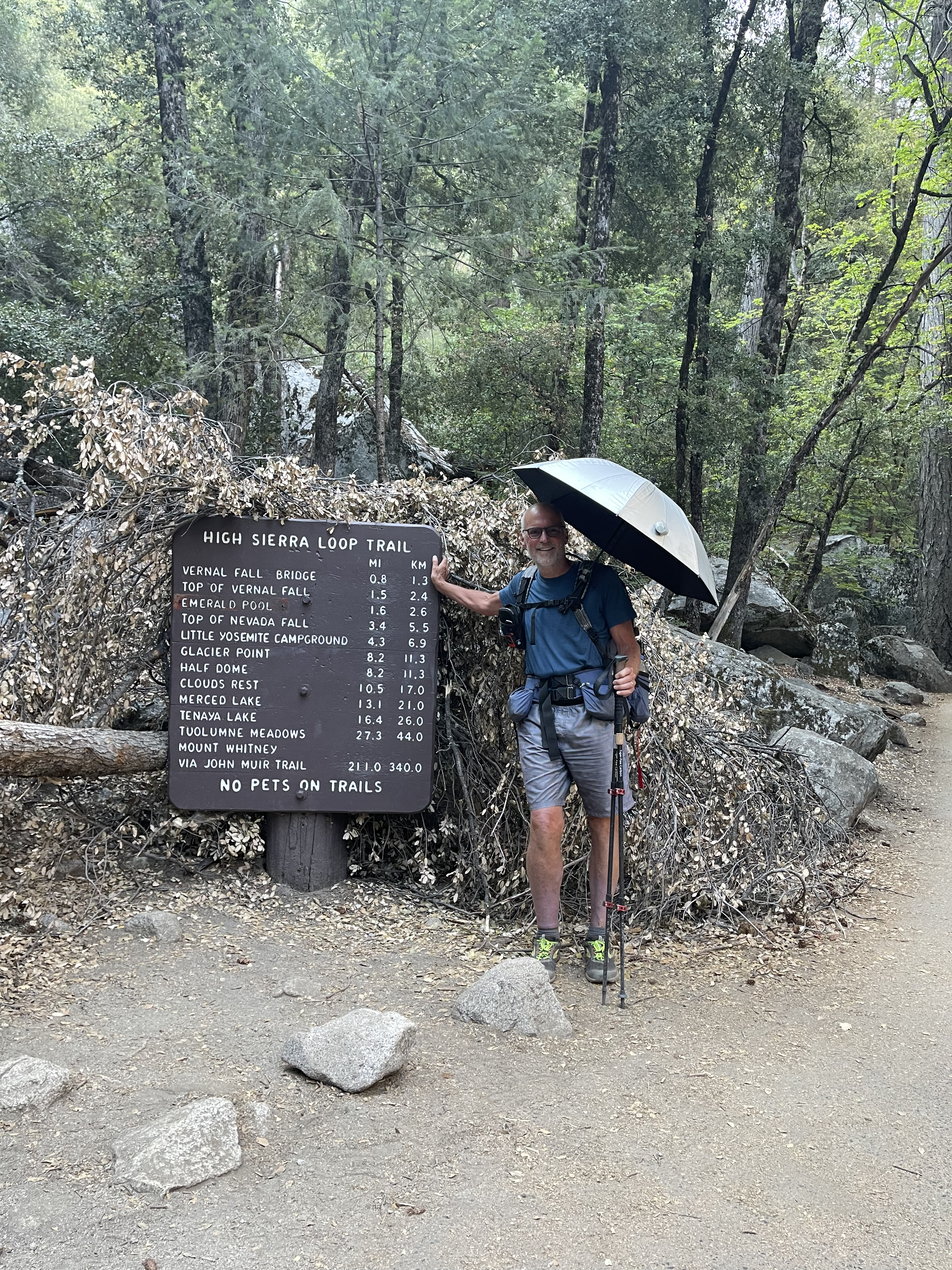
FYI I have booked a flight to and a car in Las Vegas. Leaving Thursday 9/1/2022 and returning Sunday 9/11/2022. I have no hike planning done yet but I am going. You are welcome to join me for all or part of the hike.
Art
———-
Damn-it. Art and I haven’t hiked together since 2015. I’d love to, but don’t think I can manage a week off that quick. But it gets me thinking about how to squeeze in a hike.
———-
My summer was full: a month-long work assignment in France (and some awesome day-hikes),
and ongoing project support upon returning home, and then maintaining the “homestead” and caring for our geriatric cats while Nancy takes some extended grandma time.
And I leave exactly one month after she returns, for some grandpa time. So, I’d concluded, no hike this year.
Then I get the email and it lights the fire.
———-
I get the okay from my boss to take the extra time off but I need to button up a couple projects first. I’ll miss Art by a week.
I cobble together a route, secure a permit and with the knowledge I can actually make this happen raise the subject with Nancy. She is none too thrilled but obliges and I spend the last week of August booking travel, ordering food, checking over my gear, and doing whatever else is needed to prepare for a hike.
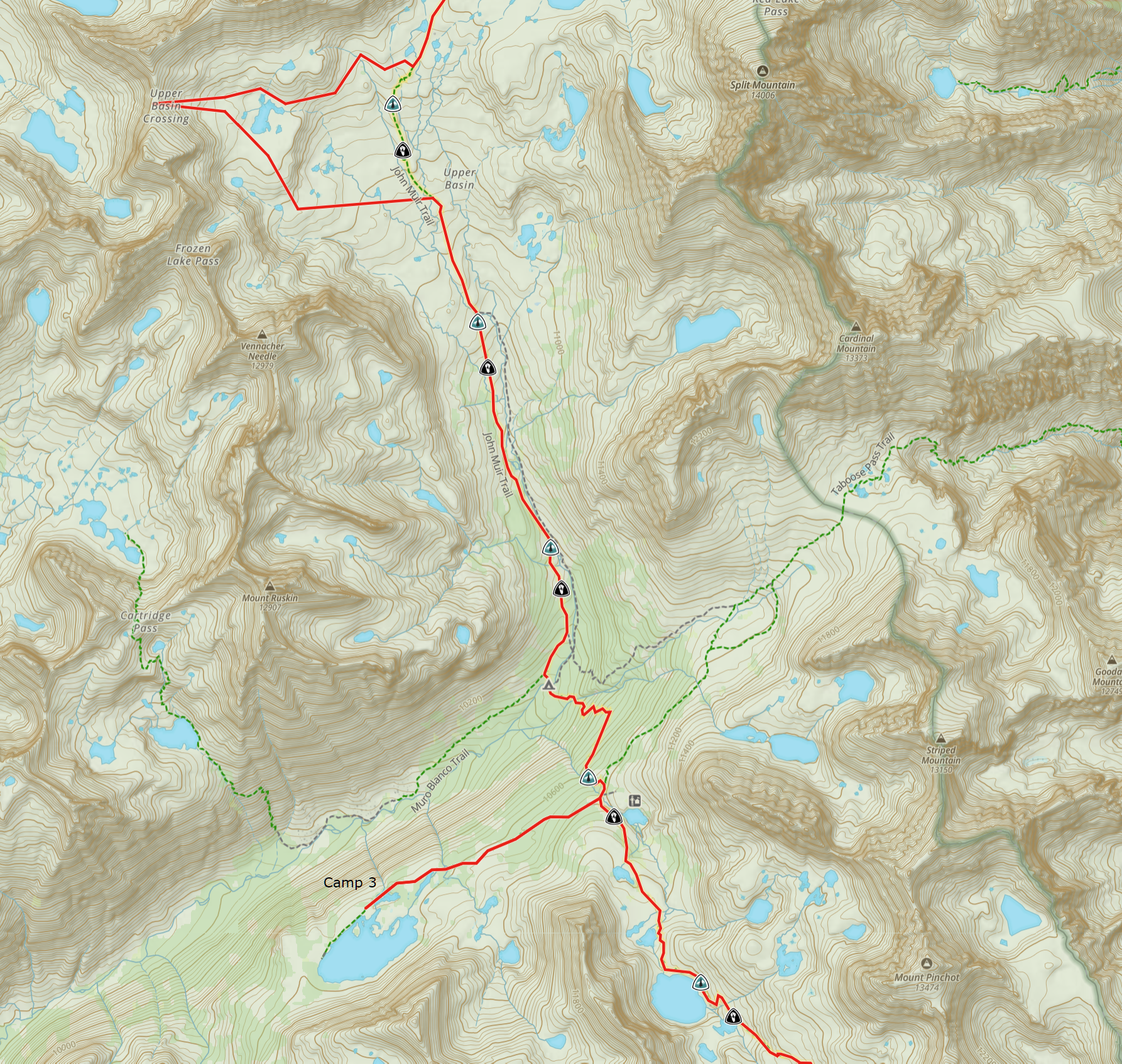
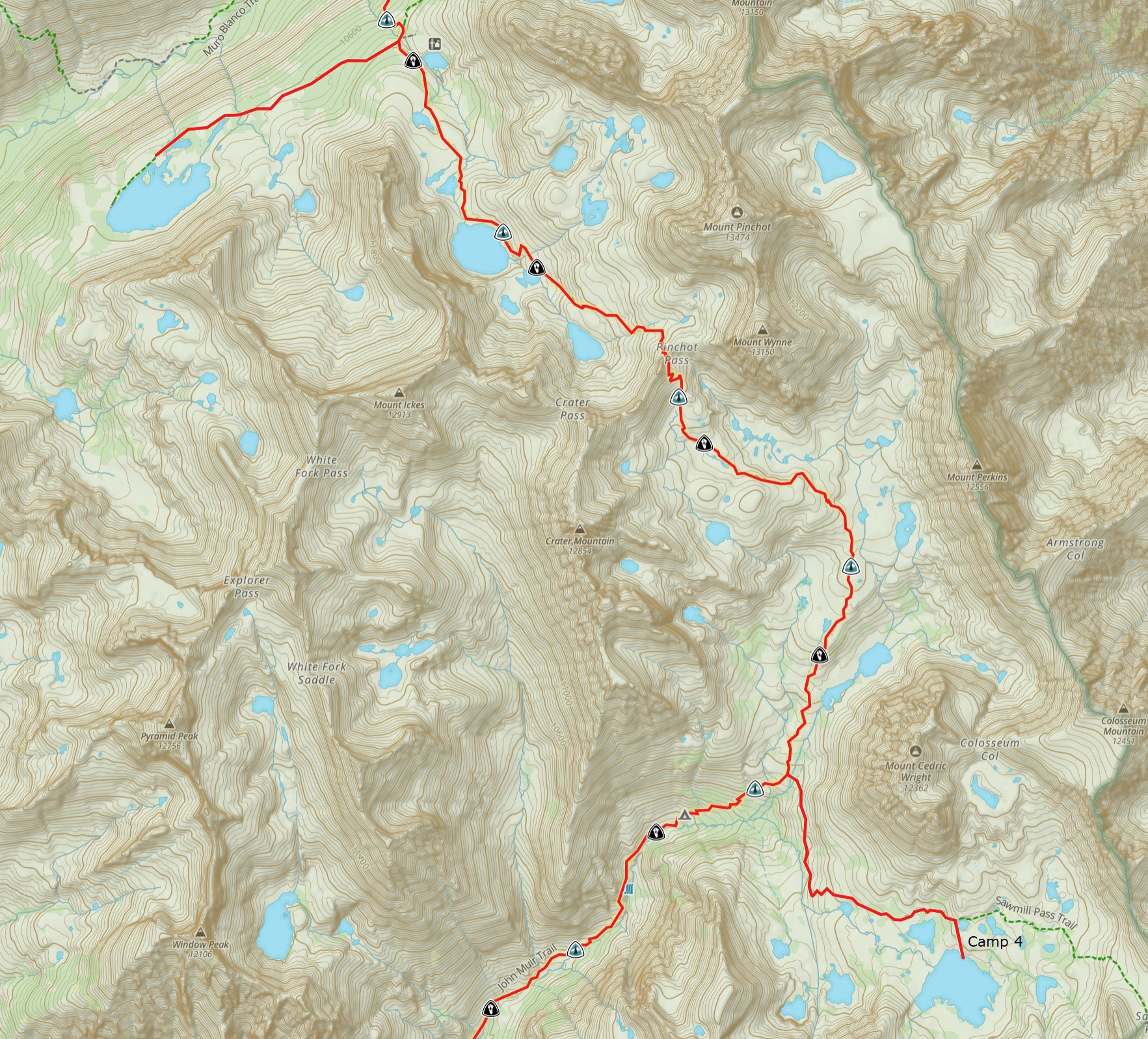
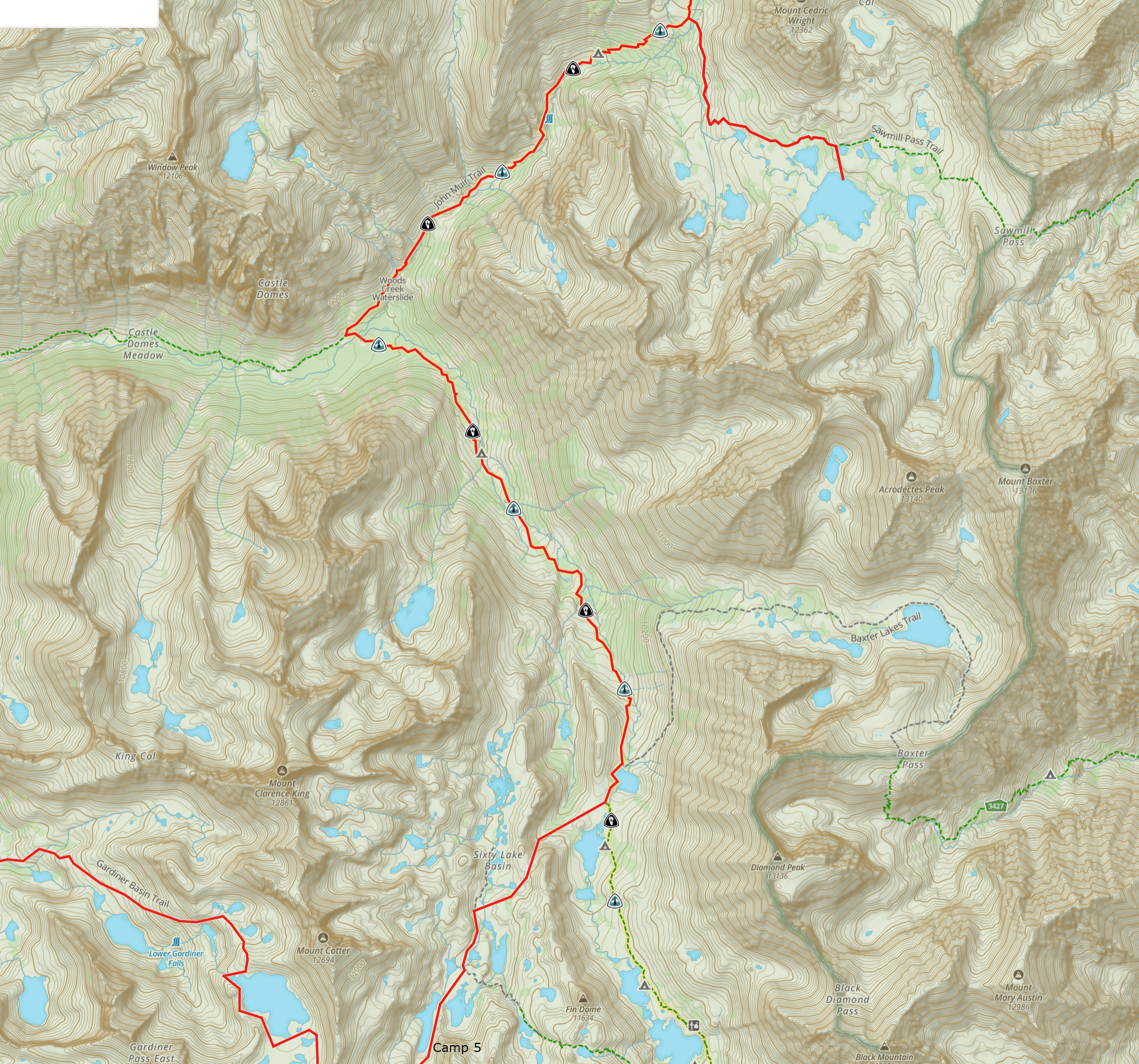
My route: South Lake to Onion Valley, with intent to stay at and route through places I’ve not been before. Start hiking Saturday Sept 10 and finish Sunday Sept 18.
The lead-up is not without drama, I test positive for Covid. And though, night before I leave, I no longer test positive, I still have chest congestion and a morning cough-fest as I board my flight to Las Vegas on the 9th.
———-
I’ve been texting Art via inReach, his hike has been dogged by a number of calamities and he is ending a day early. The good news in this is we can meet up when I arrive in Mammoth Lakes.
Art greets me as I pull into the hotel parking lot. It’s damn good to see him. We met in Lyell Canyon in 2009 and hiked together the next few summers. I broke the cycle when work moved me to New York.
We reconvened in 2015, but life and other things have kept us from hiking together since. This year as well, but this is the first summer since that we’ve both made it to the Sierra and though not hiking together, it is a good reunion.
I modify my hotel reservation from a “King Room” to “2-beds,” we both move in and then head to dinner. Conversation is a mix of catch up and reminiscing. And some cautionary discussion about the weather Hurricane Kay is bringing to Central California and the Sierra. We wrap up around 10pm a long, nearly 22-hour, day for me.
———-
Back at the room I organize and pack my gear. Then, as I lay to sleep a handful of thoughts ramble through my head: it is great to see Art again…be up at 5 on the road at 6am…once I get to Onion Valley I need to find my ride back to South Lake…try to be quiet in the morning and not disturb Art…will the hurricane bring torrential rain…damn it was good to see Art…will I hear the alarm…and so on. Perhaps 30 minutes of churn then I fall asleep.
I am up with the alarm. I shower and dress and load my pack and travel duffel in the car. I am on the road just before 6am. A stop in Bishop for a Mahogany Smoked Meats breakfast burrito (well worth it) and then on to Onion Valley.
I arrive quarter to 8, park, set my pack outside the rest room, and do my business. Stepping out I see, and right on time, Paul, proprietor of East Side Sierra Shuttle Service. I’ve used these guys twice now. They are punctual. And with both drivers, great conversation. The only downside is you need to plan an extra 30-45 minutes on your transit time so they can charge their EVs. My plan was to arrive at South Lake around 9:30 and start hiking at 10, the reality is arrived at 10, started hiking at 10:30.
———-
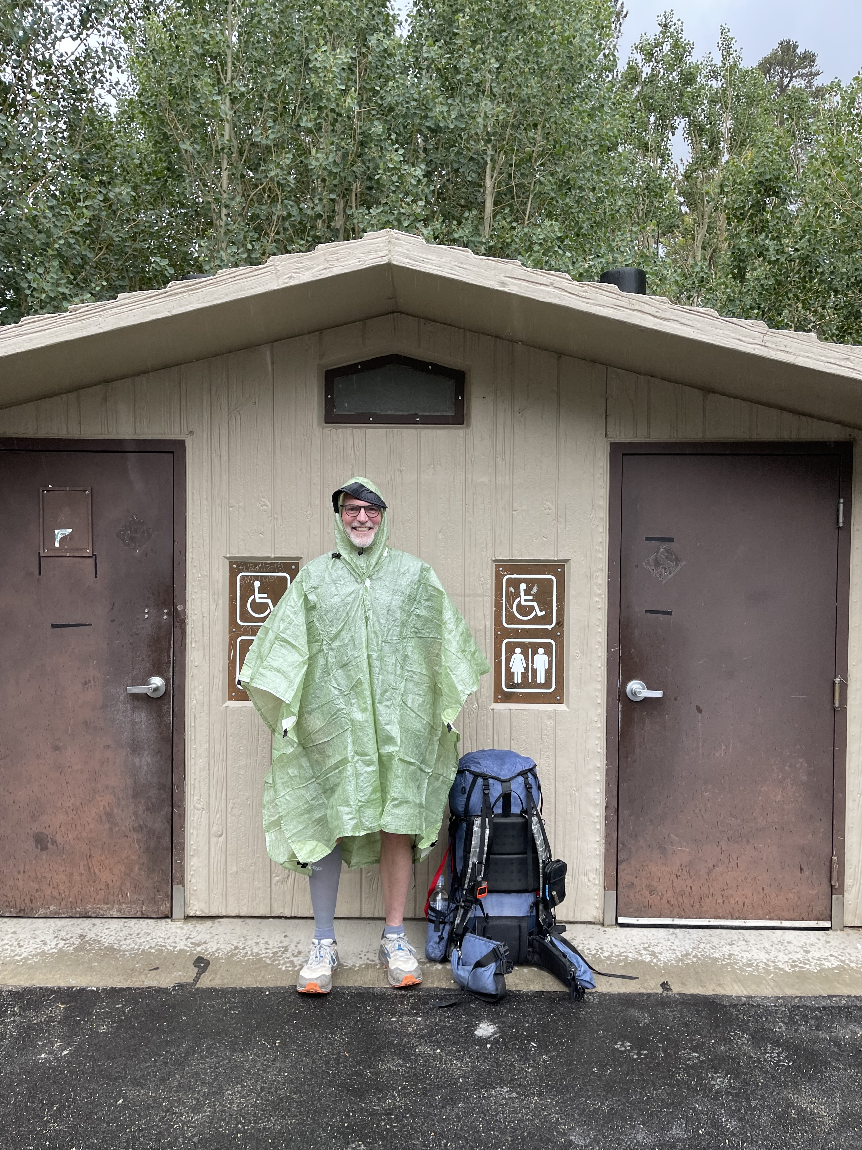
We reach the trailhead parking at South Lake and to my delight Art is there to see me off. It is raining, hard, and as I pull my poncho to keep dry, he offers me a ride back into Bishop. “You can let this pass and then set out.” But no, I am set to start hiking today. Besides, the weather will remain unsettled, and it may be 5 or 6 days waiting out the rain for a weather window. No, I am going to start now.
Art takes a couple pictures of me afront the outhouse, the only sheltered spot, and we say goodbye thinking already about next summer.
———-
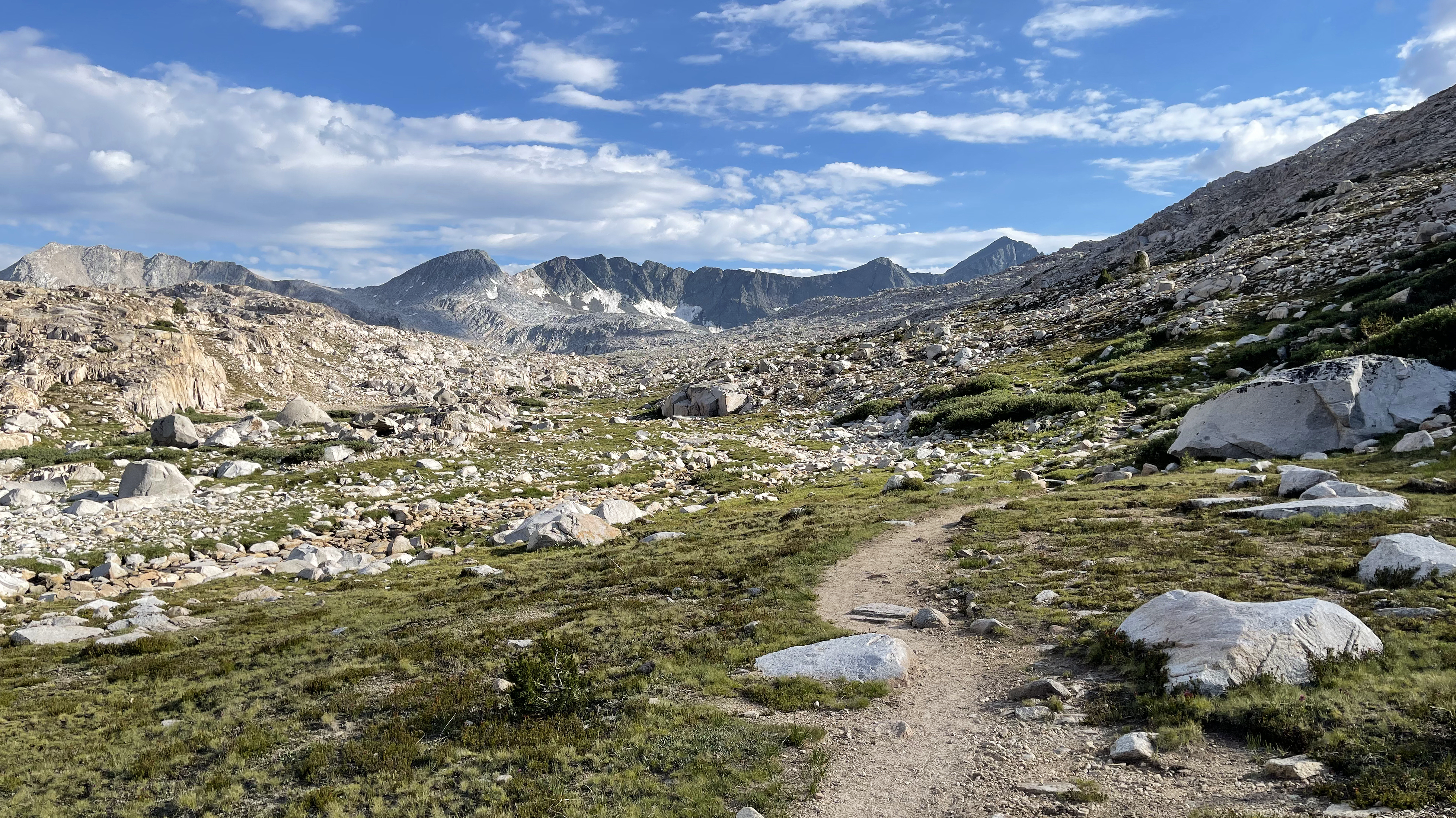
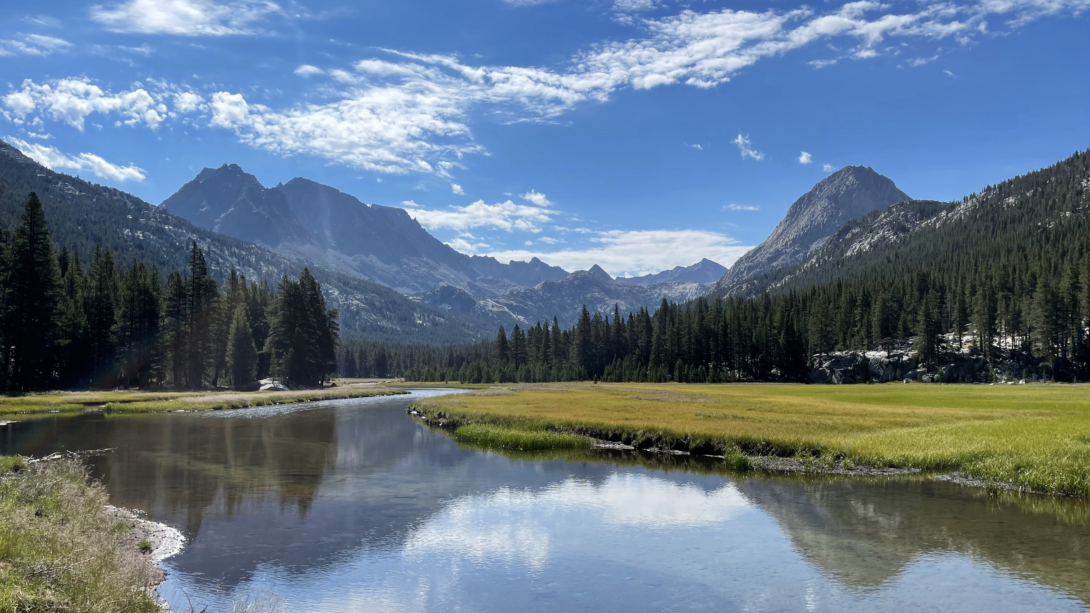
It’s been 10 years since my last hike up Bishop Pass. Where does the time go? And today, amidst the deluge, I wonder if I’ll actually take note of much or keep my head down.
It was good I had that thought. My challenge: keep the head up, take it all in, and don’t let the rain drag me down.
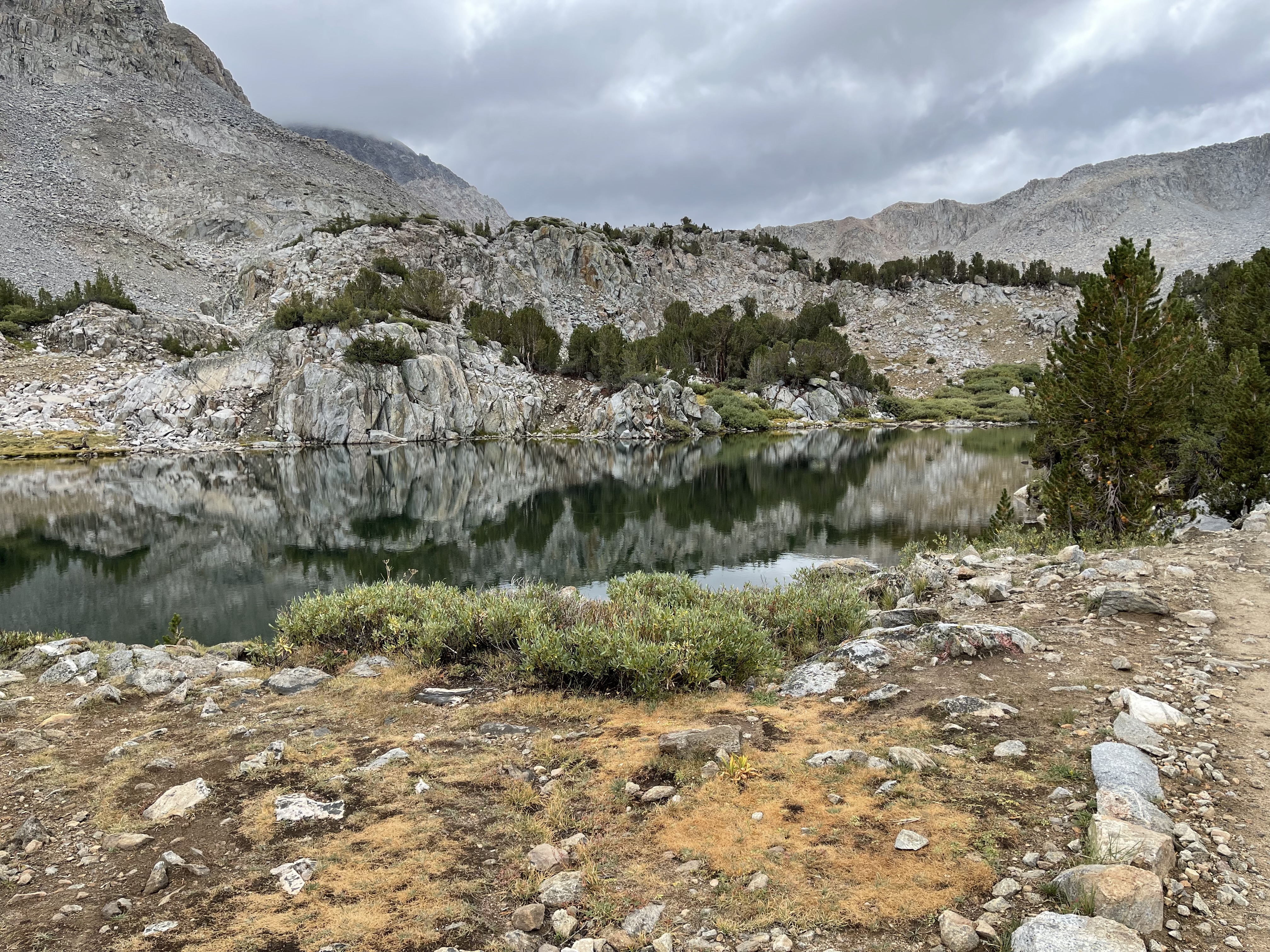
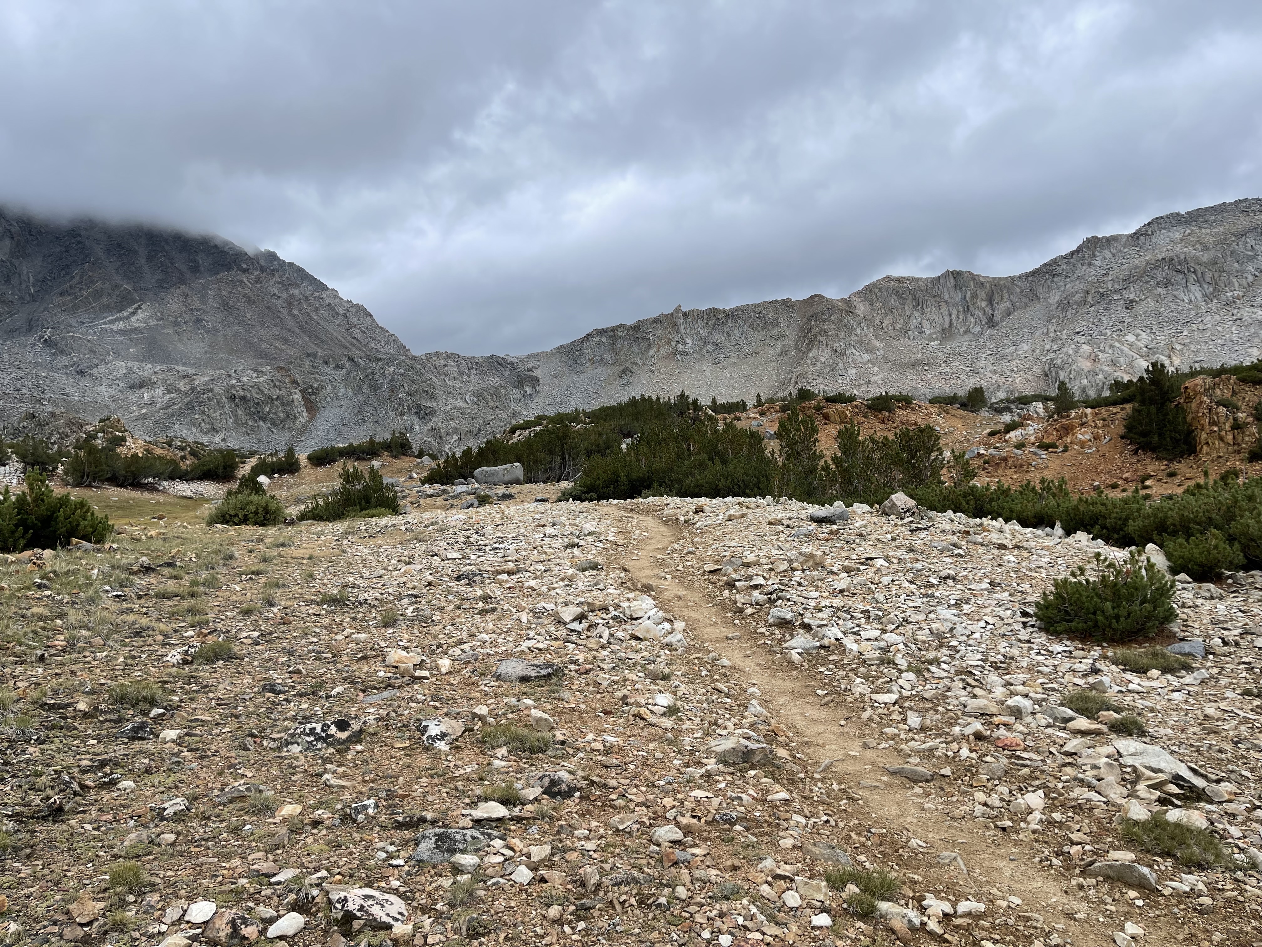
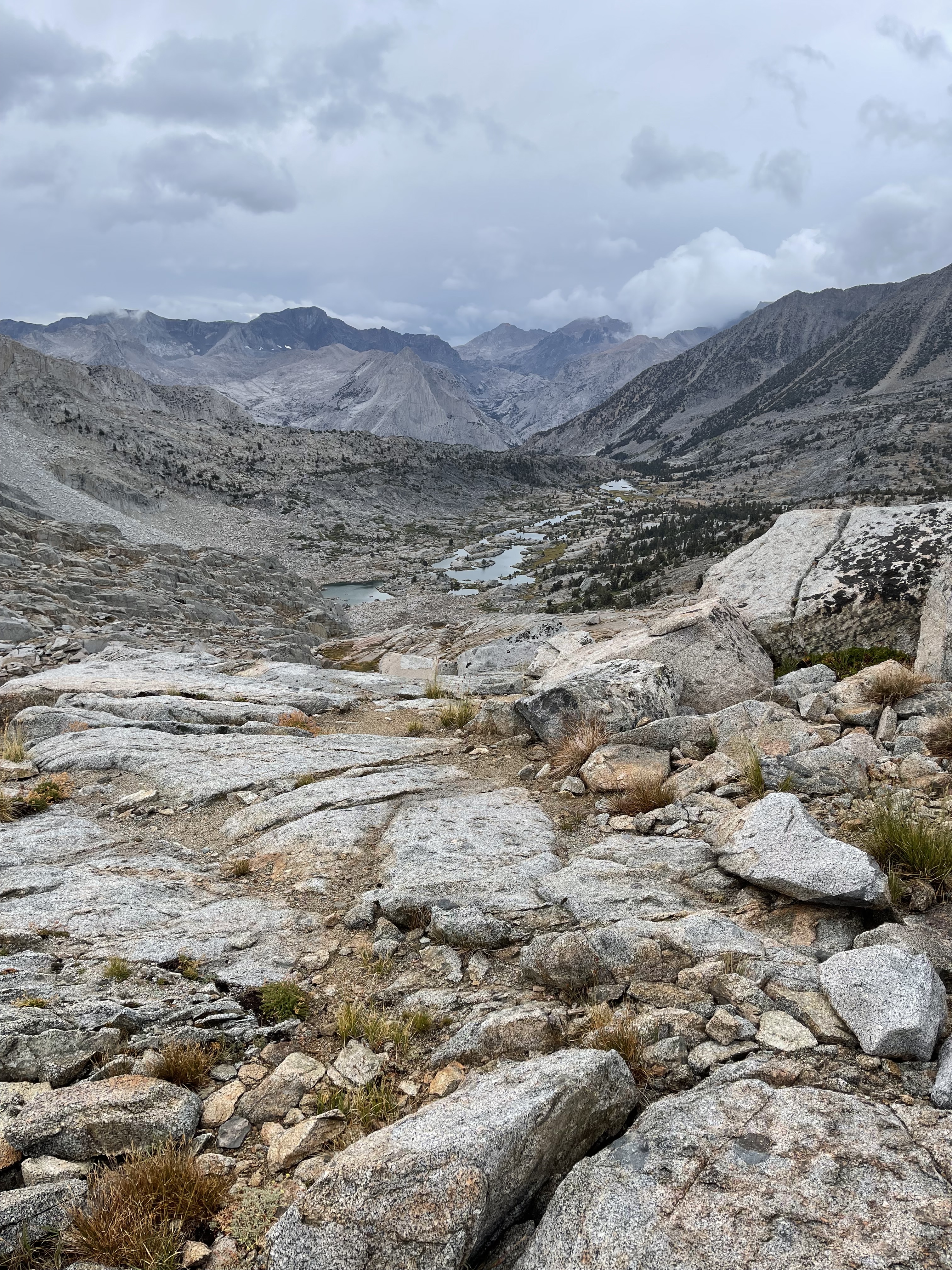
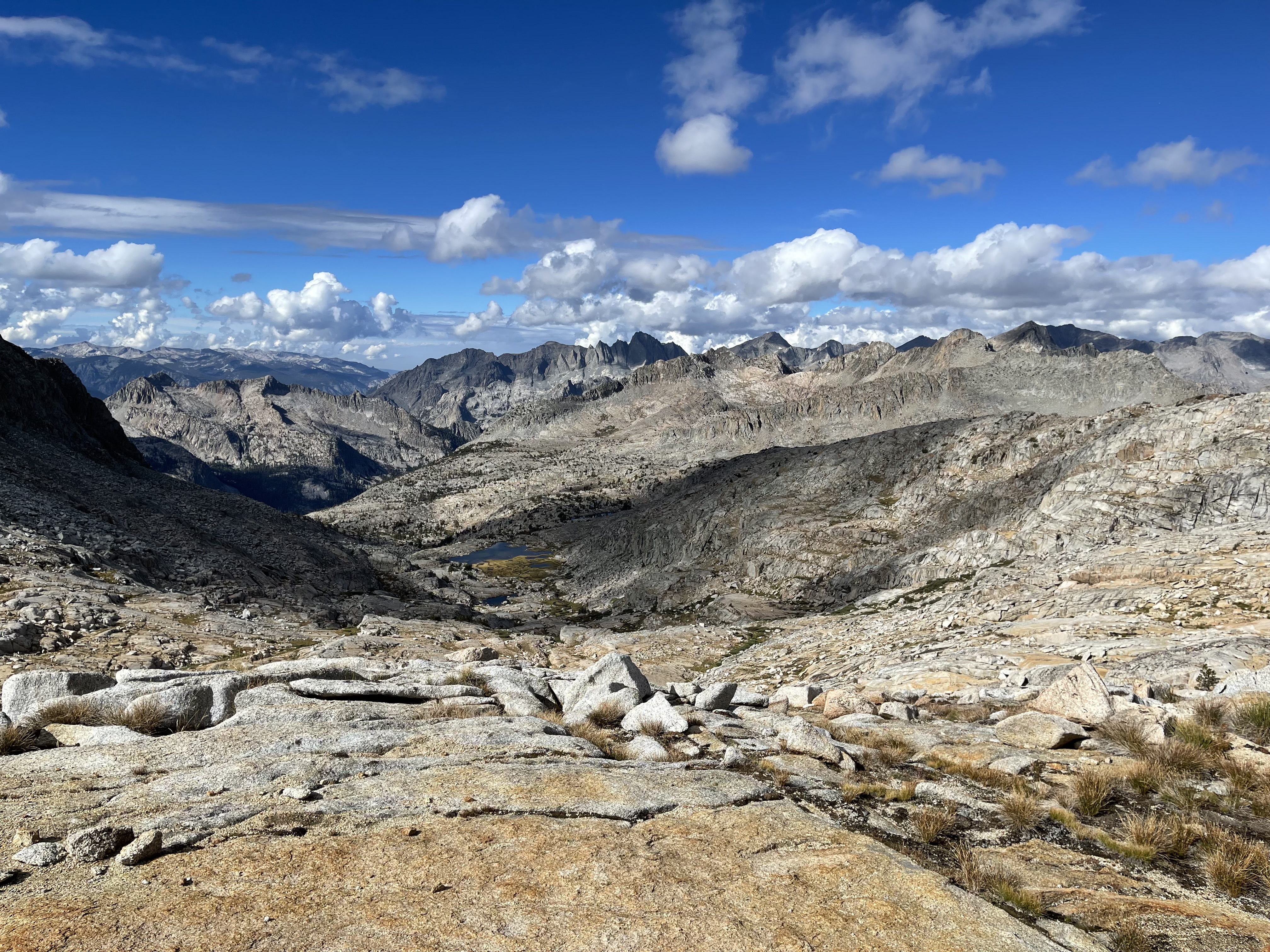
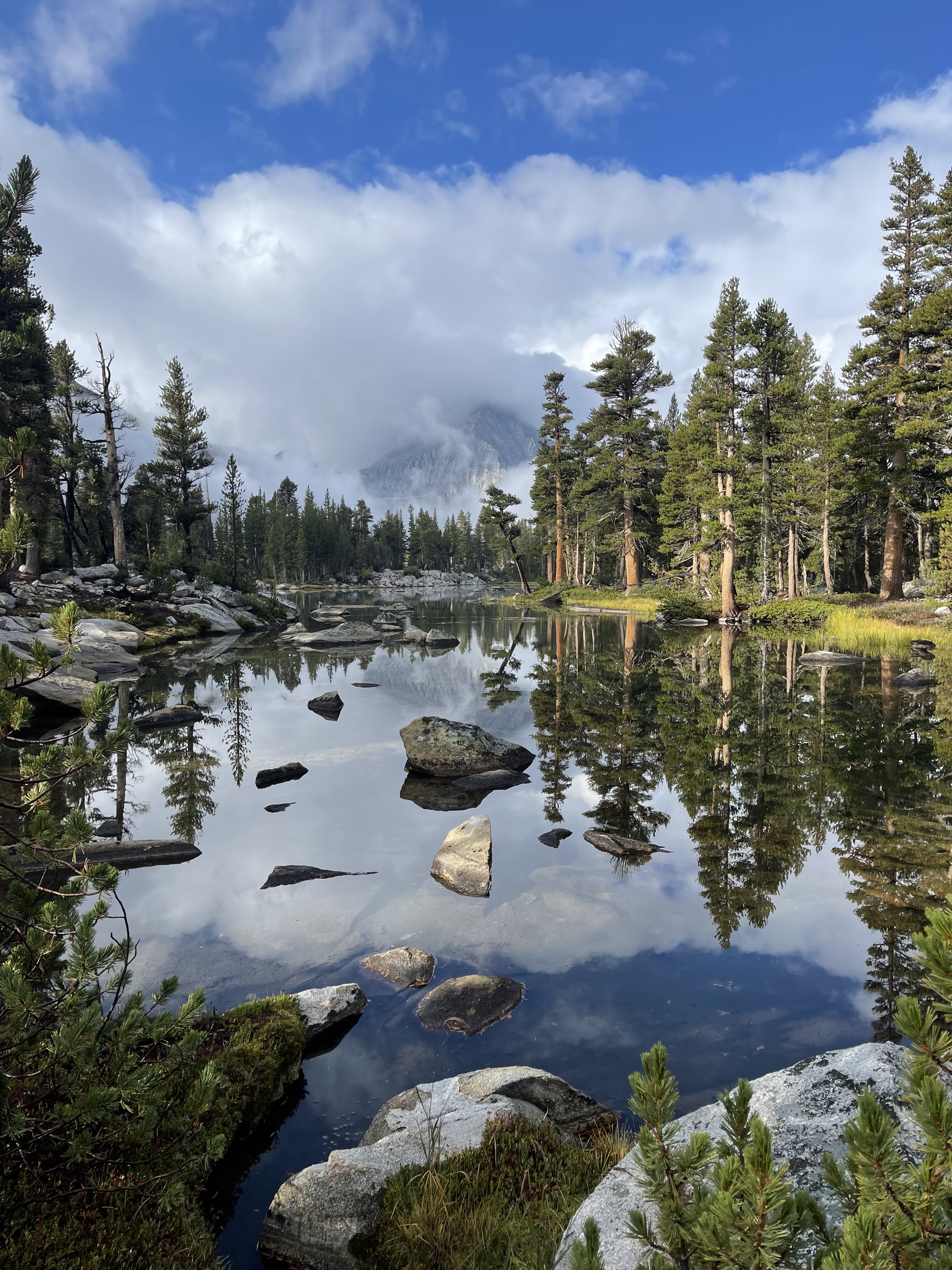
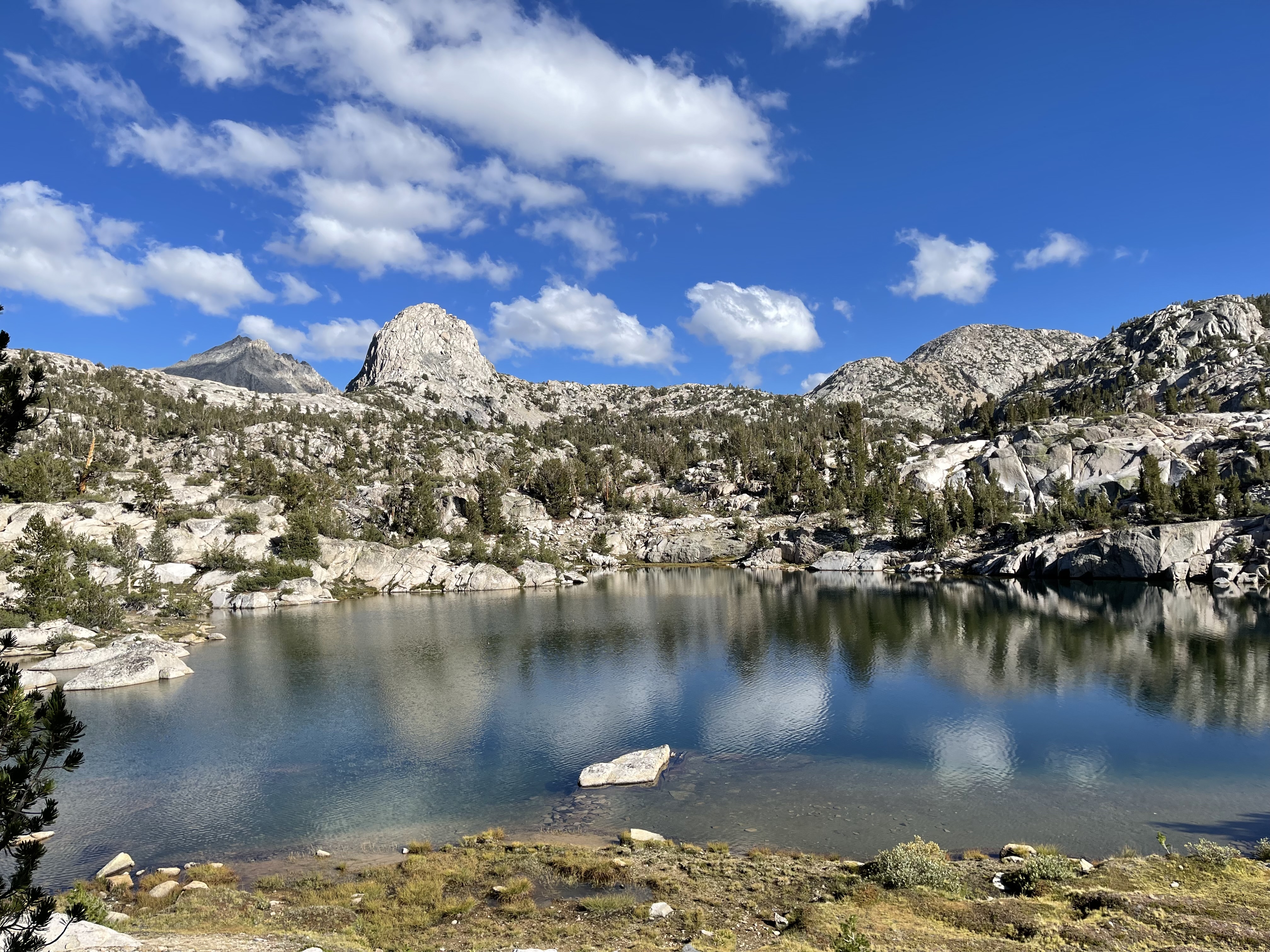
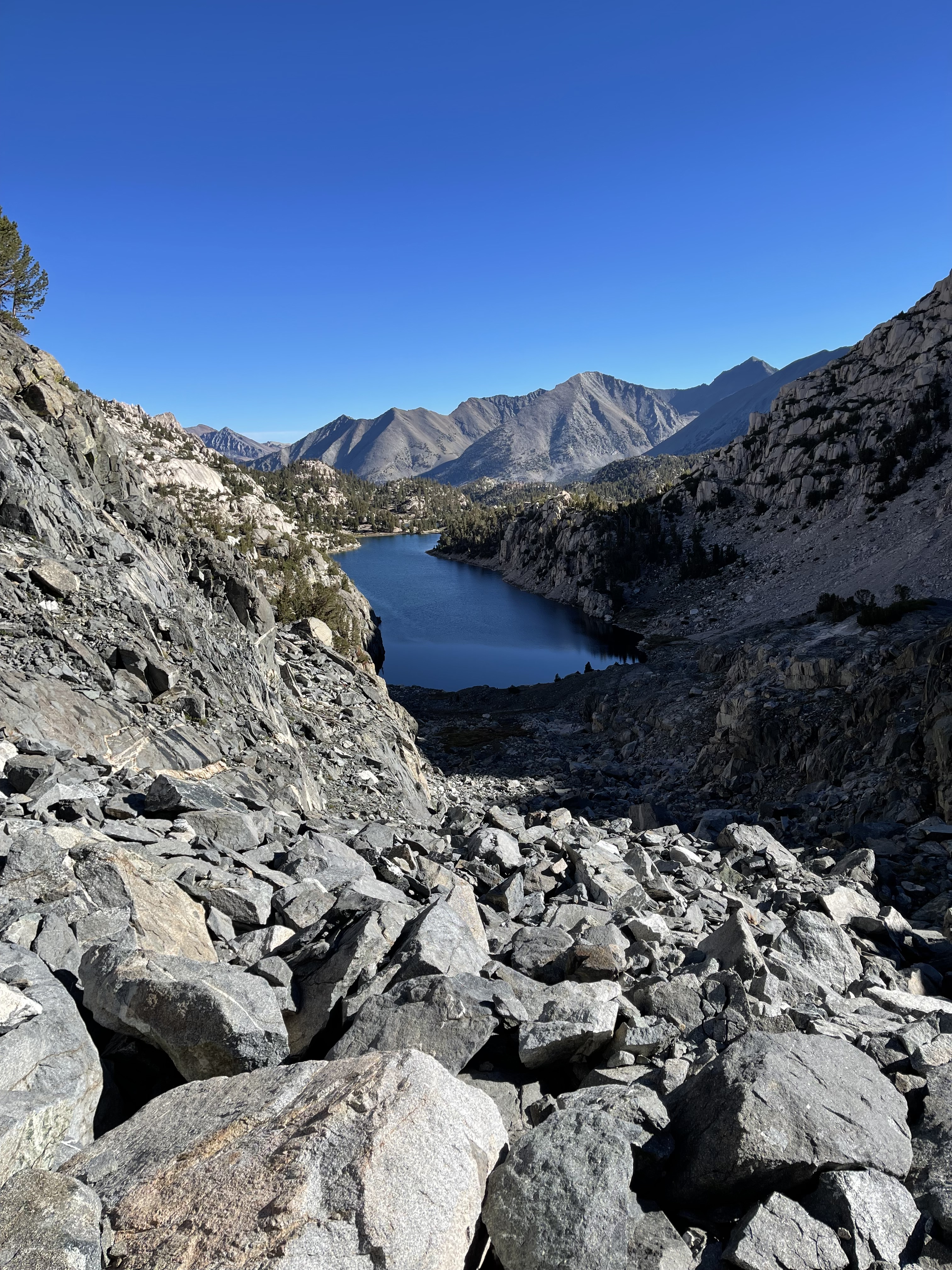
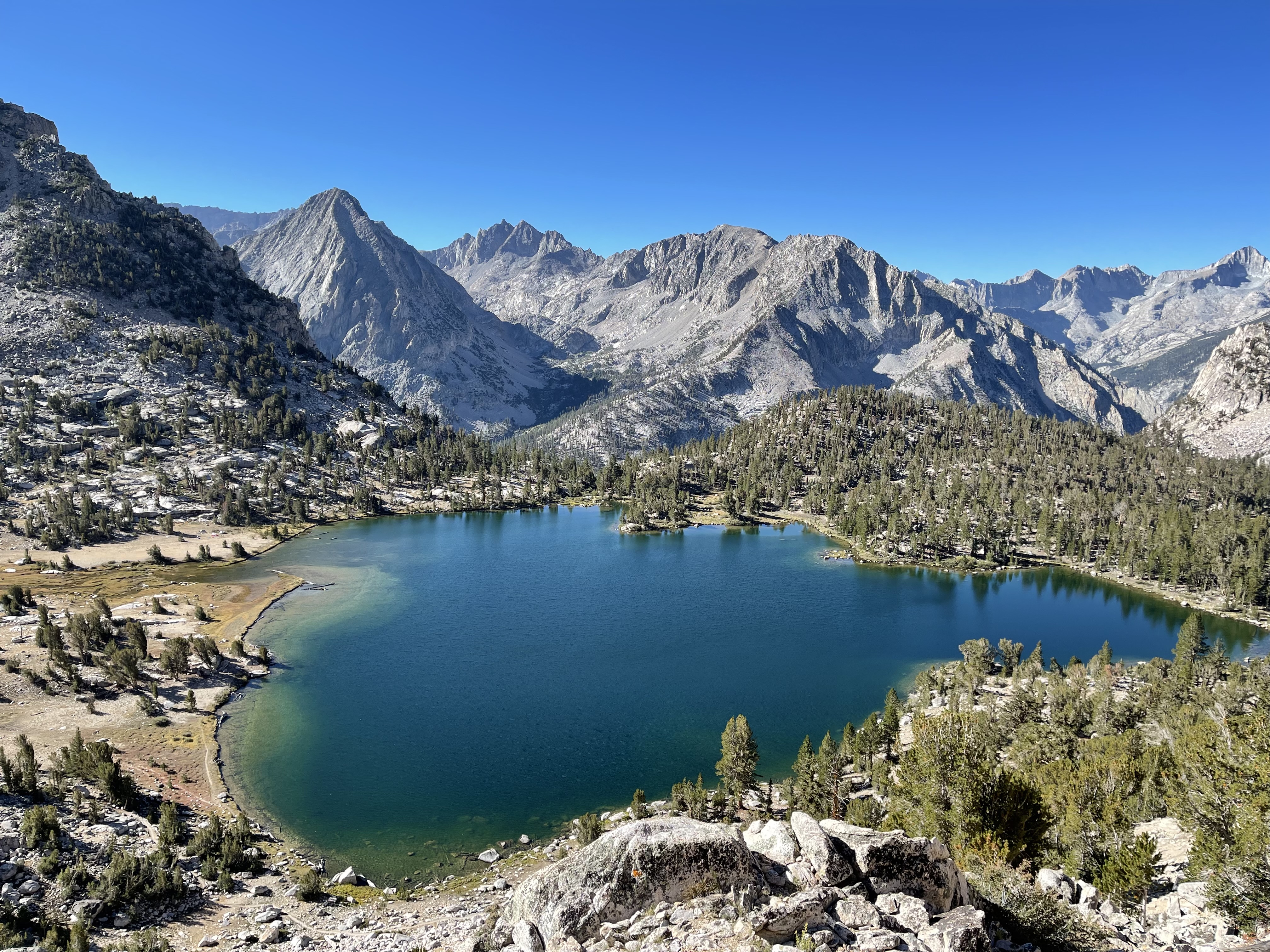
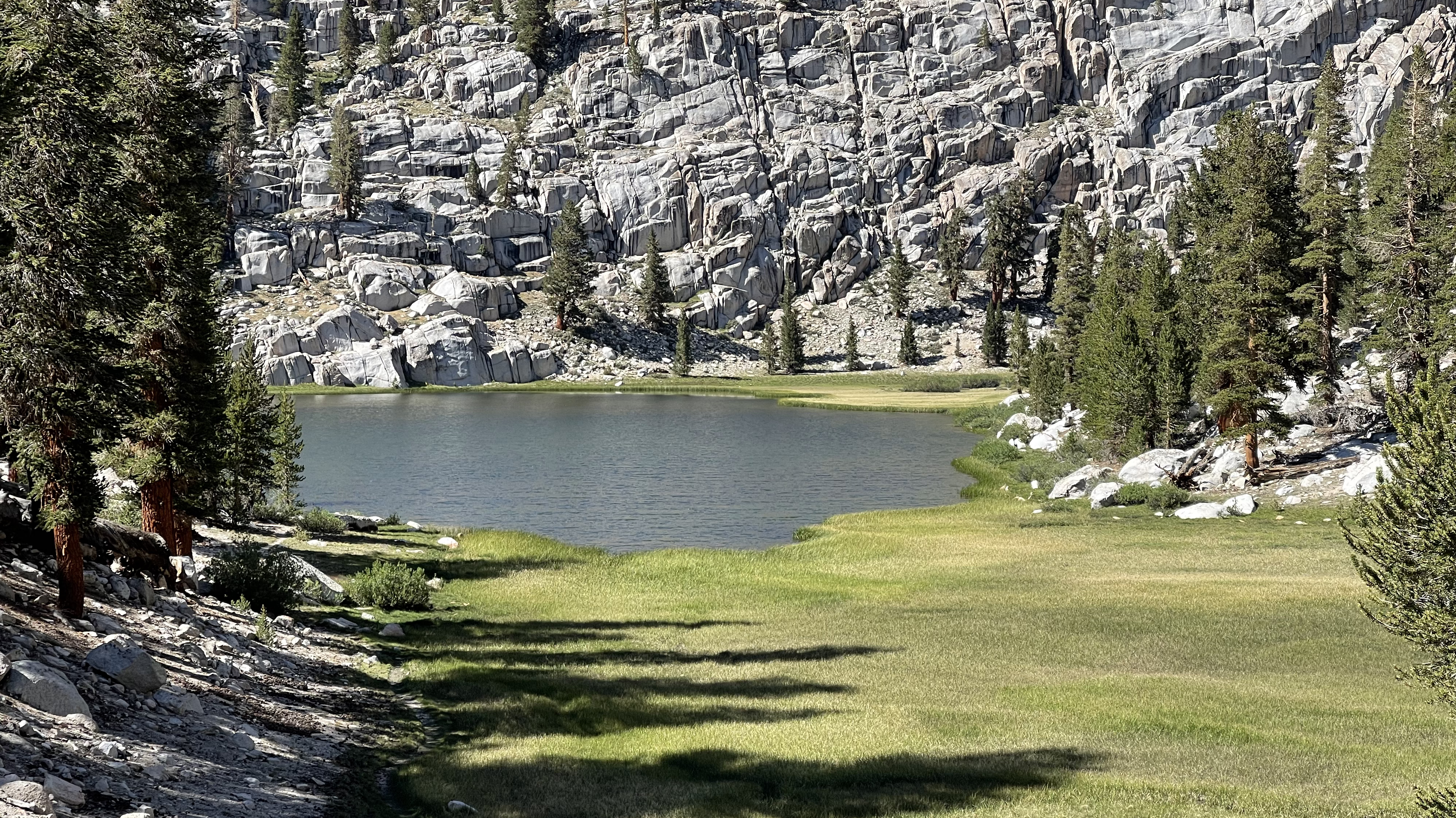
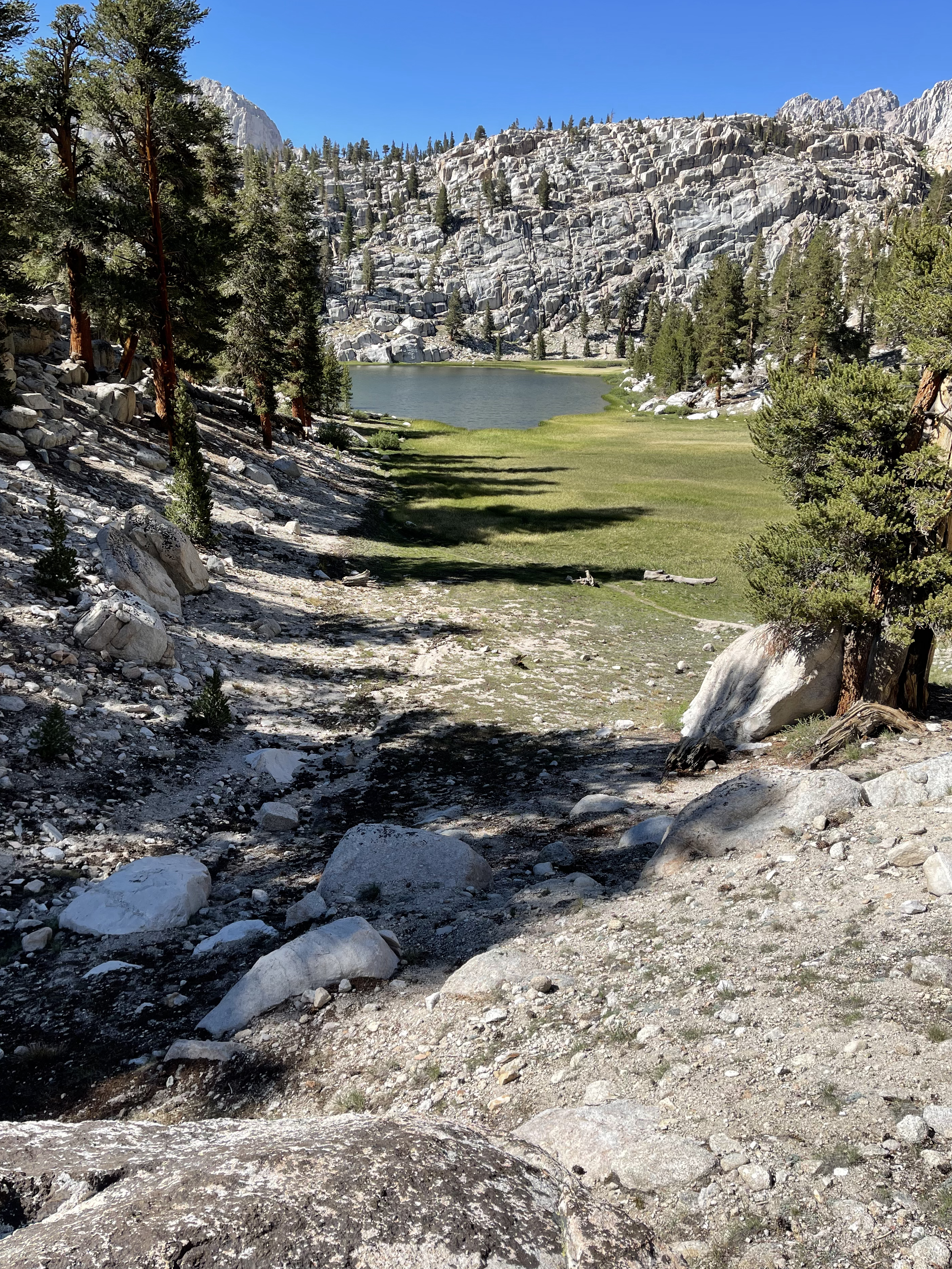
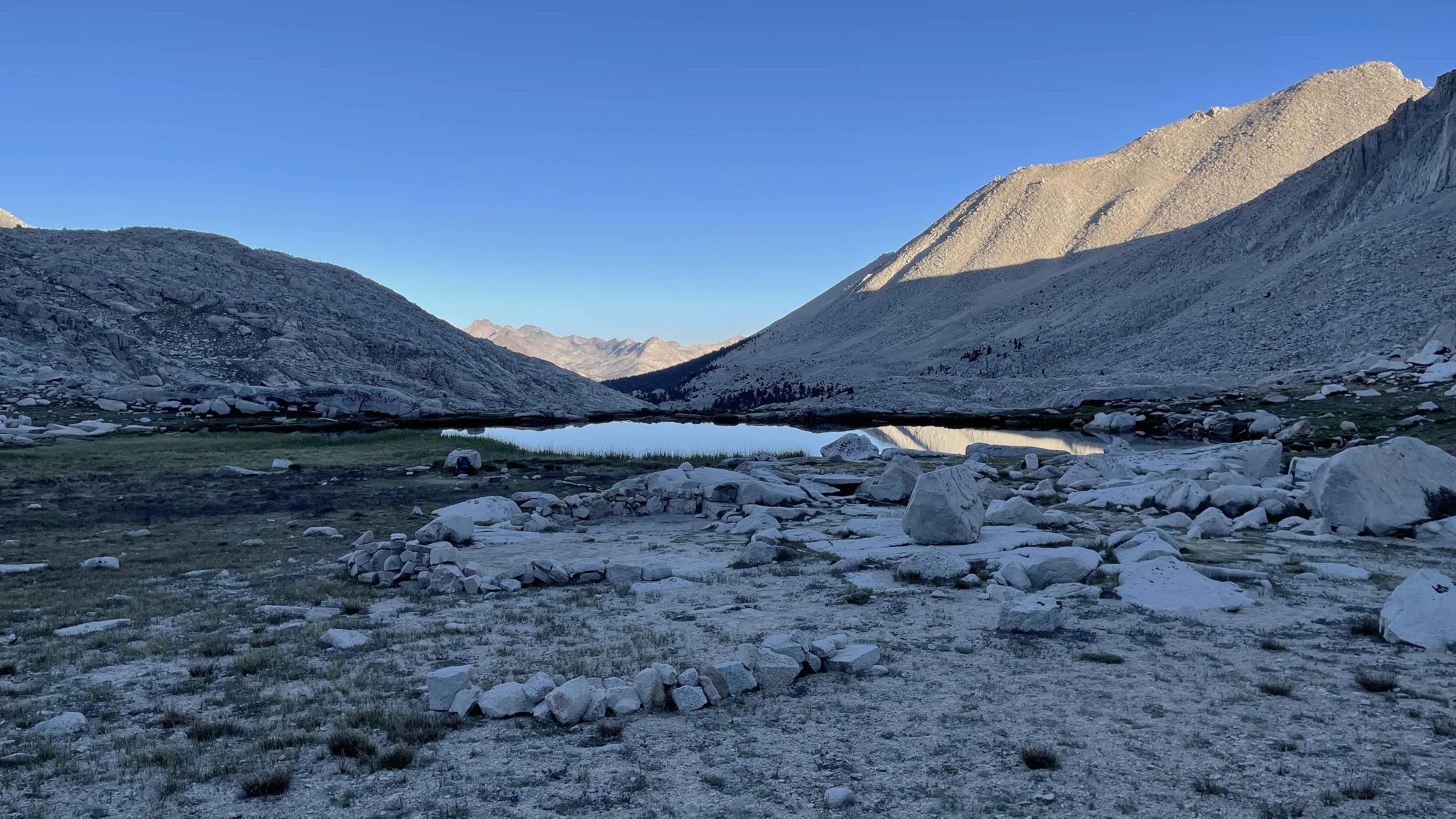
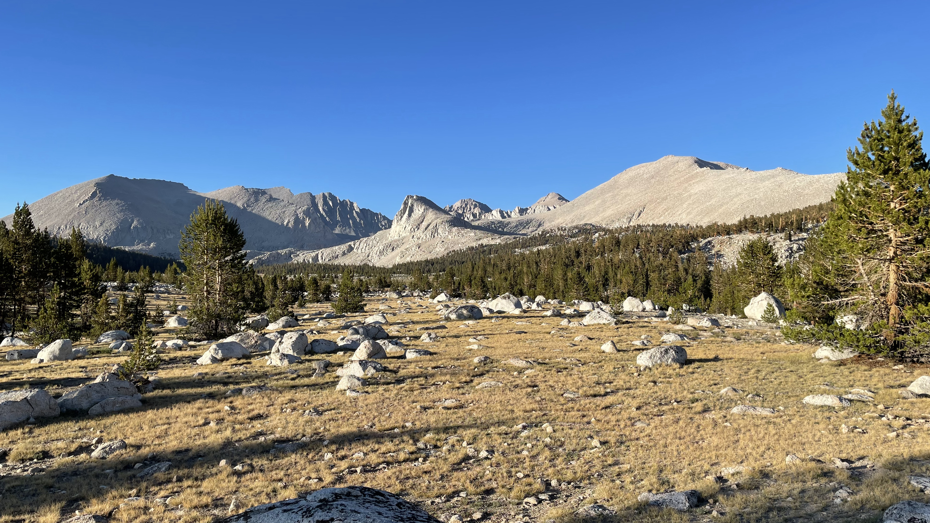
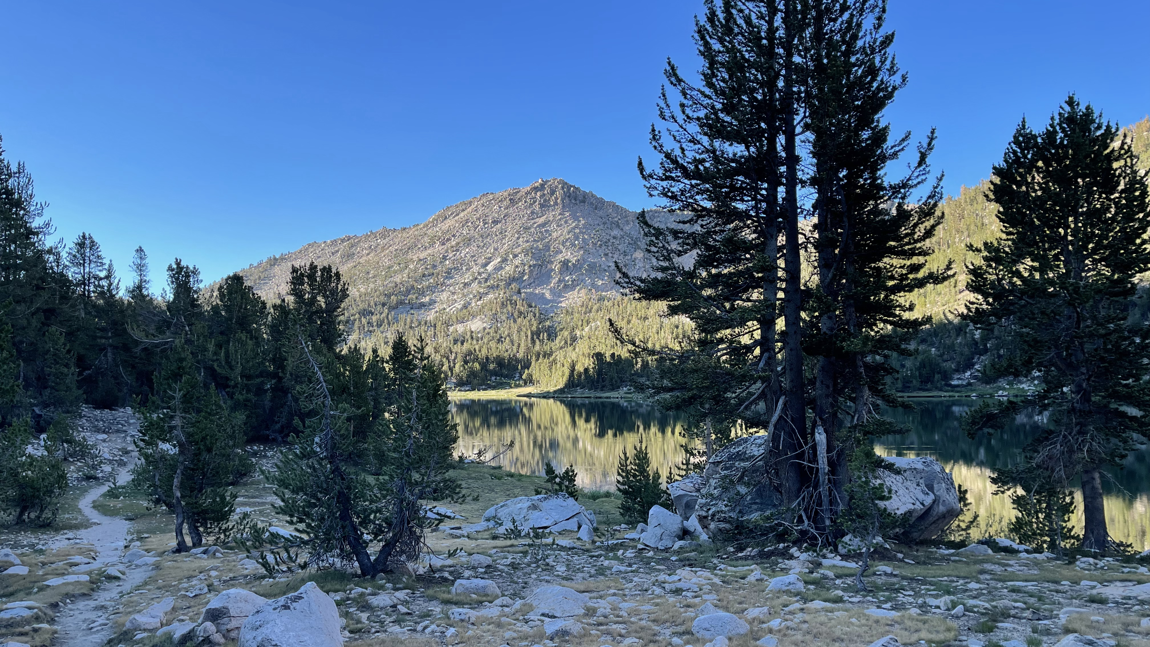
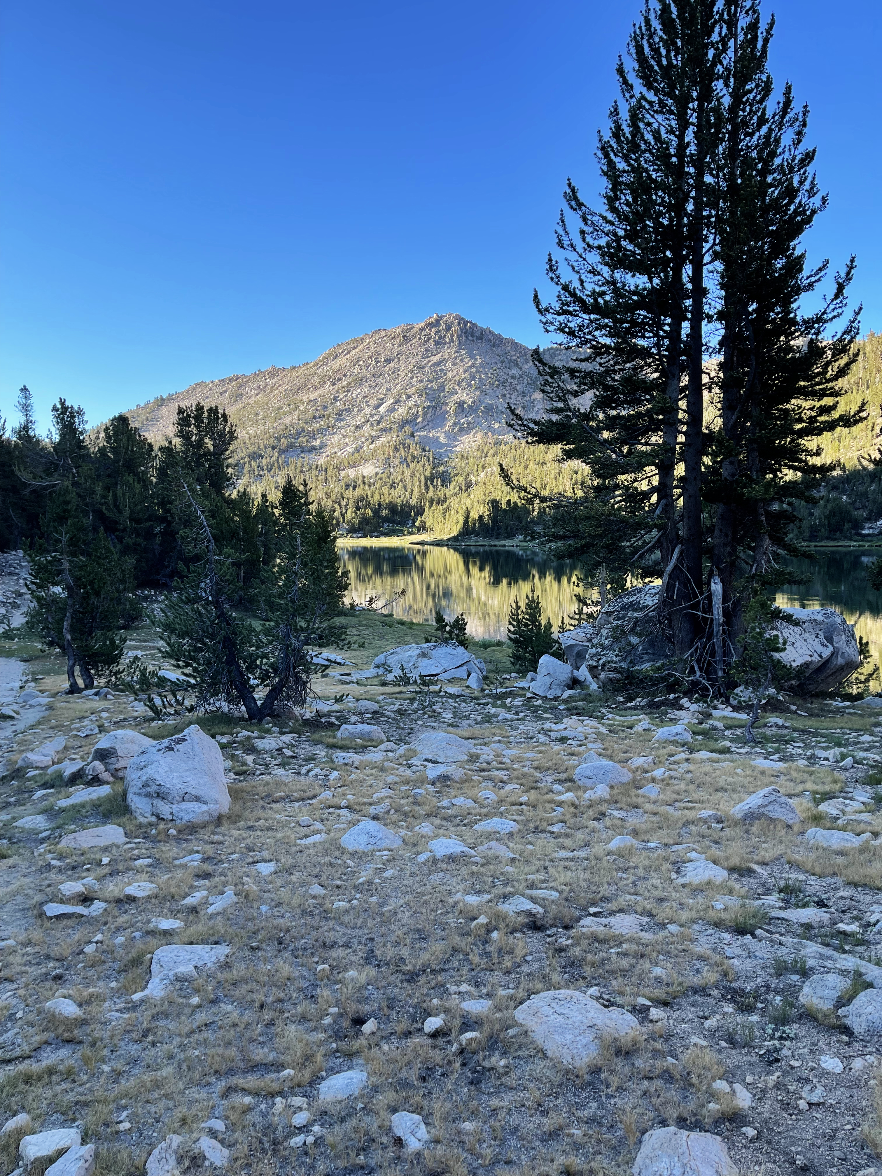
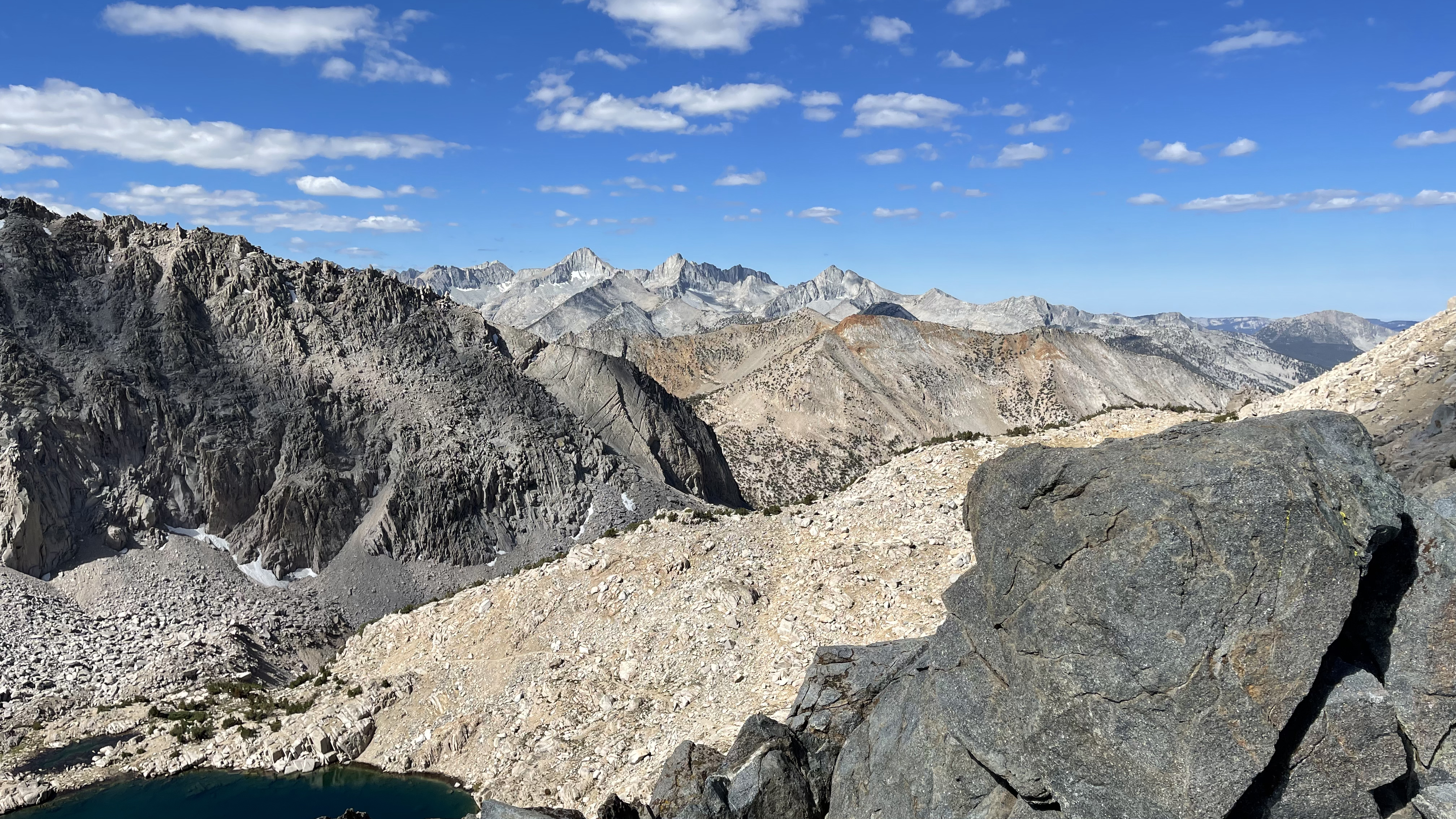
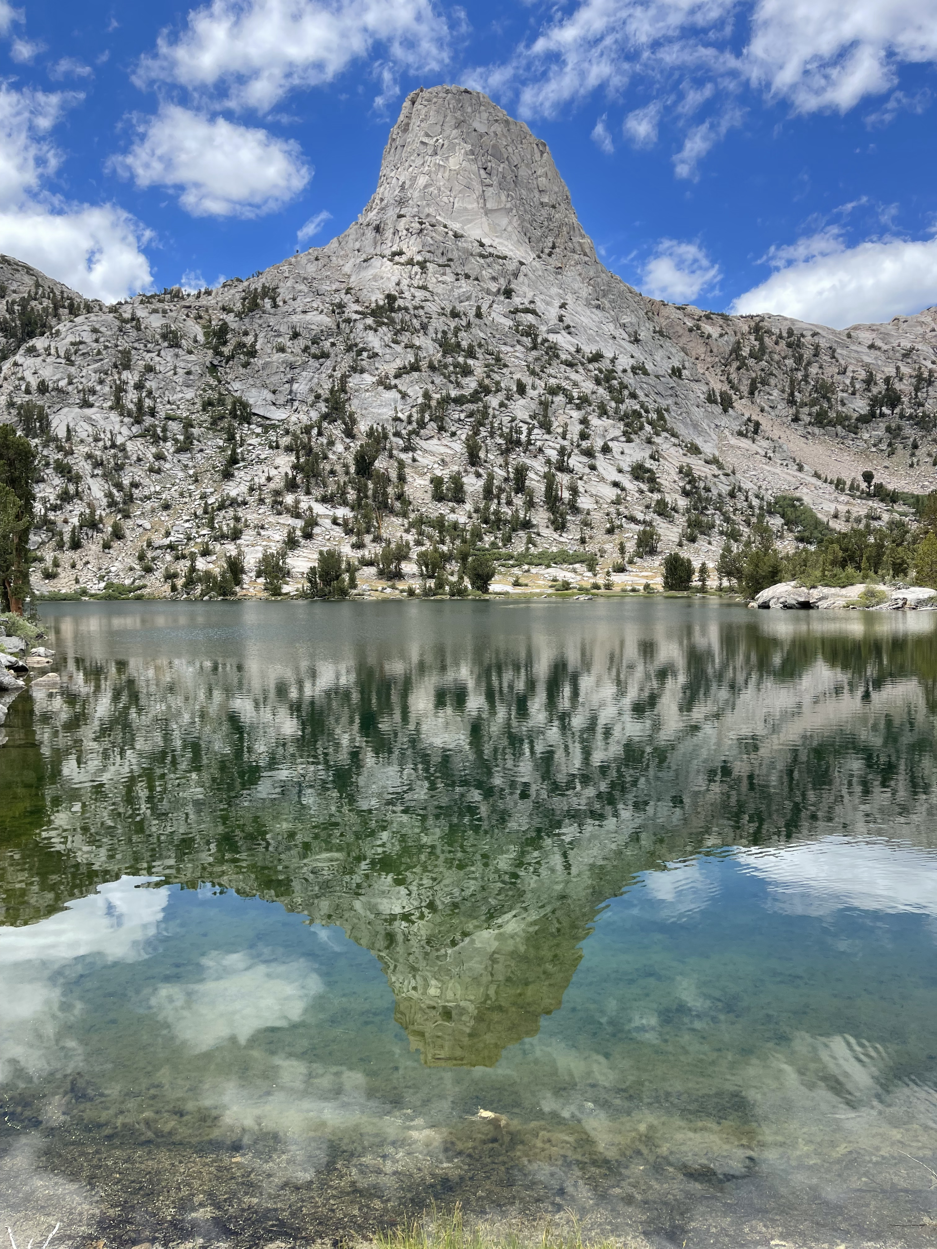
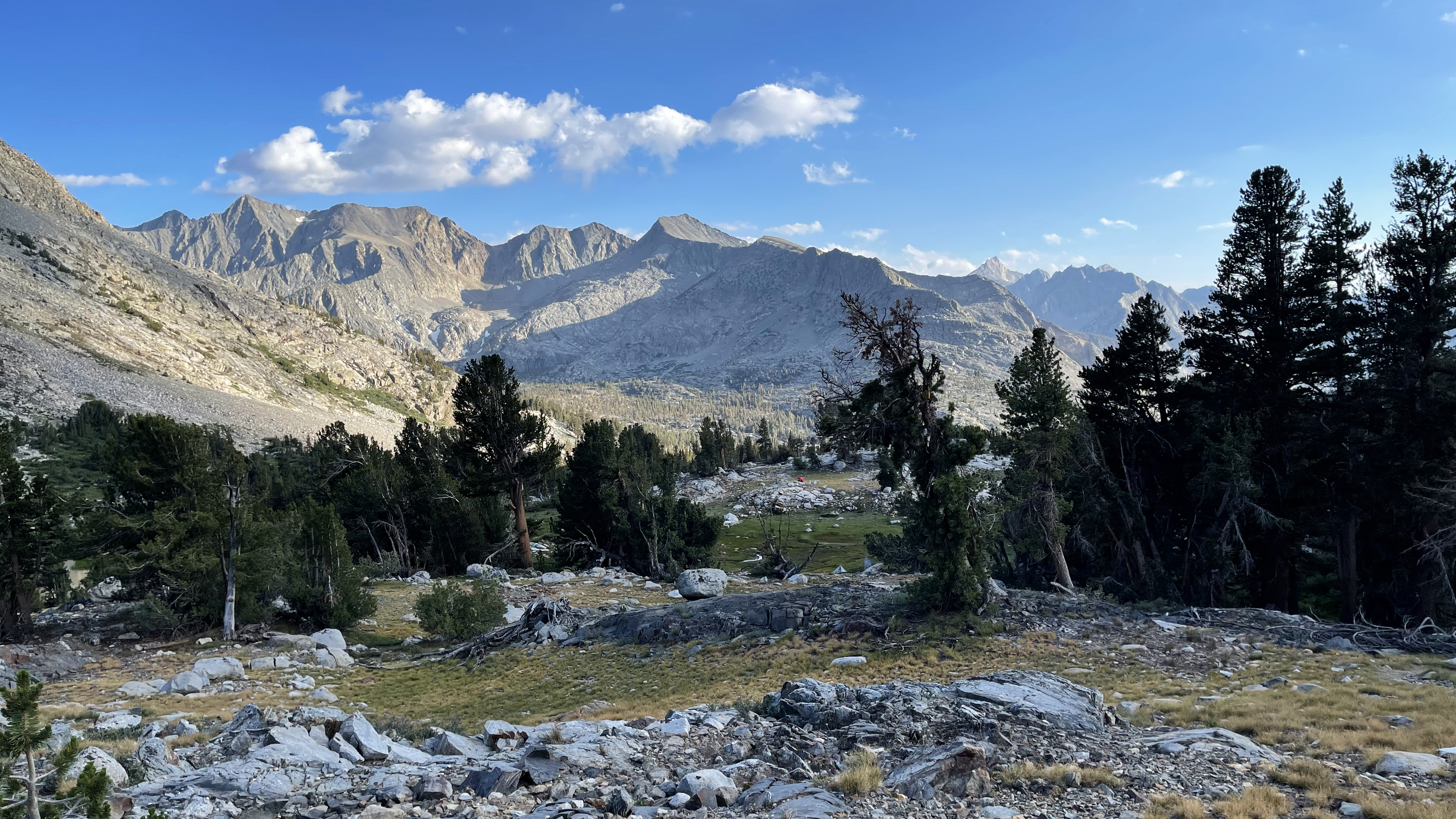
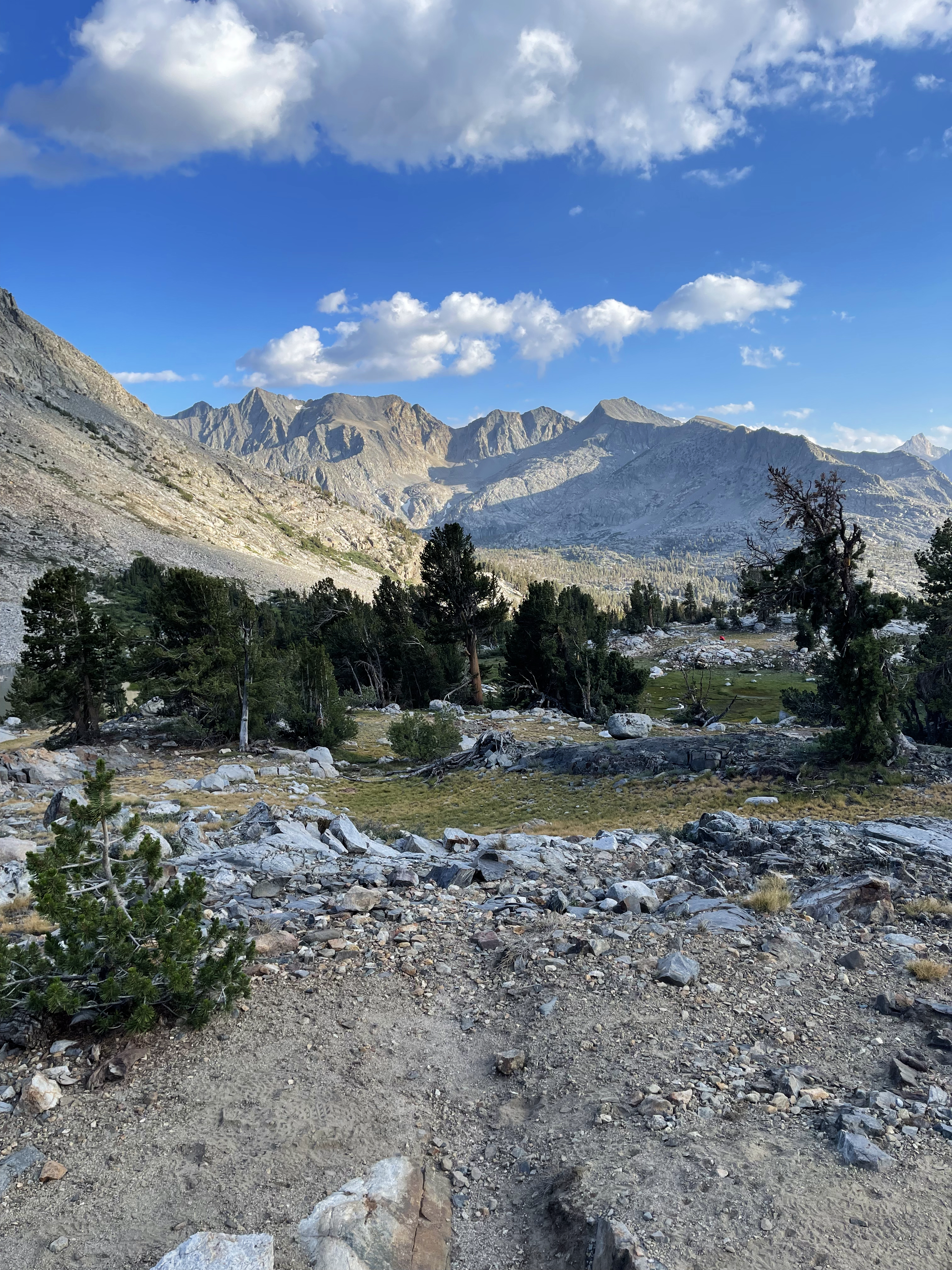
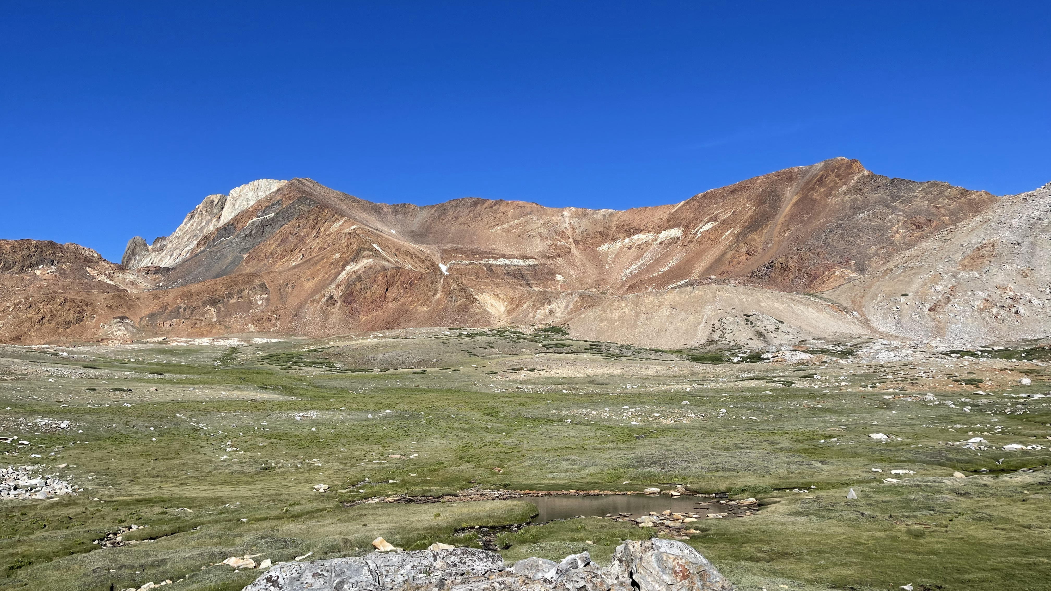
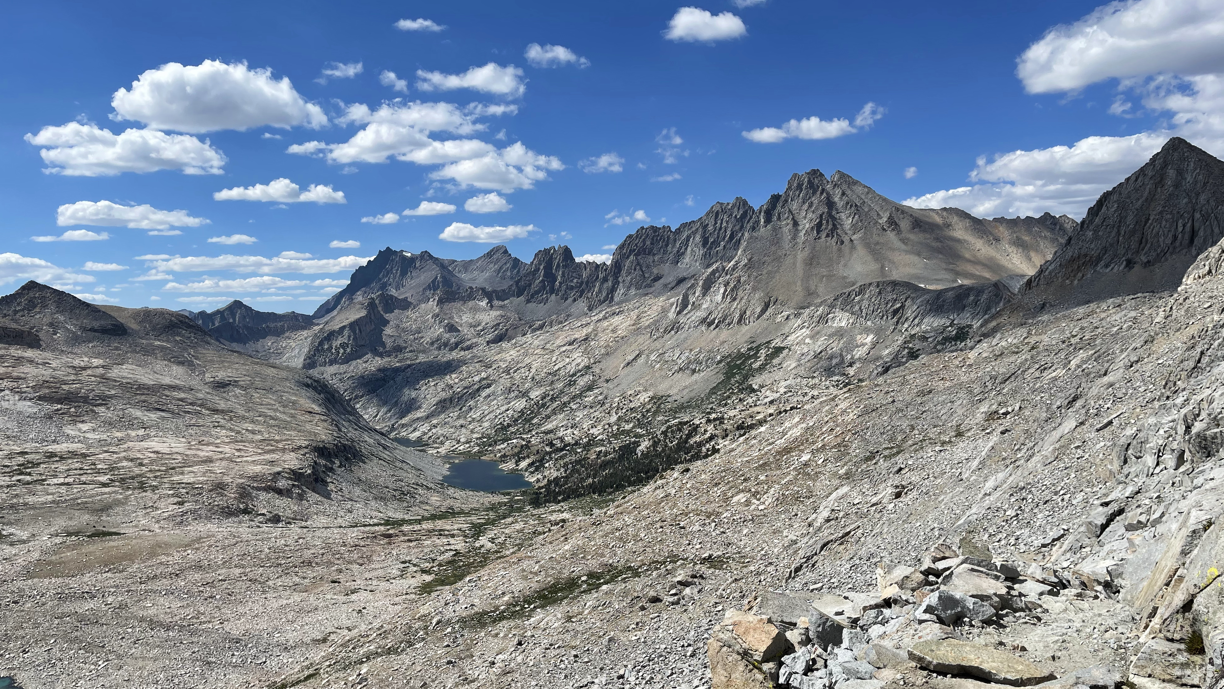
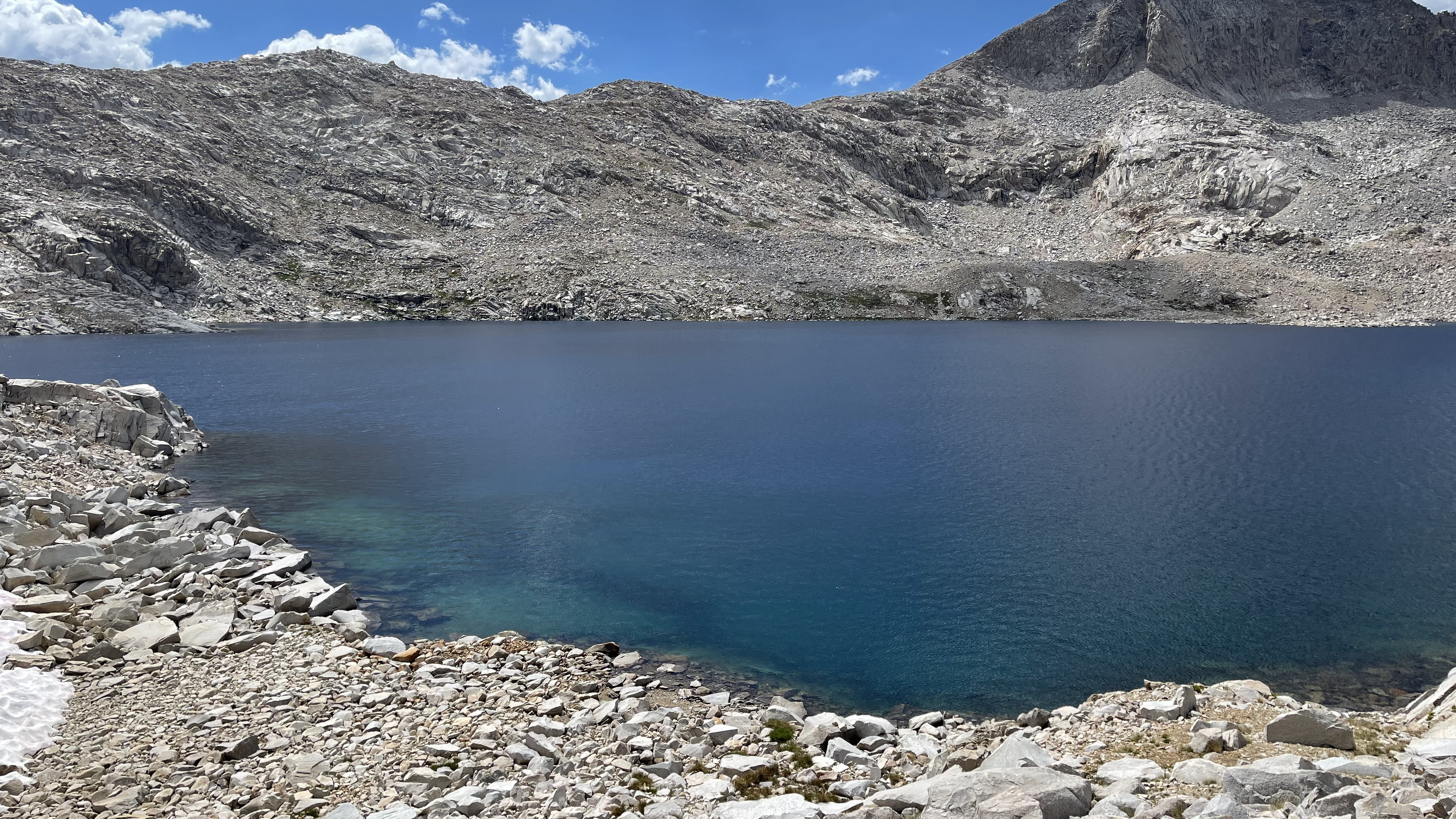
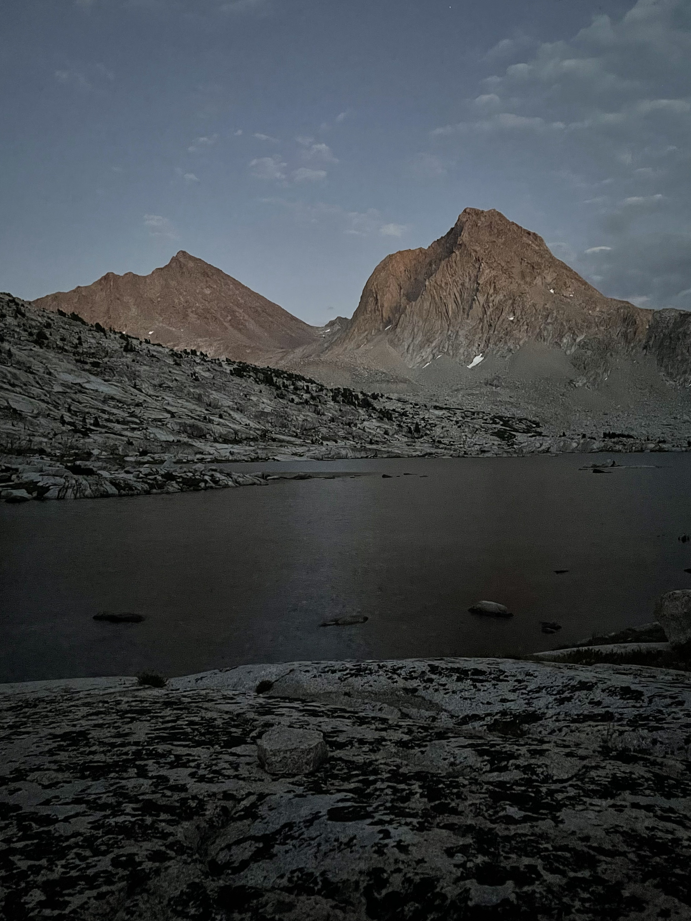
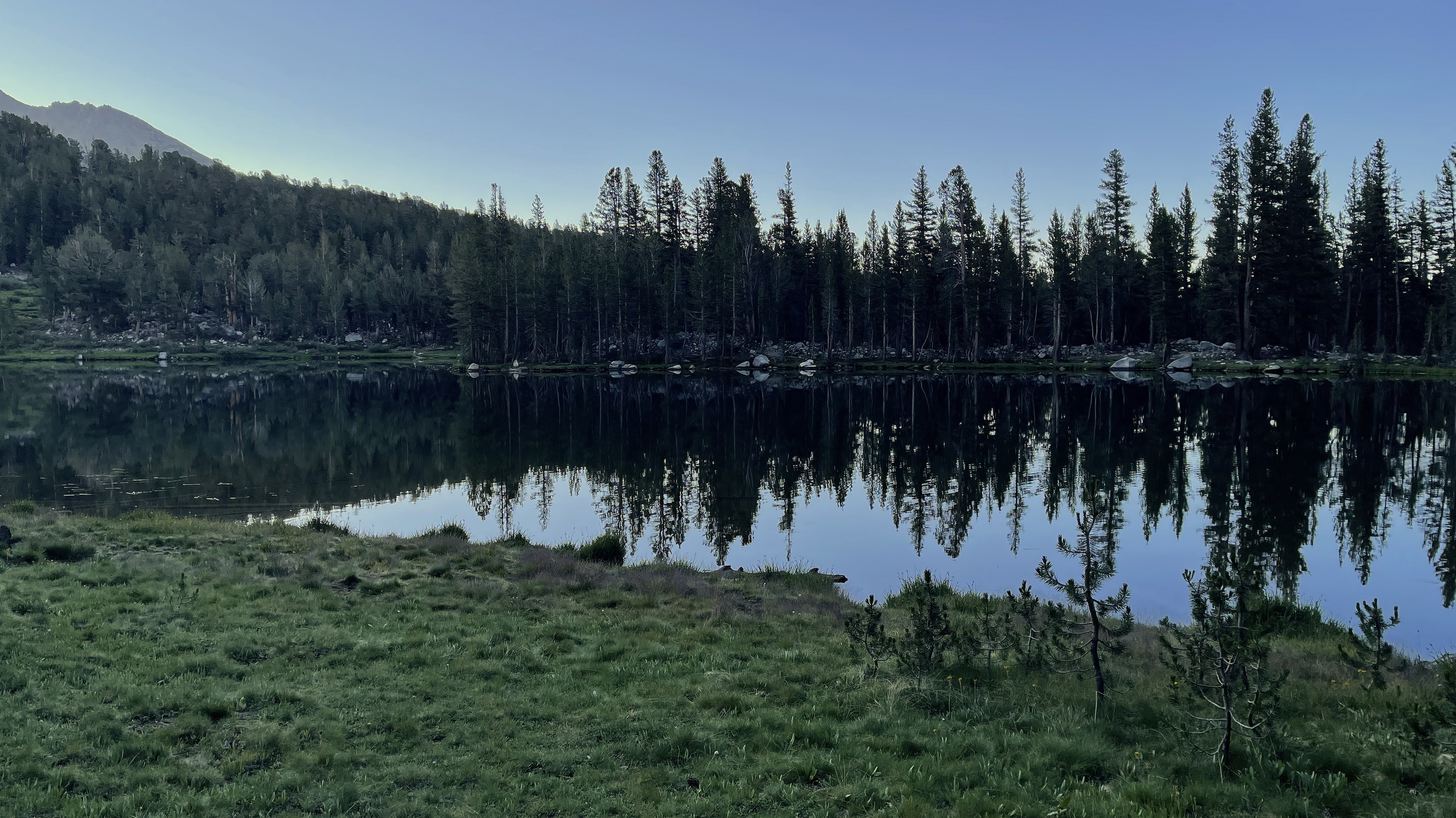
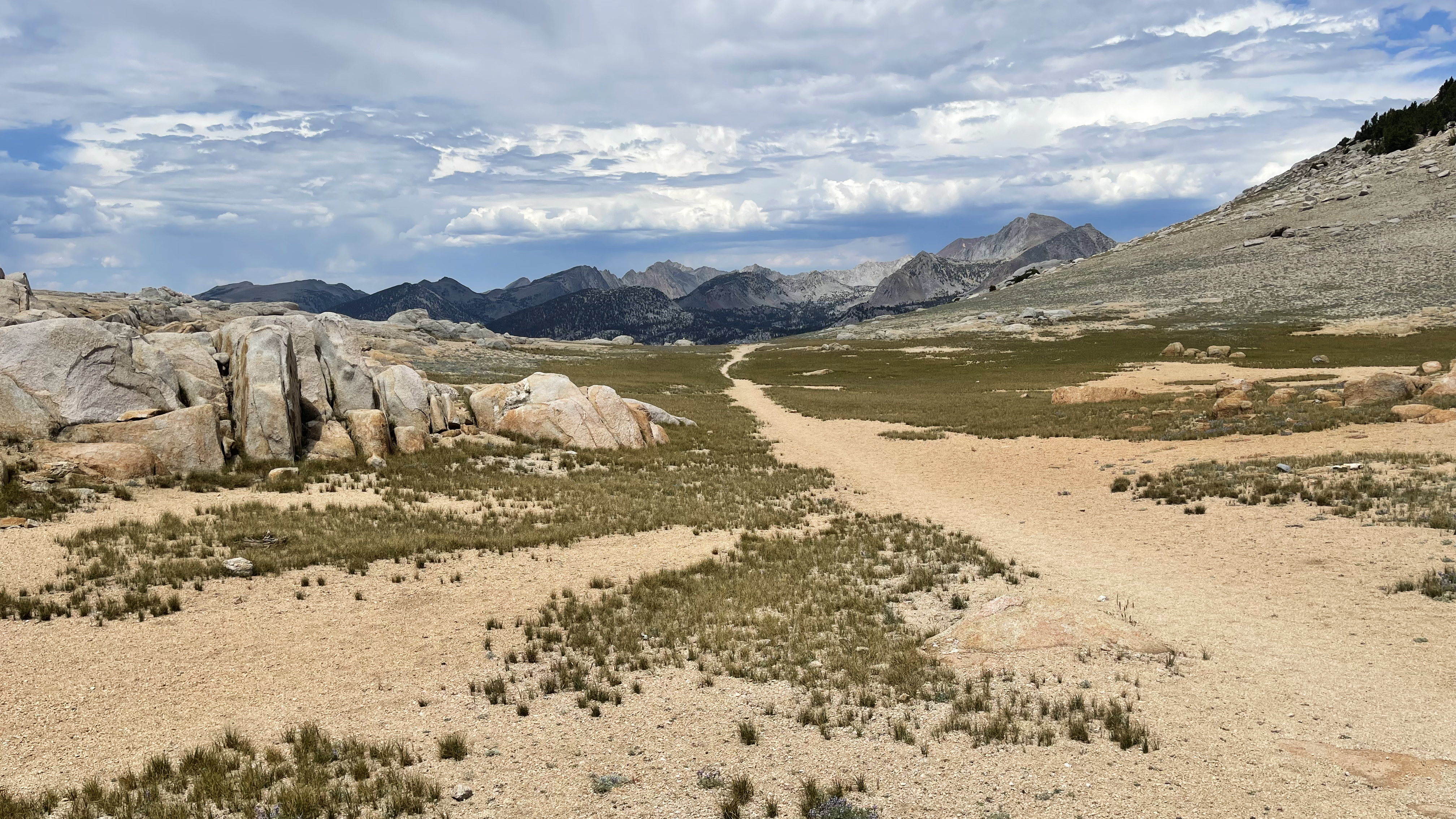
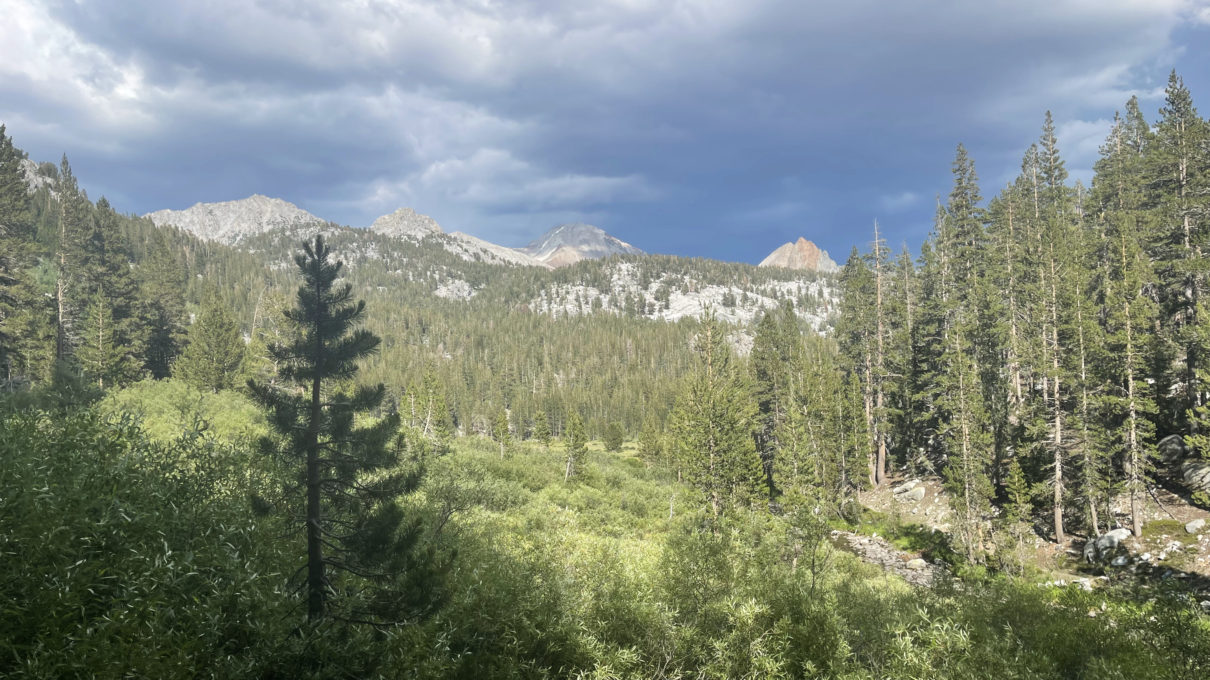
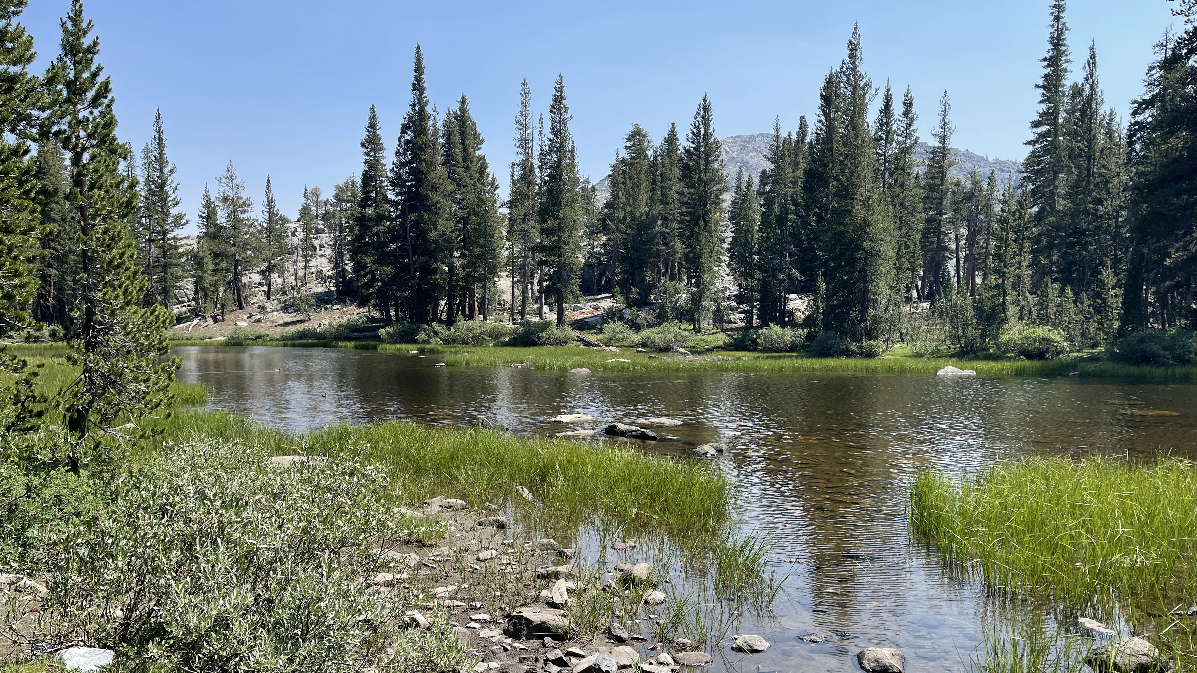
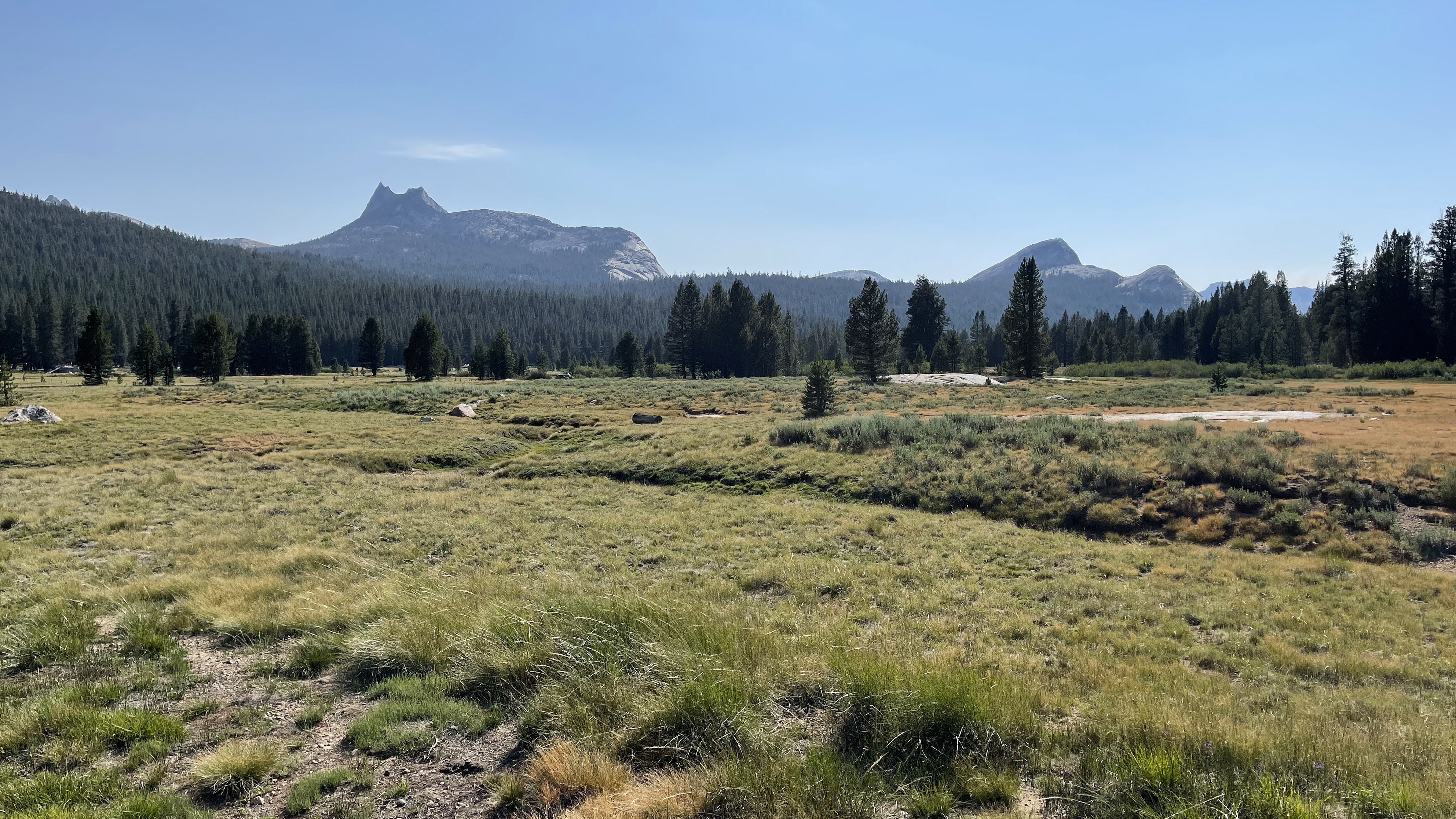
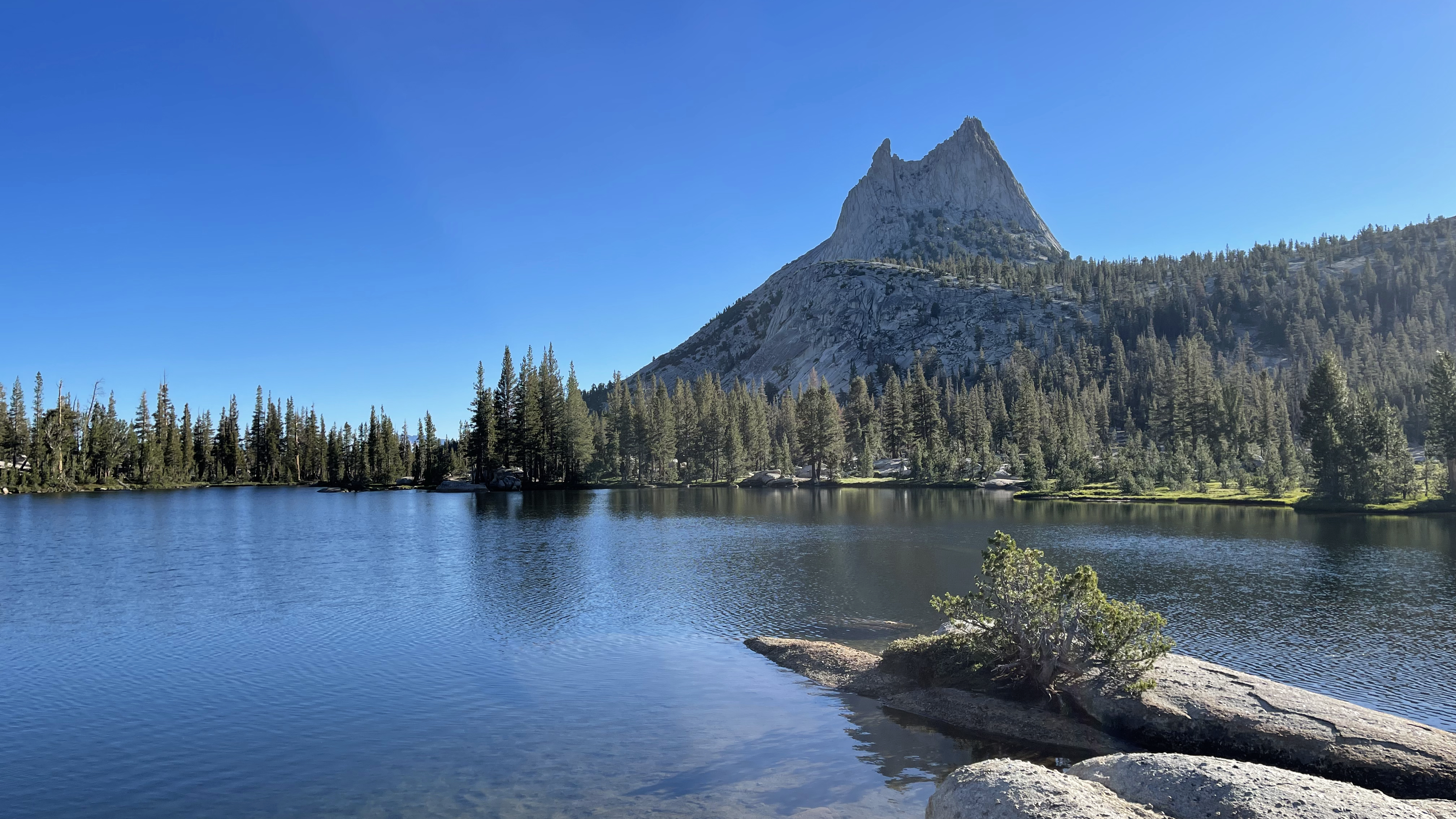
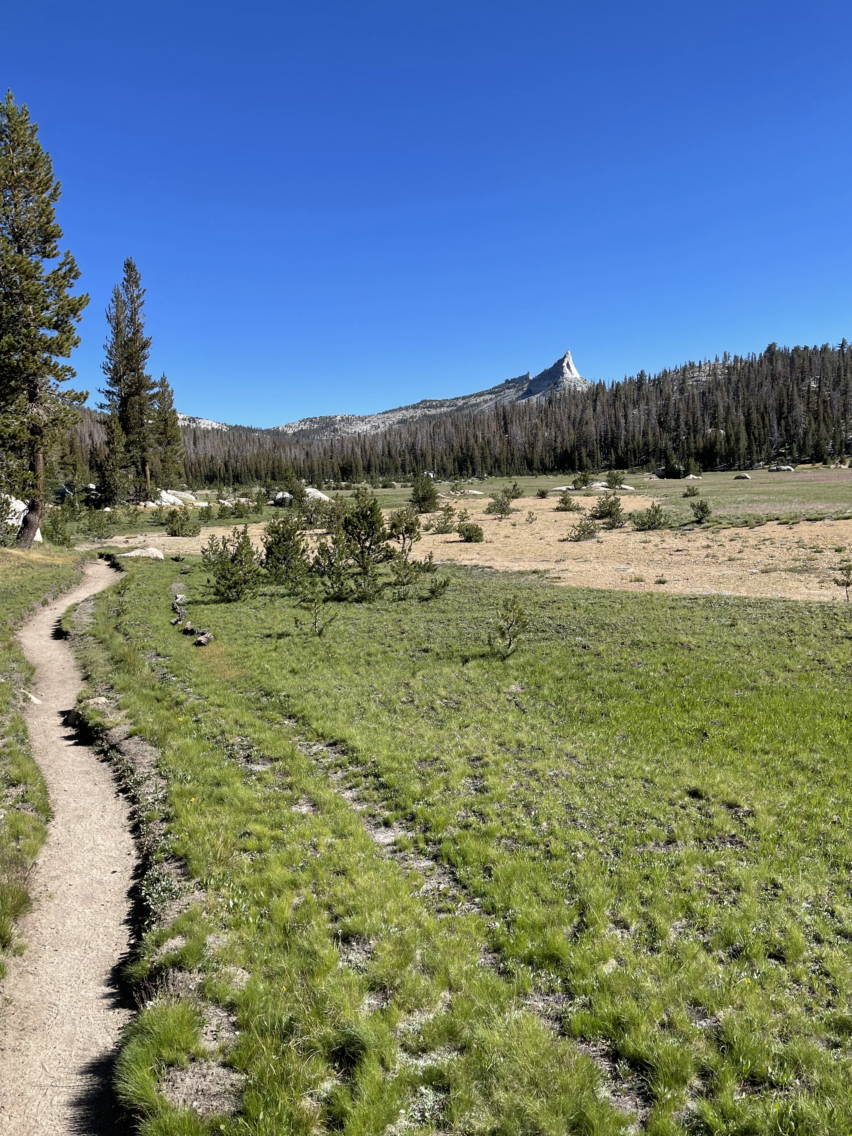
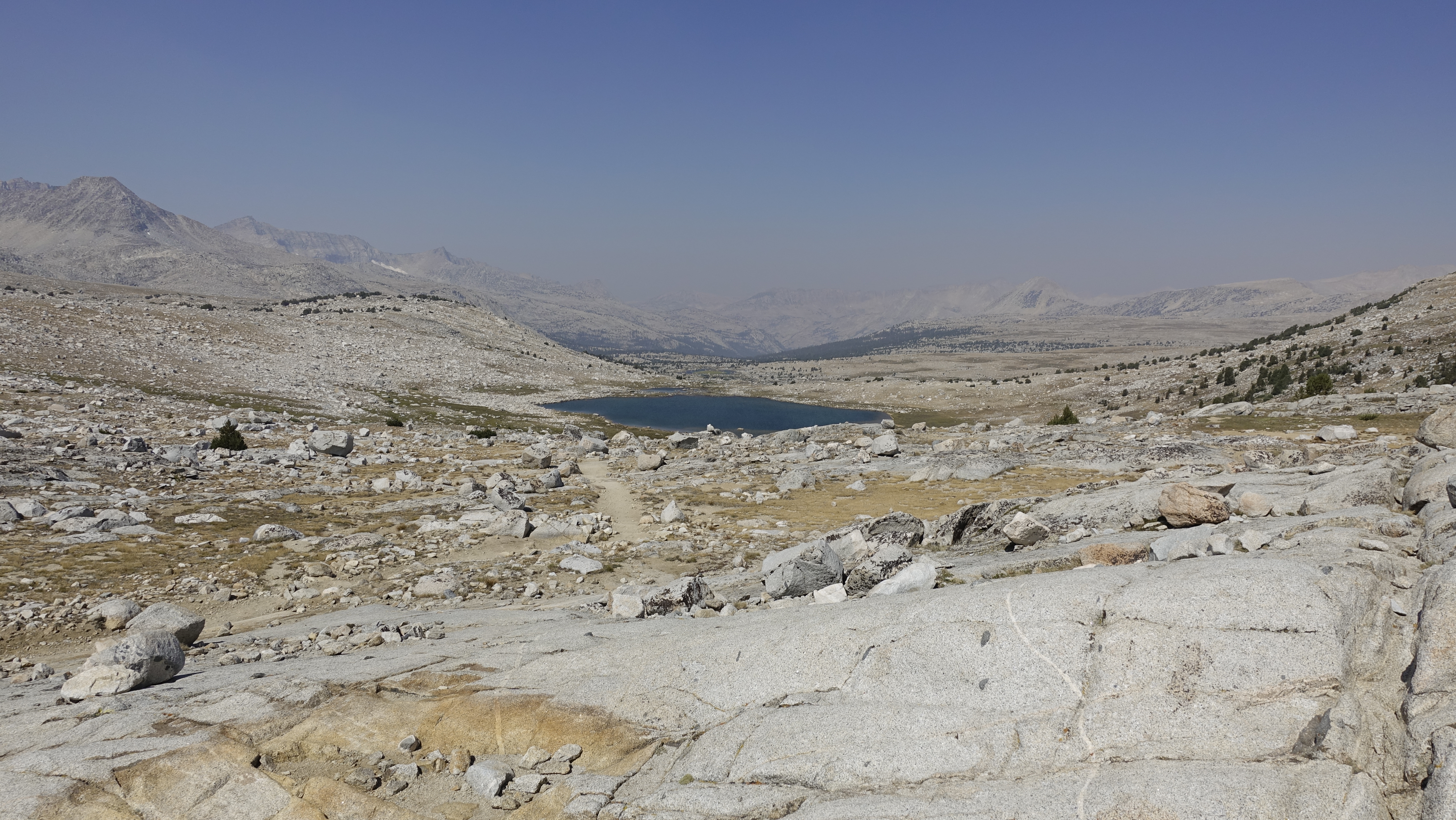
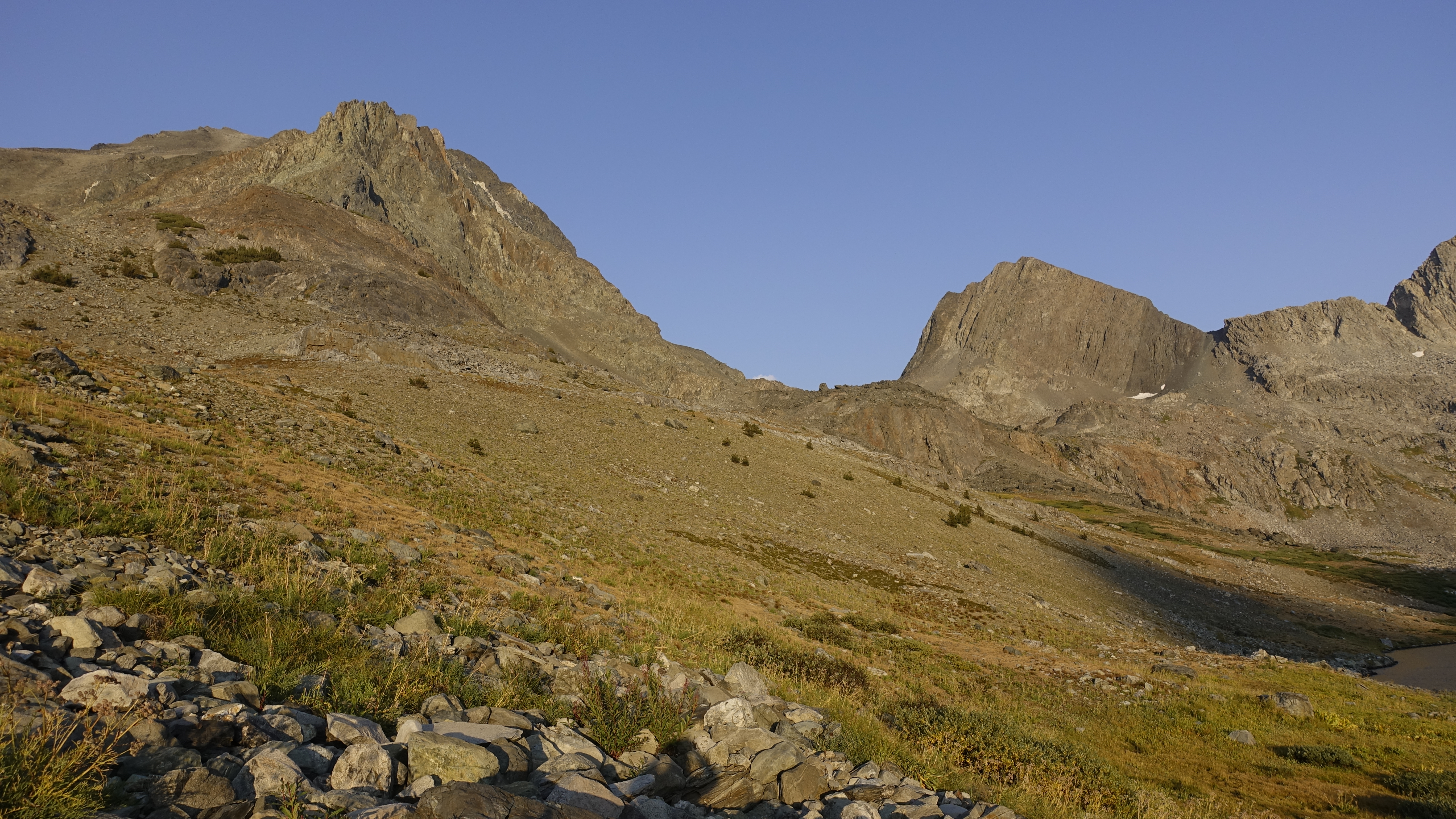
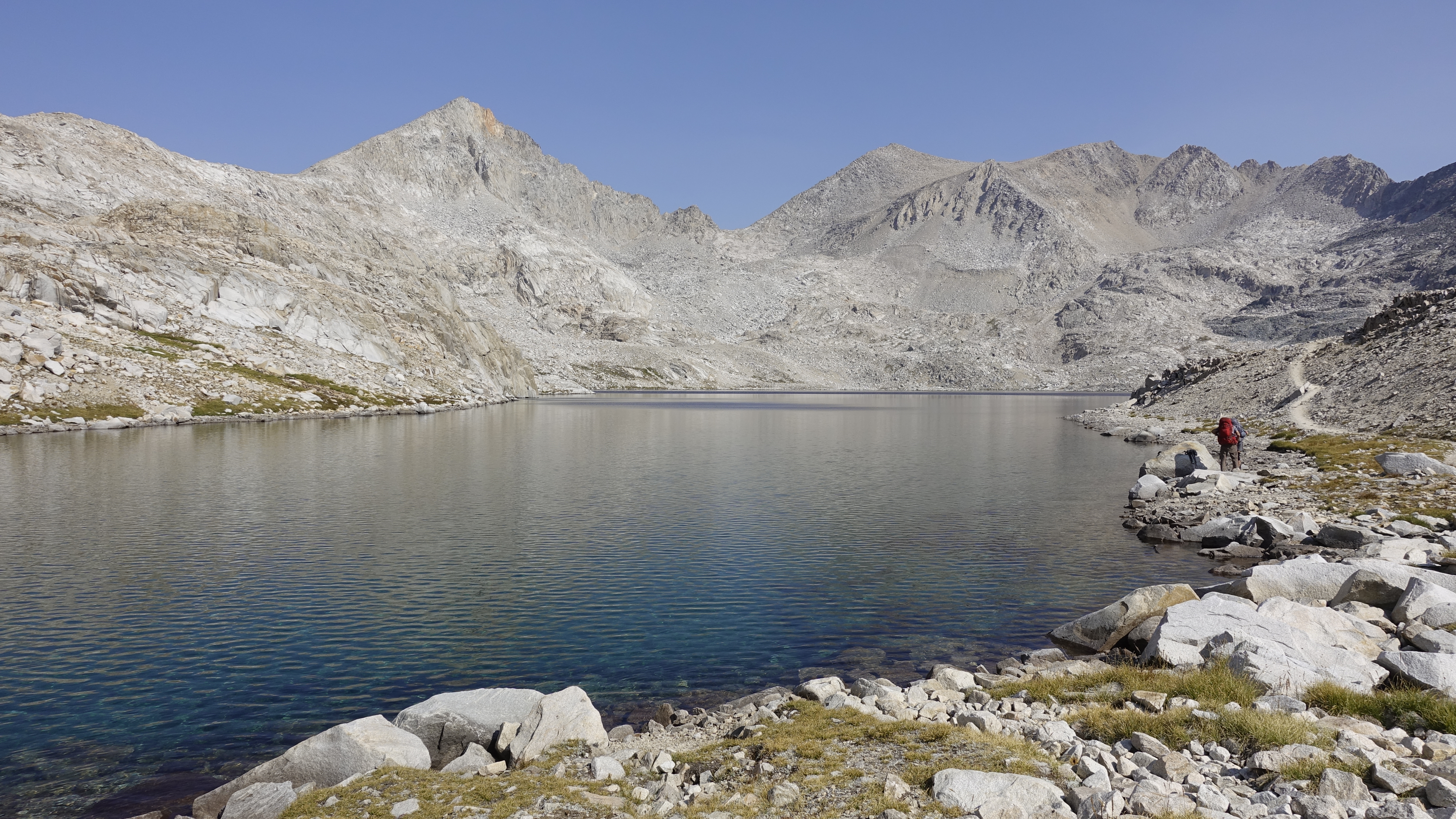
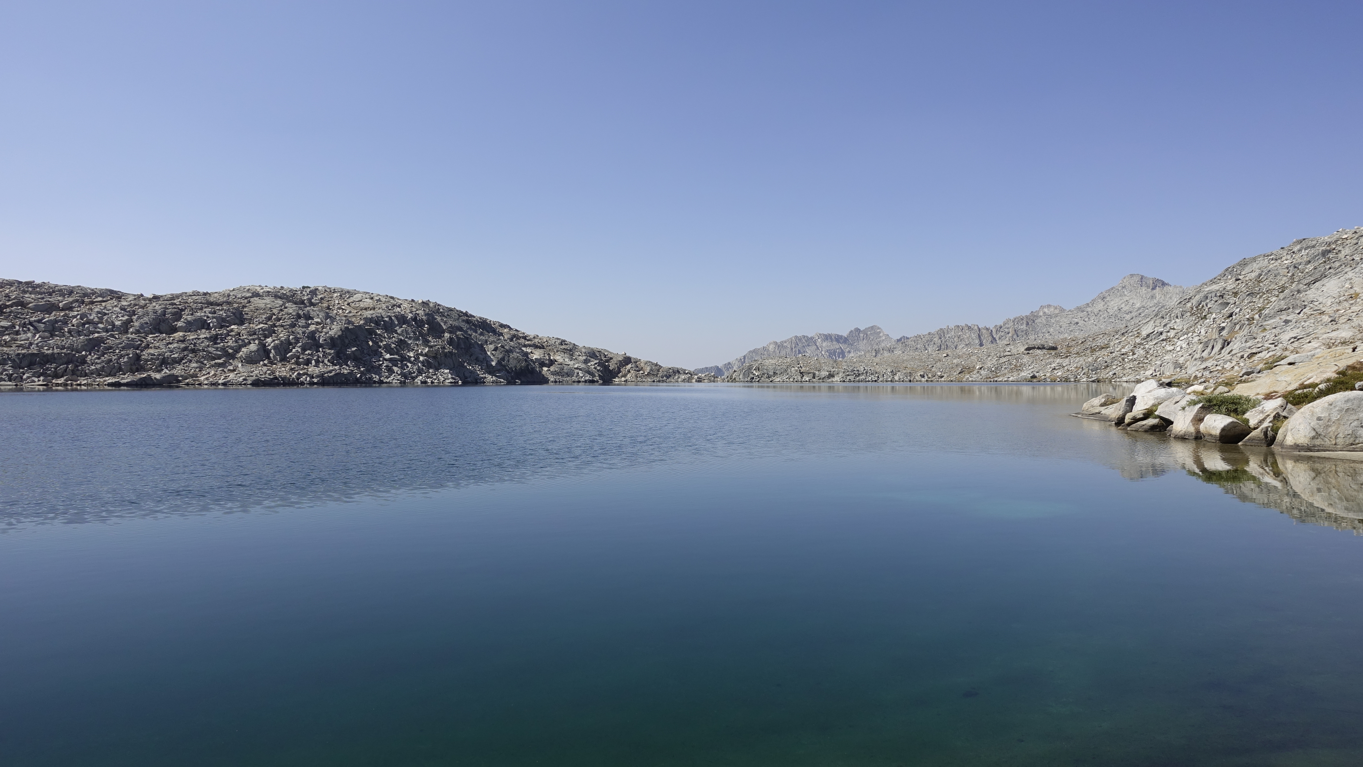
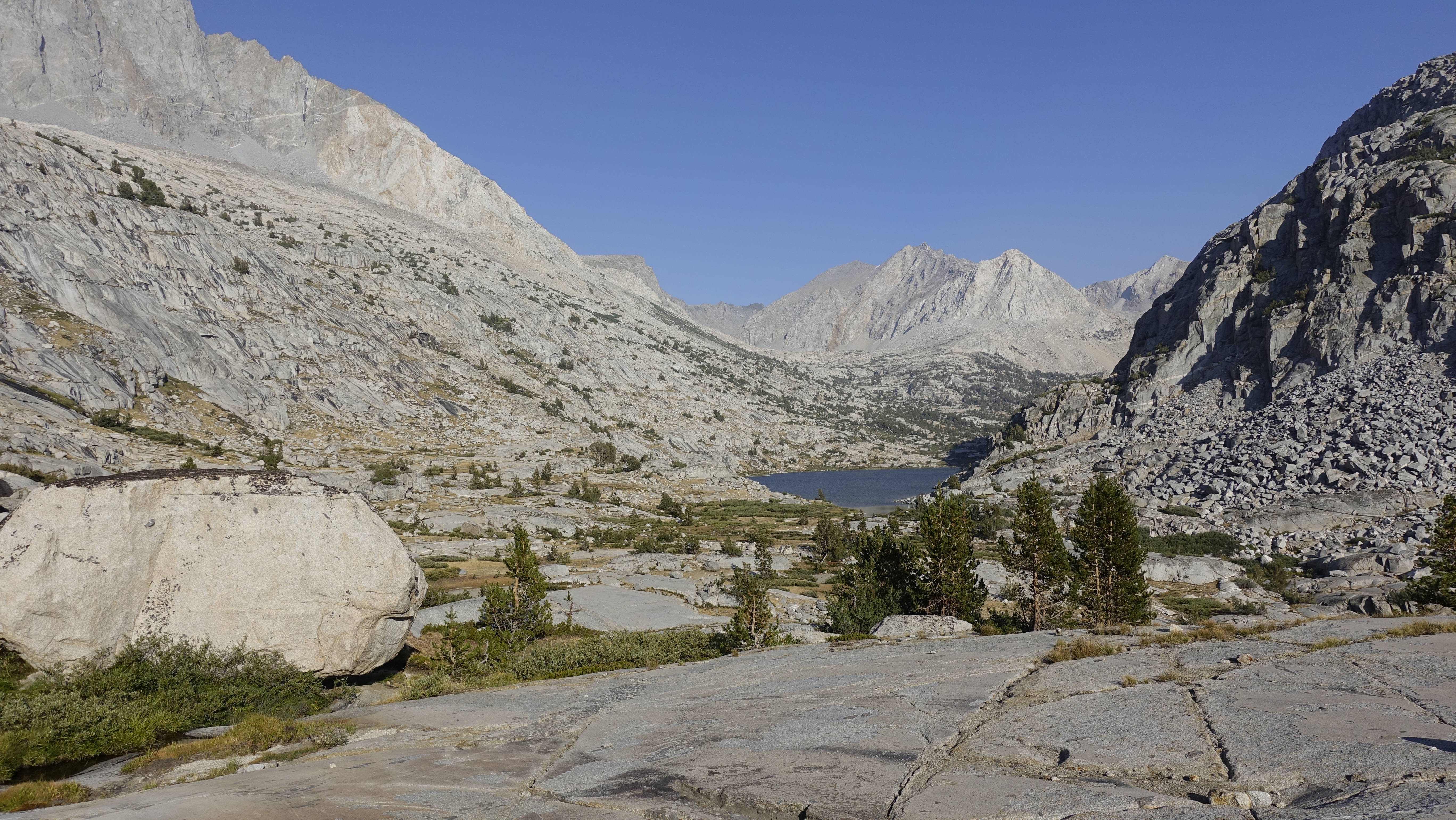
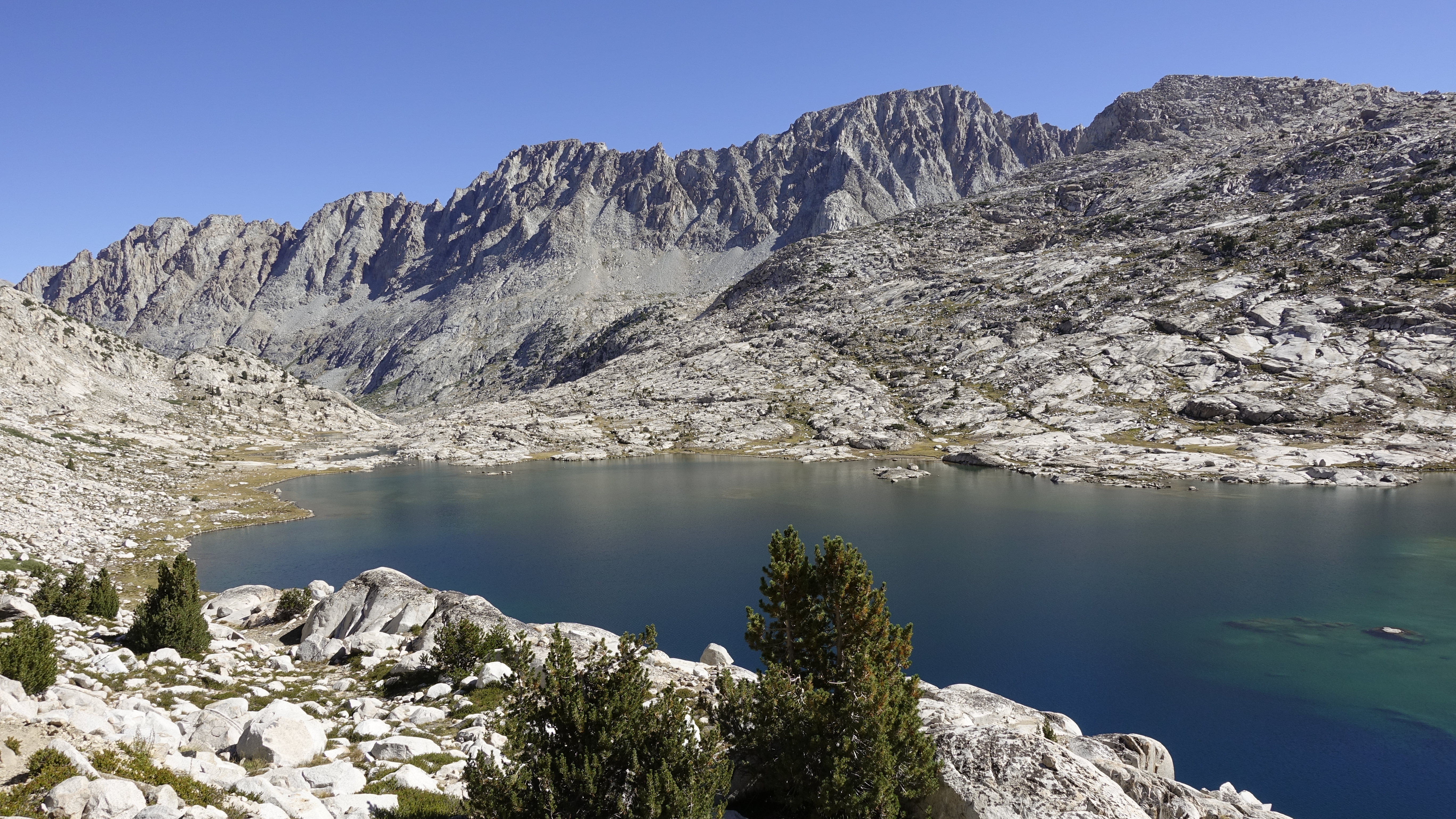
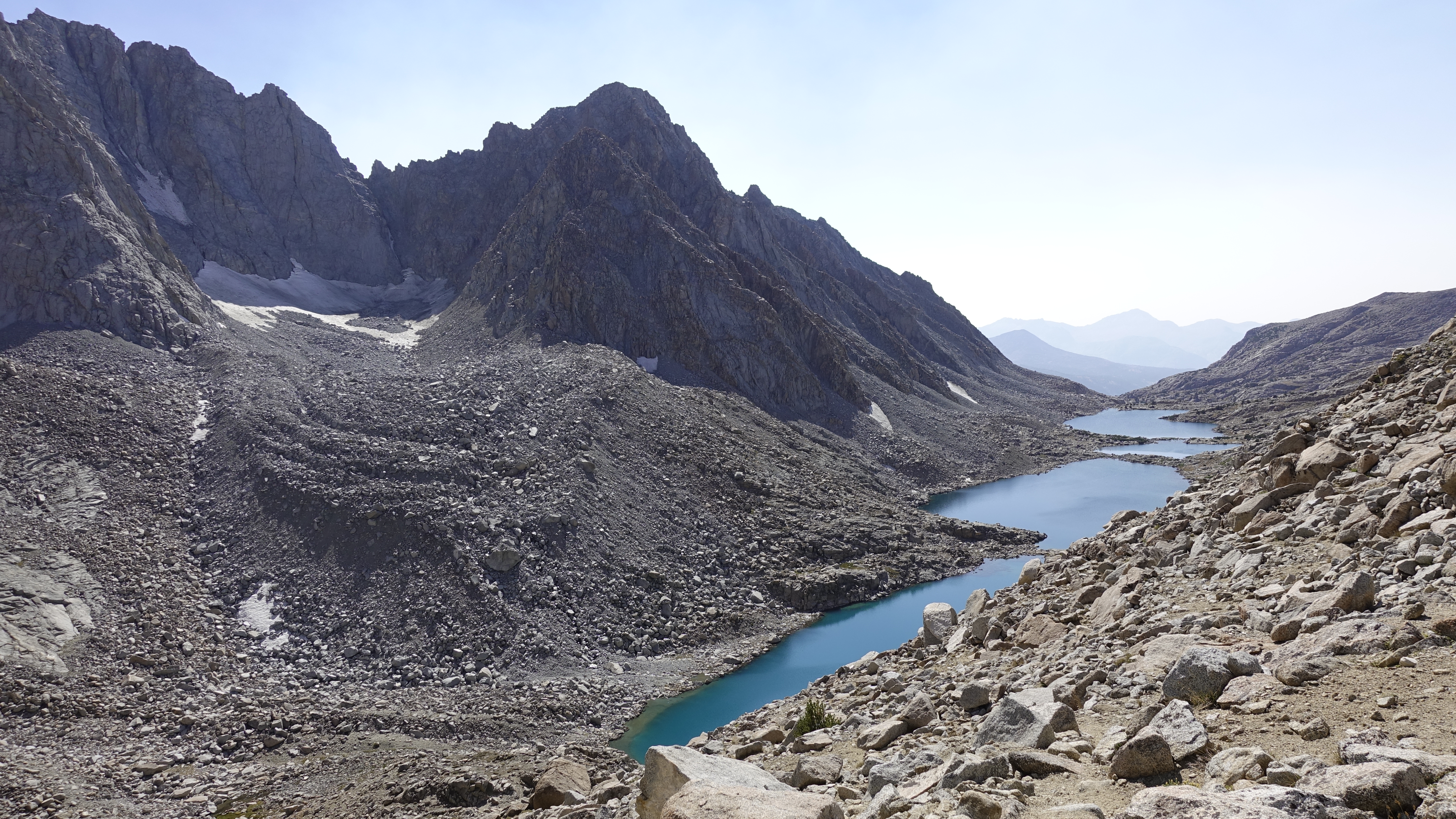
I take it slow and control my pace, breathing only through the nose in and out. I don’t groan, there is no drudgery, and remarkably no breaking sweat. Just a pleasant climb. There is lightning and thunder, but the forested, for now, trail gives me a (false?) sense of security. The rain however breaks as I reach Saddlerock Lake. The sky periodically spits, but there is no longer lightning and thunder. I decide to make for Bishop Pass.
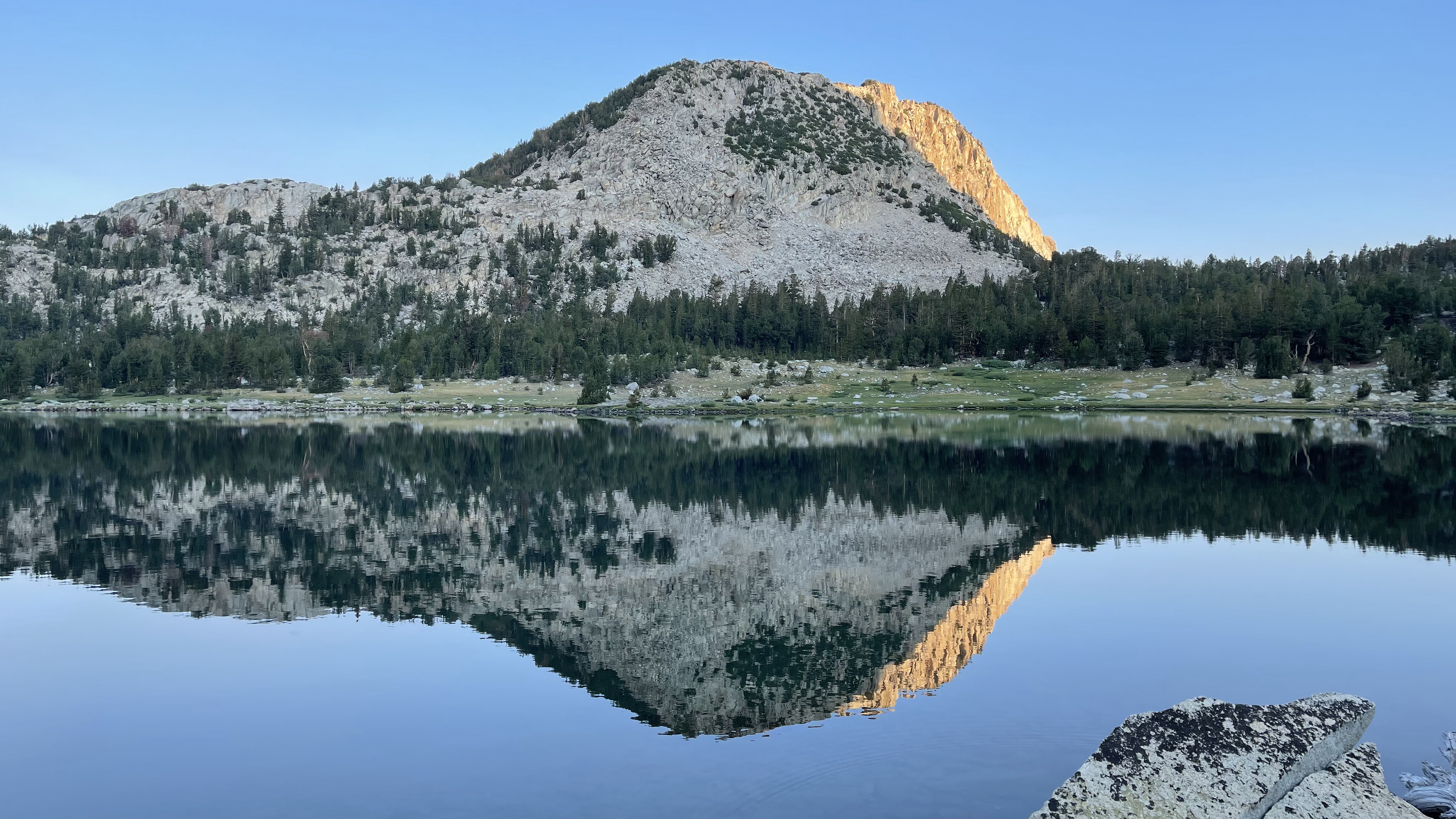
Saddlerock LakeSaddlerock Lake
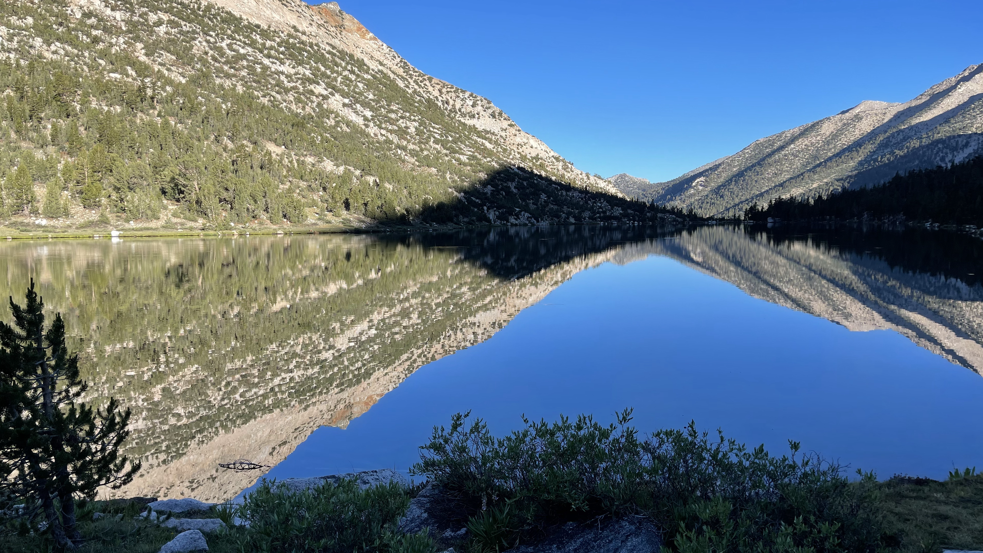
Though overcast there is a vibrance I haven’t noticed before. There is a greenness from the wet summer and every granitic grain pops; the cloud shaded light enhancing the contrast. Can rain actually make for a better, more scenic hike?
It certainly isn’t miserable
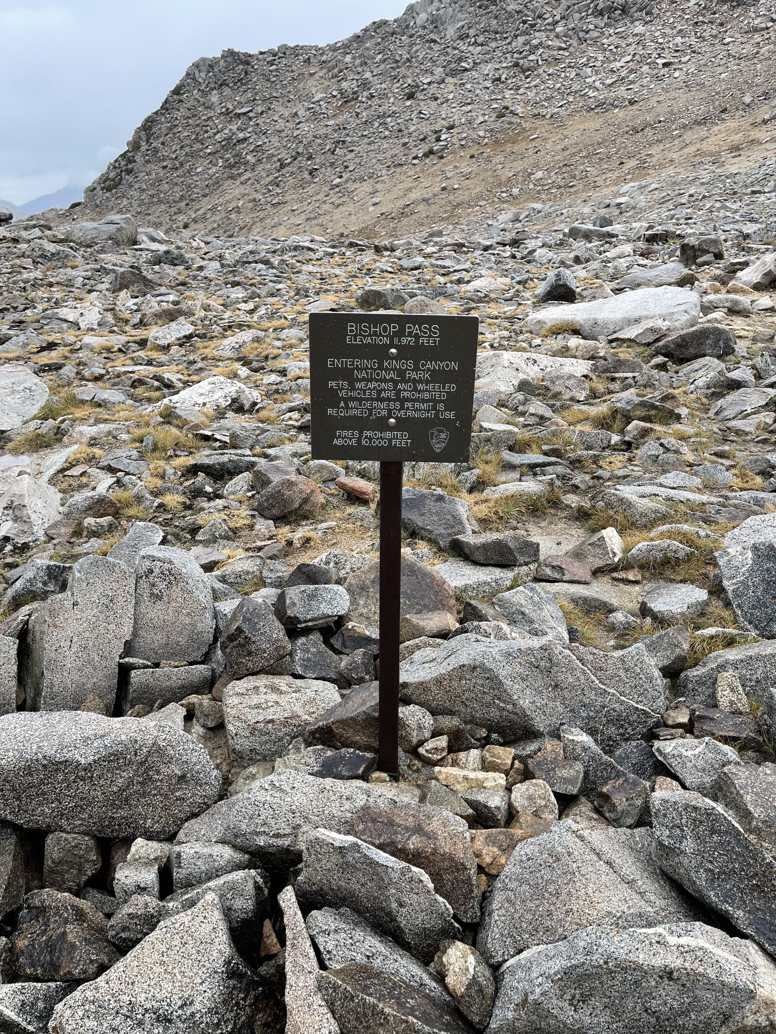
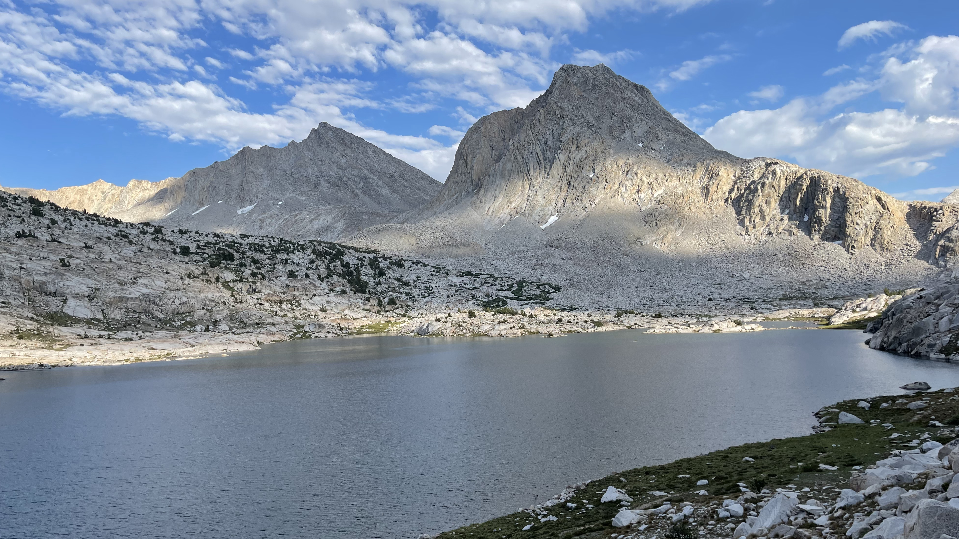
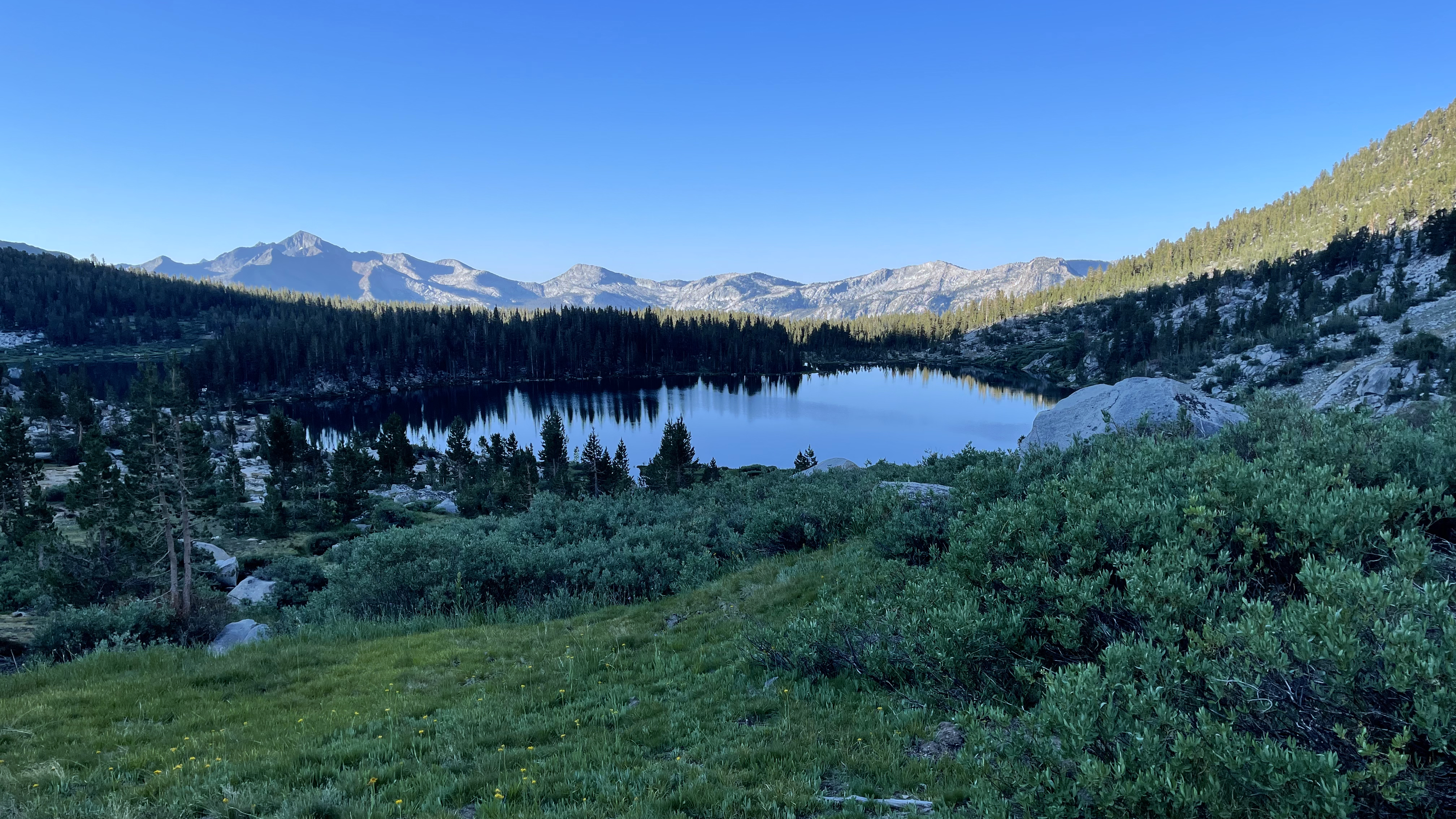
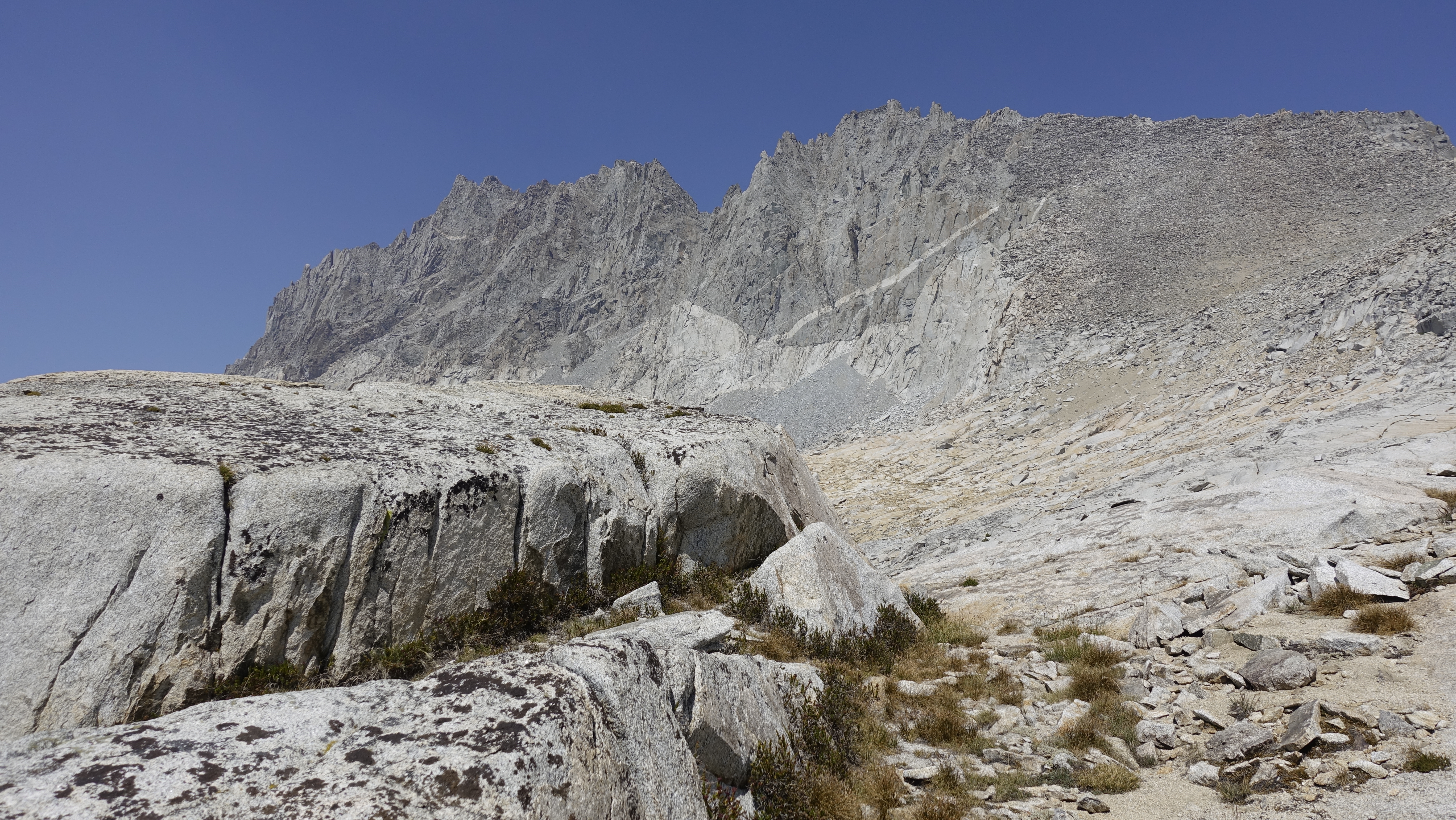
Bishop Pass
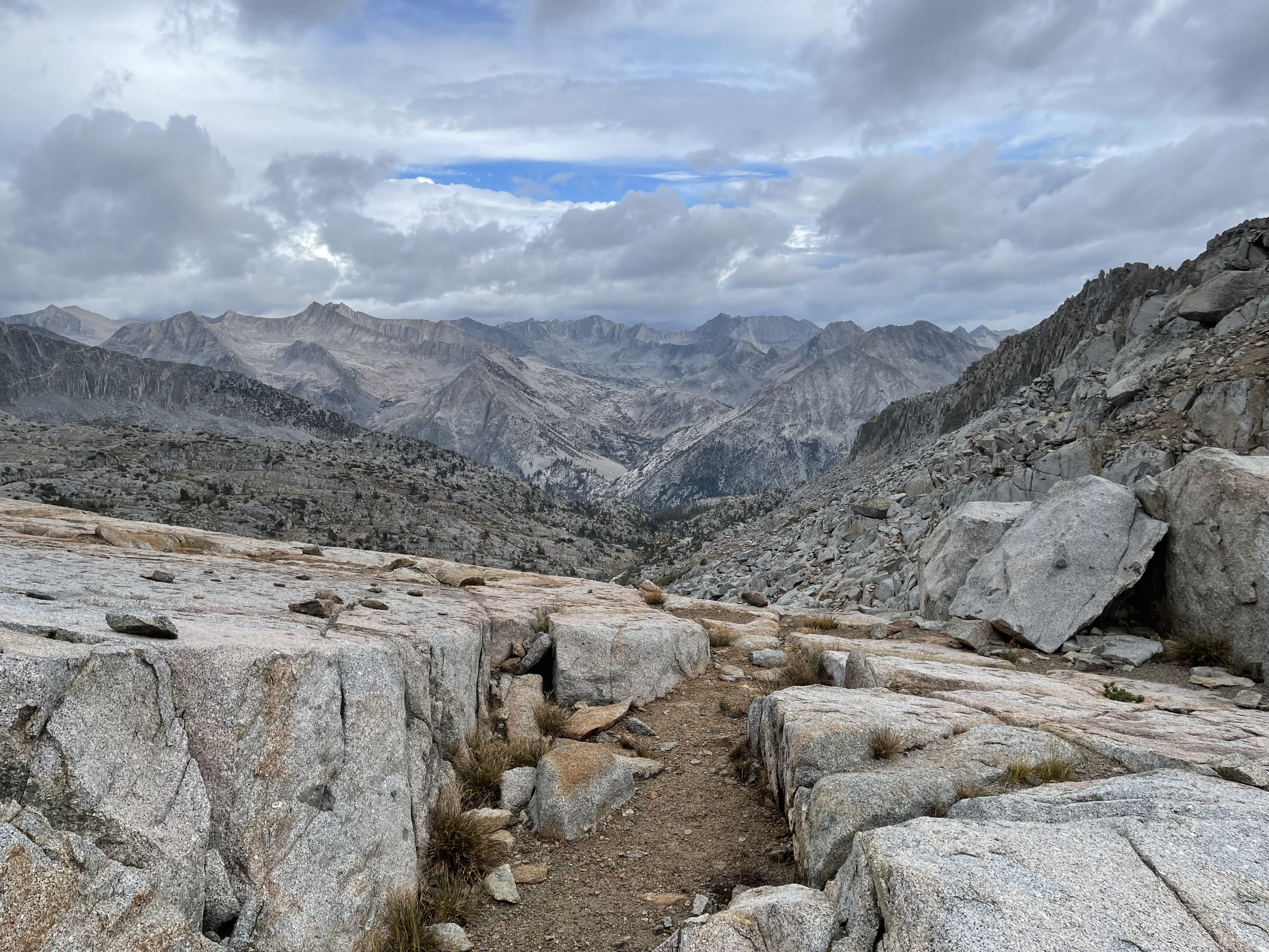
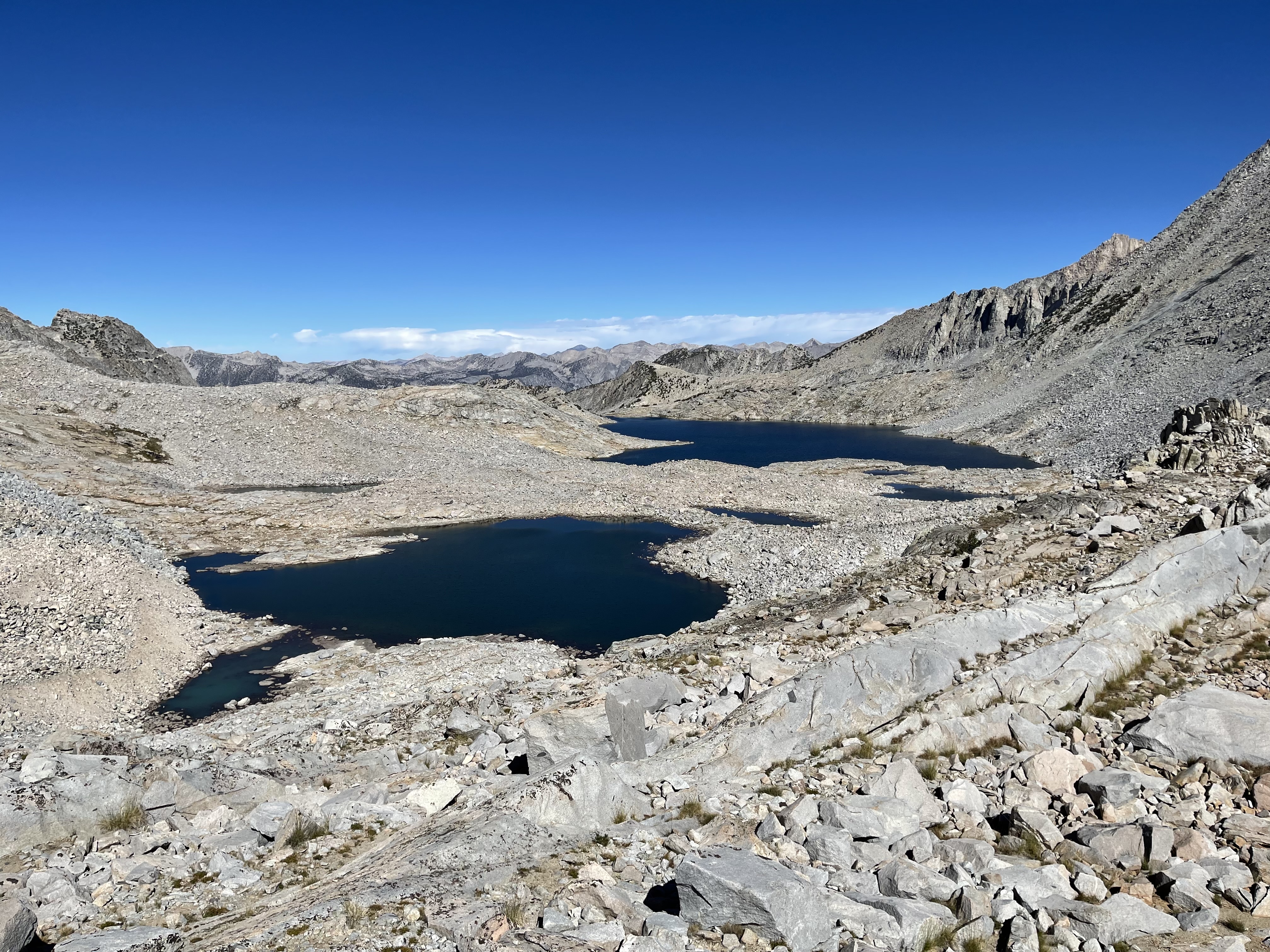
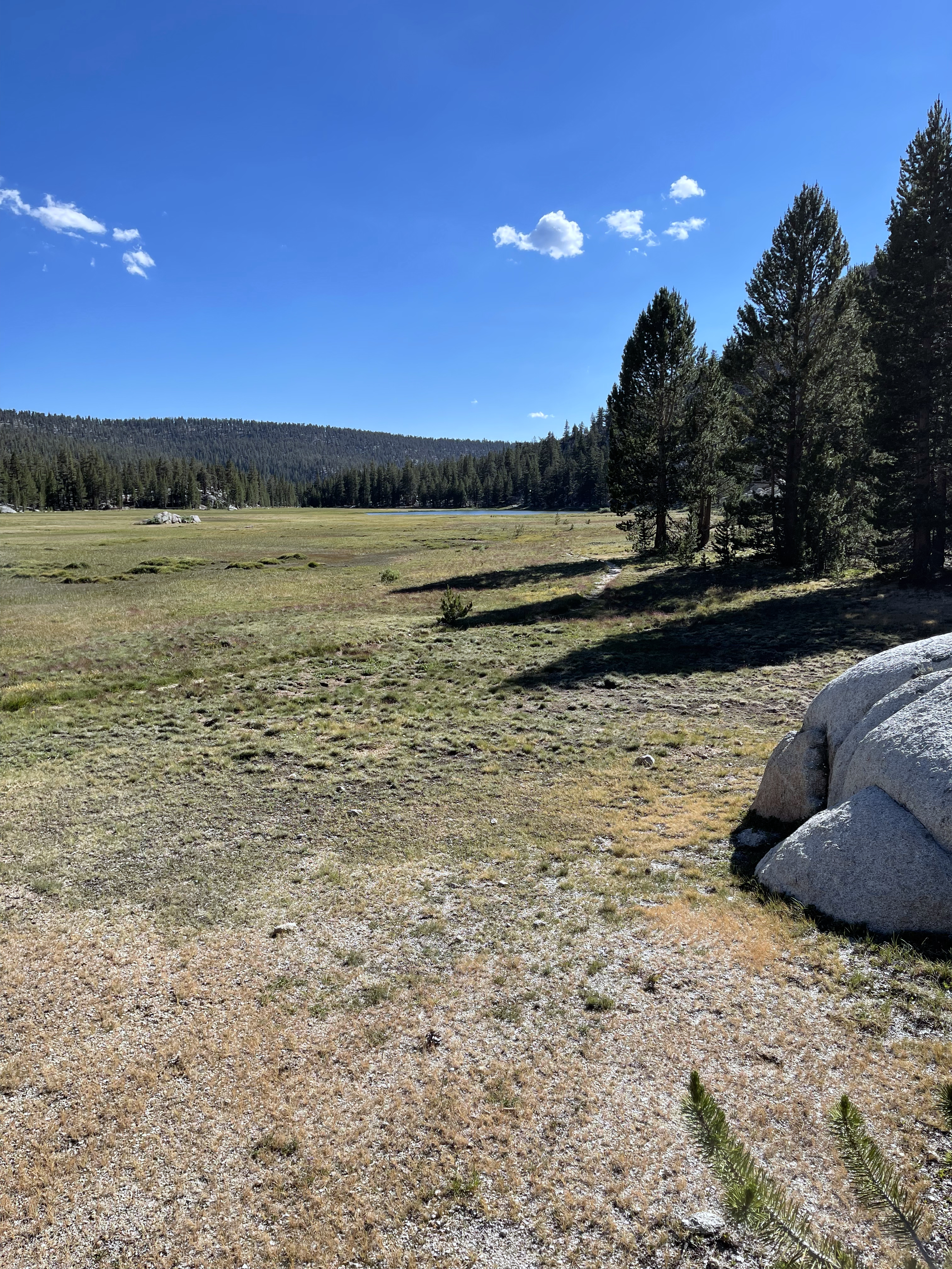
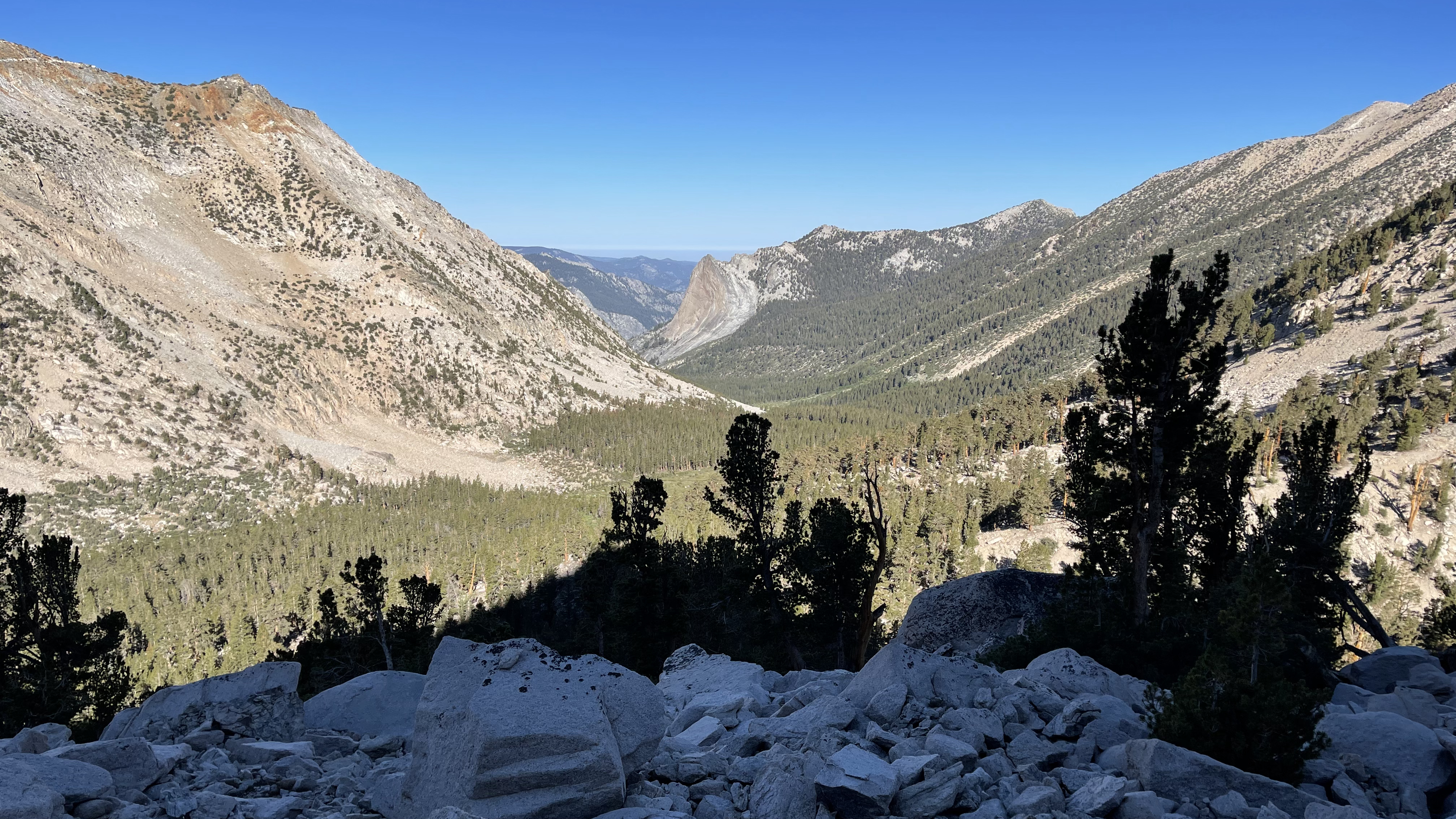
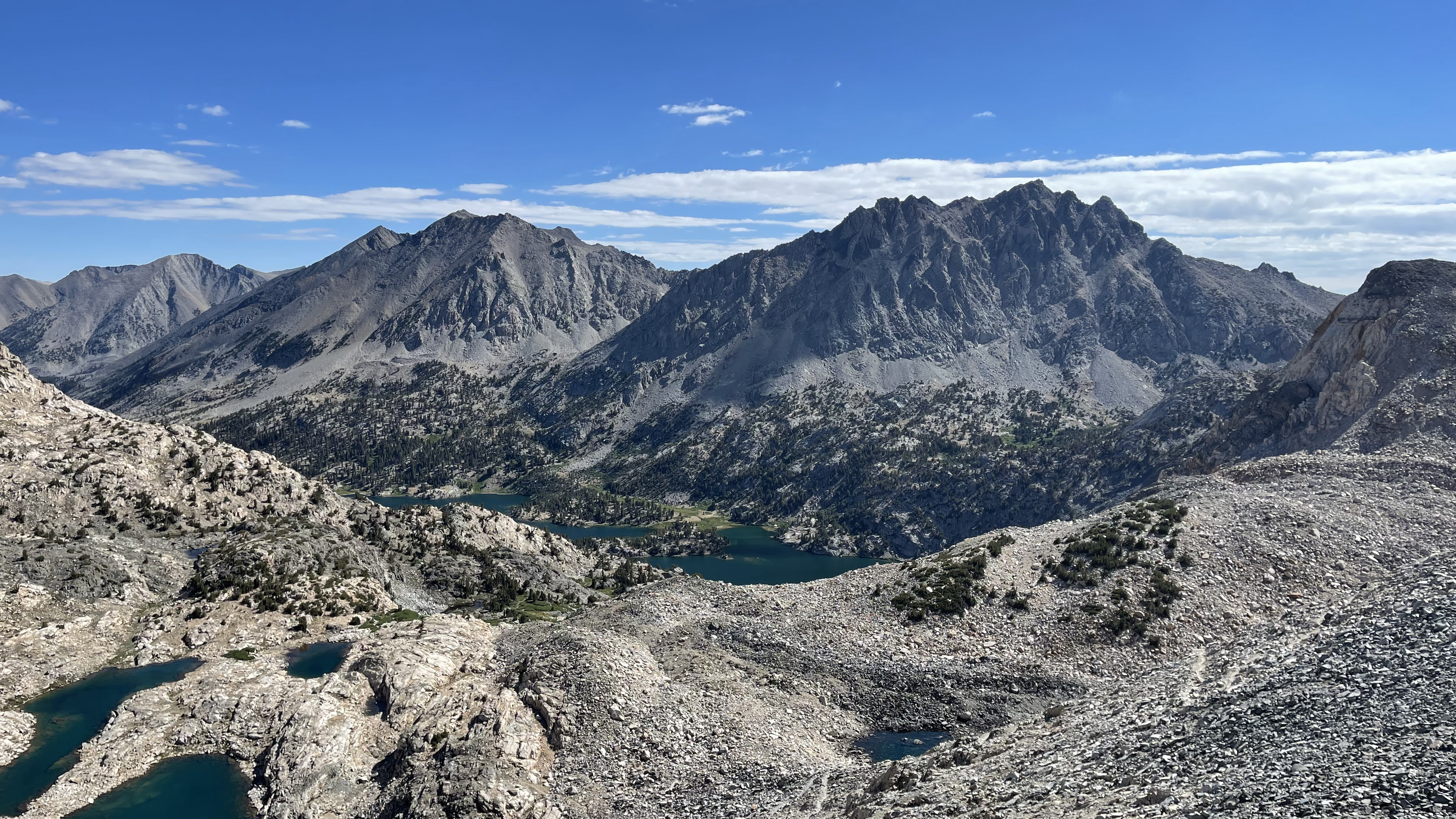
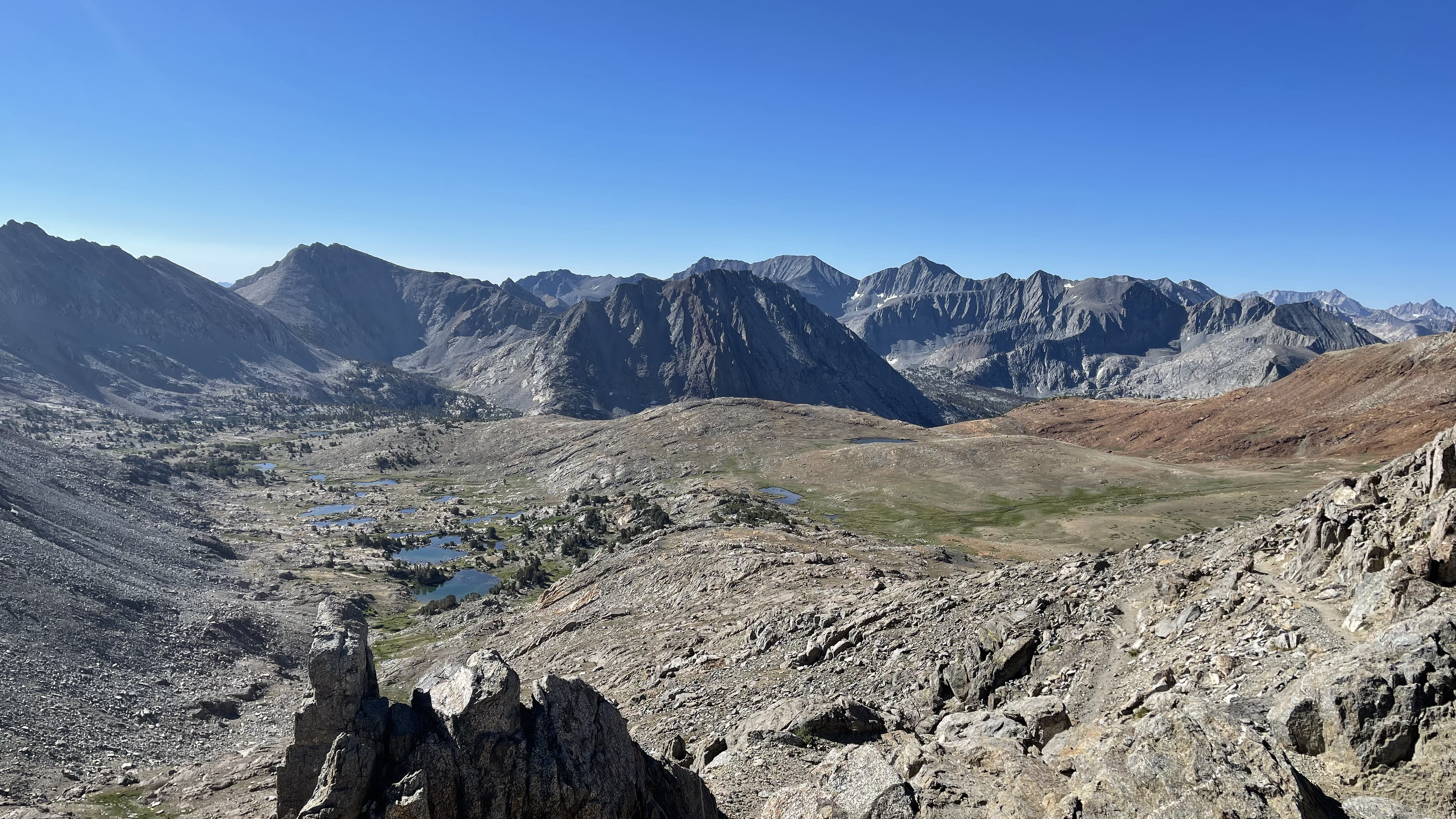
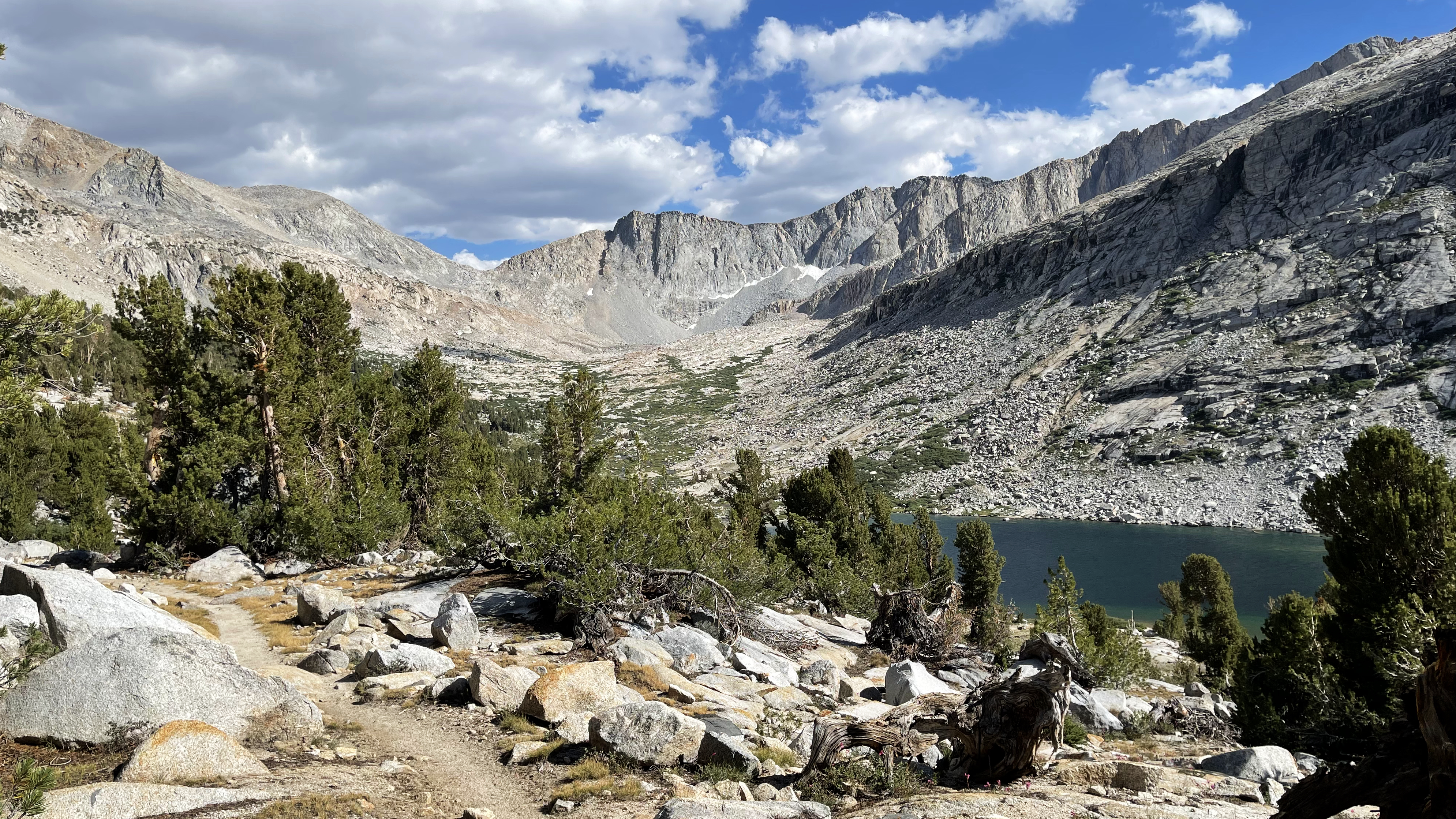
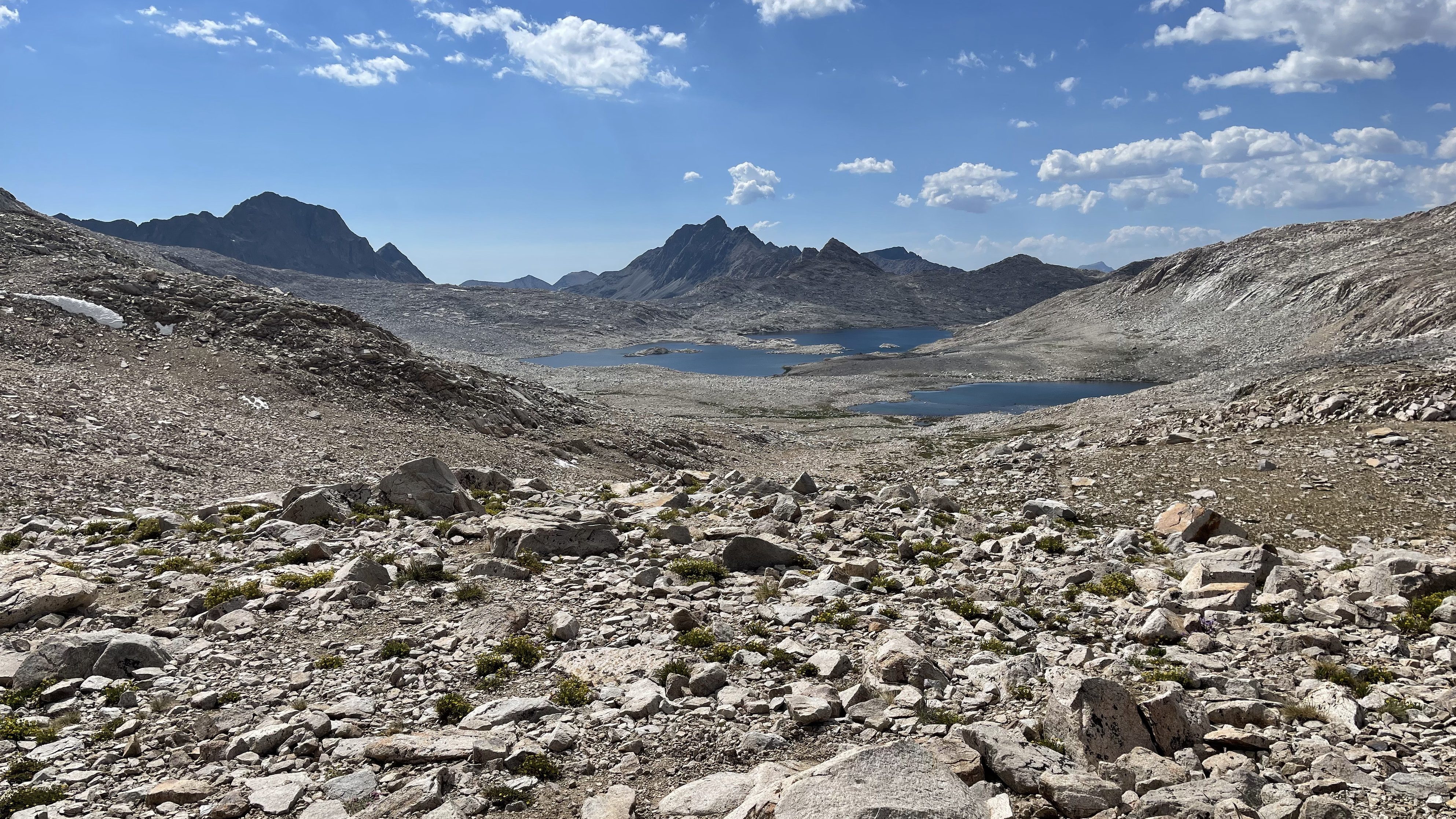
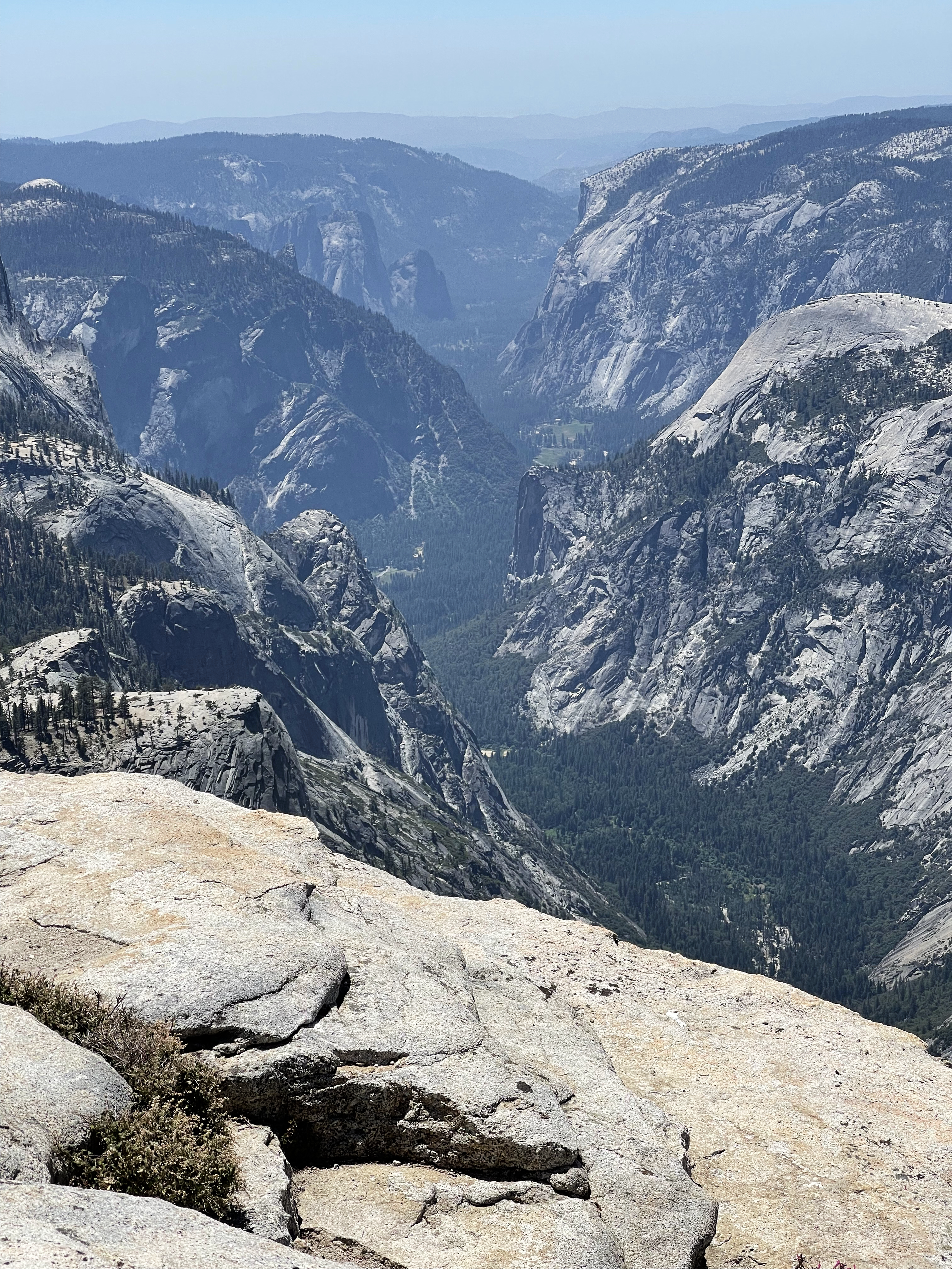
I start a memory filled descent into Dusy Basin. 1971: The Elson’s invite me on their family camping vacation. We camp on S Fork Bishop Creek between Parchers and South Lake and take an overnight backpack into Dusy Basin. 1972: My Boy Scout Troop hikes North Lake to South Lake. 1973: My Boy Scout Troop hikes a cross country loop that includes my route over Knapsack and Potluck and returning to South Lake. 1990: With Fred, Manoogian, and Steve, our South Lake to Mt. Whitney hike. 2004: My solo North Lake to South Lake hike. 2012: Art and I doing a figure 8 with 2 passes through Dusy Basin. And my 2020 loop out of North Lake. I haven’t tallied everything, but I’ve quite possibly been into Dusy Basin more times than any other Sierra location. All of it good.
I leave the trail and make my way east around the upper most lake and then head south to Knapsack Pass. I stop for water and a snack at the inlet and am called to by someone camped at the lake’s west end. Just a friendly hello and “where you headed?”
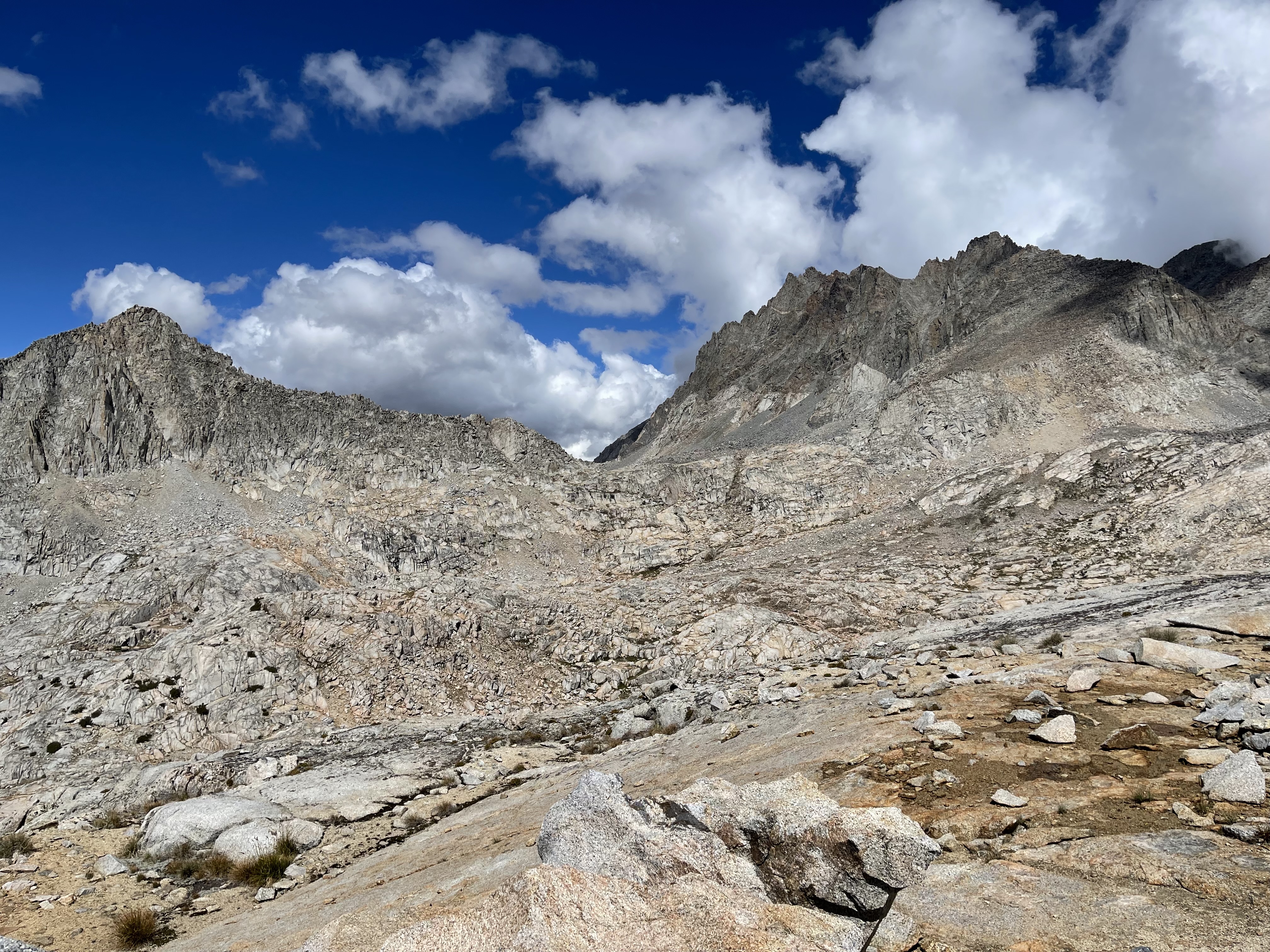
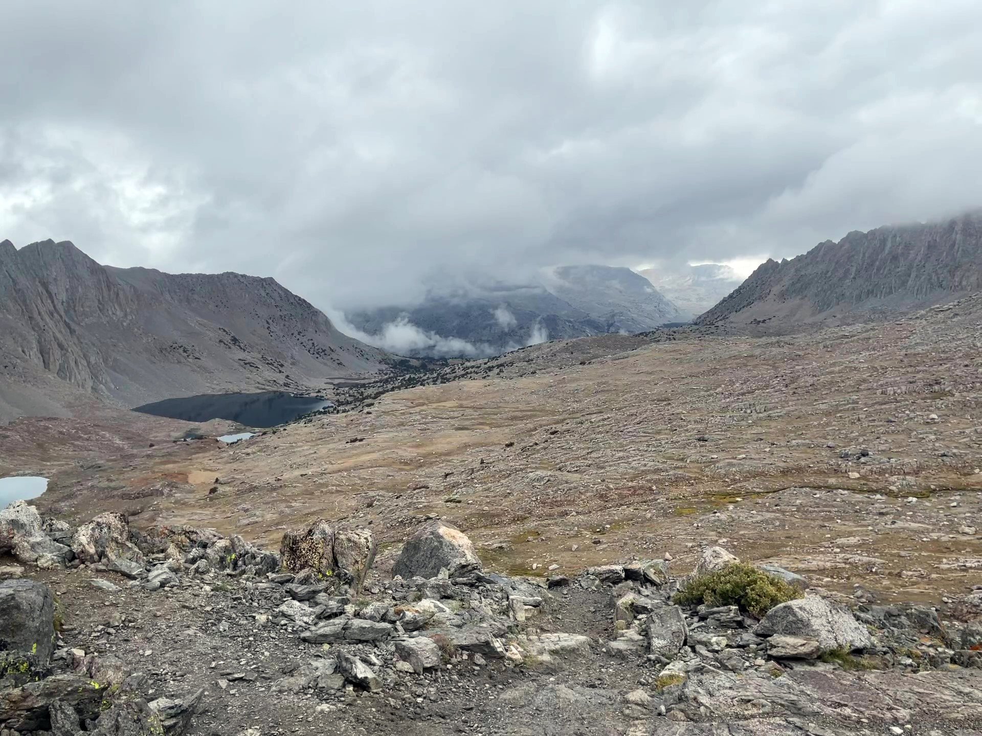
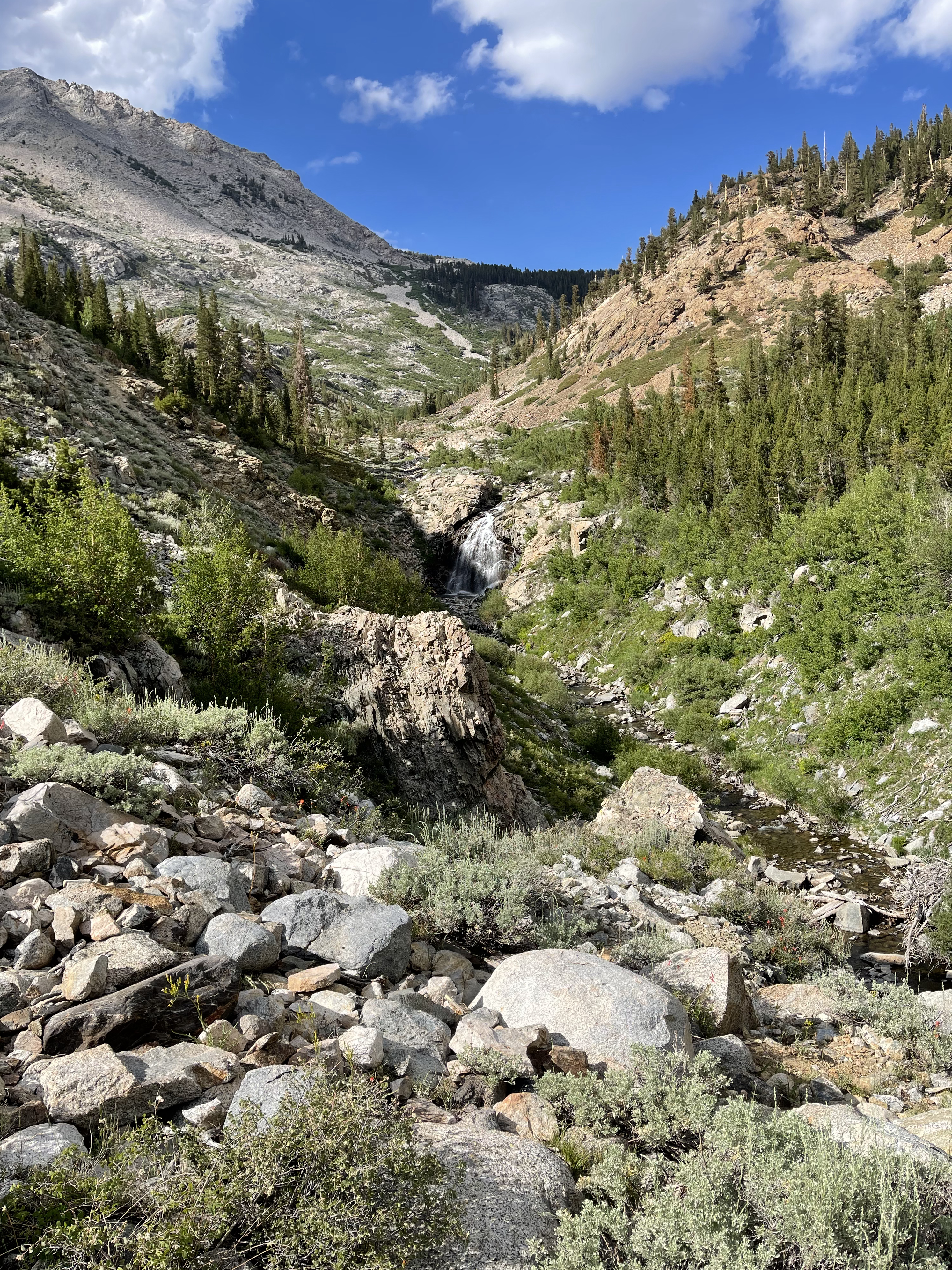
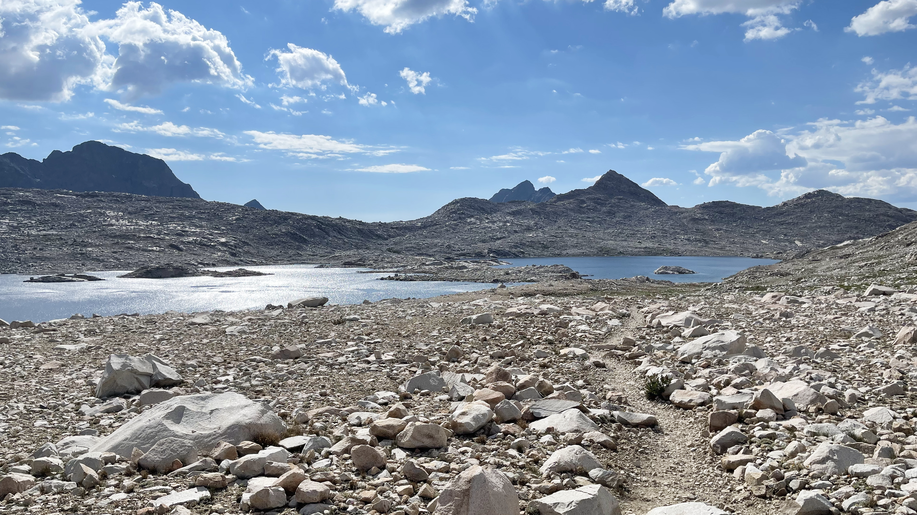
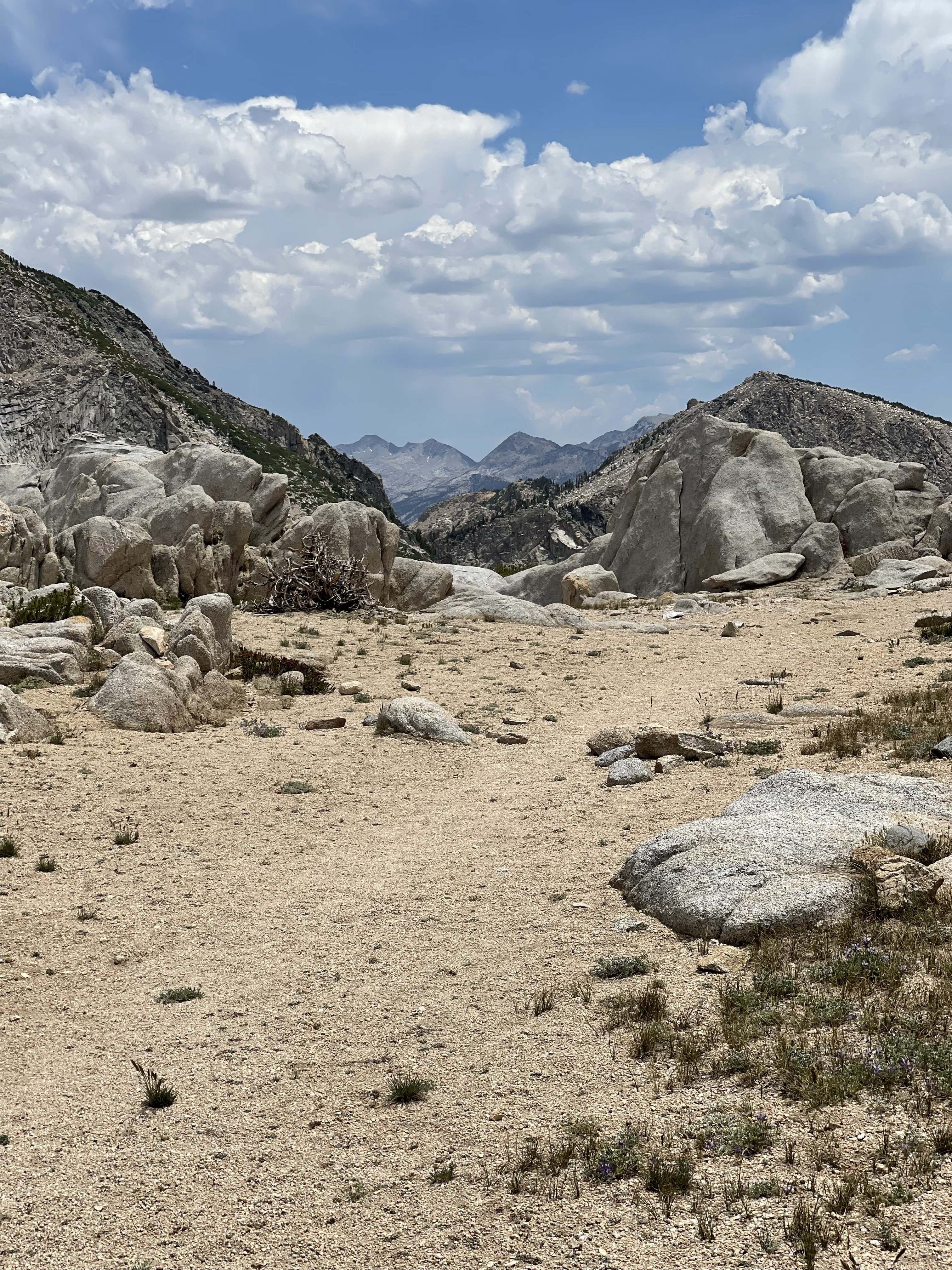
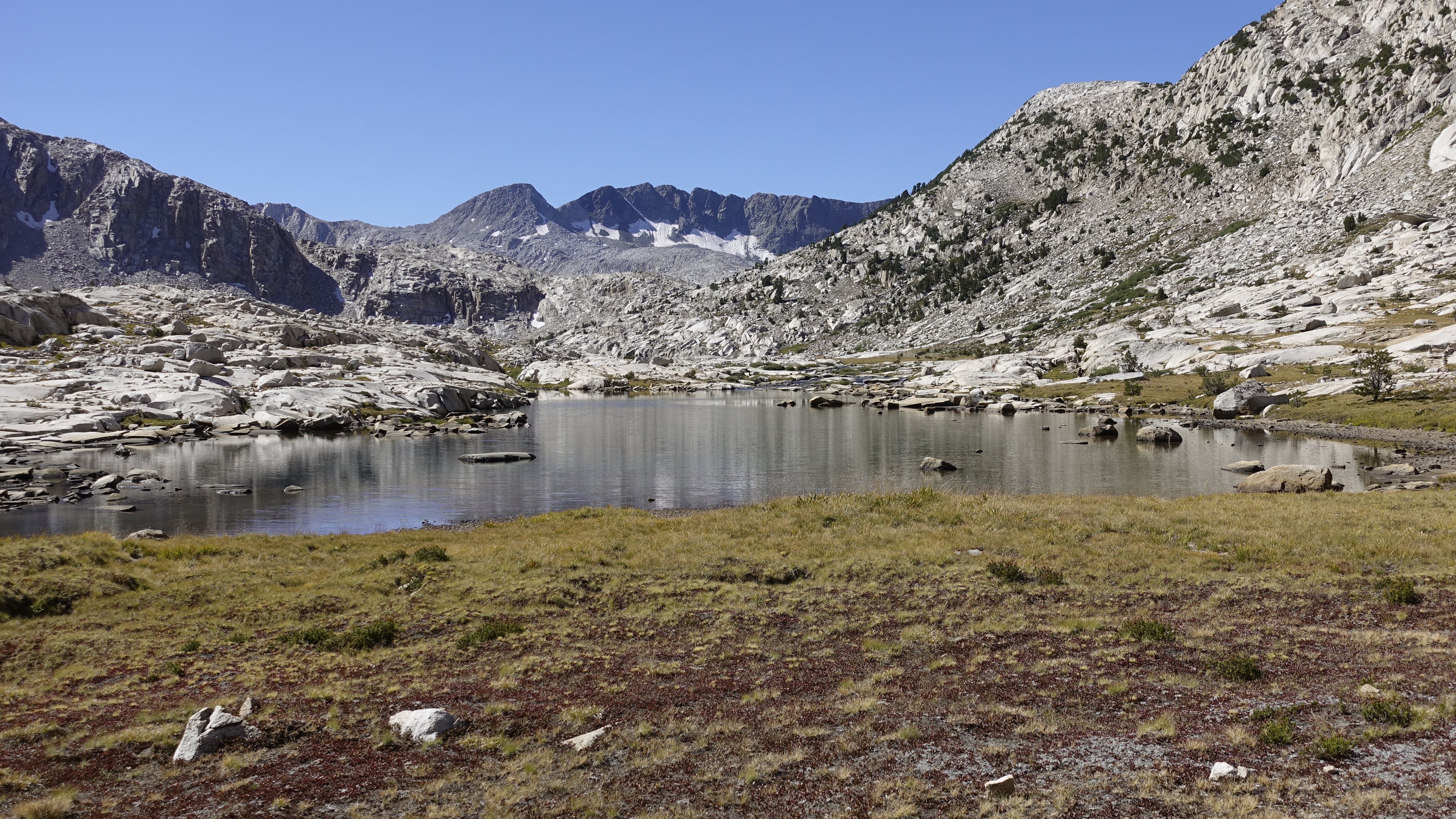
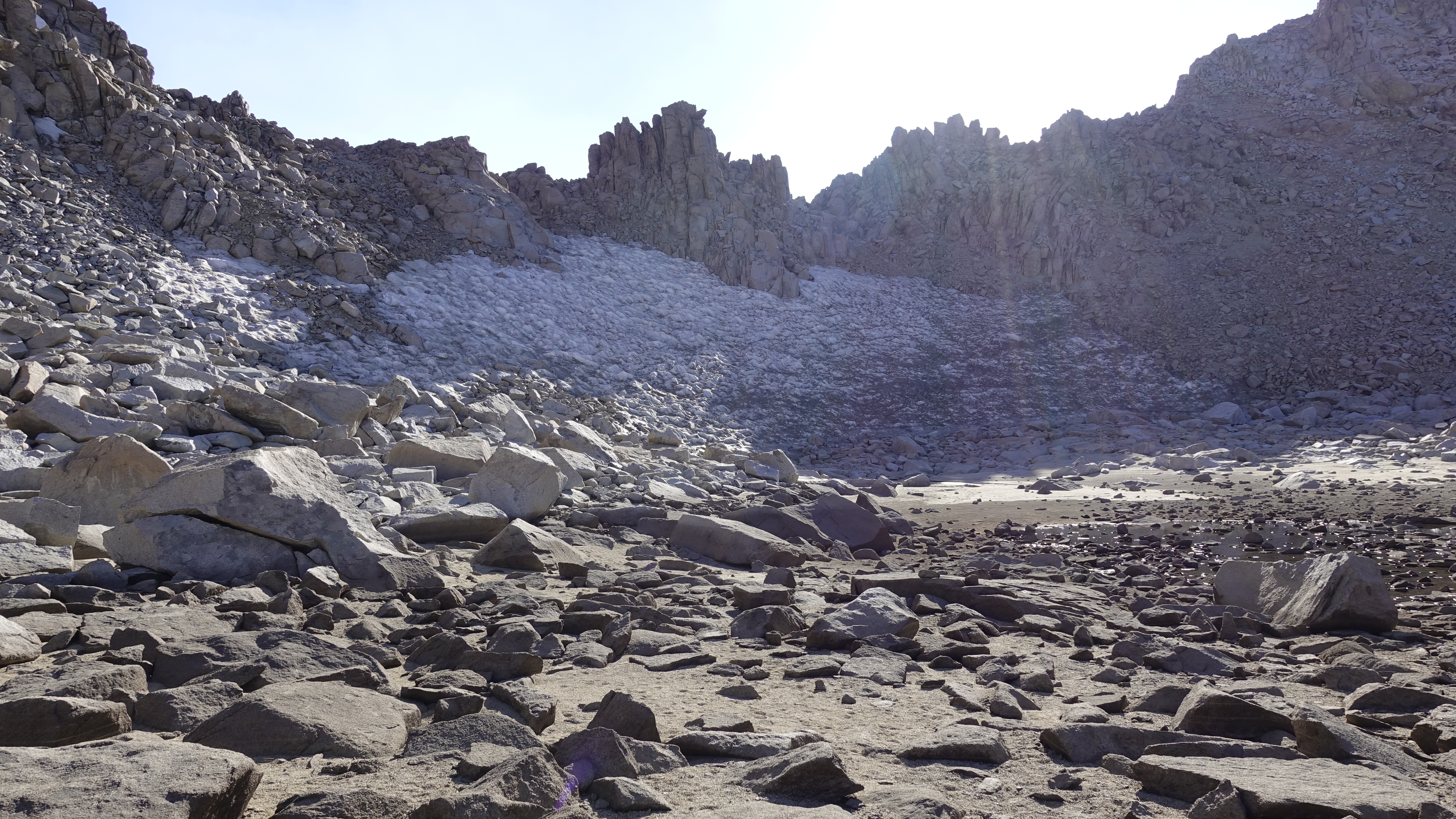
It is raining again, but I take heart at the lack of lightning and lack of thunder and take it as a sign that I should continue over Knapsack Pass and make for Palisades Basin and the Barrett Lakes. My intent is to camp at the upper Barrett Lake, but the steady rain and pressing darkness suggest otherwise. I find instead a granite outcrop above the lower Barrett Lake.
Dusy Basin from Knapsack PassPalisade Basin drainage from Knapsack Pass
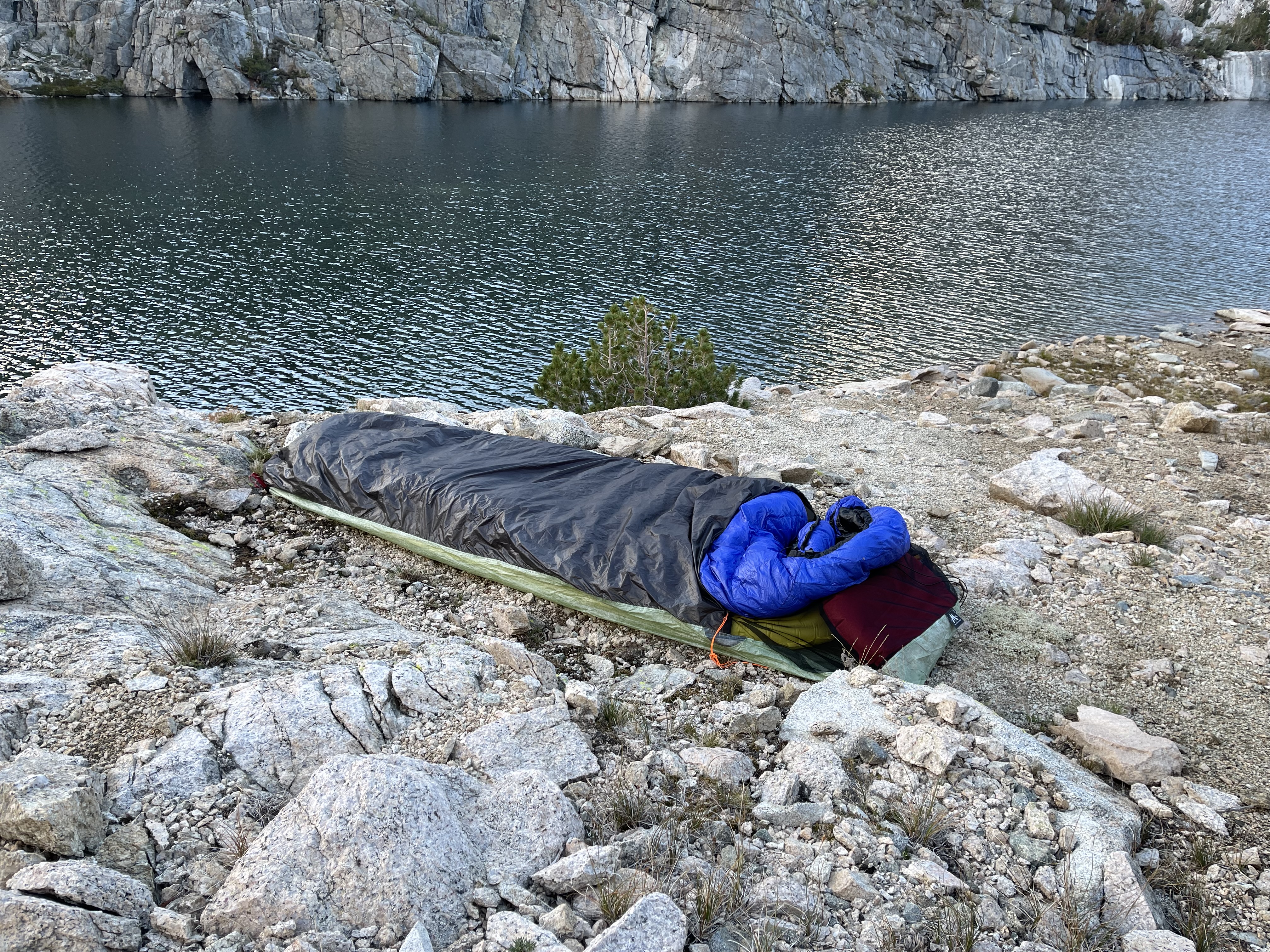
I lay out my tarp and attach the guylines. I bury each stake as a “deadman” under rocks. With my hiking poles I lift the a-frame, do one last cinch to get a good pitch, doff my pack from under the poncho, and then crawl under my shelter. I doff the poncho, crumple it into a wet ball and set it aside. Sure, the stone is wet, but there is no standing water and in short order have laid my bivy as a ground cloth, my pad, and my sleeping bag. Pause and organize.
Then all hell breaks loose. Well maybe. At least in memory it has never rained this hard while out backpacking. I chose my site wisely and all the water flows away.
I cook dinner under the tarp. I have headroom to sit, so it is reasonably comfortable. I eat, pack up, then take a few deep breaths. Let it go, Steve. I take a few minutes and try to relax every tense muscle.
The pouring rain continues. I make a few notes in my journal and check the time. 8 o’clock. Early, but with the rain I can’t really be out and about, it’s dark, and I’m first day tired. I call it and settle in early. But first things first. Unfurl and don the poncho and out into the rain to find a suitable spot to pee.
There is no sleep, only rain. And it is a noisy rain pelting my DCF tarp.
What do you think about when you cannot sleep?
Just about everything.
My mind starts cycling: my wife’s unhappiness with me being out here – the joy of my reunion with Art – the remembrance of each time being in Dusy Basin – that I actually succeeded hiking today while breathing exclusively through my nose – that I’d been now in 9 hours of rain and am completely dry… All this and more on kind of an endless loop. And somewhere in the midst of all this I take another potty break. Eventually I doze off.
It seems but minutes later I am wakened by the wind; the percussive raindrops replaced by the flapping and snapping of fabric in the gusting wind. Did I sufficiently weigh down and anchor my stakes? The wind presses the tarp down, and then lifts the tarp up. And repeats. And repeats. And then clink, clink, clink. I hear my cook pot and caldera cone blow and scatter away.
I am up and out in an instant and sweeping my headlamp about in the hope I might find my kit. Nothing. I walk in what I think is the direction it blew. Lakeside. I look down, and there, within arms-reach is the submerged pot, still nestled in the windscreen, the lid also submerged just a few inches away.
Luck, or hiker’s karma? At this point I don’t care. I thank God I found it, and returning, set it under my pack. Another pee and then back into my sleeping bag. It’s nearing 1am. The wind still whips, but exhaustion wins out and I fall asleep. Not uneventful, my first night ever in Palisades Basin.
———-
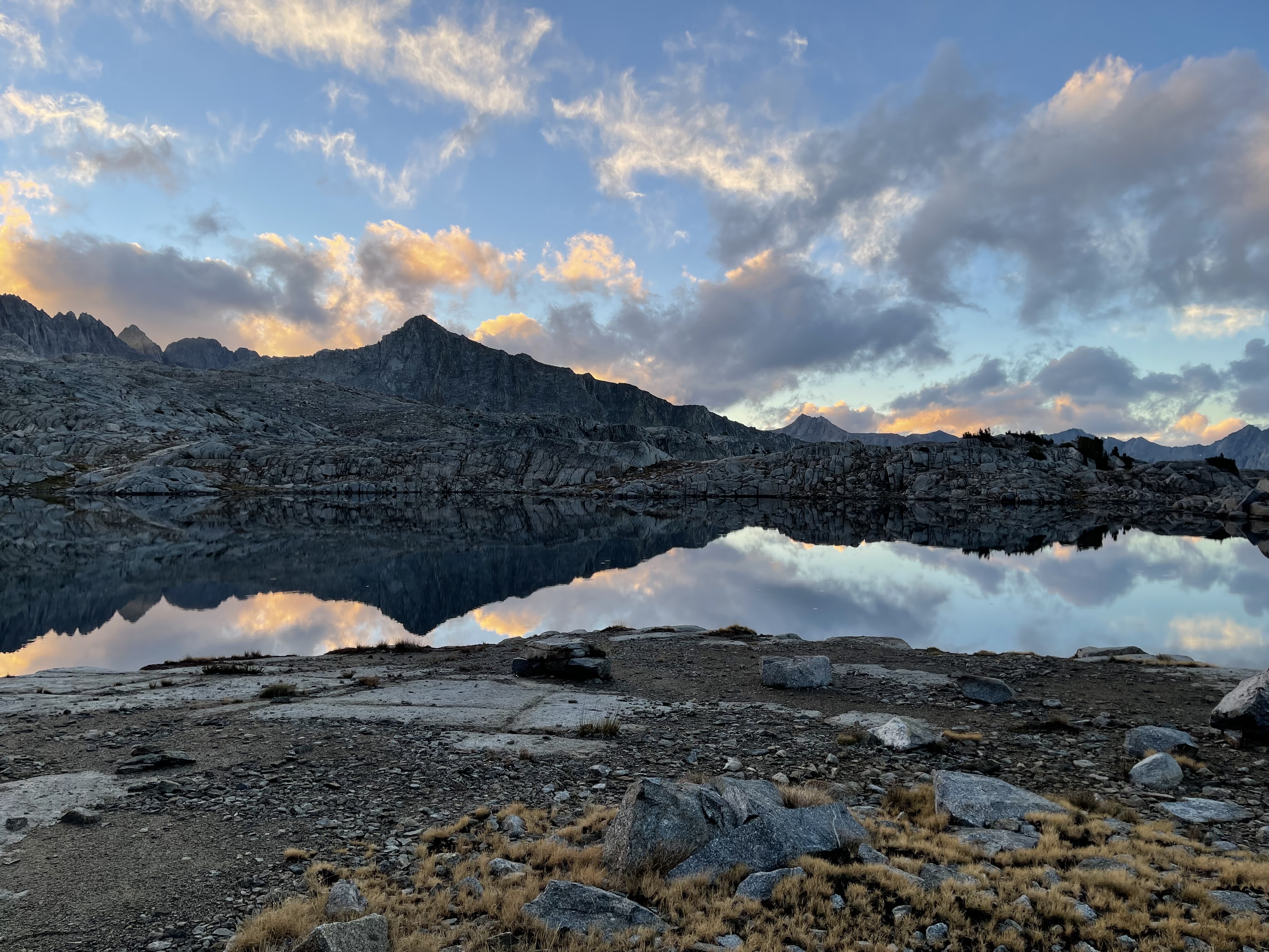
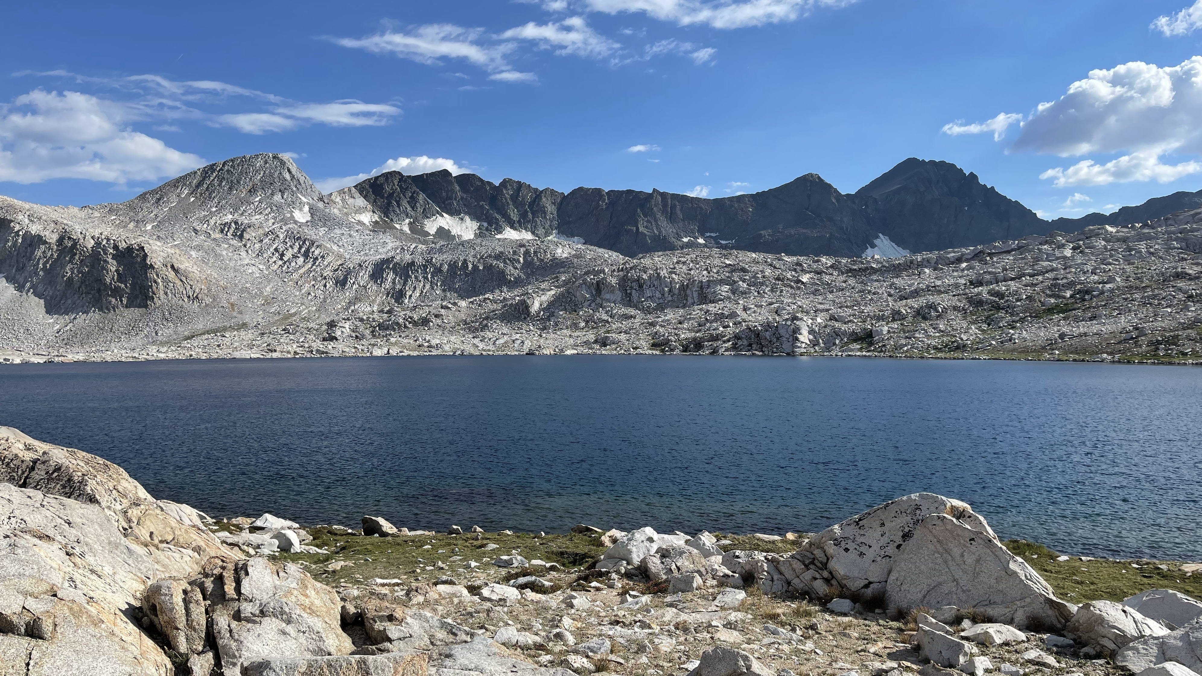
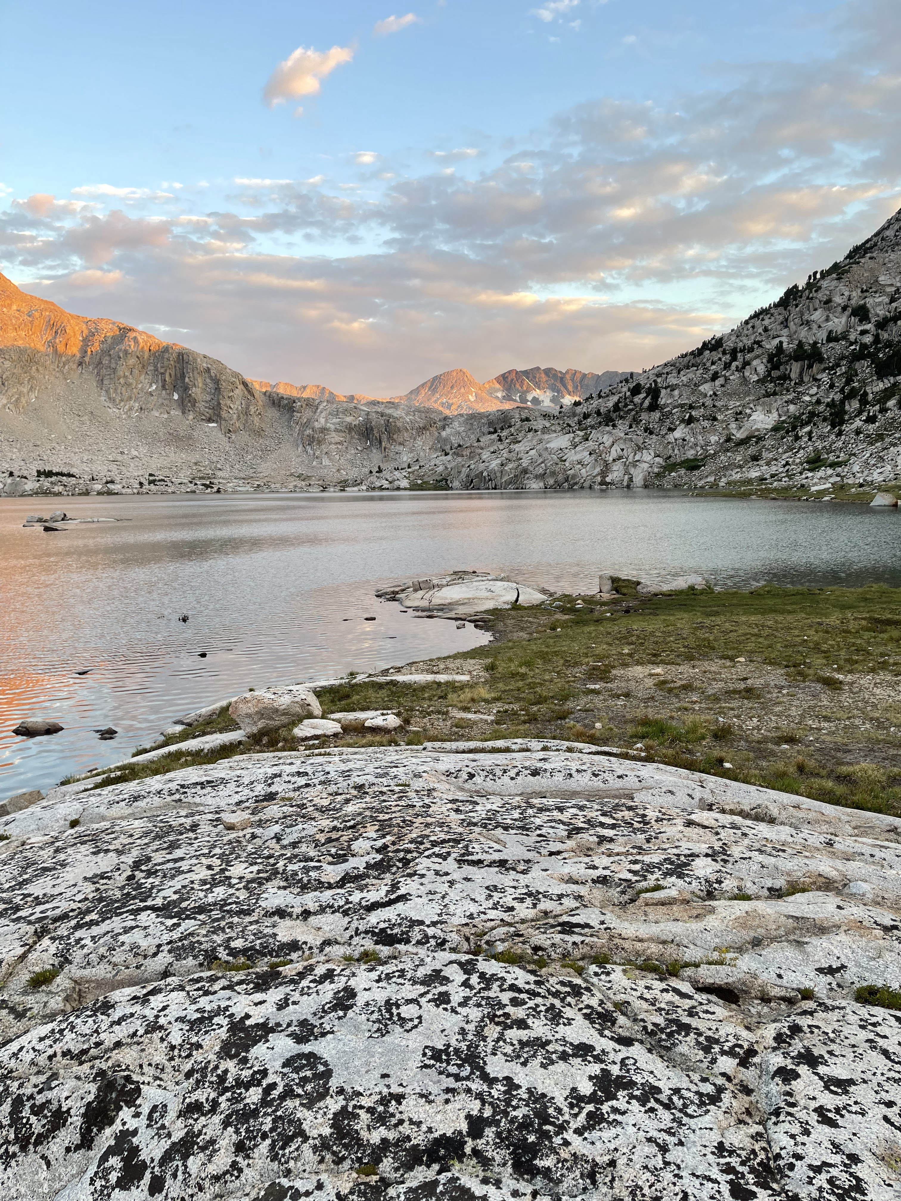
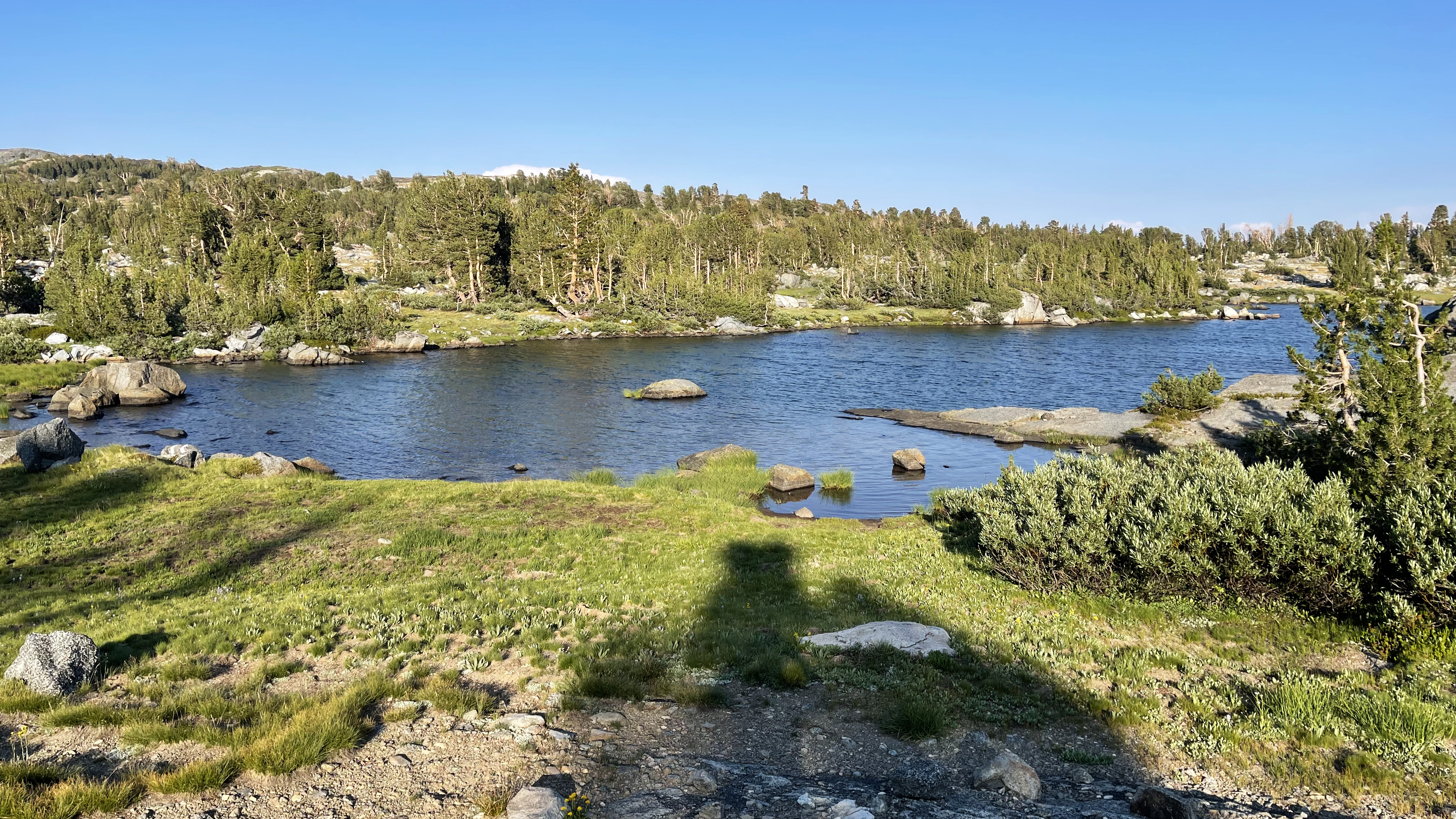
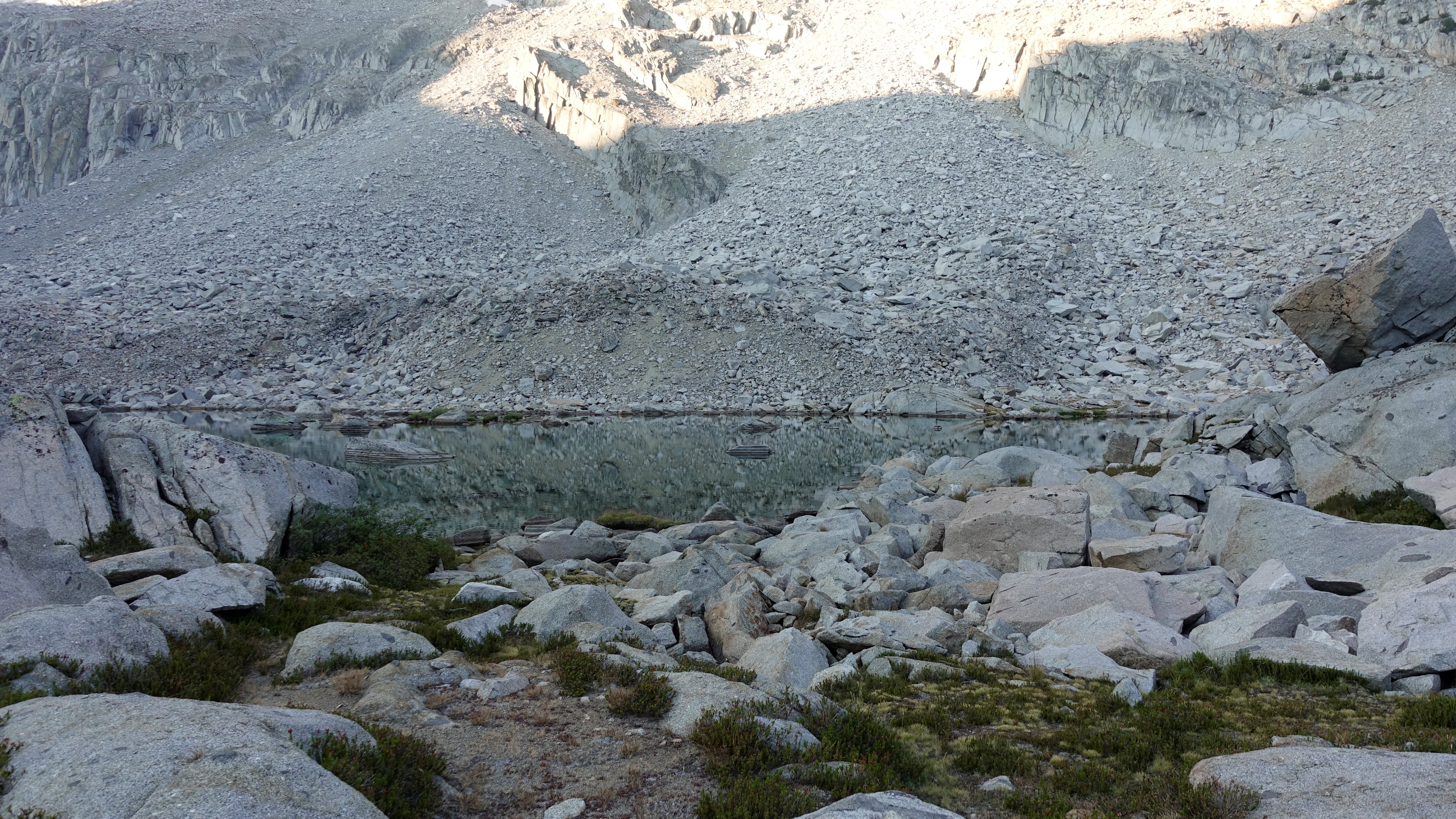
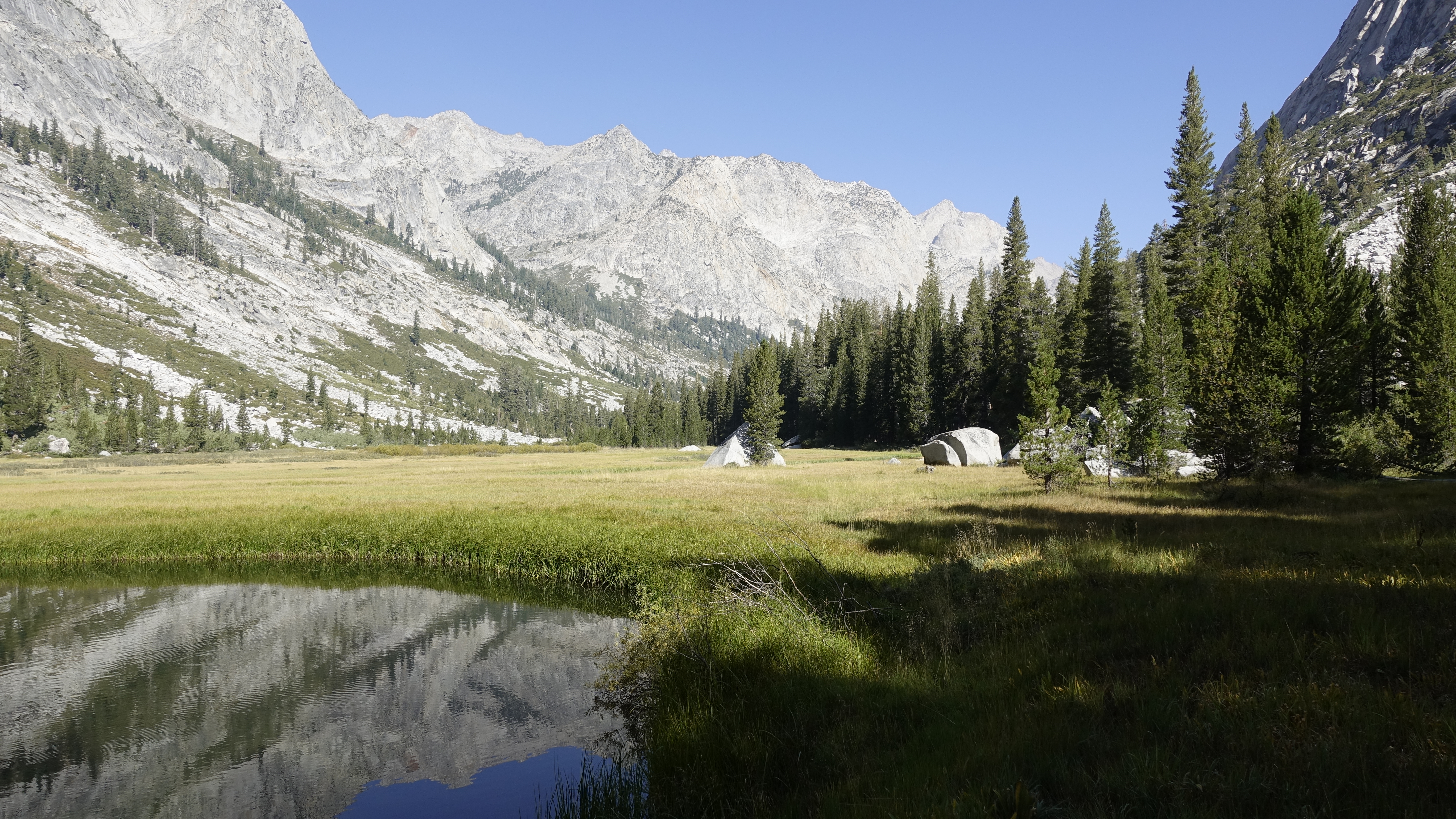
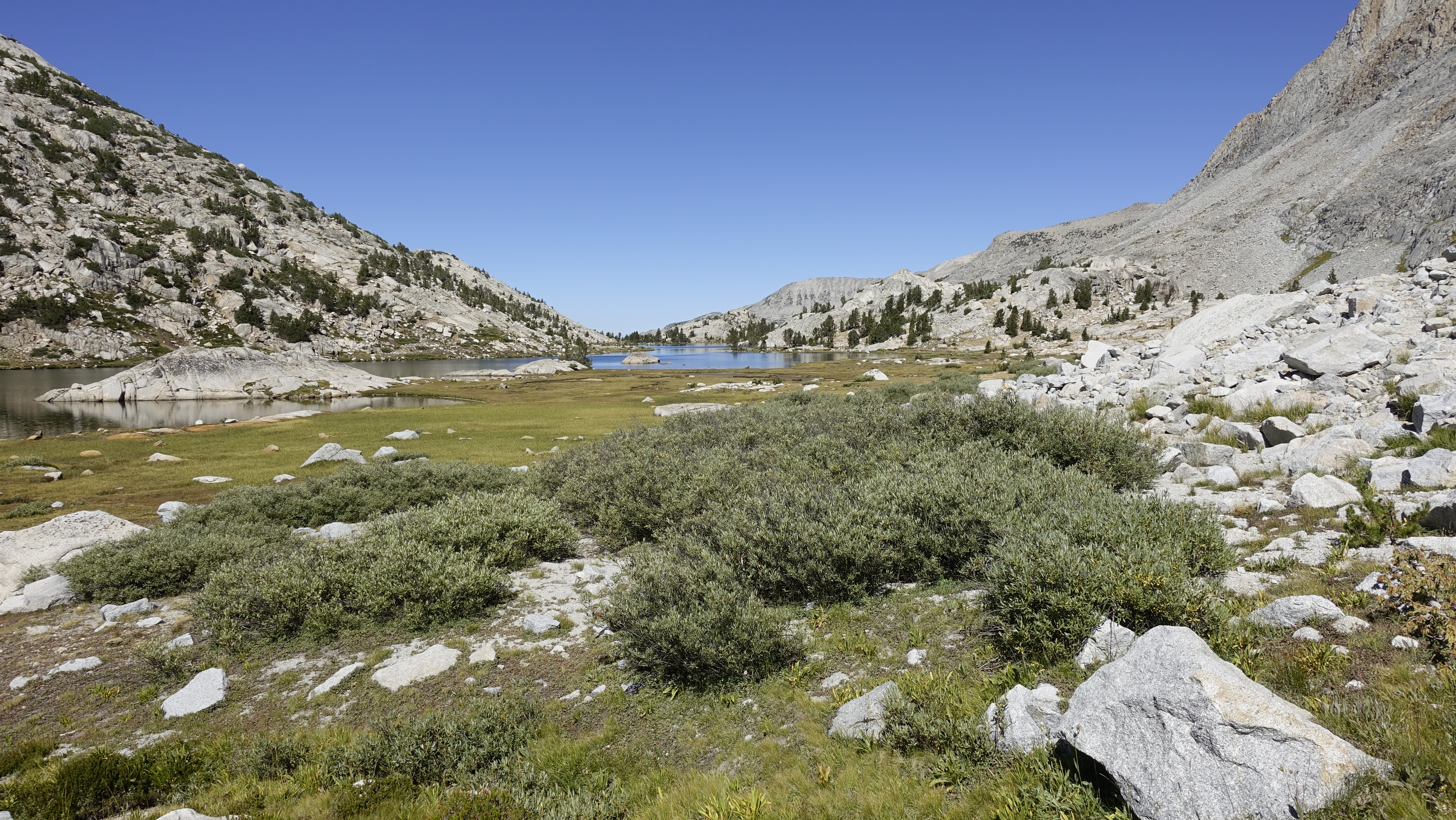
I awake to light, to calm, to surprisingly dry, and a slight chill. I set water to cooking and pack up. A gear inventory shows nothing else blew away during the night.
Daybreak at the Lower Barrett Lake
The coffee warms and the hot breakfast is a treat. I gave up hot breakfasts, what, maybe 15 years ago. Instant oatmeal then, so no loss, and replaced them with muesli. But a few years ago, I met a woman atop Pinchot Pass raving about the Packit Gourmet breakfasts, so I gave them a try the following summer. Game changer. Yes, they take longer to prepare than the muesli, but much more satisfying. And the leisurely 7am hike start is fine. I can always hike into the evening if needed.
Funny how age has changed my mindset. I used to “have to” pack and be out of camp as quickly as possible. And I always wanted to be “in camp” early enough to swim, do laundry, and what-not before dinner time. Yeah, I don’t really have to do that. I am out here to enjoy myself and take the edge off from life. If I want to enjoy the morning I can, and I’ll still be on trail before most. And then I’ll hike until I am ready to stop. And if I want to get to a certain place then I’ll just keep hiking and eat dinner and keep hiking if needed. Yeah, I might not get to bathe, but I’ll spend more time in the flow.
It is good to unwind.
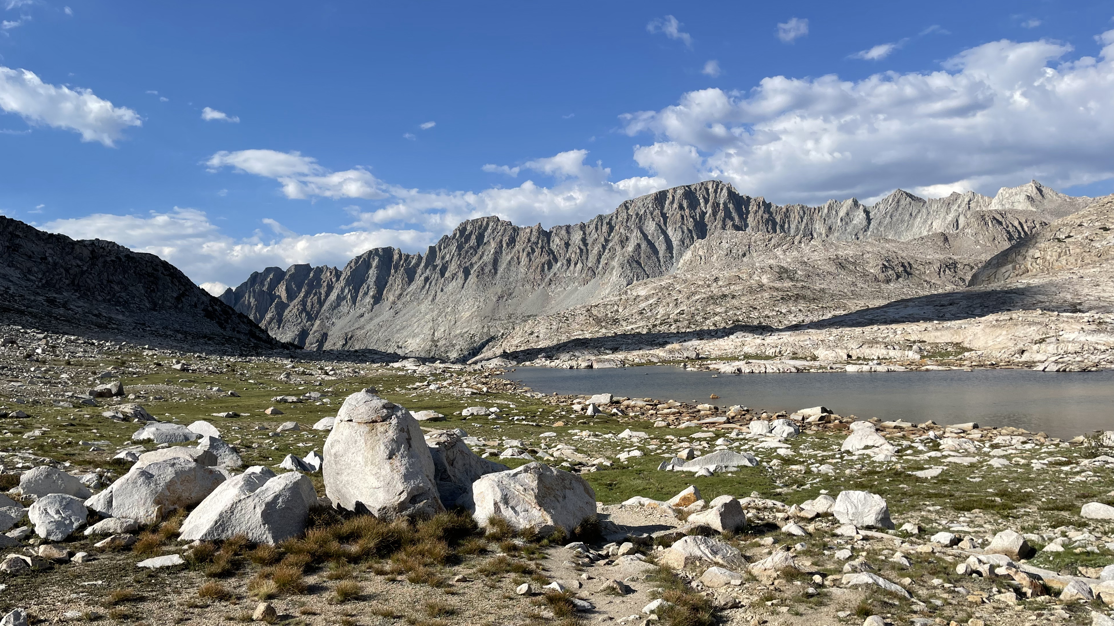
I backtrack a bit to loop around the south side of the lower Barrett Lake. Near the outlet stream I meet 4 guys base-camped and planning some climbs over the next few days. They arrived last night during the deluge and in haste chose poorly. There are soggy quilts and sleeping bags strewn about and many complaints of a miserable night.
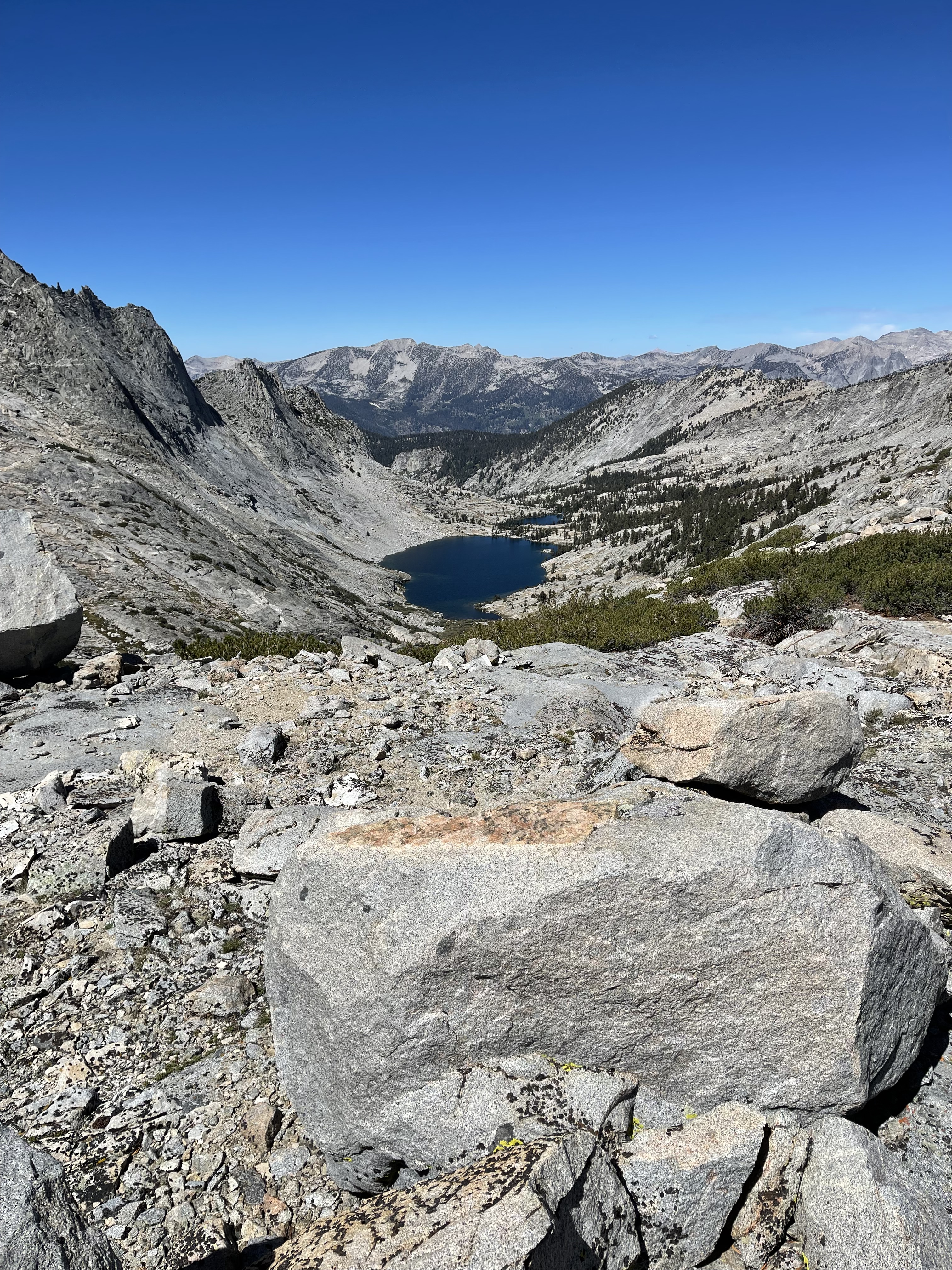
It’s an easy traverse over Potluck Pass, and then Cirque Pass. I like this crossing and have done it a number of times no two the same. I’ve hit the line and missed the line. Today goes smoothly. I pause briefly at the lake that feeds Glacier Creek. I’ll never forget setting camp there during a thundersnow.
Potluck PassPotluck PassGlacier CreekApproaching Cirque PassInitial descent of Cirque Pass
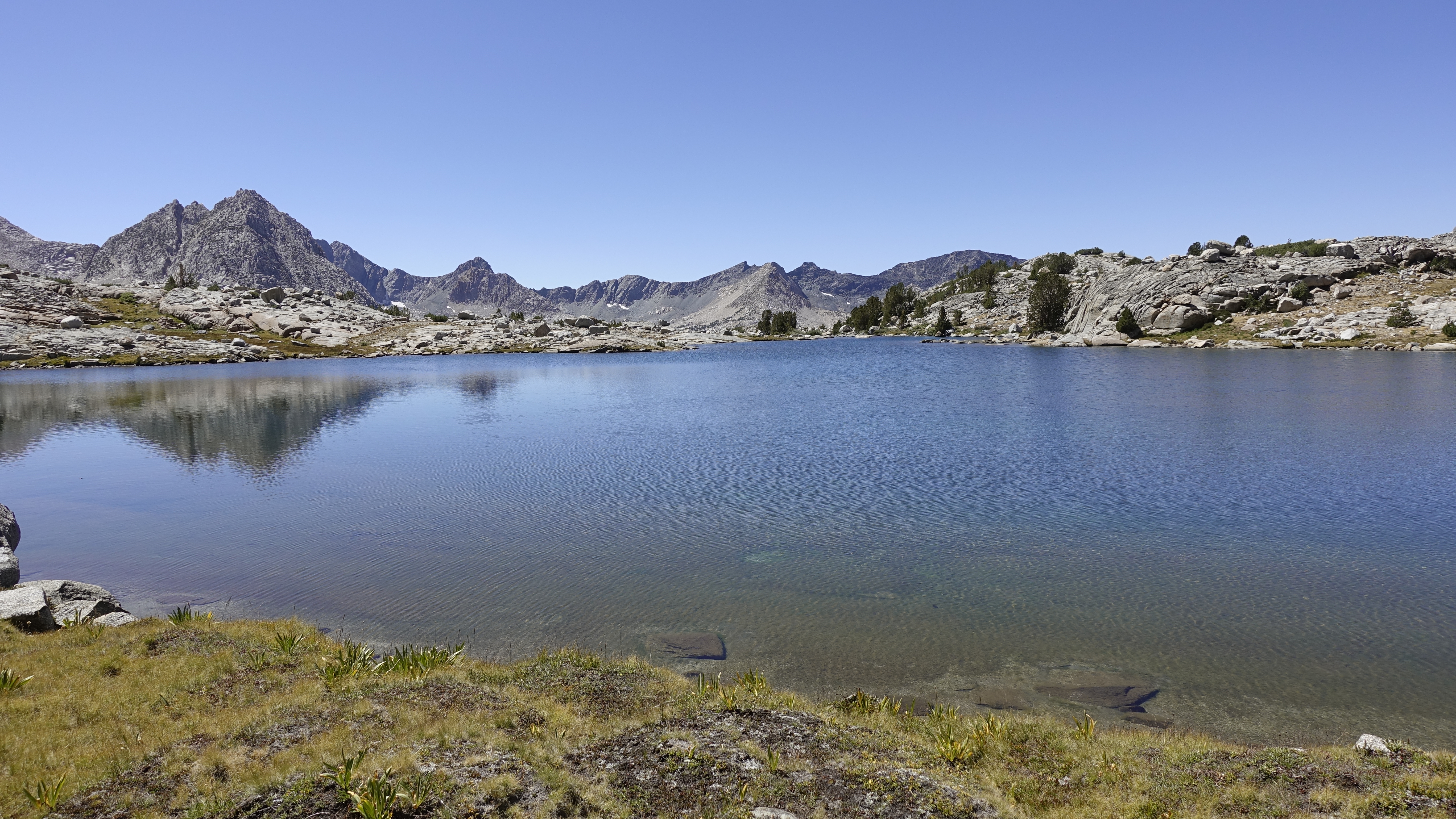
It’s about 1:30pm when I reach the lower Palisades Lake. I give my feet a good soak, filter some water, and snack. The clouds overhead periodically block the sun, alternating chill with warmth.
I turn left onto the JMT and make for Mather Pass. Again, I pace, breathing only through my nose. It forces me slower, but my heart rate stays below 130 and I don’t break a sweat. And I get none of the head-pounding that often accompanies my first few days, my first few passes.
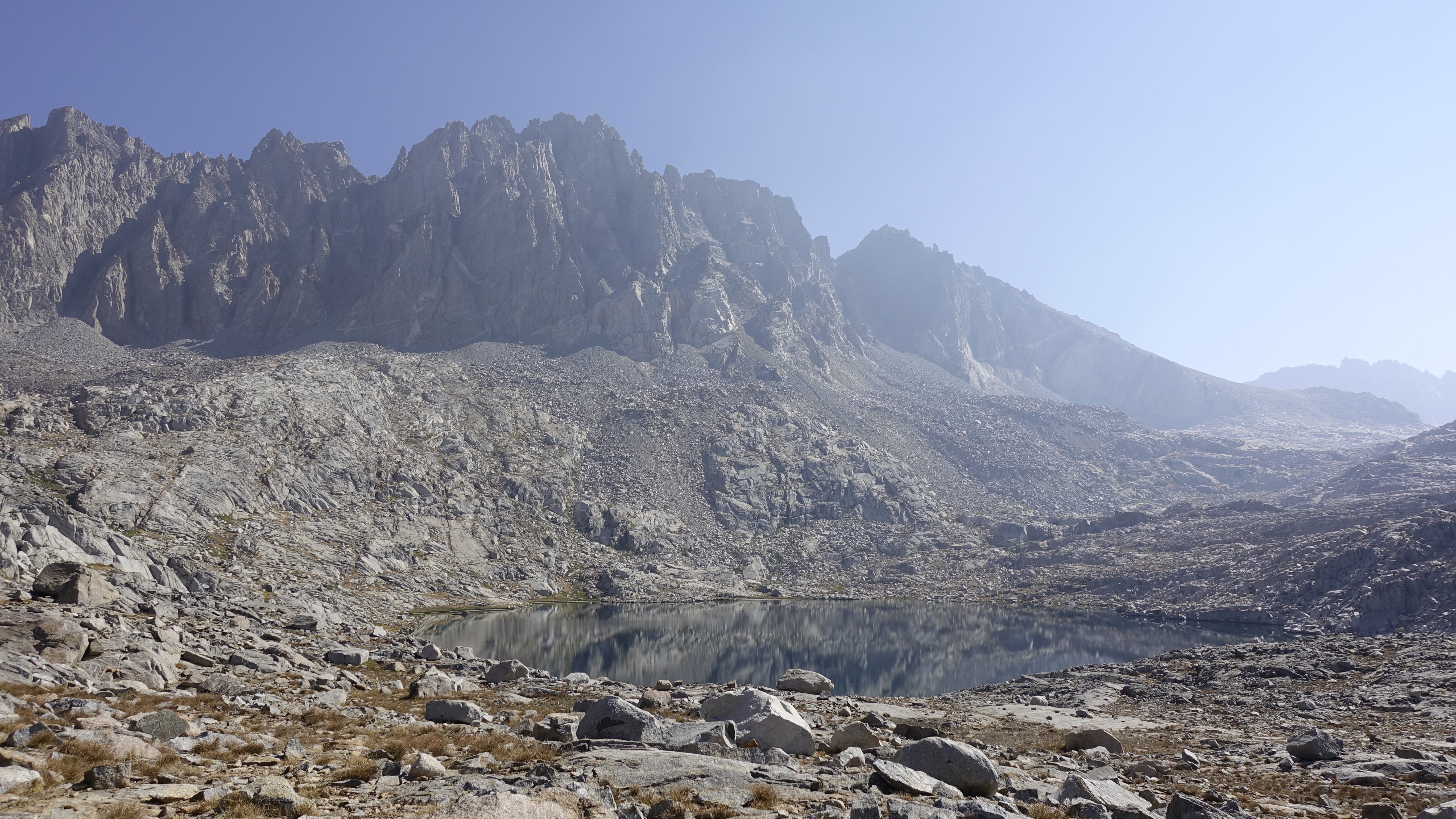
The mid-September JMT is empty.
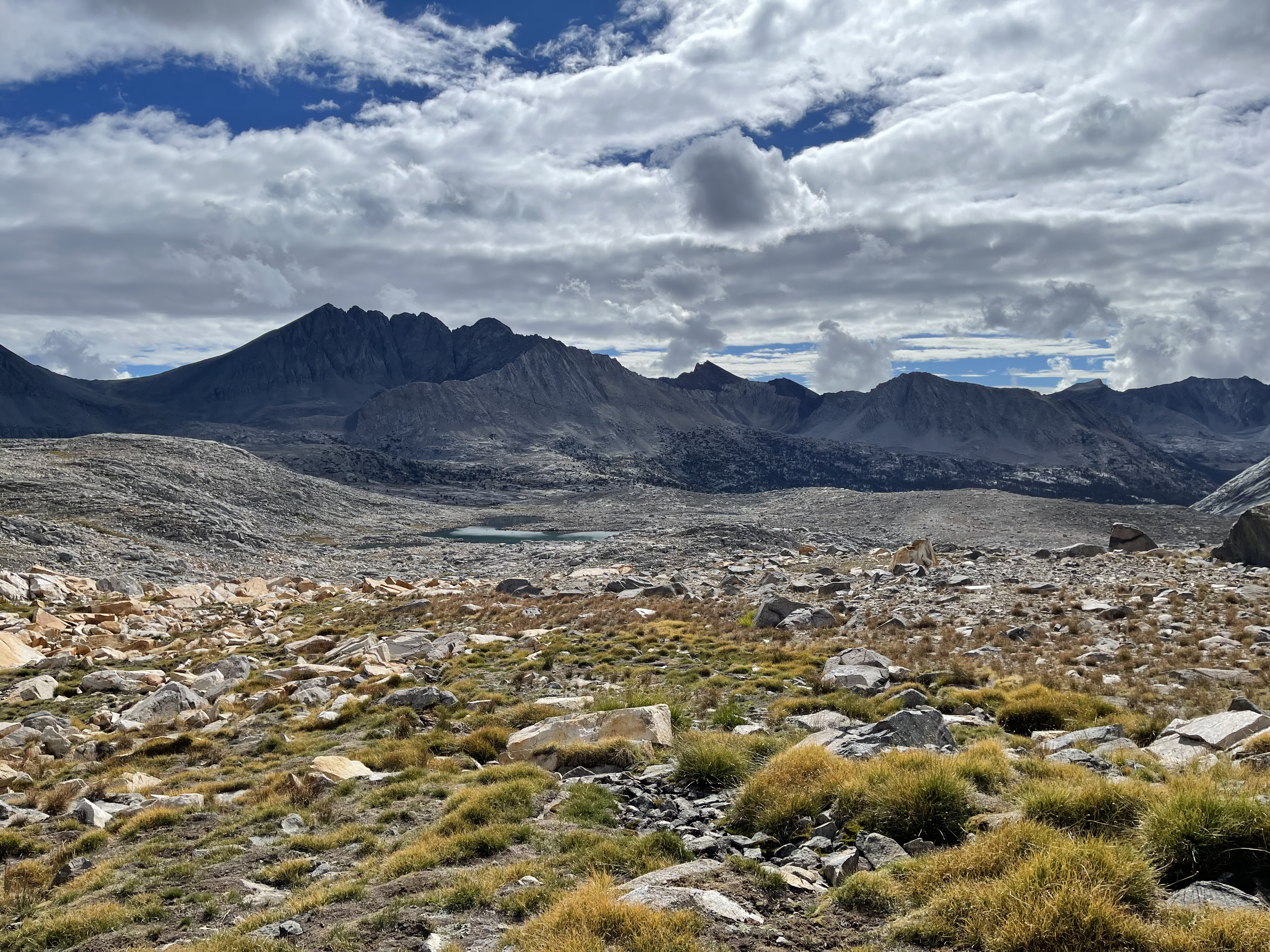
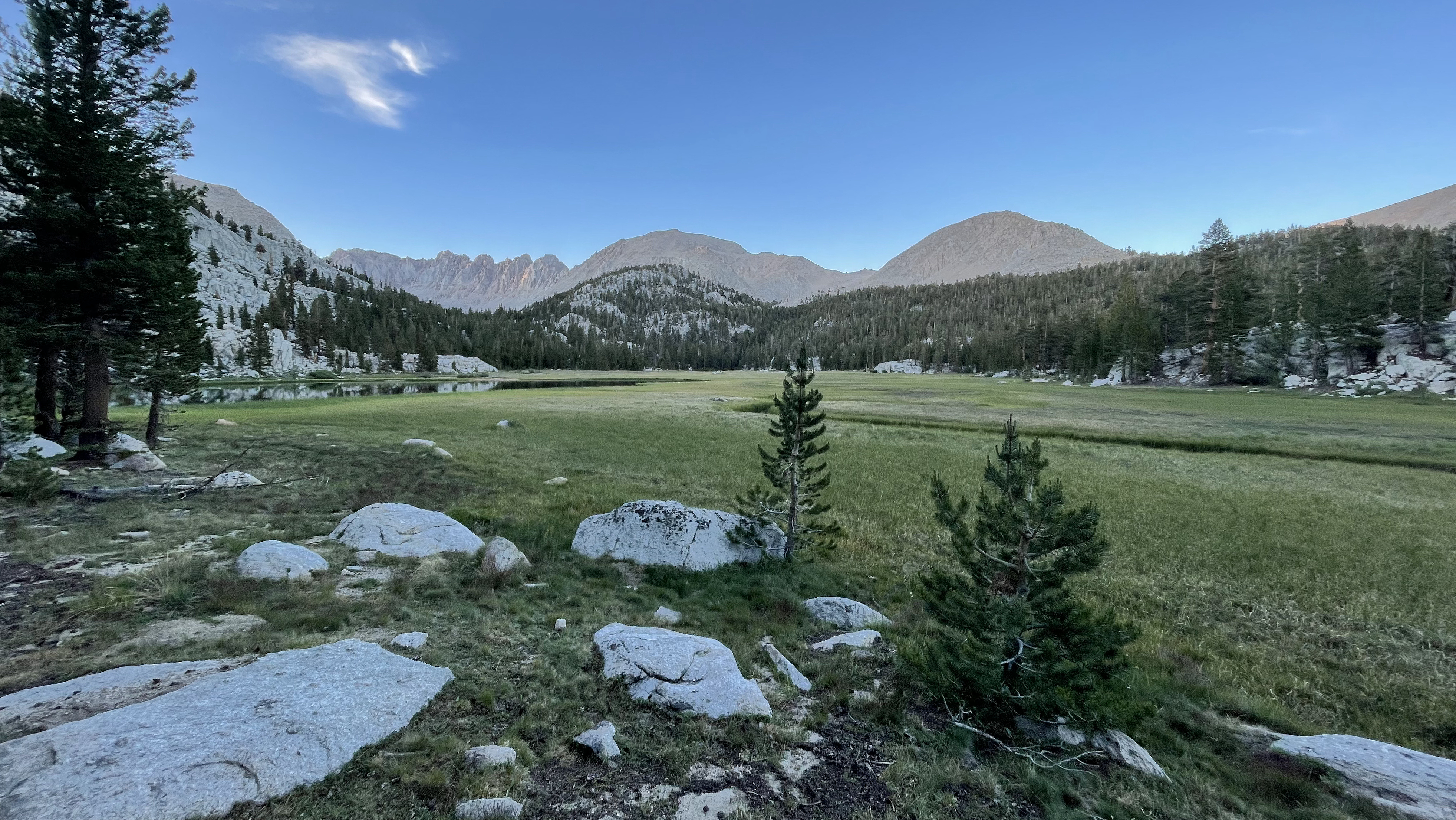
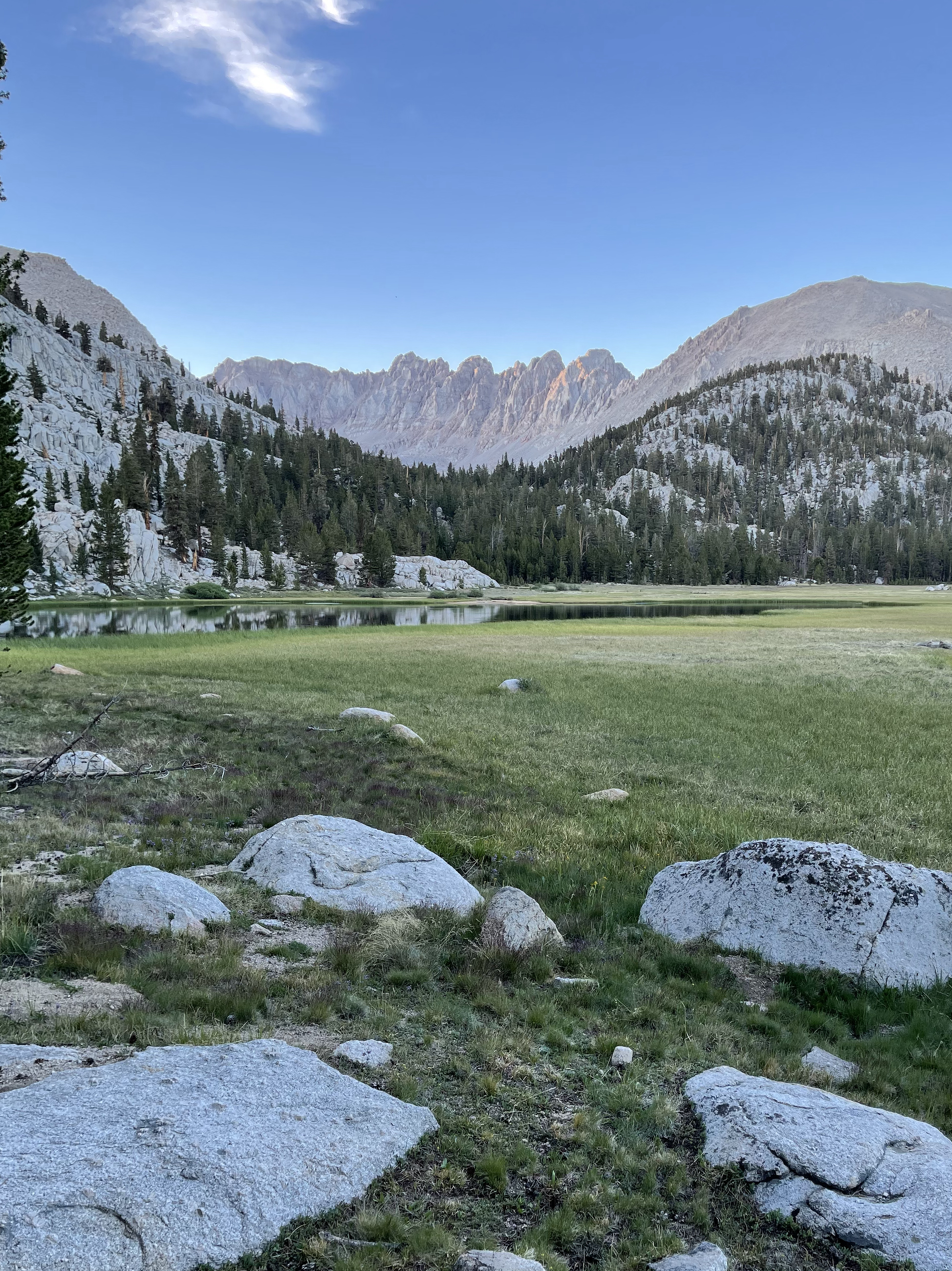
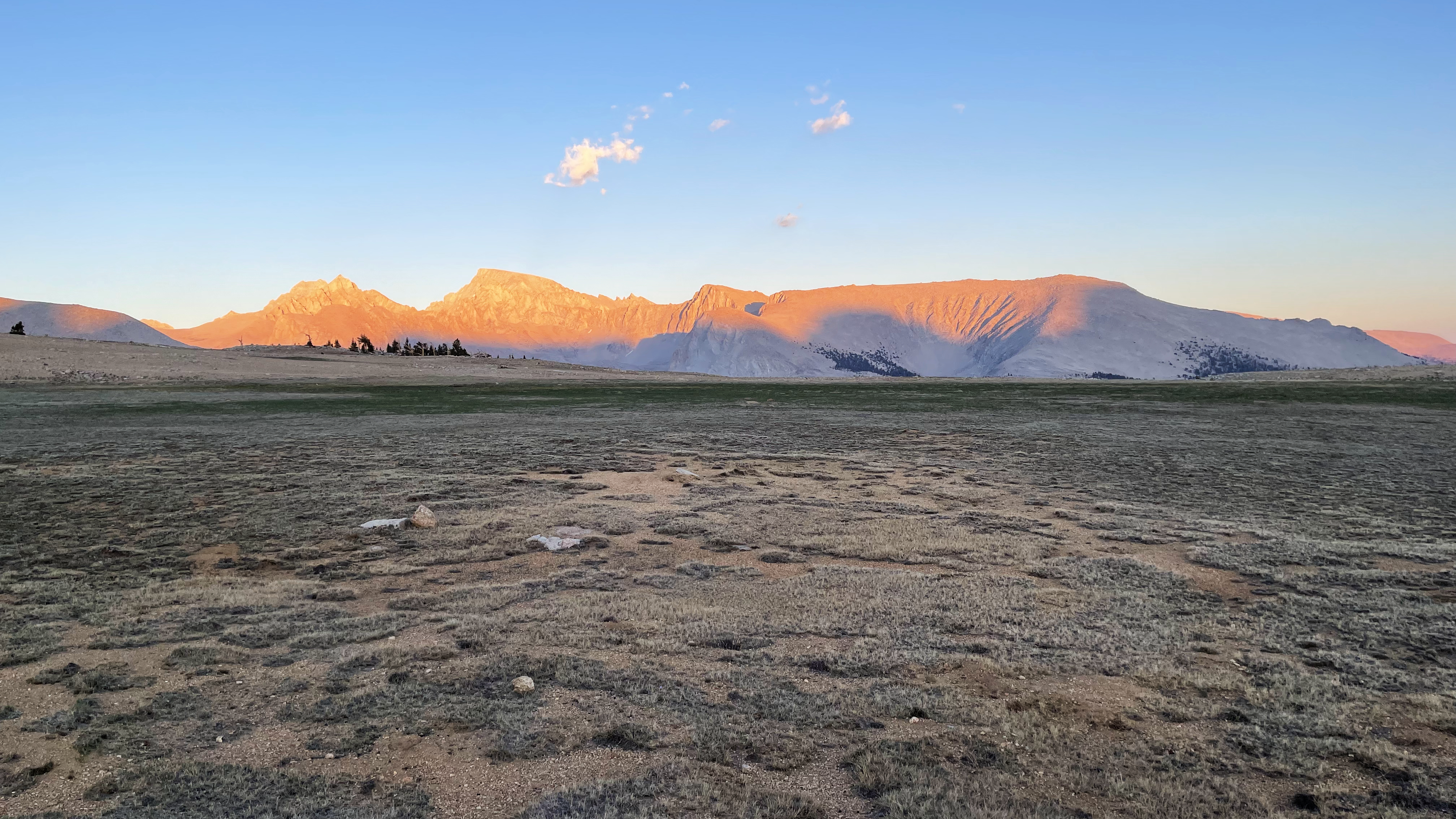
Clouds build against the Palisades, but ahead, for the moment, the sky south of Mather Pass is clear. I drop into Upper Basin and set camp at the 3rd tarn west of the trail. Upper Basin has not been, for me, one of those “I have to camp here sometime” places. But today, in the fading light, I find it austere and beautiful, and peaceful, and I grieve over the countless places I’ve simply passed through, not pausing long enough to really see and absorb.
Clouds settling on the Palisades
The sky is so clear stars appear well before darkness. I prepare dinner, and while eating, sitting atop my bear can “perch,” periodically rotate a few degrees to absorb and build a 360 panorama. My muscles release all tension. How long has it been since I’ve truly relaxed? I complete my spin, and there, from the south, Upper Basin fills with clouds.
It will be a wet night.
Clouds consume Upper Basin
When you are inside the clouds, a tarp means nothing. There is cloud over and cloud under.
It is a curious thing to be “inside” and yet have just a couple feet of visibility. My choices are stay up and about and get wet or slide into the sleeping bag and let body heat do what it can to keep the moisture right at the shell. I choose the latter, and surprisingly fall right to sleep.
———-
I wake and everything is wet, but the clouds have lifted to deliver a gloriously beautiful morning. I break down camp, shake what water I can from every piece of gear and set it all about hoping it dries a bit while I breakfast. Being ahead of the sun, it proves to little avail. I pack up damp and start the climb of my first routing over Upper Basin Crossing.
Morning in Upper Basin
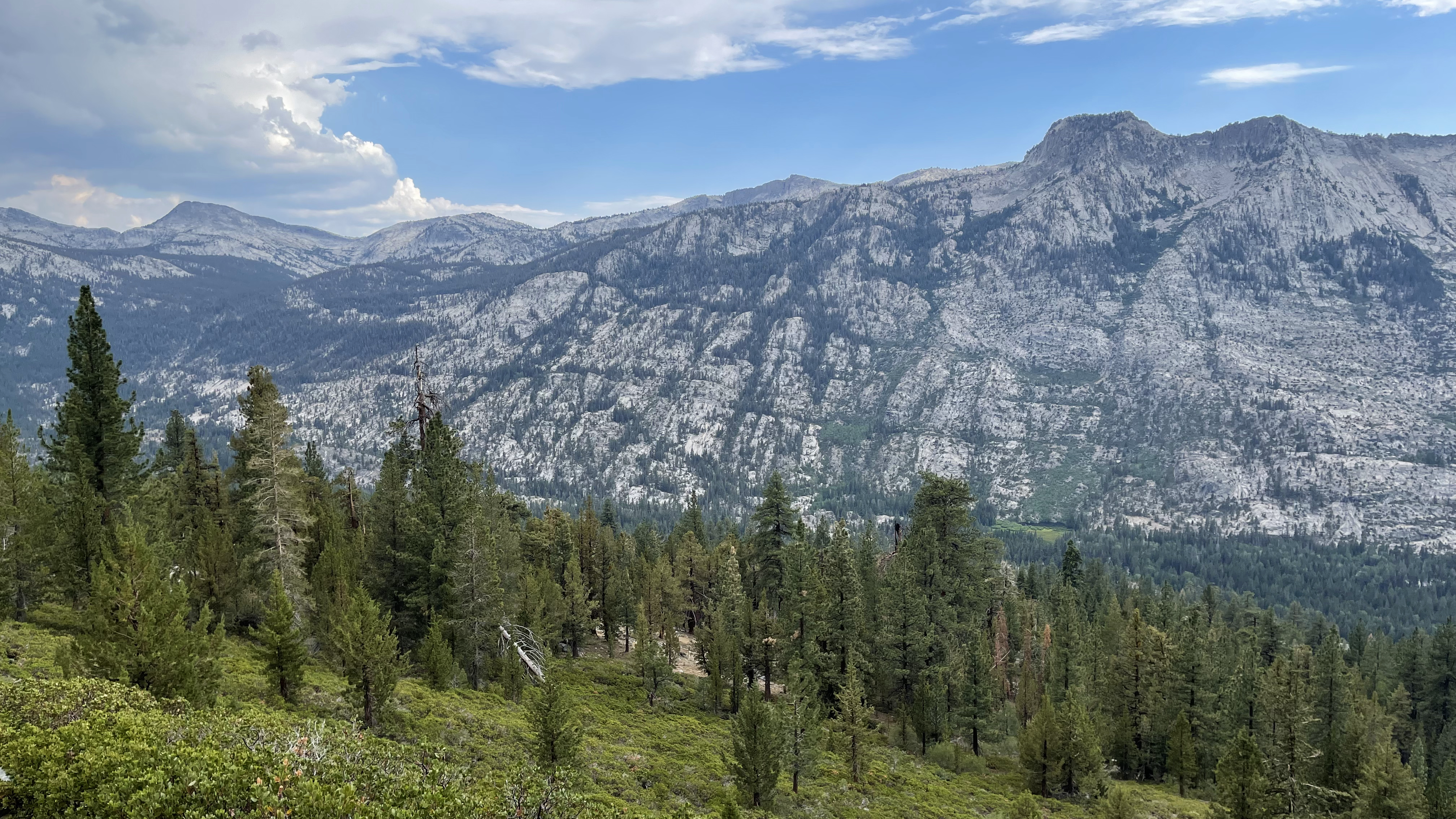
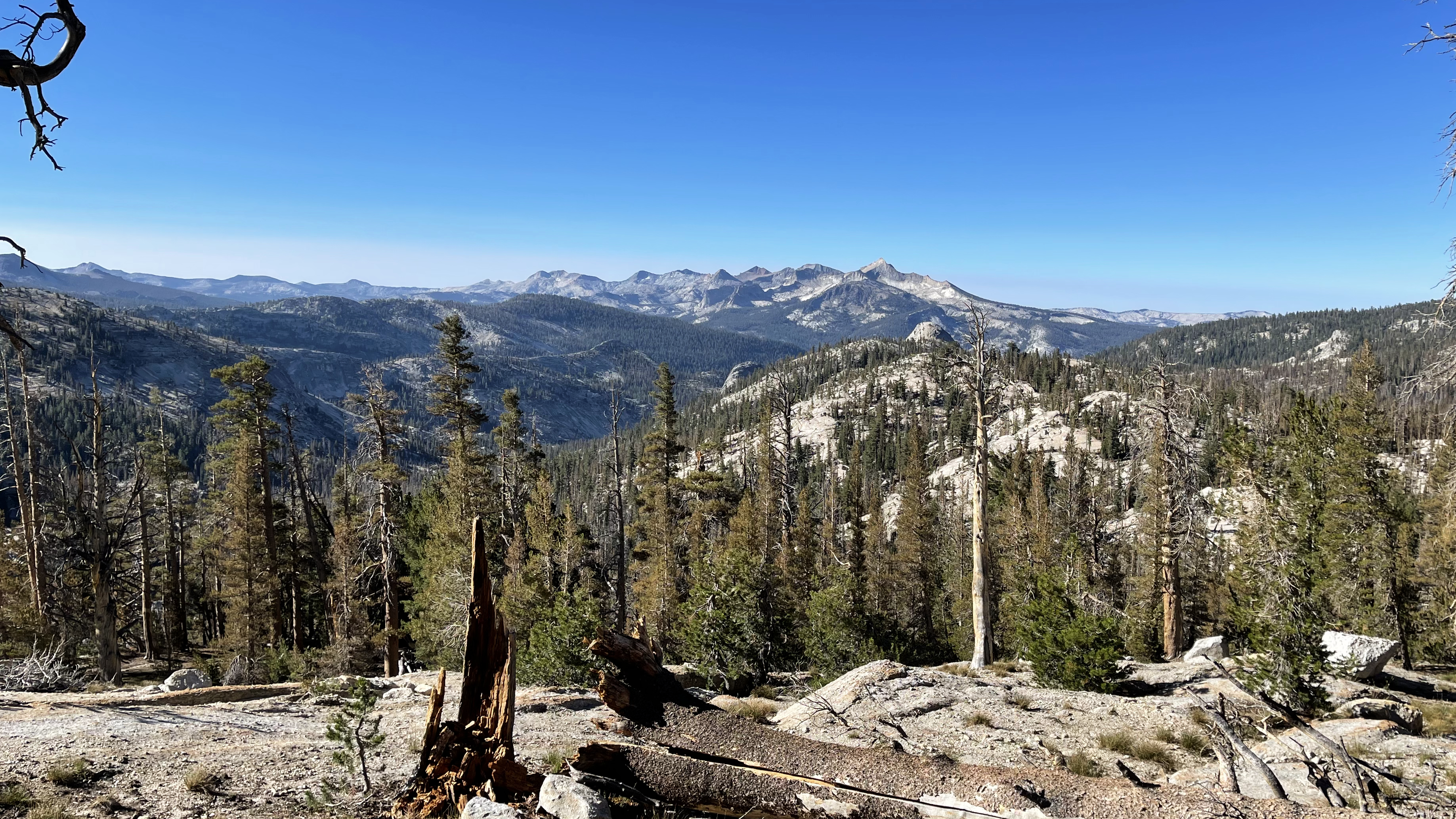
From the east this proves rather easy. Sure, lots of talus, but also a number of grassy and a number of gravelly patches. Basically, just follow what looks to be the easiest path to the saddle. I pause briefly at the tarn 11600 to refill my water and visit with a couple grouses. Clouds start to build as I ascend adding texture and beauty to an otherwise sunny sky. Now to find the route down and over to Amphitheatre Lake.
But I don’t.
The look back on ascent of Upper Basin CrossingAmphitheater Lake (right-most) from Upper Basin Crossing
I have Cameron’s notes… “climb to the south to a granite ramp.” I find what looks to be said ramp and it is easy going, and then it abruptly ends. I look further south for anything that might be a ramp, but nothing emerges among the cliffs. But directly below, maybe 50ft is a ledge. Perhaps just climb down. I start the down climb, but it is crumbly and halfway I lose my resolve. If the ledge doesn’t go, I am not sure I’ll be able to climb back up.
I pause and debate. And decide to climb out. I dislodge a couple bowling ball size pieces searching for handholds and am shaking when I again reach the pass. Were I with someone we probably would have scouted around more looking for a way. But solo and rattled I decide my best course of action is back down to Upper Basin. The route over Cataract Creek Pass and to the Dumbell Lakes will wait for another hike.
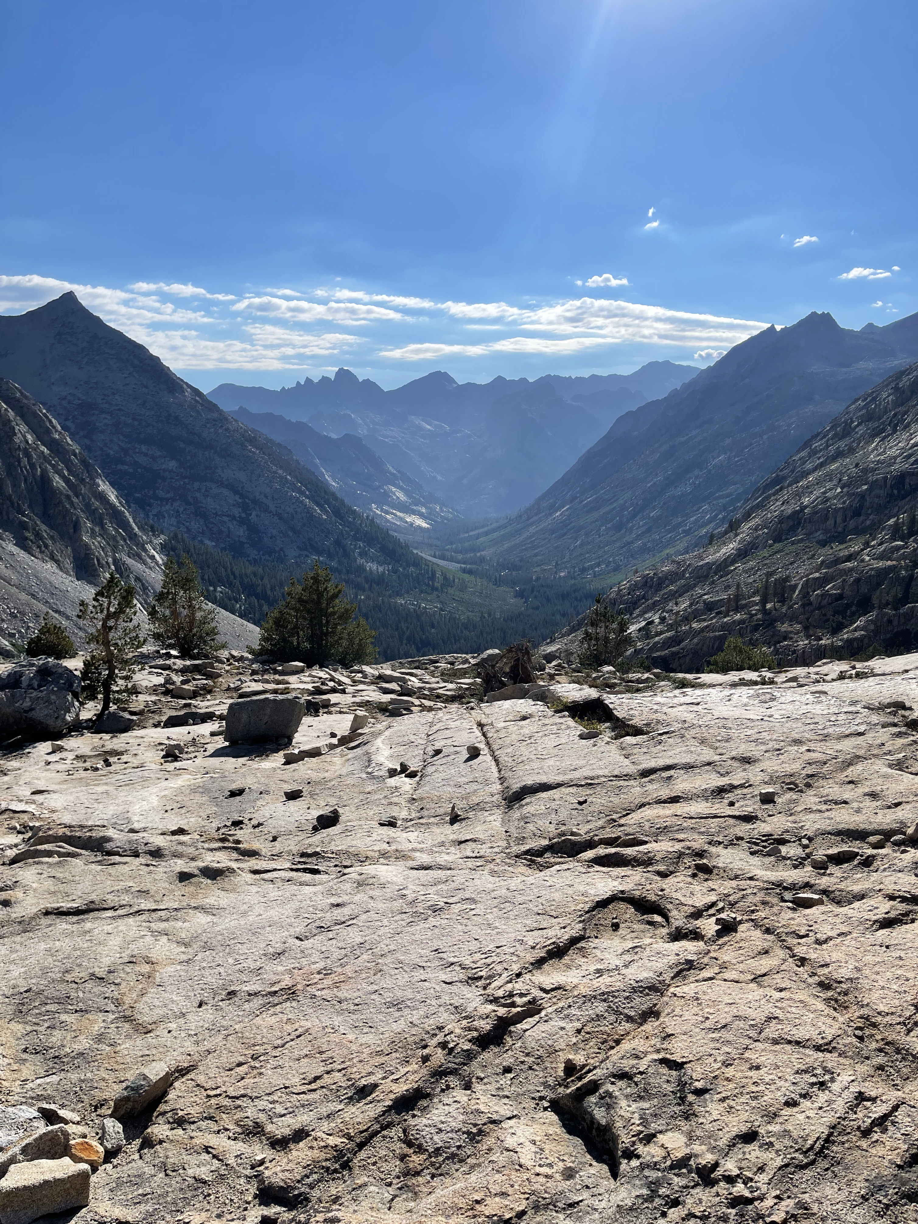
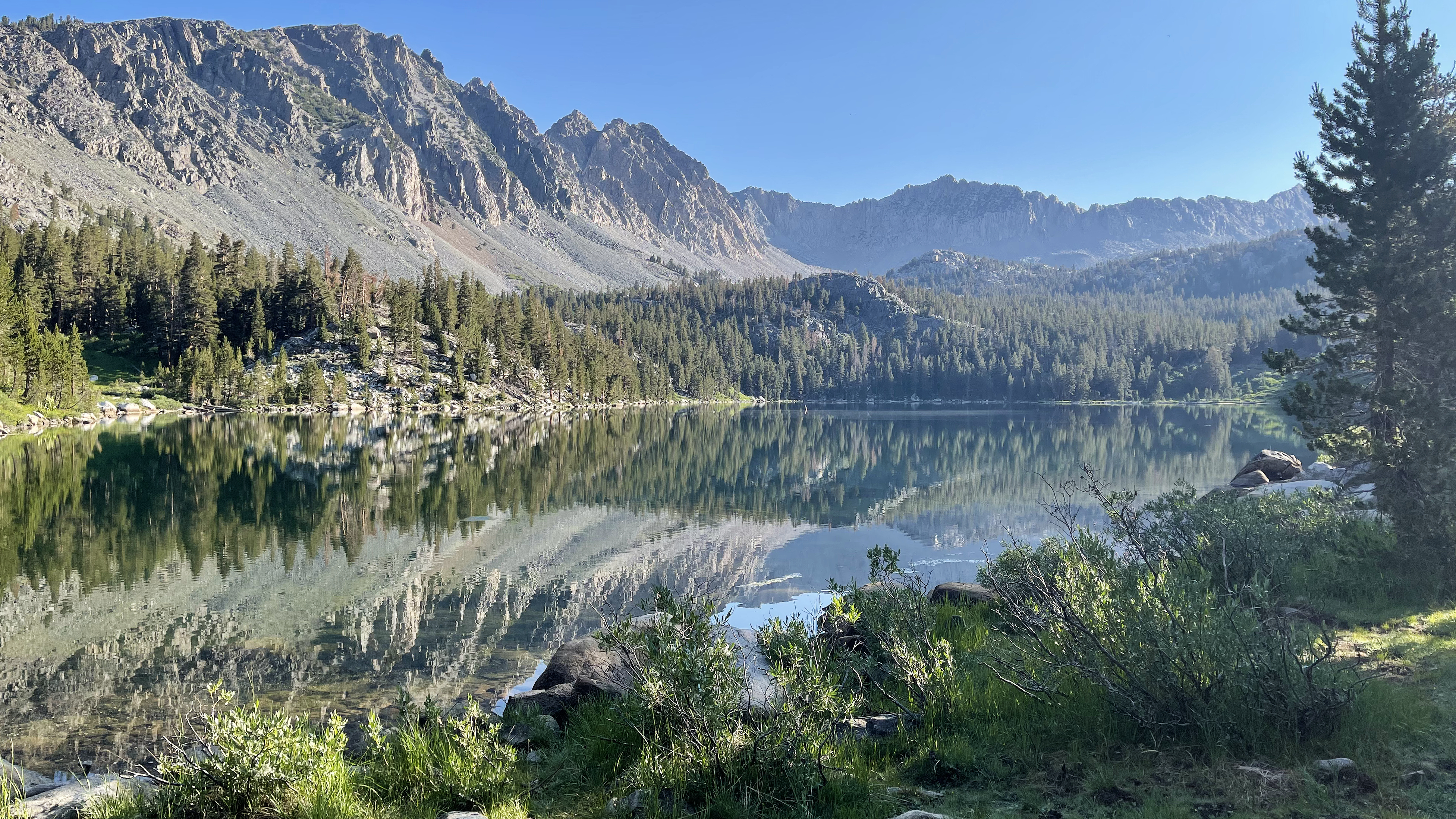
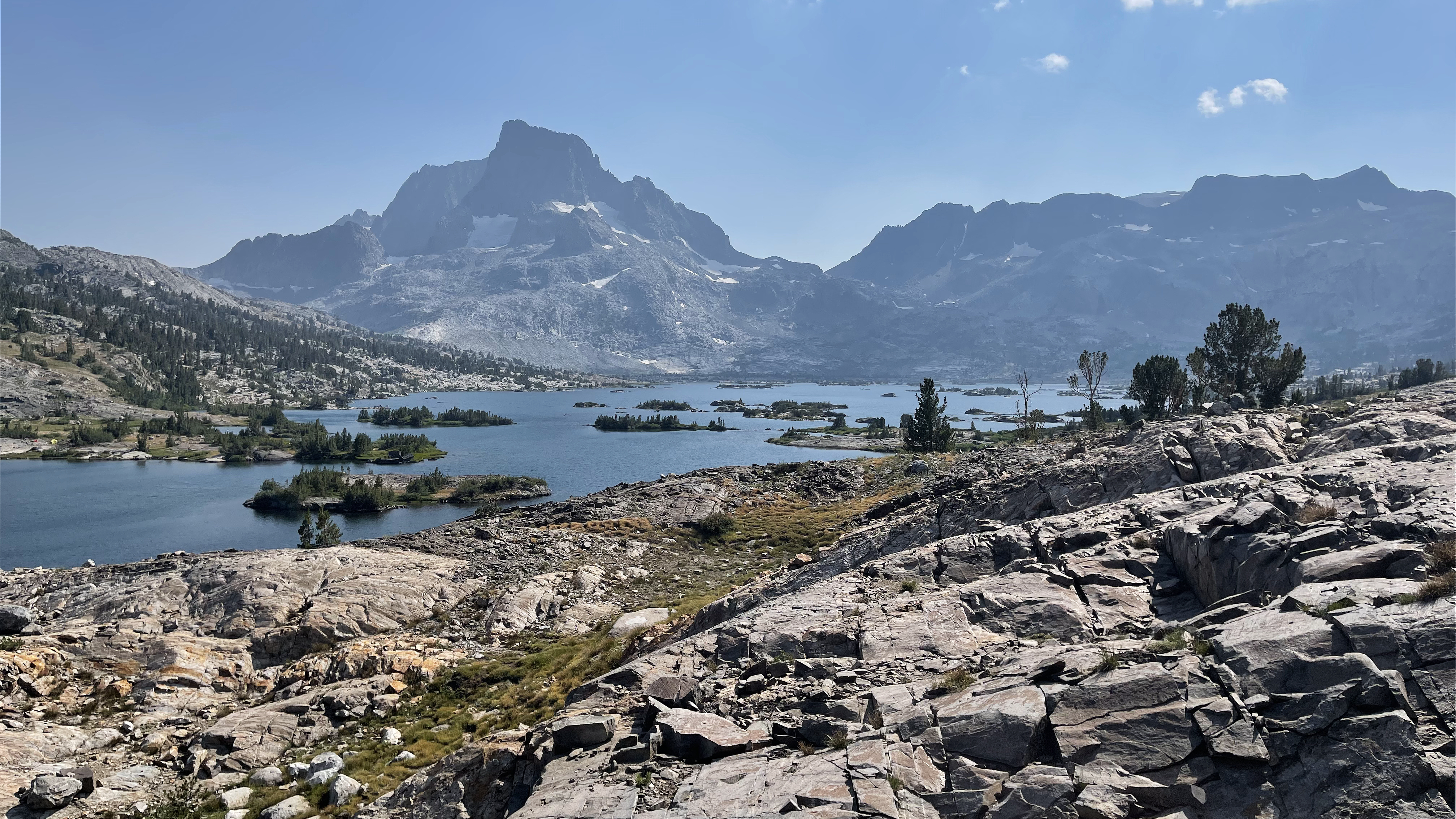
About 2 hours later I reach the JMT. My new destination is Bench Lake. Had I been with my planned itinerary I’d camp there tomorrow. Bench Lake has been on my list since 2009.
Clouds build and the humidity rises as I descend to the S. Fork Kings River crossing. Easy trail miles.
Clouds building all afternoon presage an all-night rain
I meet Claire resting just north of the crossing. She is hiking the JMT SOBO. She is from Oregon but goes to school in the bay area. I ask, “are you a bear or a tree?” She answers, “tree” and concludes that I am a Golden Bear. She opens up and exuberantly talks about her hike. I listen.
I didn’t always have the patience, or maybe attention span, to just listen and enjoy. But something in me clicked in 2008 on my Tonto Trail thru-hike in Grand Canyon. I found that if stopped long enough, and listened, everybody has a story, everybody has something interesting to say. That isn’t to say everything everybody says is interesting, but, if I stay with it long enough, something interesting, something that connects them to me, always emerges.
Always.
That is how I came to hike the 2nd half of my 1st JMT with Jon. How I came to hike several summers with Art. How I wound up last year hiking a day with Chris and having the evening meal at VVR with Don. The slumber party atop Mt. Whitney with Art, Ric, Lauren, and Jen. Had I never stopped, I’d have missed those (and more), some of the best memories of more than 50 years backpacking.
I say goodbye to Claire. She says, “you know, since I’ll be resupplying in Independence, we might see each other again.” I smile, “perhaps.” I am doubtful, but hope we do.
It’s about a mile climb to the ranger station and the spur trail to Bench Lake. The sky is now dark and thunderous. On with the poncho, cross the creek draining Lake Marjorie, and onto the forested plateau holding Bench Lake. It is raining hard, and though forested, the trees give little relief.
I reach the lake, low clouds precluding any view, and find a level site about 100’ back away from the lake and trail, with a perfect layer of duff, about 4” thick. The rain might run-off underneath me, but absent a flood I should stay nice and dry.
So, I think I have the drill down: doff the pack from under my poncho and rest it on my feet, remove the tarp and stakes, and flip the tarp out on the damp ground. I don my pack and proceed to stake and set up the tarp.
Thunder and lighting and heavier rain.
It is again, off with the pack and under the tarp it goes. I follow. Off with the poncho, out with the bivy, pad, and sleeping bag. Get the sleep kit set and then off with the shorts and on with the long pants, my sleep hoodie, and puffy. An early finish to the day, it is not yet 5pm. With the rain I am not going to be going out to explore so I bide the time singing and making notes in my journal. My most wonderous note, “I am not frustrated or bored, just simply at peace.”
When did I learn to just deal with and not gripe at the rain?
———-
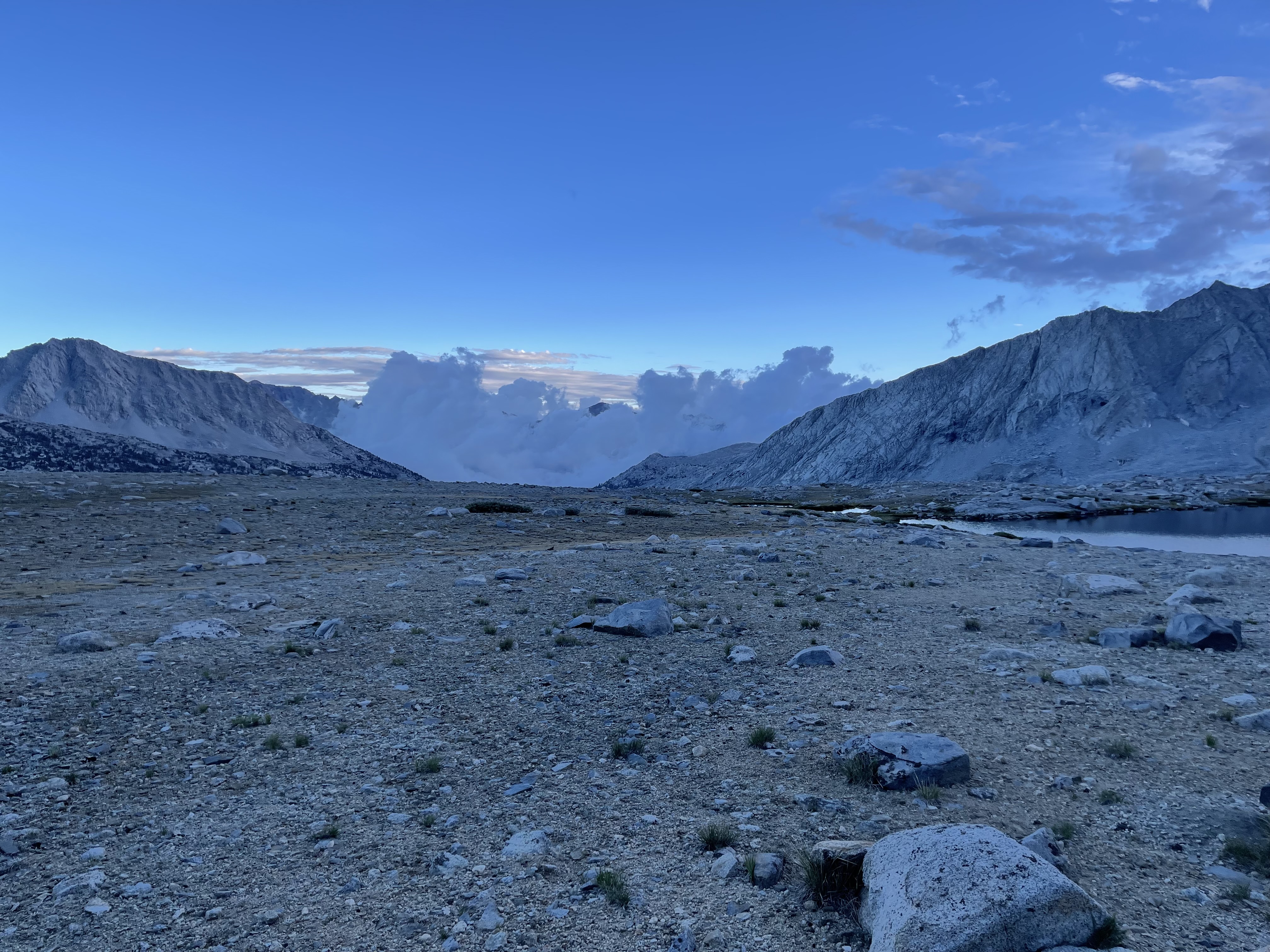
It rains, as best I can tell, all night. I am up 3 times to pee, on with the poncho each time. And then I wake again, this time to silence, and think I woke because the rain stopped. It is 5am. I doze and this time wake to rain. 6:30.
I prepare breakfast and pack. A 5min rain shower, 5min calm, a pattern that repeats for about an hour. The clouds lift and I break down and pack the tarp.
Nice and dry
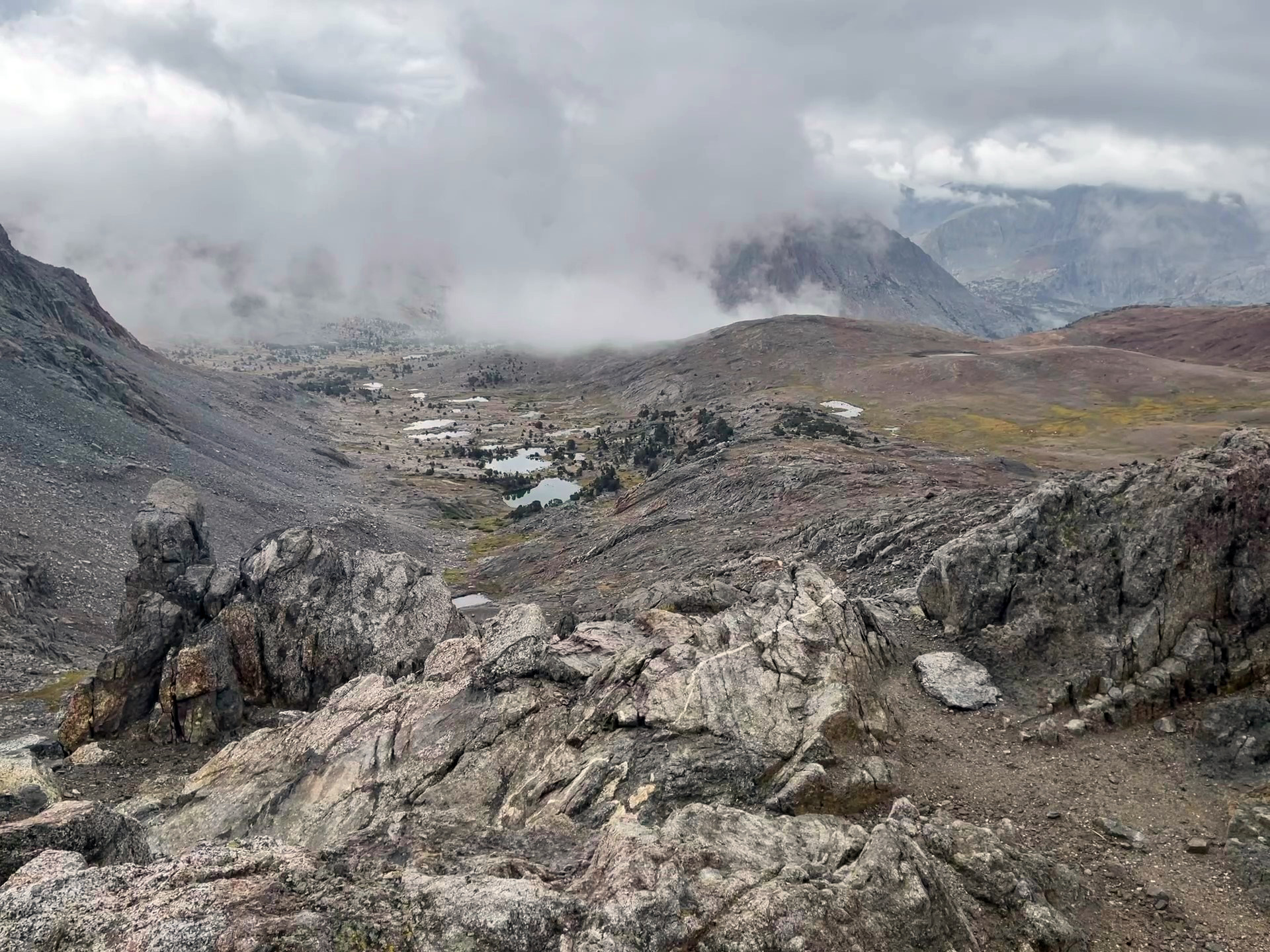
Ehh, my body decides bowel movement. I walk a couple hundred feet, dig the hole and while doing my thing the fog rolls in. THICK. Visibility, maybe a couple feet. I clean up, pack my kit, stand up, and am totally disoriented with no idea which direction is south-ish back toward my pack.
In a moment of panic, I see and read my headline in the Fresno Bee: “Backpacker dies of exposure, lost in thick fog after taking a dump.”
And then a moment of clarity; my watch has a compass.
I press a couple buttons face south and start to walk. I find the trail and figure to find my pack about 100’ in either direction. I guess left and in maybe 10 steps I find the pack.
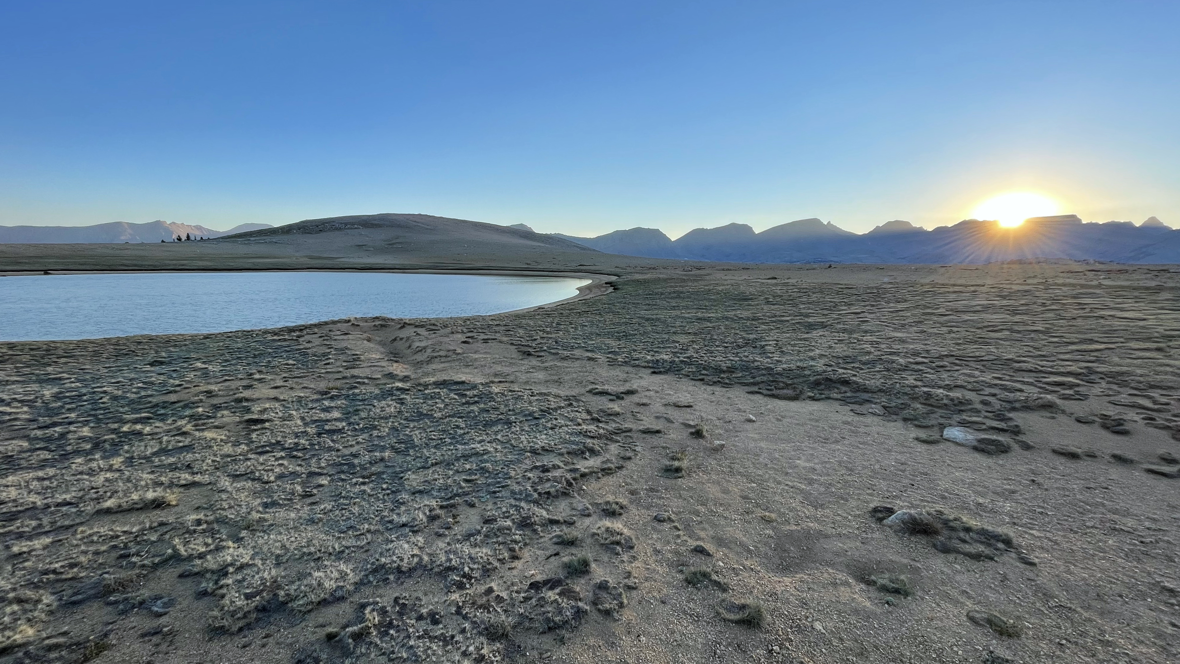
I stow my bathroom kit and grab the inReach to send a note home that I am starting to hike. Then as suddenly as the fog rolled in it rolls away, blue sky opens above with a smattering of sunshine. I walk to the lakeshore and wow. It is just one of those moments that takes your breath away.
A momentary cloud-break and the beauty of Bench Lake is on full display
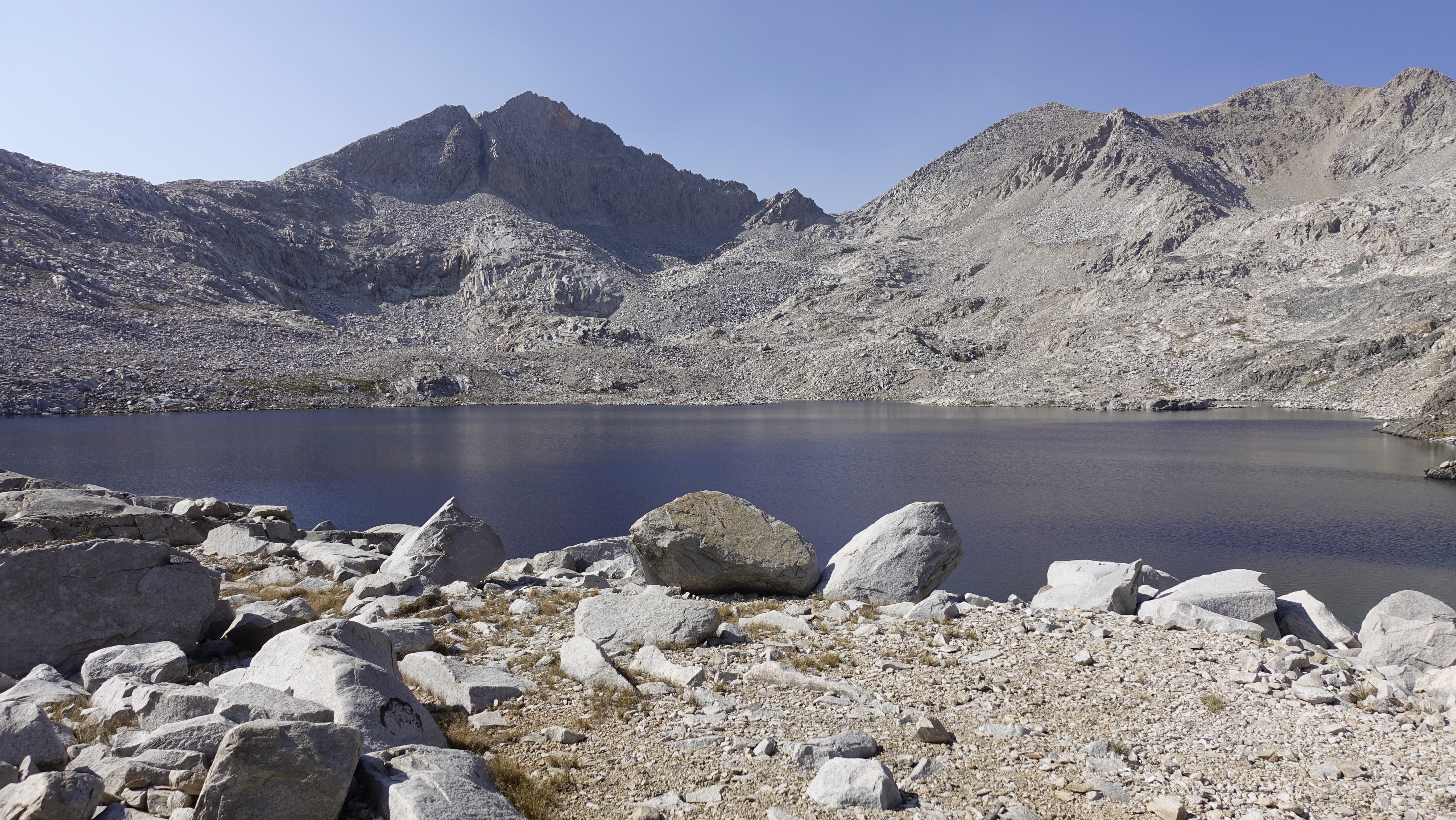
And just as quickly the clouds drop low, it gets windy and cold, and the rain resumes. And it stays such pretty much all day. Okay, the rain turns to little ice needles as I near and summit Pinchot Pass, and they sting the crap out of my face. But apart from the ice needles it is rain.
Lake Marjorie from Pinchot Pass
The JMT is busier today. Maybe a dozen people heading north and south, and nobody saying much, rather it seems we are all just dealing with the rain. Grin and bear it.
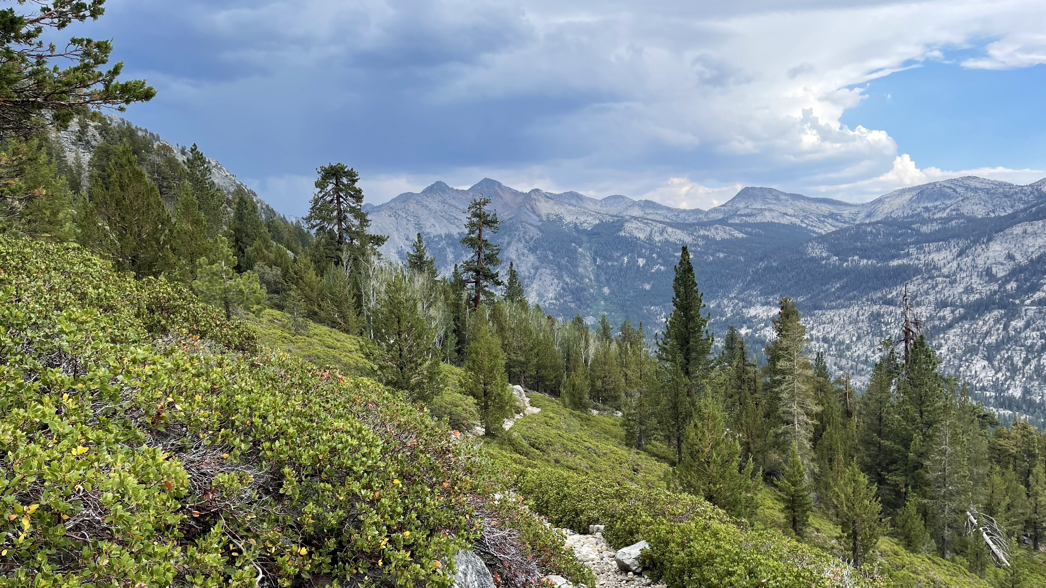
From Pinchot Pass my intended route is over Colosseum Col to Woods, maybe Stocking Lake but the canyon from Twin Lakes is completely socked in. I decide to not attempt a new to me cross-country route in the near zero visibility and make for Woods Lake via the Sawmill Pass Trail. And though not my intended route, it is one I’ve not traveled before.
Clouds fill the Twin Lakes Basin and my intended route
Leaving the JMT, the Sawmill Pass Trail crosses Woods Creek, climbs briefly, and then contours south at 10400 for about a mile. Turning east toward Woods Lake the trail climbs then meanders through boggy areas, climbs again and meanders through more bogs.
Is it always this wet or it is just the aftermath of this particularly wet summer?
In any event it is pleasant hiking even if there is a bit of route finding to find dry-ish ways around the sometimes-submerged trail.
Woods Creek Canyon from the 10,400 foot contour of the Sawmill Pass Trail
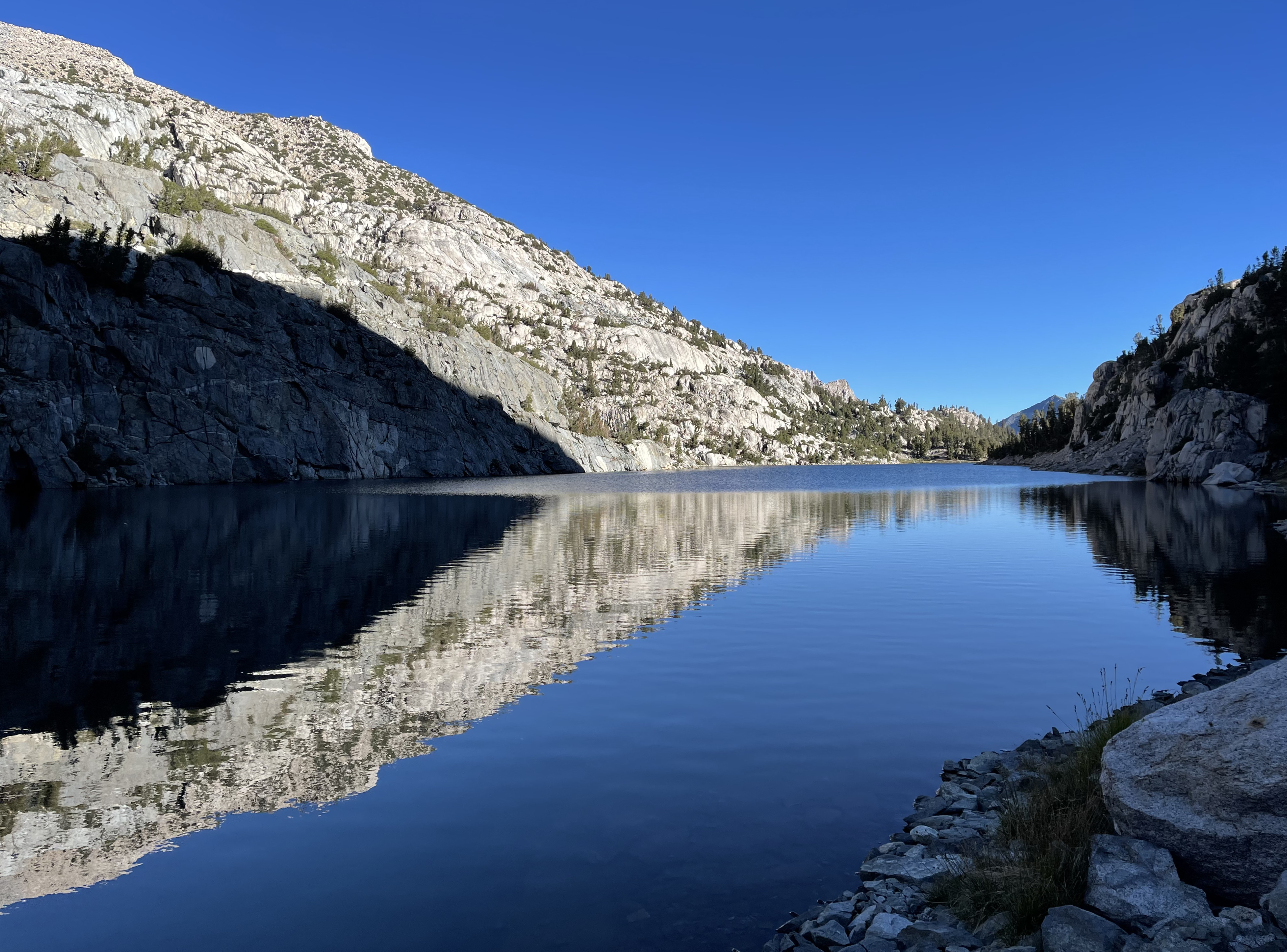
The rain abates about 3pm, nevertheless I keep the poncho and continue hiking until at length I reach a trail-side tarn. I pause and remove the poncho before making a hard right and making the brushy 200ft scramble down to Woods Lake. I arrive about quarter to 4 and search for some flat lakeview property to set my tarp.
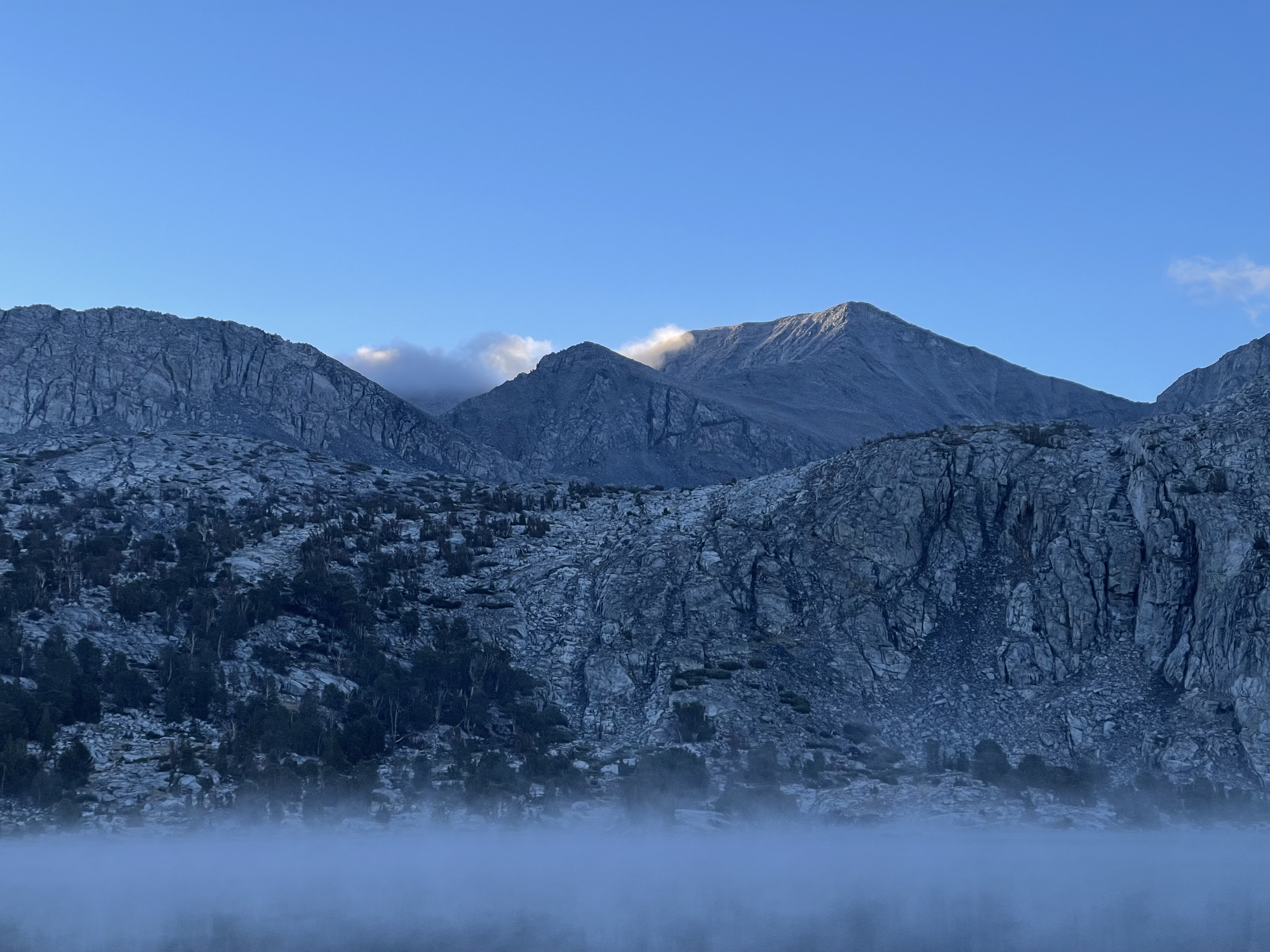
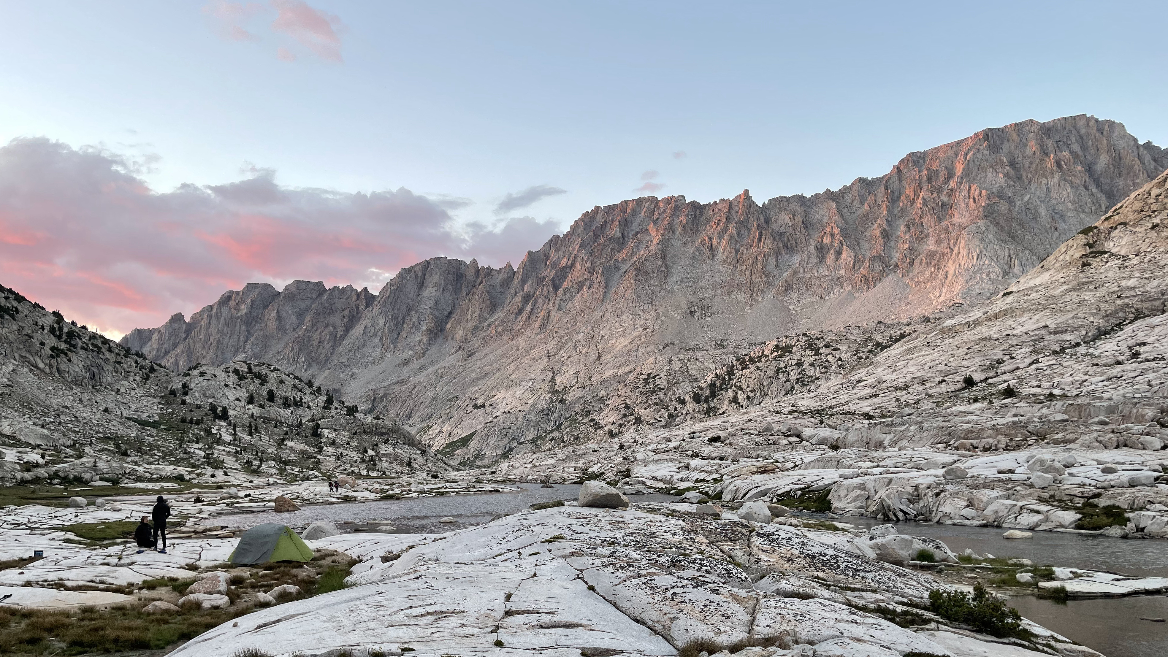
Colosseum Col to the north remains completely socked in. To the south and east the clouds lift sitting just below the Mt. Baxter summit. Woods Lake is choppy in the breeze. I set up the tarp expecting another night of rain.
Rain returns around 6 and I set to cook dinner from under the tarp, my alcohol stove, an arms-reach out. Lazily I don’t sweep away all the duff and mid-boil set a small fire inside the caldera cone windscreen. Big lesson here and I am fortunate for all the rain.
I easily extinguish the fire, but what, had it been dry? I need to be waaay more careful. 54 years backpacking and never yet such an accident. And though I suspect we’ve all let our guard down and gotten lucky in one way or another I never want a repeat of that. I disperse the ashes of my 4” diameter unintended fire ring.
When the rain abates, I go and sit lakeside. I’ve an argument in my head. Do I take the SoSHR Baxter Peak route or skip it? An easy call if the weather is bad, but what if the weather is good? There’s the sketchy chute to attain the north ridge. Will I lose my nerve like I did on Upper Basin Crossing? I stare in the direction of Baxter Peak, nothing to see but cloud. I continue to toss it around, but my confidence is shaken. I decide “no” and go to bed.
———-
I wake. A fog hangs over Woods Lake, but the sky is mostly clear and the Baxter Peak route calls again. I ponder briefly but stand by last night’s decision. I think, were I with a hiking partner, we’d have given each other the courage to go for it, but for now it awaits another trip.
Fog over Woods Lake, Baxter Peak calling one last time
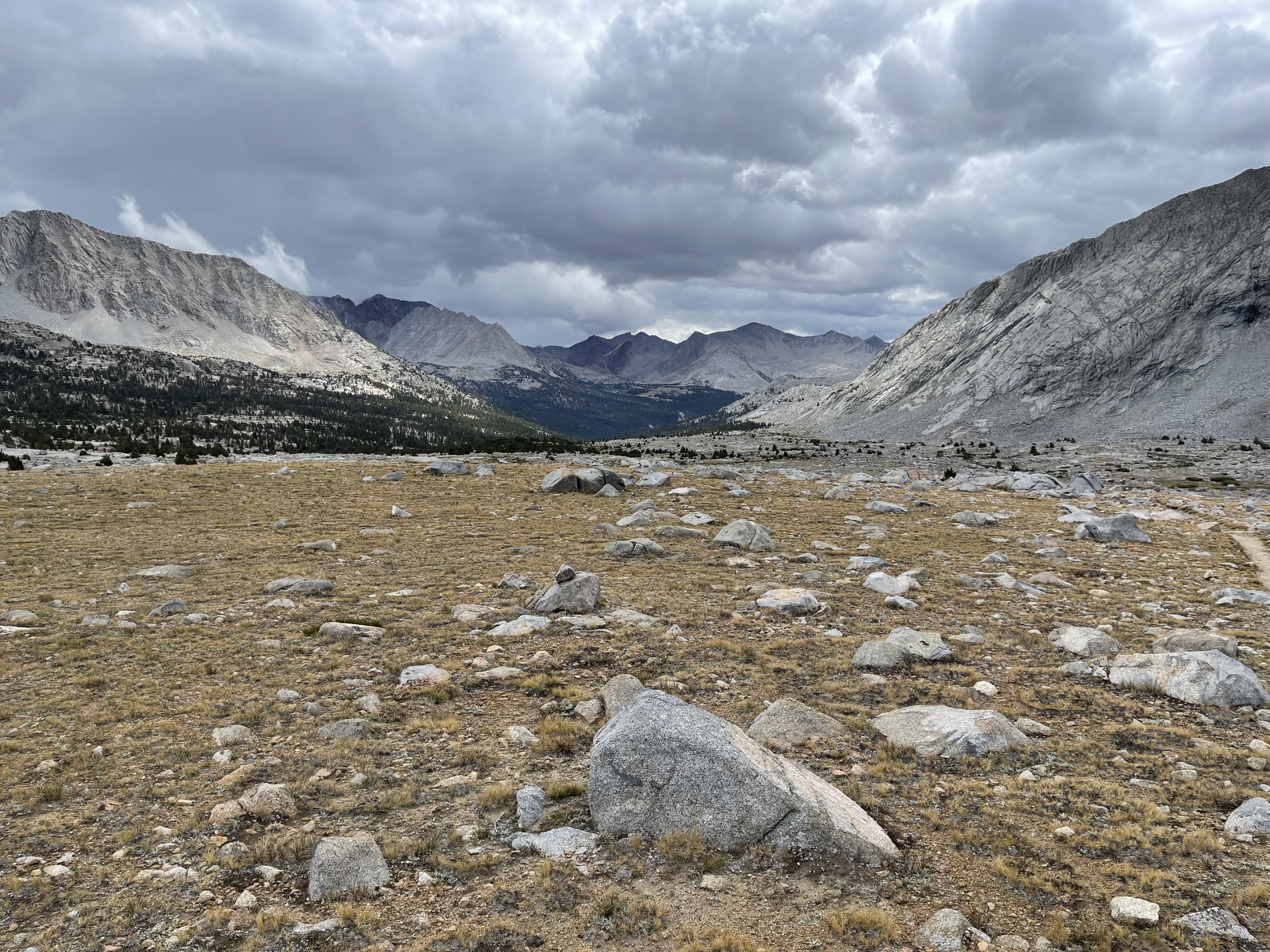
It is a cool and clear and fast track back to the JMT. And, decidedly less humid. Kind of the calm between storms. Hurricane Kay has dissipated, and the first taste of winter is marching in. The forecast says snow on Sunday. For me, it is just a steady drop in temps over the next few days.
It is still surprising the lack of people on the JMT. Perhaps that’s the way it is after Labor Day. I typically hike the back half of August through to Labor Day and see plenty of people while on trail, and finish to trailheads packed with Labor Day Weekend crowds. Mid-September though? The father and son camping at Dollar Lake constitutes a crowd.
It’s roughly lunchtime and I stop at Dollar Lake. I meet a father, about my age, and son planning to stay an unintended 3rd and possibly 4th night. They are out on the Rae Lakes Loop and planned a couple nights each stop, but the son, they think, has altitude sickness, or flu or Covid, something, and they’ll hang out here until he feels human again. Today, so far, is better.
Dollar Lake and Fin Dome
It is easy track from Dollar Lake over Basin Notch and in to Sixty Lakes Basin. Before heading cross-country, I meet Don, a Rae Lakes Looper. He asks some of my favorites that get little “love.” I tell him the entire SHR used to be that way, but even so, Lakes Basin, the section between the Isberg Pass Trail and Thousand Island Lake, and the Bear Lakes are not to be missed. Don shares he is thinking about a side trip to Lake Reflection. I encourage, enthusiastically.
Point of departure to Basin Notch
The route to the base of Basin Notch is well marked by manure. I don’t think stock, at least recently, have ascended, and there are short garbagy sections that might make it impassible to stock, but they have wandered this 1/3 mile stretch from the JMT plenty.
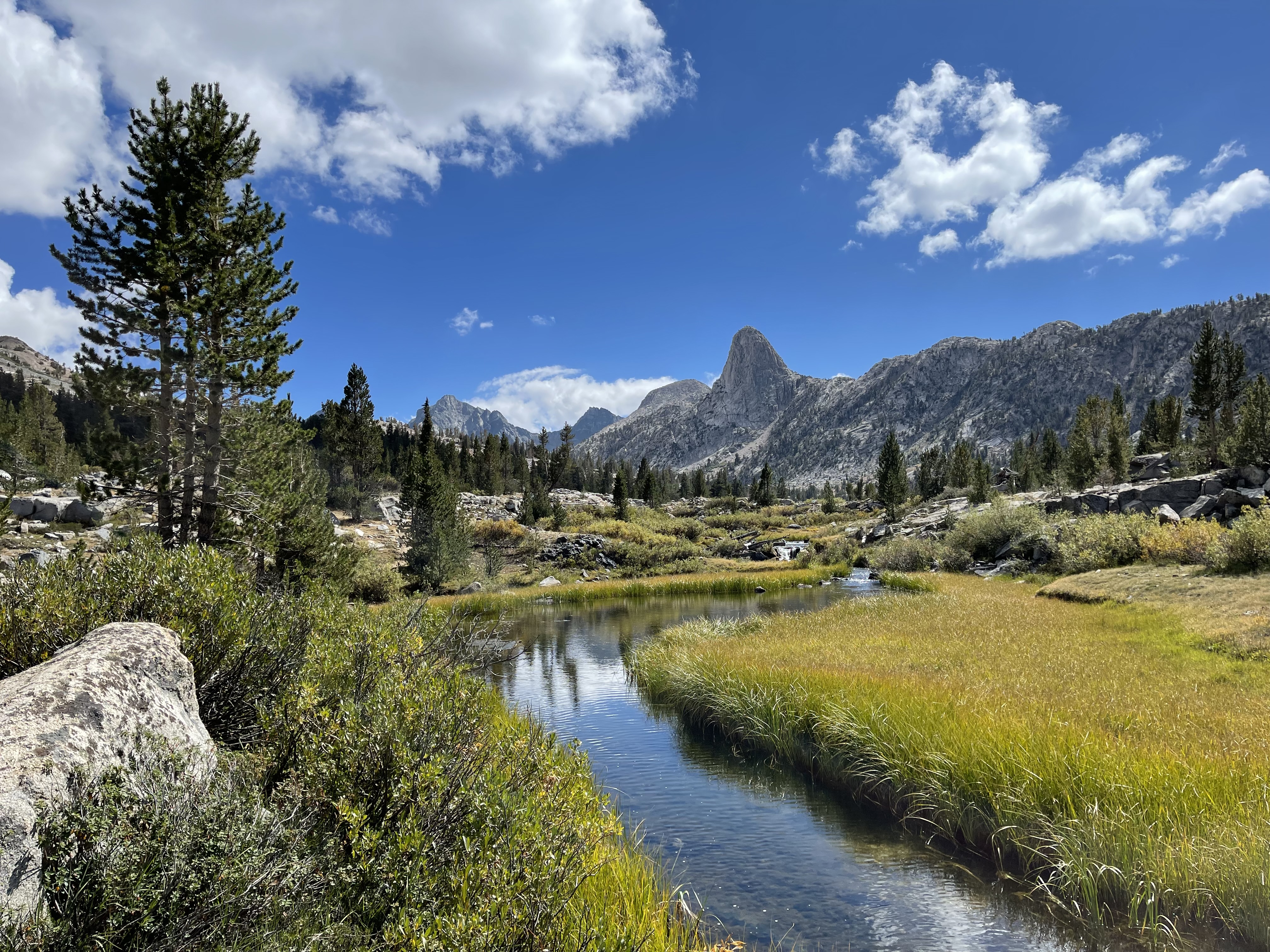
Reaching the top, the view south into Sixty Lakes Basin at first disappoints, but a short descent later reveals a gentle lake dotted parkland. I move rather lazily absorbing a new place. And what a contrast to the Rae Lakes Basin. Rae Lakes is awesome, magnificent, huge, Sixty Lakes Basin is beautifully intimate.
Sixty Lakes BasinThe “backside of water” view of Fin Dome
Places to camp abound. I reach the parkland at the north end of the finger lake around 4pm. It is still early, and from what I’ve seen so far am certain I’ll find a glorious site at its south end. I choose poorly.
The south end is flat enough, but completely littered with rock. The slopes above must shed constantly. Moving a few softball-sized stones I clear a patch just large enough for my bivy. It is easily the most austere camp I’ve ever had. Frustrated, but no, I’m not going to drag myself back to the parkland a half hour north.
Tiny campsite at south end of the Finger Lake
———-
The night is clear and cold, and I wake covered with frost, my sleeping bag shell bonded to the bivy. The best part about ice, as I shake my gear, is that it flakes off and leaves things relatively dry.
Weather-wise it is a Chamber of Commerce Day; a chill to the air and a beautiful deep-blue cloudless sky.
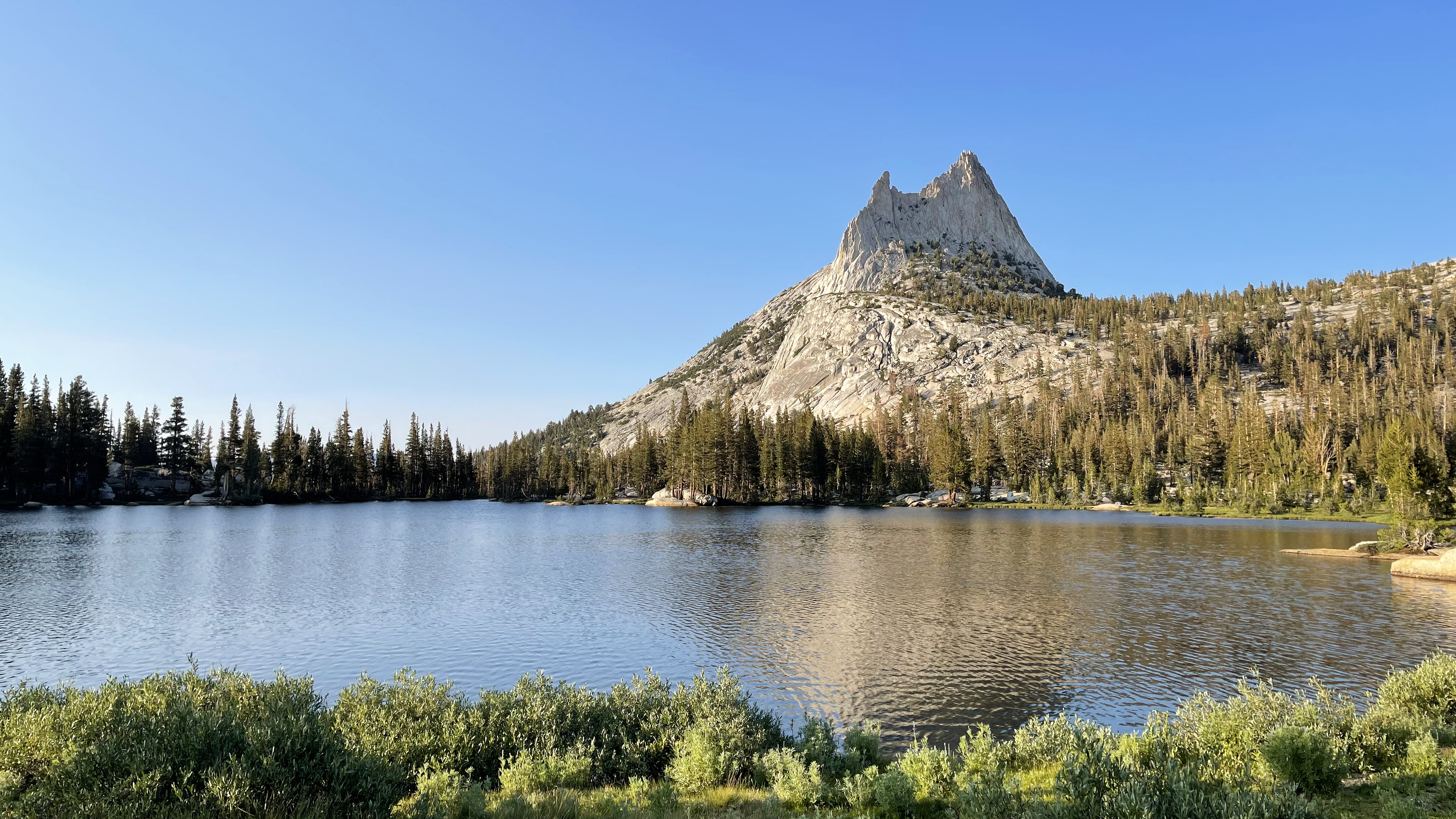
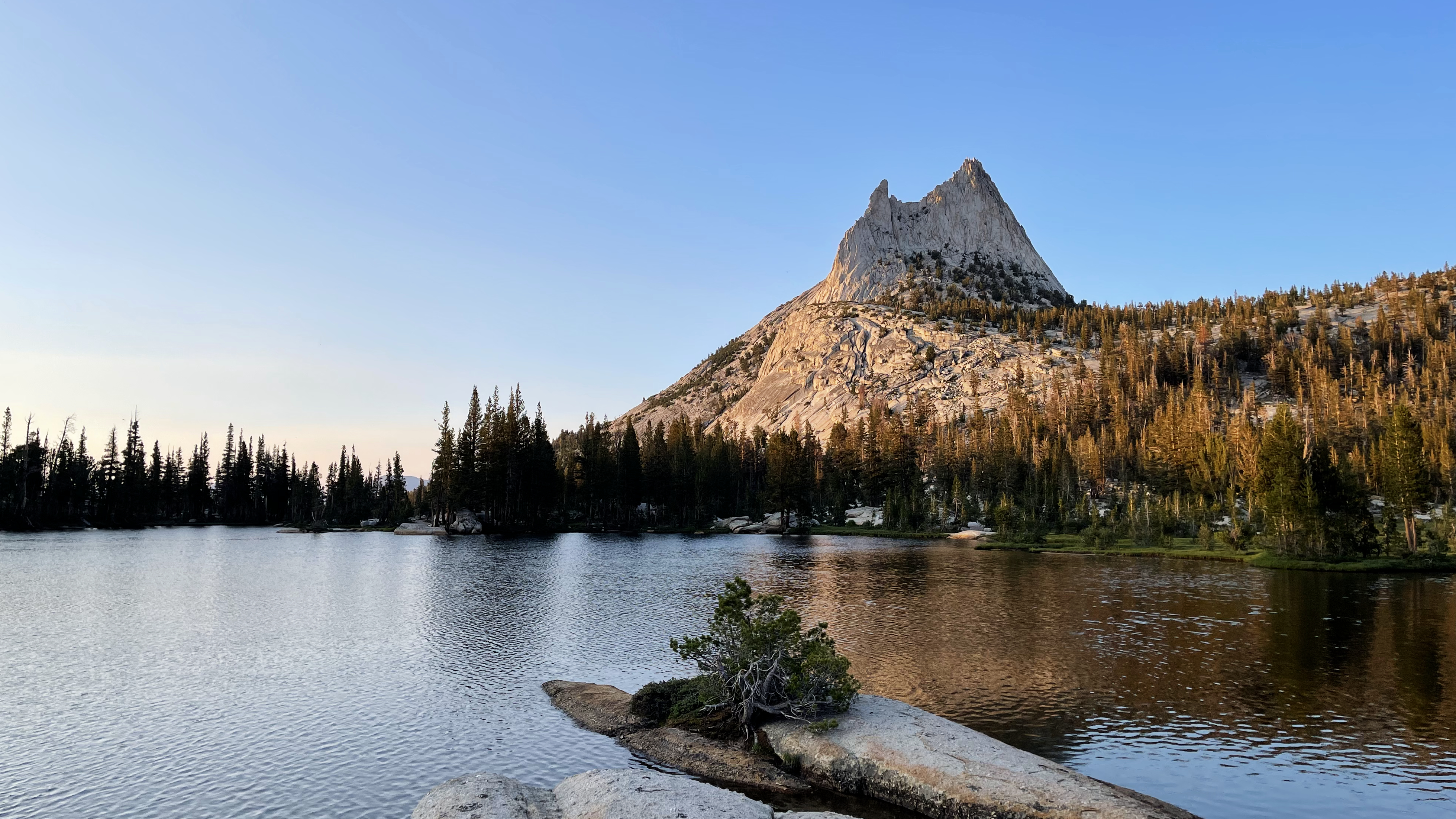
The Finger LakeThe Finger Lake, beautiful park lands at the northern end
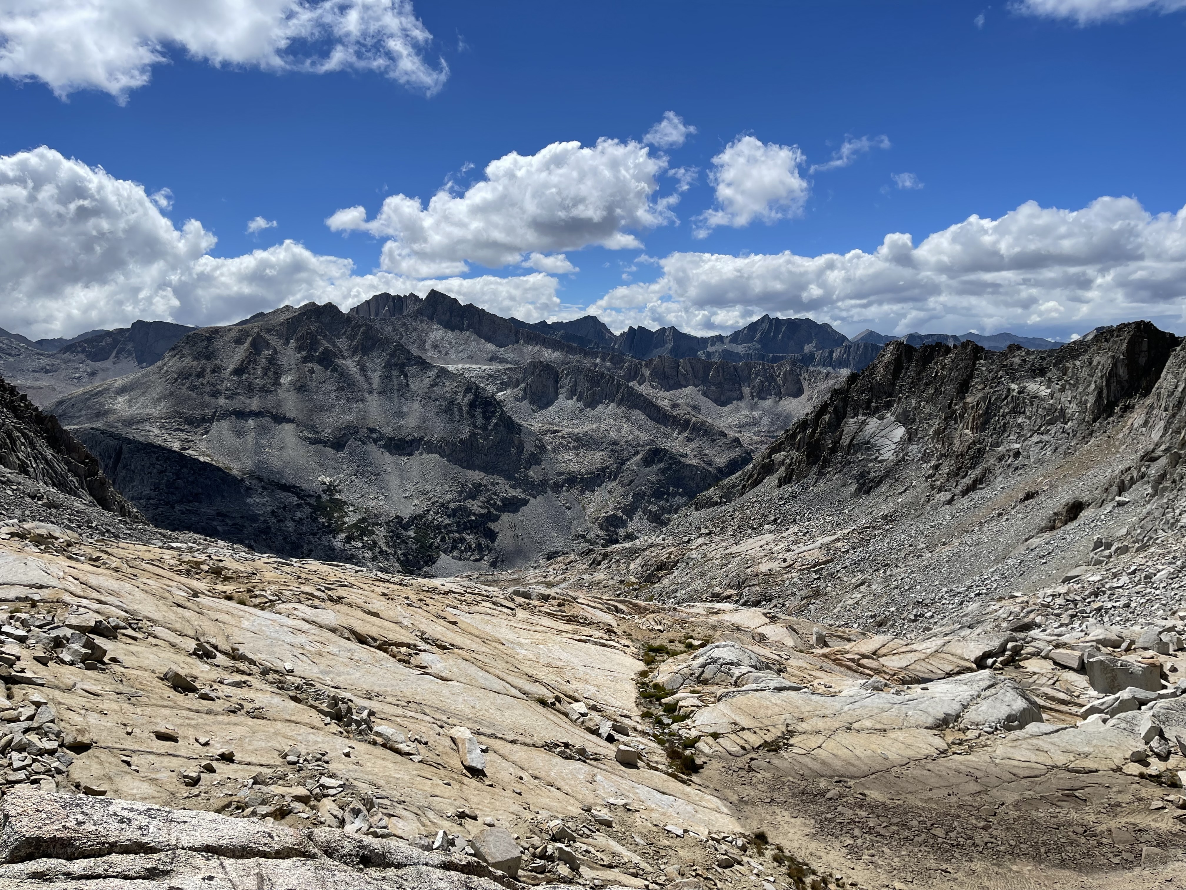
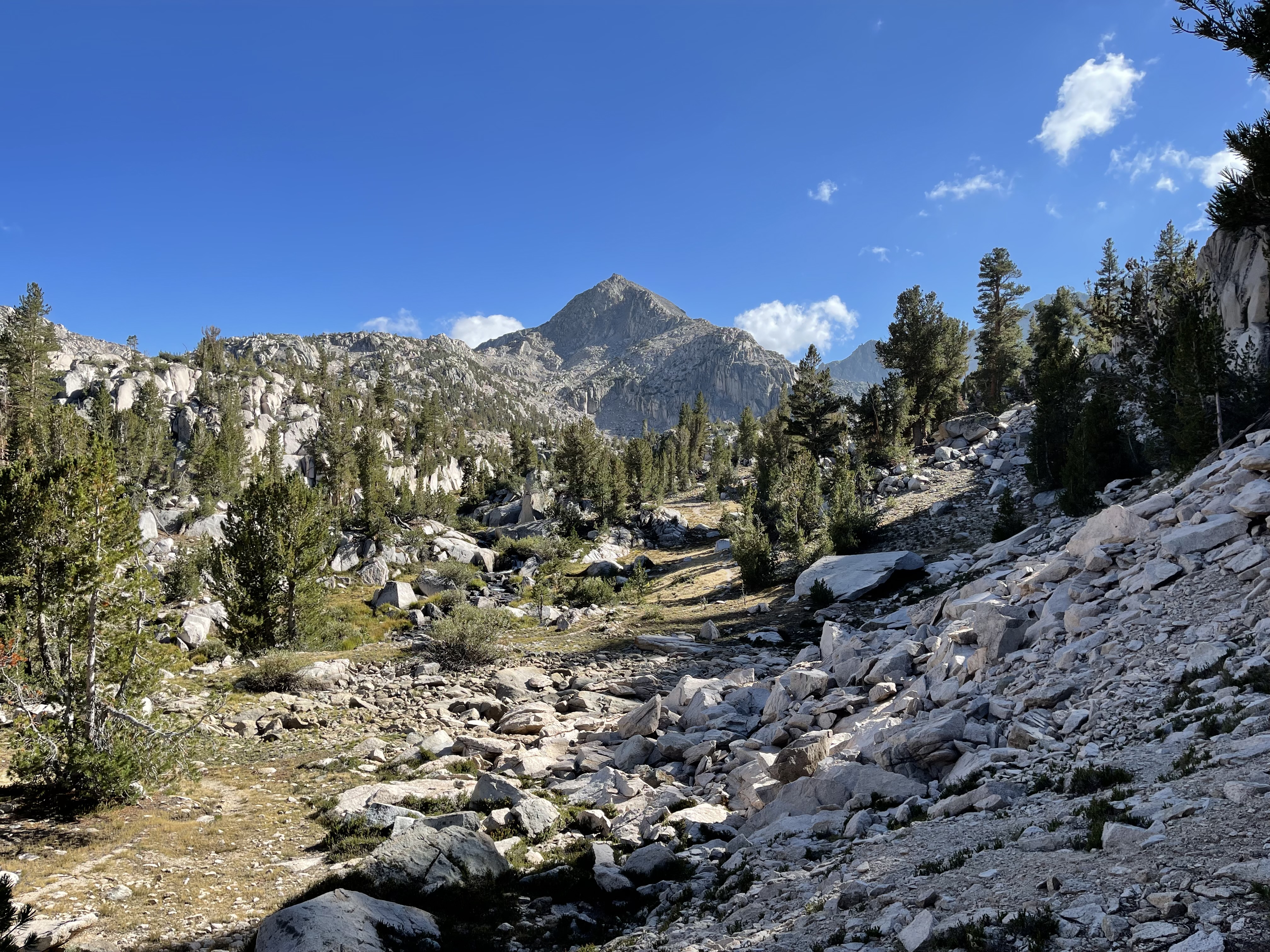
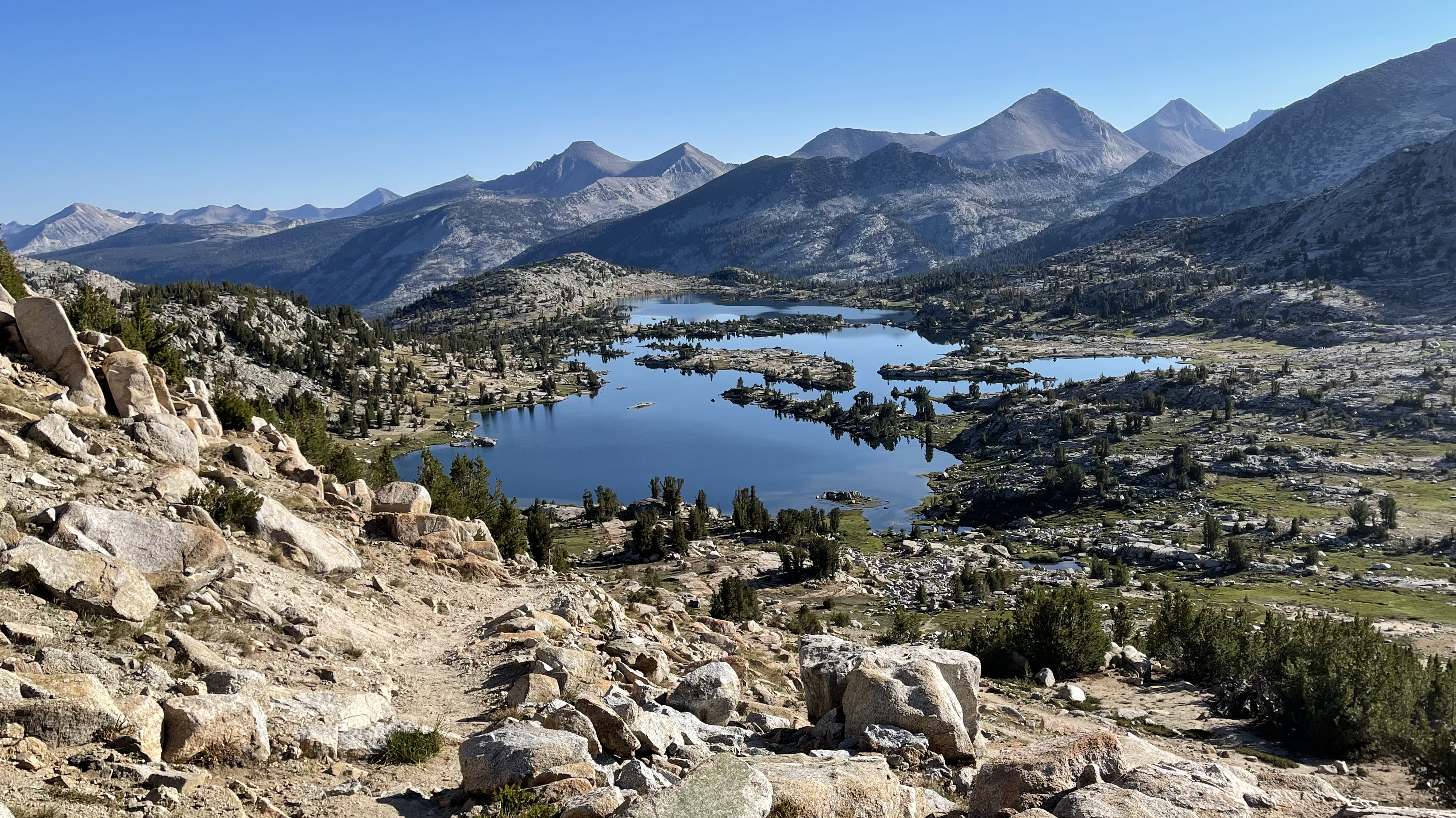
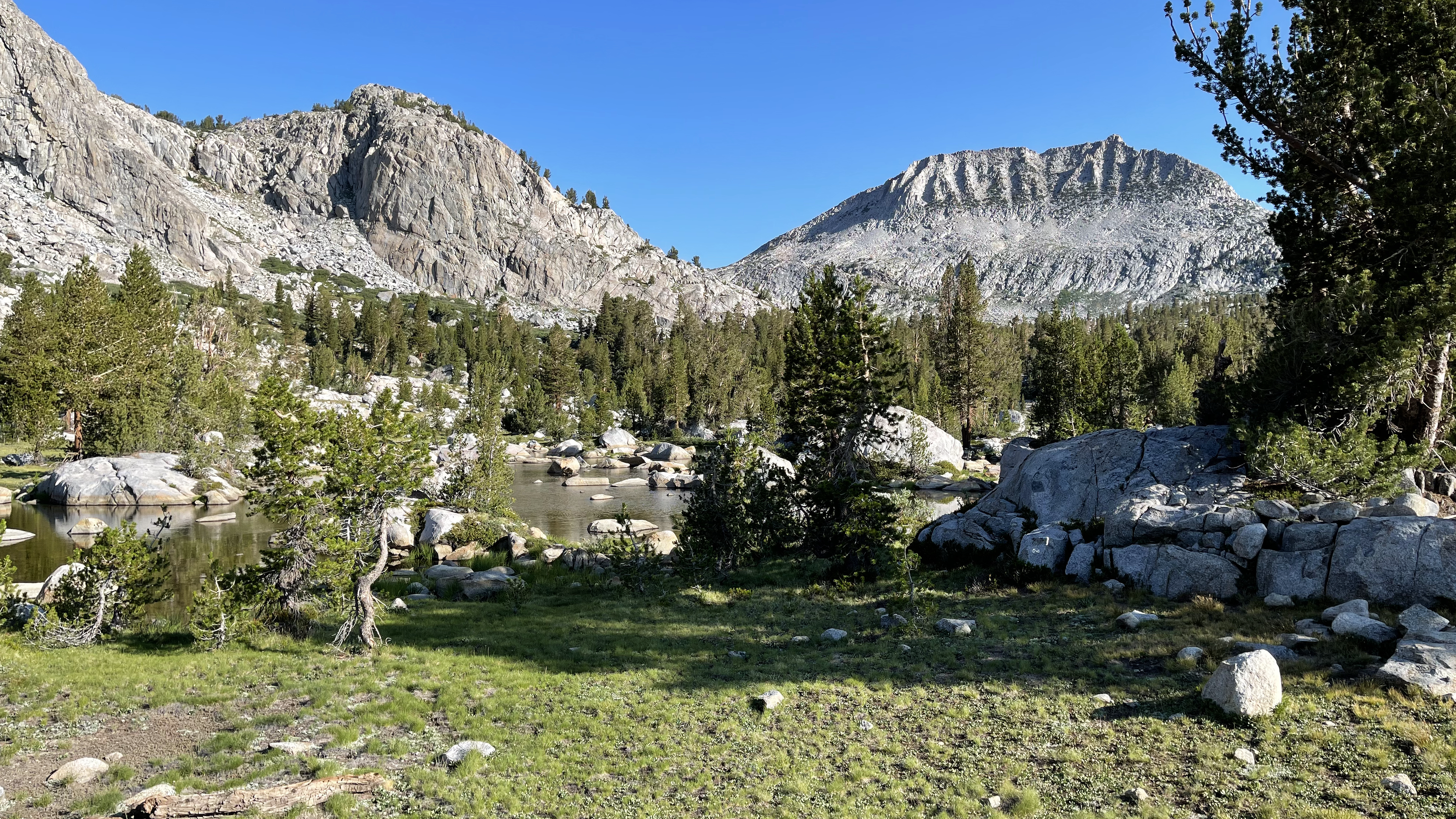
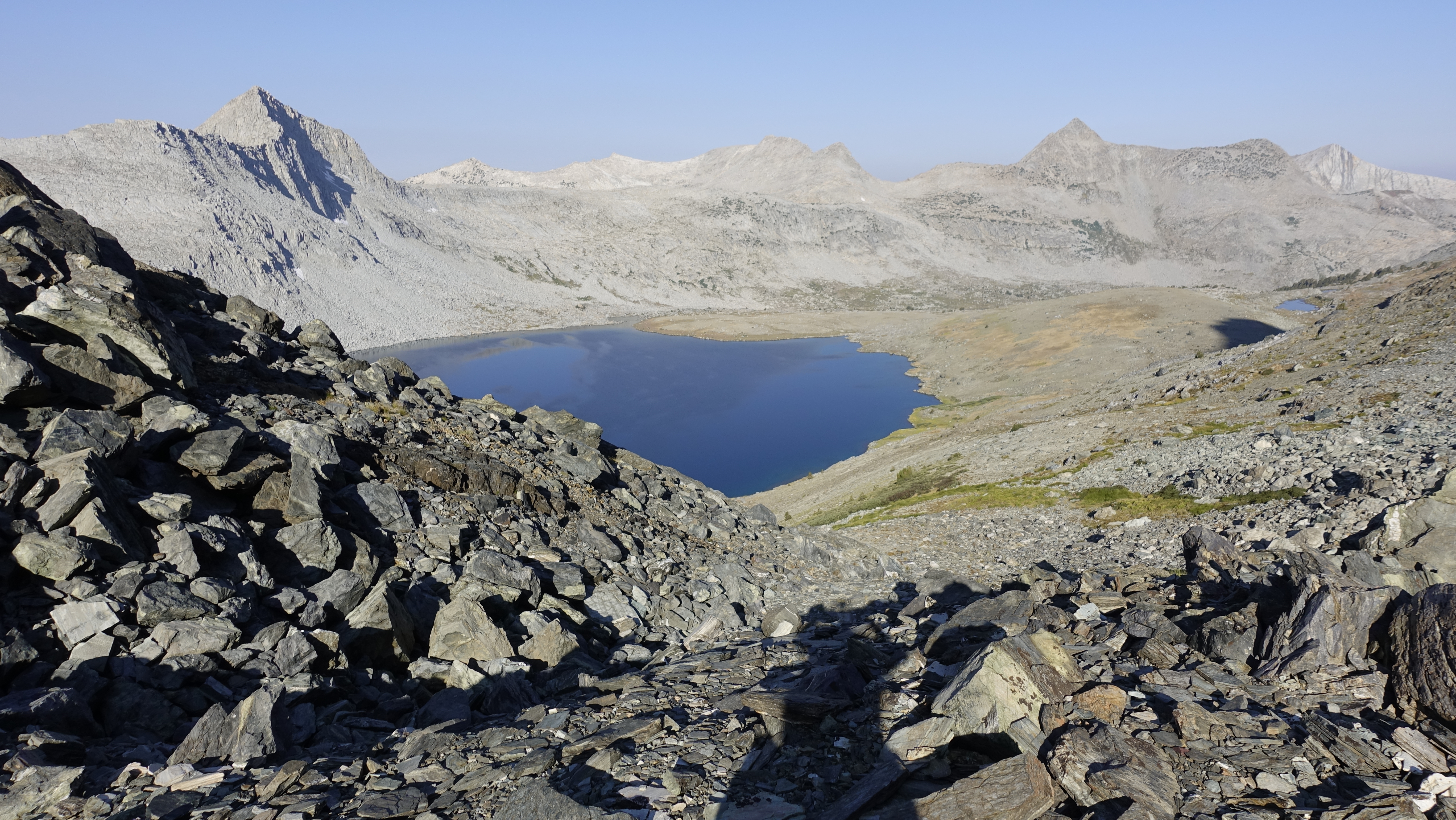
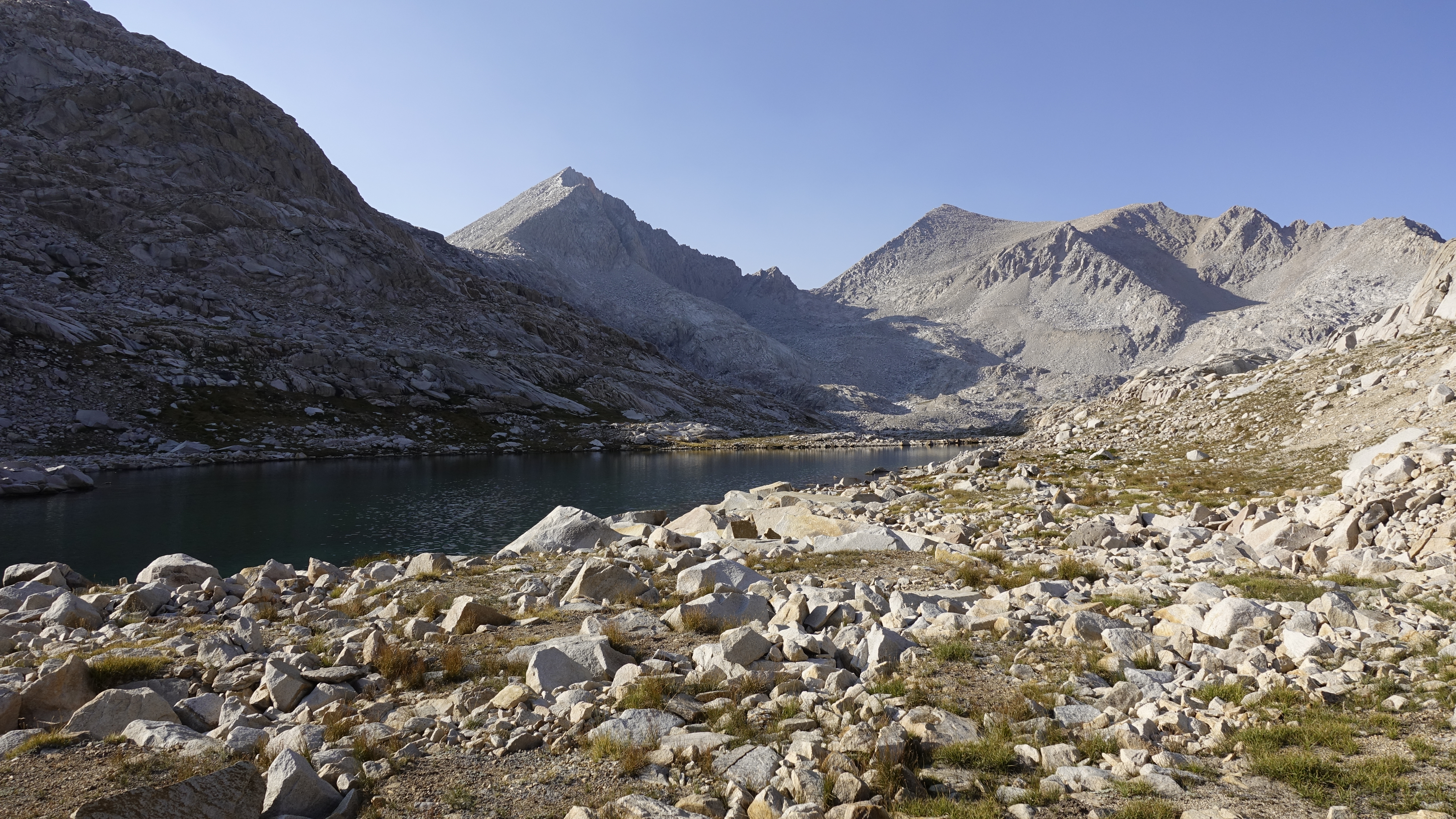
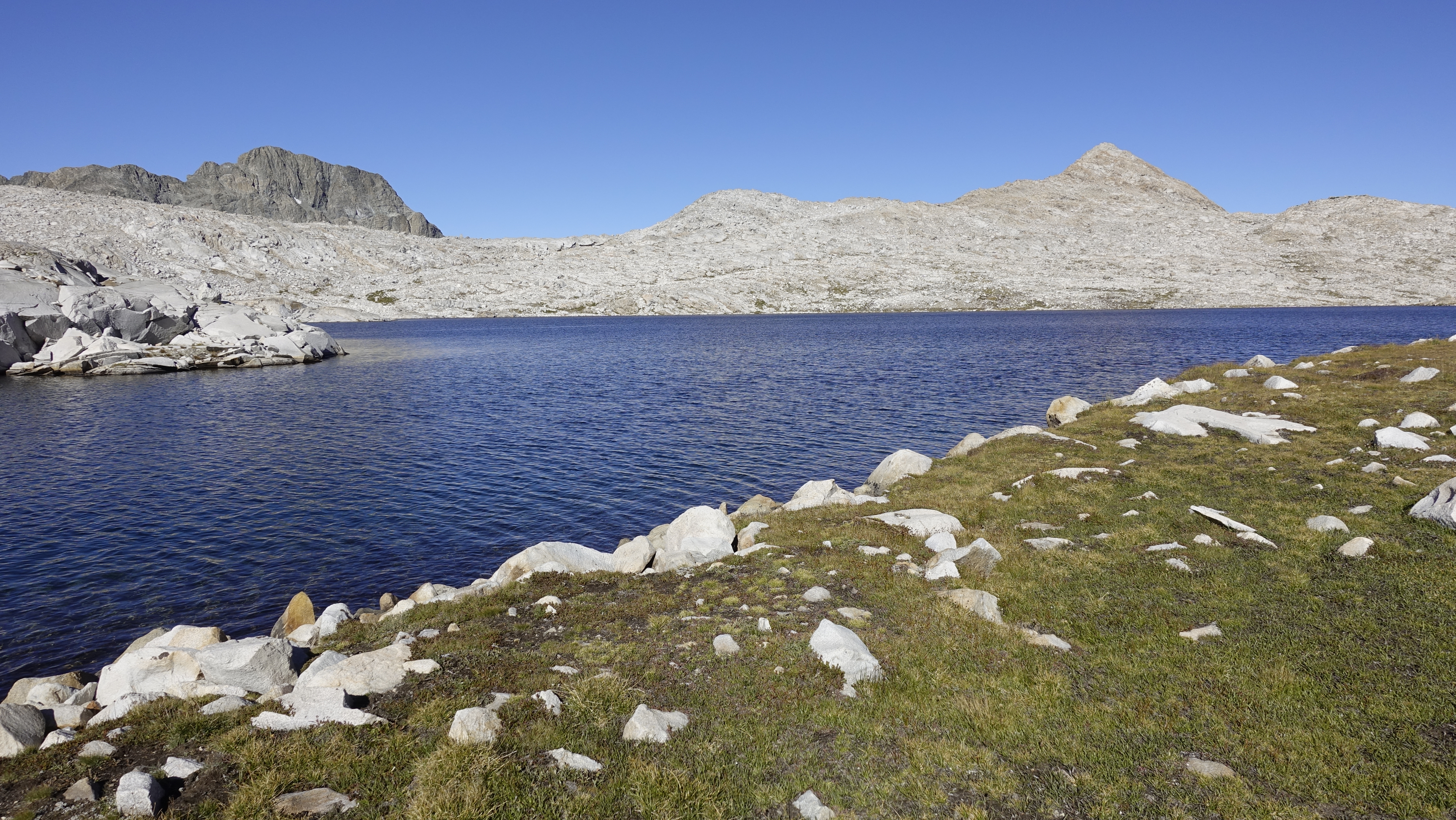
My route heads south, ascends a garbage chute to a couple of rock-bound tarns, and then makes a hard right to find the ramps that ascend to Sixty Lakes Col. Views into Gardiner Basin are spectacular.
Sixty Lakes Basin from Sixty Lakes ColGardiner Basin from Sixty Lakes Col
I pick my way through talus and arrive at the large Gardiner Lake in less than an hour. I route around its south and west, cross the nascent Gardiner Creek and take a long swim break. Gaia GPS shows the old Gardiner Basin Trail. Don’t believe it. I wasted a lot of time trying to find what I thought might be a track like the old JMT through Lakes Basin. Track or not, it is easy enough to find a way through. Some talus, some easy slabs, some steep slabs; in all, relatively easy passage until about 10,000’.
Gardiner Basin, my track stayed near the tree line on the north side (right) of the lakesGentle hiking at 10,600 feet, looking back toward Mt. GardinerGentle hiking at 10,600 feet
Along the way I meet up with a small herd of Bighorn Sheep. 7, I think. The first I’ve ever seen in some 50 years hiking the Sierra. What a treat. They see me about the same time I see them. I take a picture and think maybe I can get closer. They decide otherwise. I take one step, and they vanish. Magical. Still, what a treat.
My first encounter with Bighorn Sheep
At 10,000’ the basin becomes willow choked. I alternate following short stretches of game trail, with short stretches of thrashing. And a few back-and-forths across Gardiner Creek. Not difficult, just slow. Is there an easier route? I don’t know. But I am thankful it is not raining. Ponchos and willow thrashes do not mix.
At 9200’ I reach a clearing to a nice view across Gardiner Creek, some 200’ below and spy a wide-open area that from above looks like it may have been a Packers Camp. Upon arrival there is no trace of a camp though given its size and proximity to water it has undoubtedly “housed” weary travelers. I lay camp right in the middle in view of the largest possible expanse of sky, then look at tomorrow’s “way out:” a talus field, then steep slabs interspersed with ledges. No obvious route, just something to figure as I go. I’ll deal with that in the morning. For now, it is bathe, eat, journal, sing a few songs, and at last to bed.
My mind wanders as I lay. I reflect on the new places I’ve seen and the 2 gifts I’ve been granted: Bighorn Sheep, and the momentary opening of the sky over Bench Lake. My mind then drifts across the entirety of my time a backpacker. I don’t recall all of what amounts to probably more than 300 hikes, but wherever my mind goes there are memories, some grand, some intimate, all meaningfully shaping me. And some, like Bench Lake, alter my understanding of beauty.
Little did I know then, how the experience at Camp Wolverton in Sequoia, amidst altitude sickness and my huffing and puffing as an overweight and out of shape 11-year-old, would change my life. It was then I became a backpacker and the Sierran backcountry home. This activity, this place is my peace.
———-
The way out is abrupt. About 500’ climbing through talus and then another climb via ramps all made more difficult by my lingering Covid Cough. The first hour or two of hiking each morning I hack until it hurts, and then spew a wad of phlegm which finally brings relief.
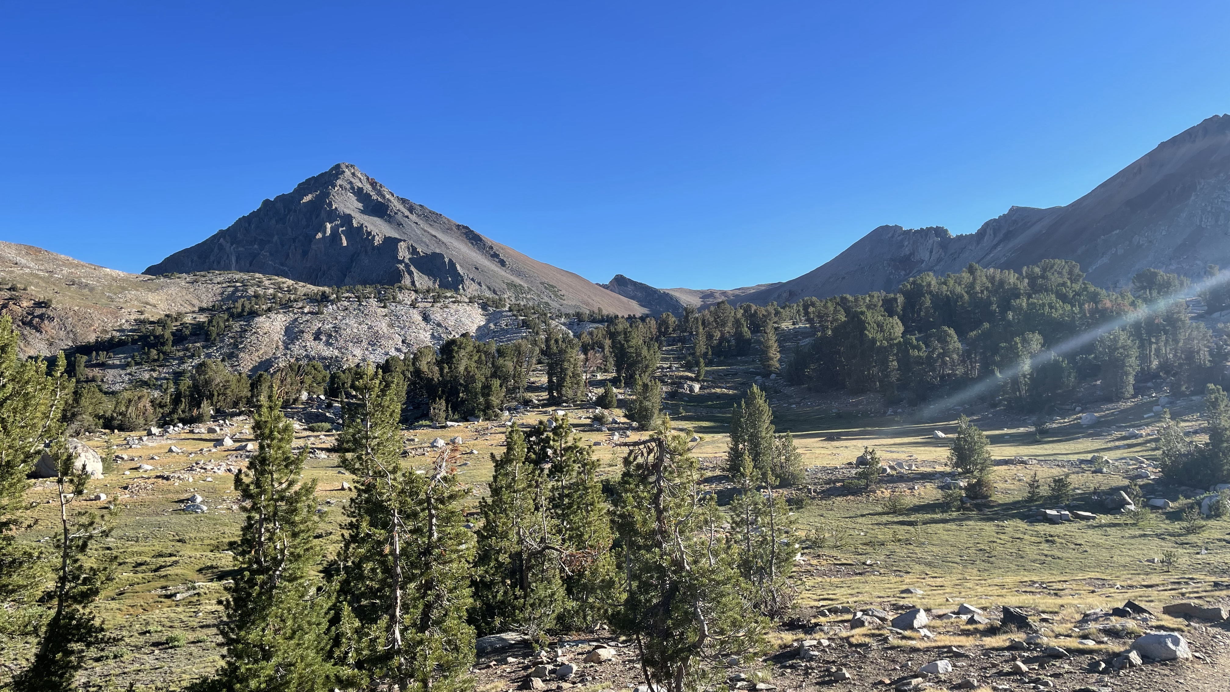
At length I find some ducks that mark about 5 minutes of “trail” then my route levels out on the ledges just east of Lake ~9600. I don’t bother looking for trail today, just take the easiest route. But if the route on Gaia shows it crossing a creek, I cross the creek, and I pass the lakes on their east or west side if the map shows that. In all, it works well, and the hiking is rather pleasant through the basin leading to Gardiner Pass.
Then out of nowhere Kenneth appears. I’d guess my age or a bit older, he is out backpacking for the first time in 30 years! He said on this hike he is reliving his childhood having hiked Gardiner Basin years ago when there was still a trail. Seeing him is good confirmation. Both of us, absent a trail are just walking what seems to be the easiest path. He says I’ll find trail as I ascend Gardiner Pass and then nothing until the track that runs to Charlotte Lake. “That trail is not real evident, so start looking for it when you get to about 10000 feet.”
I share details on the route I just finished and point out on the map where I encountered the Bighorn Sheep. And we head off. I’m thinking, 30 years is a long time, and his route makes for a challenging loop.
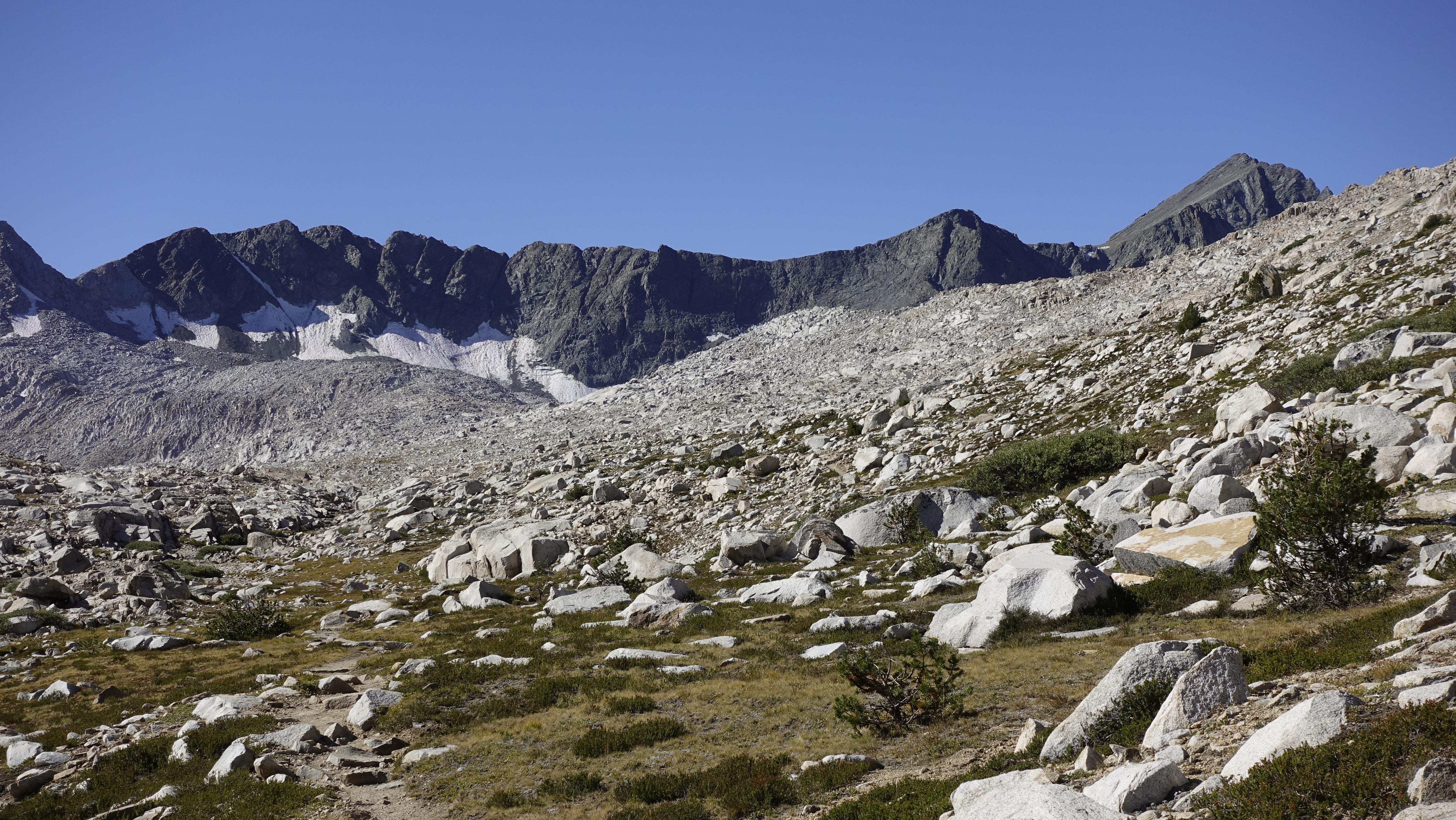
As advertised, the old trail up to Gardiner Pass appears, some sections a scramble, but mostly tight switchbacks. The descent is a slide through scree and I reach the connector trail somewhere close to the “junction” nearer to Charlotte Dome. From here it is a warm brushy stroll to Charlotte Lake.
Ascending Gardiner PassGardiner Pass – Mt. Brewer, North Guard and Mt. Farquhar
Along the way I meet a couple guys also hiking the Gardiner Basin Loop. Perhaps Gardiner Basin is experiencing a bit of a renaissance? 3 “groups” through a trailless basin in one week, during mid-September seems a lot.
I stop to chat with the first group camped at Charlotte Lake. Yet another group hiking the Rae Lakes loop and happy for the wet and cool weather. They complain of being “smoked out” of their last 2 summer hikes due to fire. I continue a short way and take up at the now familiar group site. It will be a cold night. Before the sun even sets, I am wearing all my clothes.
I pass time journaling, sending a message to my wife that I will exit tomorrow, and otherwise trying to keep warm. Far too early to sleep I walk to the lakeshore, watch the fish rise, and then pace a few times on the trail. Finally, 8pm, I tuck into my sleeping bag and start thinking about hikes for next summer.
———-
Last day, I dally, waiting for the sun, thinking it would break the frost, more than 1/8 inch thick. The sun comes, but not much warmth. Not worth the wait, I end up packing frosty gear.
I’m thinking, as a gear piece, the bivy is not so useful. On damp nights that turn cold the bivy freezes to my sleeping bag. And with my XL-wide neo-air taking up space, the bivy restricts loft and warmth. I may as well carry a polycro ground sheet and leave the bivy at home. And if there are bugs, I can wear the ballcap and head net. 54 years backpacking and I am still tweaking things.
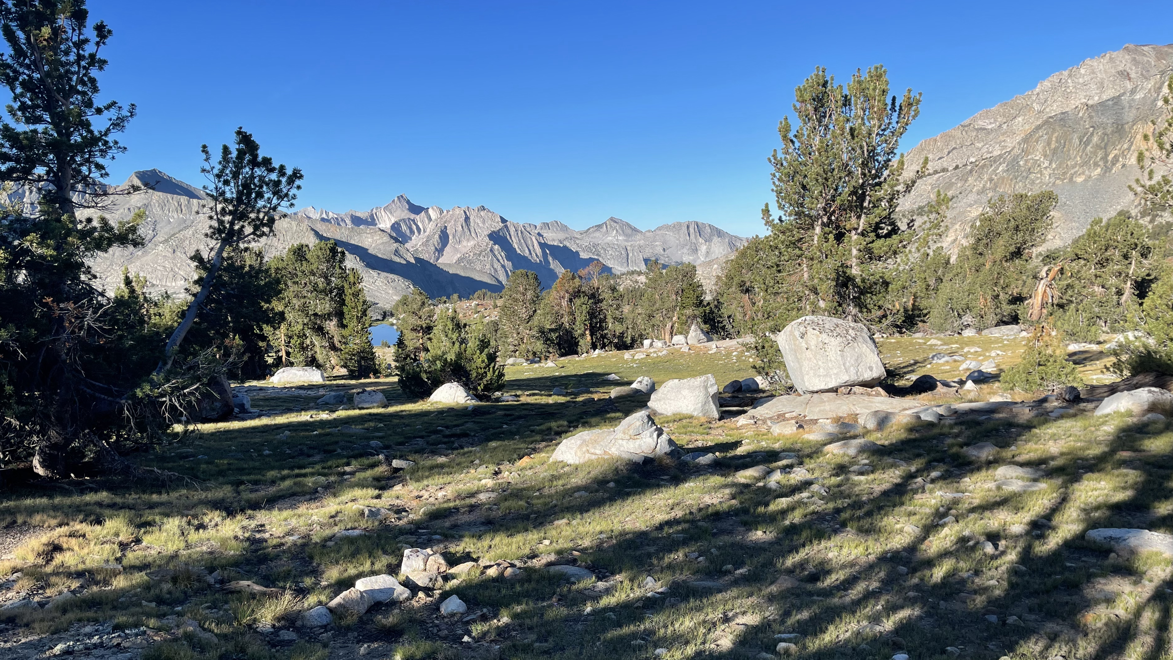
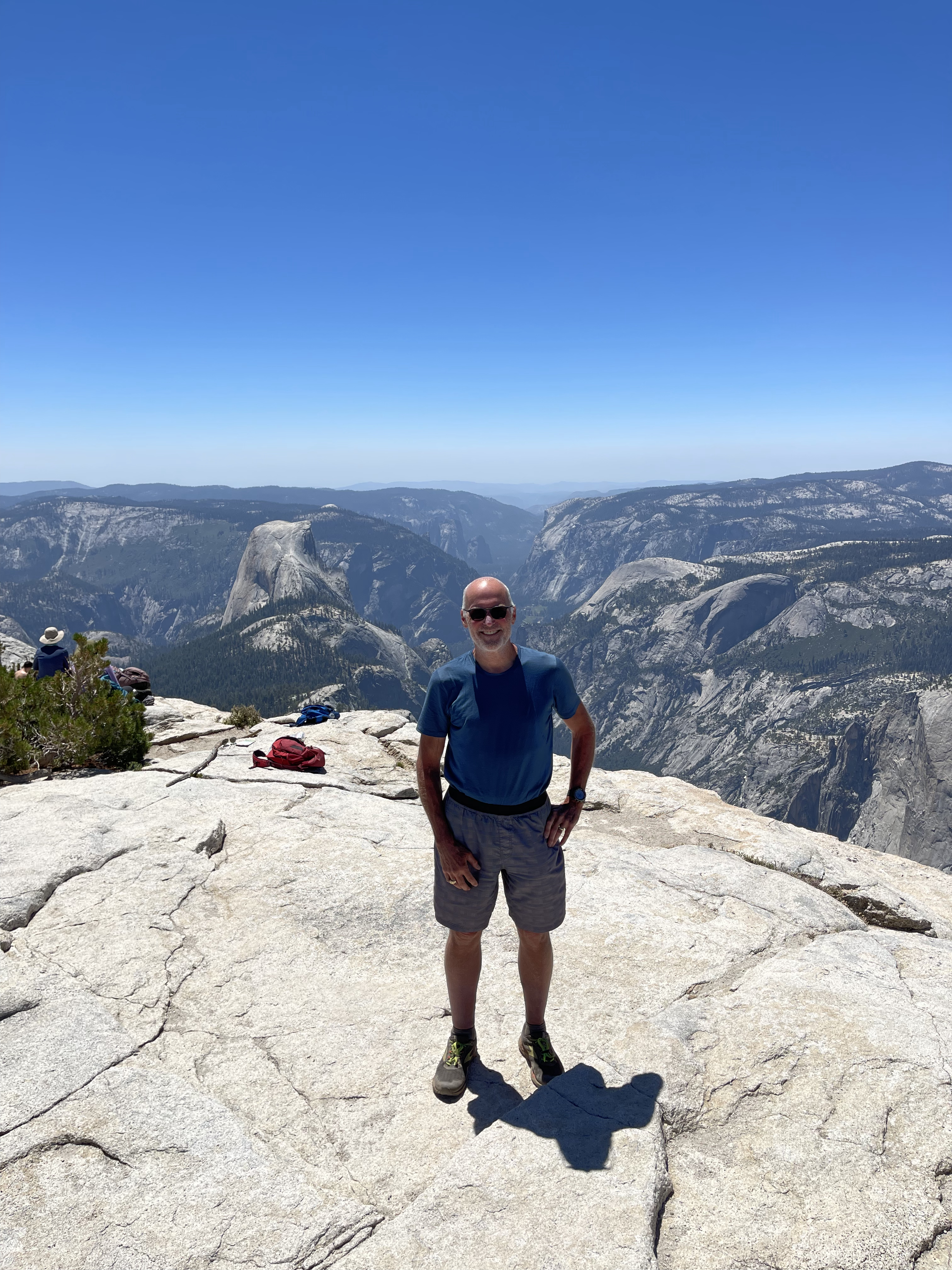
Back on good trail I pretty much blast out to Onion Valley stopping briefly “midway” atop Kearsarge Pass. I share stories with a woman my age who is guiding 4 younger women first-timers. She seems happy to chat with someone able to appreciate her Sierran exploits.
Look closely, some clowns illegally camping at Bullfrog LakeAnd me, no worse for the wear
As I am about to leave, Jim and his hiking partner arrive. They are JMT NOBO resupplying at the Mt. Williamson. I agree to wait for them at Onion Valley and give them a ride so they don’t have to wait for the 3pm pickup.
I reach Onion Valley a little before 11:30am, but not before greeting Claire on her return from resupply. I inReach my wife and wait. Jim and his buddy arrive a little after noon and we pull into the Mt. Williamson around 1pm. We sit, enjoy a beer, and talk for about an hour while their room is readied. I encourage them, even though they have an MTR resupply, to make the time for VVR, then wish them well and head to Lone Pine.
First stop, the Mt. Whitney Hostel. No room at the Inn. Disappointing for me, but great for them. Covid put a lot of stress on the small operators and to learn they’ve been booked all summer is great news. And so, across the street to the Dow where I score the last old Dow room with a private bath.
Moving in, I unpack and strew my wet gear throughout the room. There is barely enough space to set/lay it all out. The shower is small, but the water is hot, and I soap and rinse 3 times to clean. Then it’s Pizza Factory and bed.
———-
And the finale: a morning shower, breakfast at the Alabama Hills Café, drive to Las Vegas, get adjusted at the Joint Chiropractic, browse about an REI, have a Mexican Food dinner, and then wait a few hours at the airport for my redeye flight home.
———-
Some random thoughts:
Shorter days mean fewer hours hiking, fewer miles traveled, and one less bar/400 fewer calories needed. I added those extra calories as my longer hiking days required them but didn’t think to adjust on the way down.
Off trail miles can go slow, or really slow. Sections of Gardiner Basin were really slow. Something to keep in mind as I consider hiking Skurka’s High Basin Route. Much of this will be along “really slow” sections for me. Maybe I can do it in the 11 days he budgets for guided trips, but I should probably budget 14 and risk finishing early.
The bivy sack was a bust.
Colder temps mean the alky stove is less efficient. Instead of having extra, I needed all of the 2oz fuel planned for each day.
Being lazy I carried 2 bear cans instead of diligent repackaging. The 2 cannisters carried well and give me confidence in going up to 2 weeks unsupported.
Having Covid before the hike didn’t seem to slow me much. I did have the morning cough, but once I got that day’s chunks out, I was good. Better to not have had Covid, but glad it didn’t impact me too severely. Based on others’ trip reports, I consider myself lucky in this regard.
Nose breathing was a challenge, but sticking to it regulates pace and keeps me from running “too hot.” I think, though I go a bit slower, I can go for much longer and in the long run average more miles with less fatigue.
The Brooks Cascadia 16’s are solid. The uppers are robust and did not show any wear, and no lugs ripped from the sole.
Rain damn near necessitates a 2-person shelter. I appreciated the 8×10’ tarp and ability to bring everything “inside.” Smaller would have been cramped.
A poncho would be a problem if bushwhacking. I gave up on WPB rain jackets because they are not nearly breathable enough. Something to think about if I do hike Skurka’s HBR – what to bring to deal with Enchanted Gorge in the rain.
This was my first-time hiking in long sleeves. Great for managing sun exposure, but lighter weight merino would have been nice. Need to find a 150wt core spun hoody in white.
The calf compression sleeve worked and contained/prevented my right calf from painful swelling.
Injinji trail weight coolmax socks are great. Good thickness and 10x more robust than their similar weight wool socks. A new go to.
Need to apply sunblock on my face even with a long-billed cap. An umbrella is enough protection, a hat, not.
Planning a summer backpacking trip used to be stressful. There are logistics (air travel, cars, busses, shuttles), meal planning, building gear lists, etc. and I used to spend hours over the course of several weeks figuring things out and dialing them in. And once done with the planning there was the putting it all together.
For me, now, that is mostly in the past. I’ve been planning summer hikes for 45 years, and have, for 3-season hiking, a system that works though it was 2009 upon completing my first John Muir Trail thru-hike before I really had things shaken out, and 2010 before I could test the results of all those years and say, “I’ve got it.” And now, with everything online I can pretty much order it all, food included, in less than an hour.
That leaves the best parts: planning the route, and the actual doing the hike.
I start the route planning almost immediately upon returning home from each hike. Options explode and excitement builds as I pour over maps, read route descriptions from Secor and online resources, and gain inspiration from the online community and their trips and advice. And then I pack it down to into a route, blending new and familiar places, that I can complete, generally, in under two weeks.
This year I simplify the route planning deciding to simply hike the John Muir Trail. Not that there is no planning, permits for instance have become a major pain. And there are the resupplies. But getting all that down, overall, was matter of fact. Yeah, I have the little incident where I put the wrong delivery address on my Reds Meadow resupply and race back to the Post Office to correct it, but in all, for a big trip, and being someone who can get tightly wound, the planning is a pretty relaxed affair.
And that carries over to the hike and my relative lack of pre-hike anxiety. I recall wondering when I set out to hike the JMT in 2009, “if I’d be able to finish?” And I remember finishing with Jon and having the celebratory burger and beers. Nothing like that this time. I got dropped off, did once last check of my gear, snapped a couple pics and set out. And finishing, there was satisfaction instead of celebration, and the relaxed walk into Yosemite Village. I also think, with the lack of anxiety, I was more in tune with the trail.
If a day by day journal of not always connected thought sounds appealing, read on. I’ve done my best to stitch scribbles made throughout the day with the somewhat more introspective thoughts at night into semi-coherent sentences that track the inexorable progress of each step, the emotional flow of each day, and make note of the personal connections that transform a simple hello into something extraordinary.
The included pictures document the step by step track and occasional moments of stunning beauty. Sometimes they map to the text and sometimes they show places I don’t write about but feel compelled to share. Both they, and the text, are critical elements, engraving the hike in my memory.
Enjoy the ride-along.
Previous Posts / Hike Planning
These detail the plan and preparation leading up to the hike:
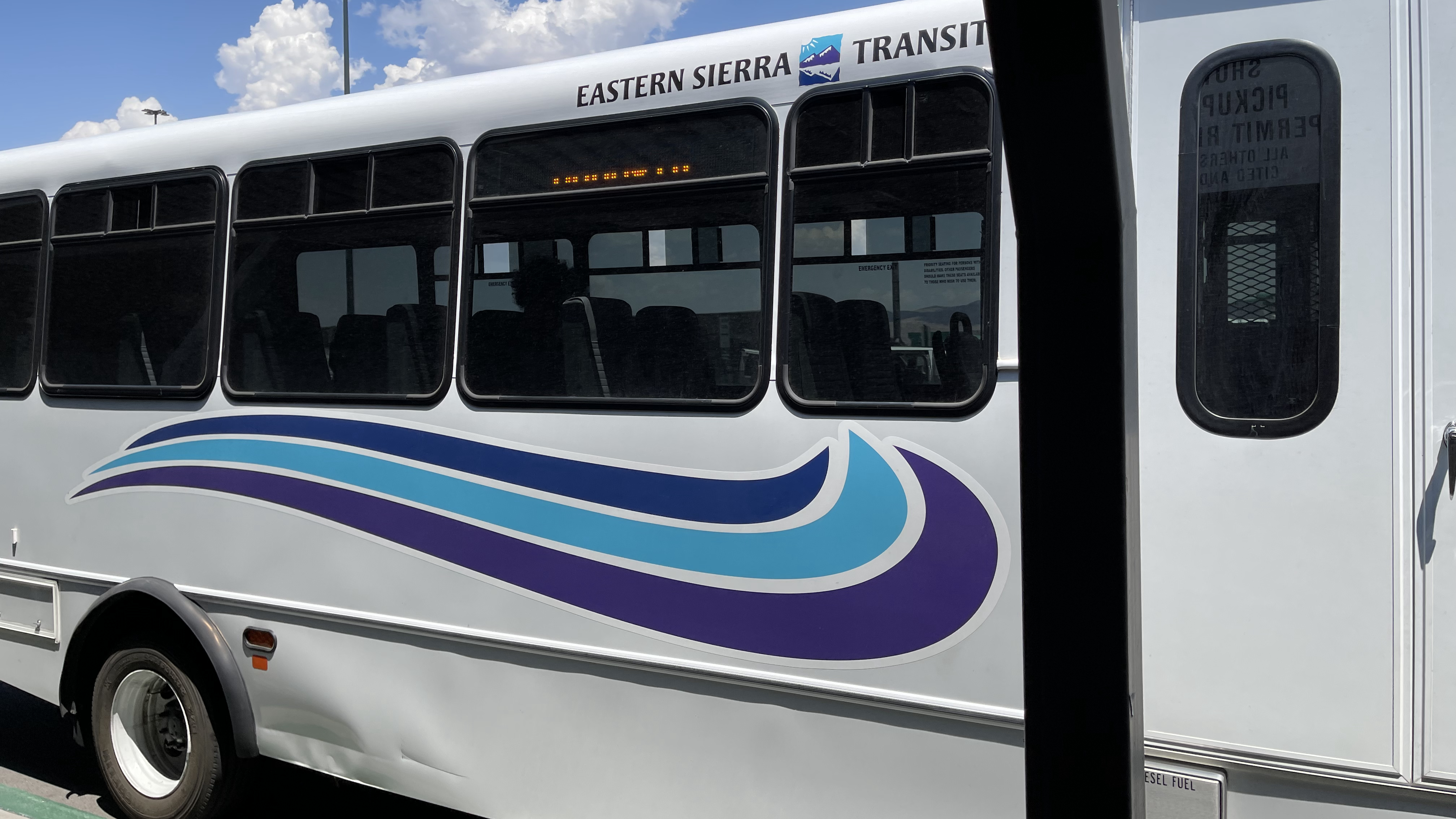
A full day of travel, 17 hours door to door. I am up shortly after 4am and Nancy drops me at the airport, just after 5 for my 6:20am flight. Southwest, Albany to Chicago then Chicago to Reno. Everything runs on time, my pack makes it, and I have about 3 hours to burn at the Reno airport before the bus arrives.
Eastern Sierra Transit Bus
The bus, Eastern Sierra Transit, is right on time. There are 8 of us, 7 backpackers and one person bicycle touring. My stop is the Vons in Mammoth. I head into the market, buy tortillas and 2 liters of Smartwater. From there it’s across the parking lot to the bank; I need cash to for tomorrow’s trailhead shuttle. And then the last leg of today’s journey, a one mile walk to the Sierra Lodge. I am in the room at 6:15pm and text my wife to let her know I’ve made it. It’s been a long day of doing just about nothing, just letting the pieces of getting-there logistics fall into place.
Sierra Lodge, ski lockers available to stow travel duffels and other stuff you don’t need on your hike
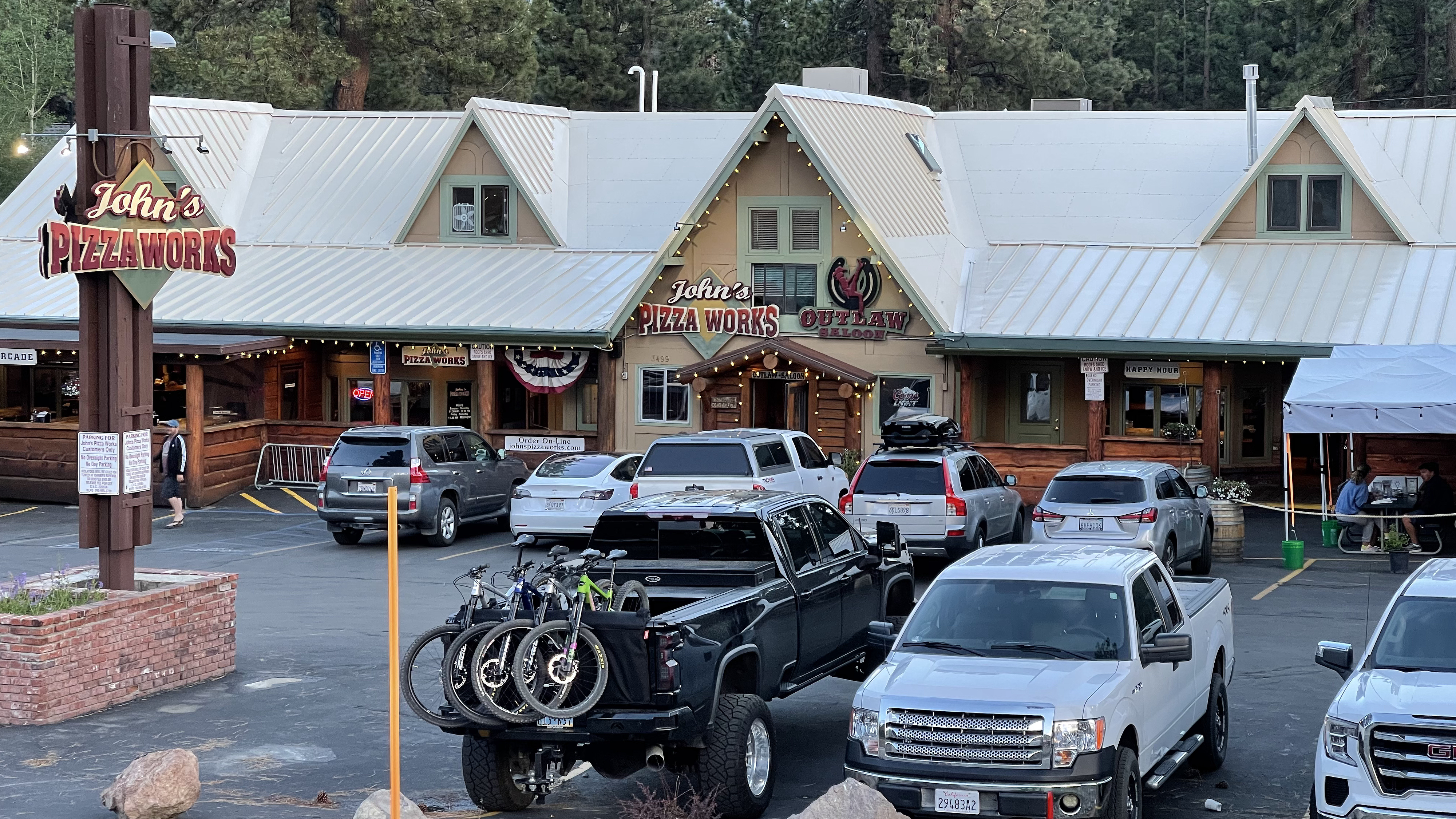
I walk across the street to John’s Pizza Works, have some pizza and beer, return to my room and crash.
John’s Pizza Works, decent pizza and good beer selection
Day 1
The alarm sounds at 5:30am. I shower, confirm again I have everything on the gear list, and load the pack. My travel duffel goes into its ski locker “home” for the next 2 weeks and I have about 5 minutes to browse the various “things to do in Mammoth Lakes” brochures in the hotel lobby. My driver Nina is right on time. We load up and are on the way to Horseshoe Meadow, it is 6:35. Nina is a driver with Eastside Sierra Shuttle. Eastside was on time and got me to my destination. The one catch is the “quirk” of them using EV’s: we need to stop for 30min in Bishop to charge so we can make it up the hill. Though I was intending to breakfast at the Alabama Hills Café in Lone Pine, I can make do in Bishop. I am not familiar with breakfast haunts in Bishop, so ask to be dropped at Denny’s. A warning to all: do not eat at Denny’s, that place is filthy disgusting. I ate there last year but due to COVID sat in the parking lot. What the inside was like I had no idea. Never again. (any suggestions on breakfast stops in Bishop?)
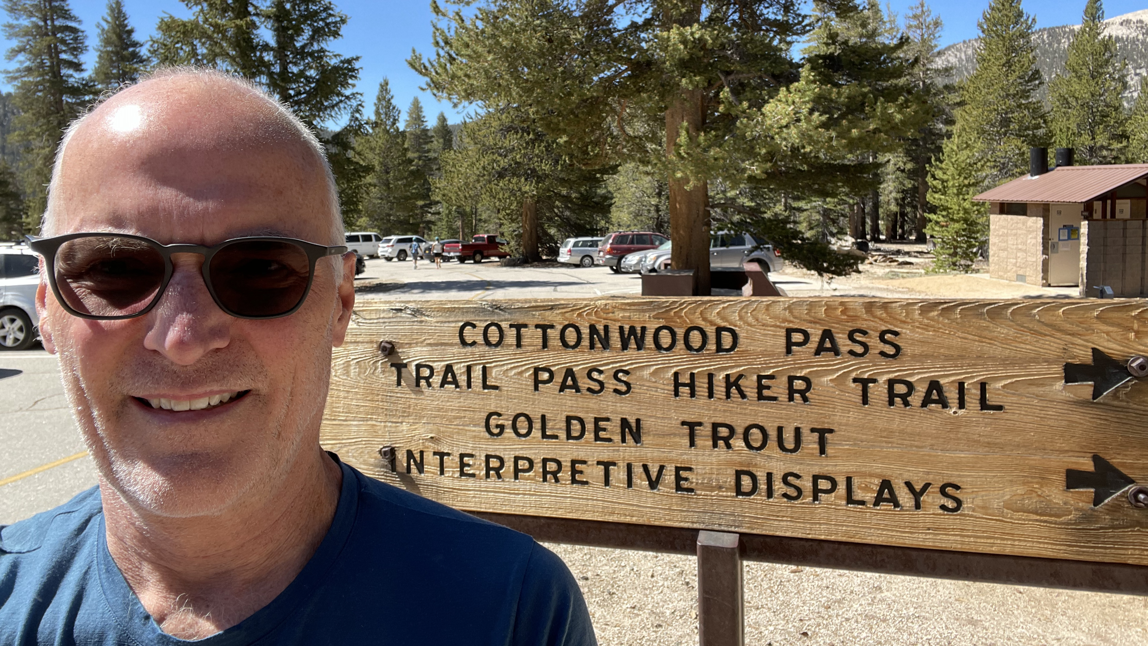
We arrive at Horseshoe Meadow about quarter to 10. Nina takes off, I make a couple pack adjustments, take an obligatory trailhead picture, and am on my way.
Obligatory photo of me at the trailhead
I am glad I changed my permit from Cottonwood Lakes to Cottonwood Pass. Last Saturday, 5 Cottonwood Pass permits came available, and I grabbed one. Cottonwood Pass at 11,000ft. and change is an easier entry than New Army Pass, and a better way to ease into this trek with my 45lbs./almost 9 days of food. I purposely take it slow, work at not breathing hard and not breaking a sweat. 2.5 hours into it I top out at the pass take a few pictures and continue.
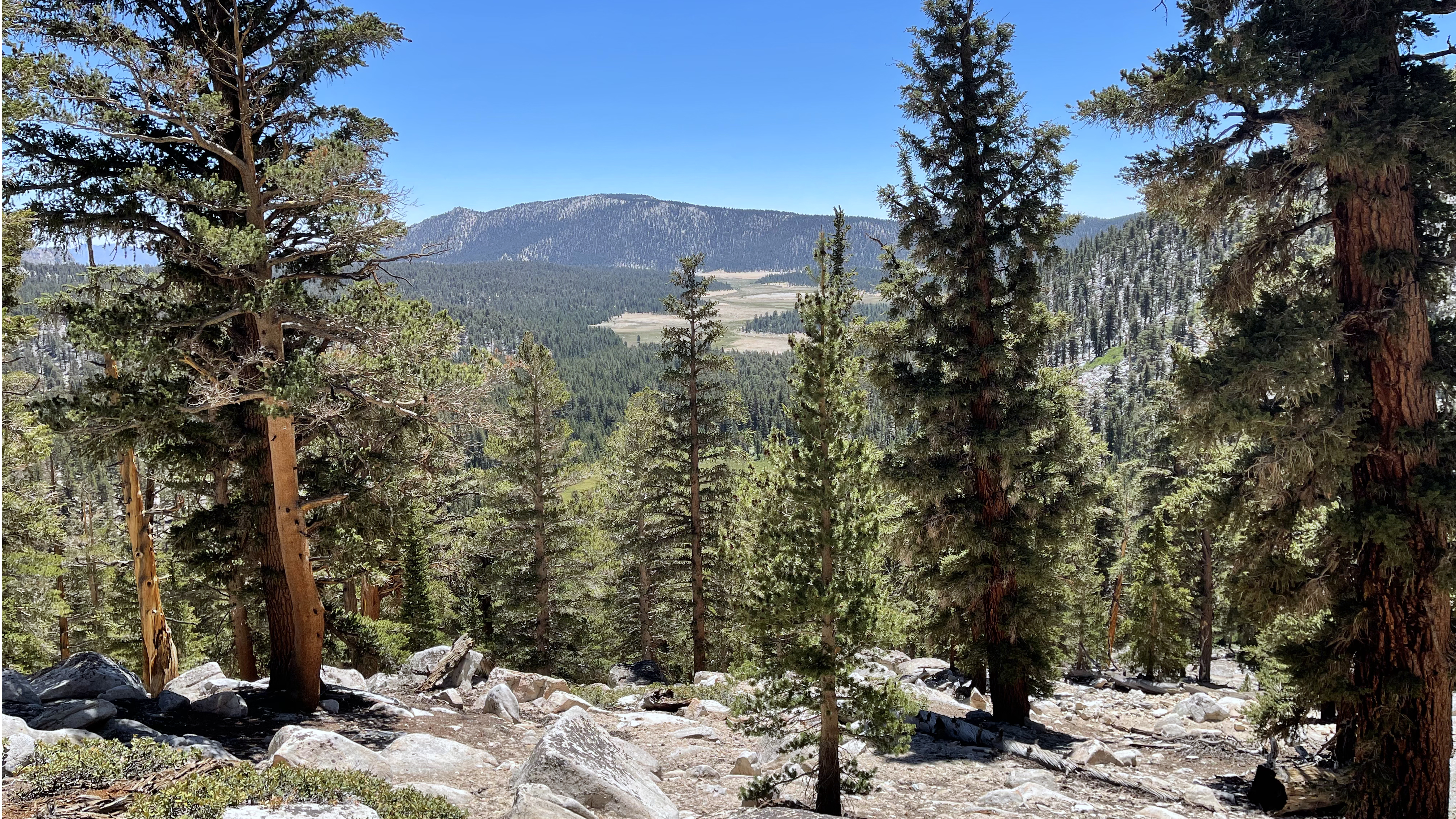
A look back to Horseshoe MeadowHorseshoe Meadow and the Owens ValleyLooking west from Cottonwood Pass
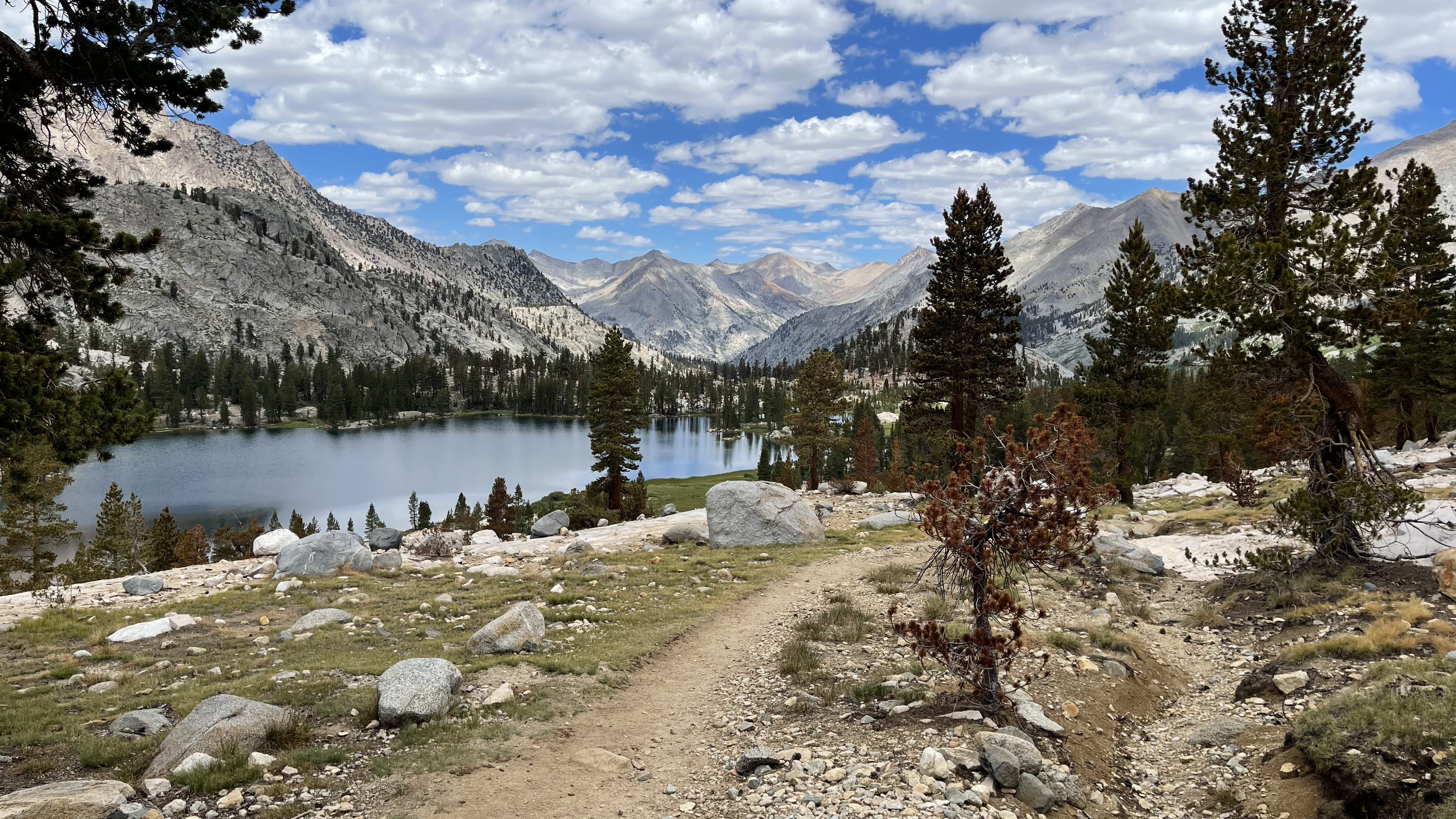
There is water in a half mile, and I’ll take a longish break there, at Chicken Spring Lake.
Pond at the south tip of Chicken Spring LakeChicken Spring Lake
Chicken Spring Lake is a big deal in this dry year. It is the first water source since the trailhead, and for PCT hikers the first significant water in 25 miles. There are probably 20 people milling about soaking, drinking, cleaning, and cooling off. The water is quite turbid by Sierra standards, but this is not the typical year. And turbid water becomes clear water as it pours through a filter. I enjoy about 400 calories of snack, a liter of flavored water, and a half liter on top of that. Plus, I fill both bottles, the next sure water source is Soldier Lake more than 5 miles away.
The trail from Chicken Spring to Soldier Lake largely contours at about 11,200’ +/- a hundred feet or so. Again, I am affirmed in my choice of Cottonwood Pass, I couldn’t have asked for an easier Day 1. My only gripe is sand. The trail plows a path through a sand field at least 6-8” deep. Dusty.
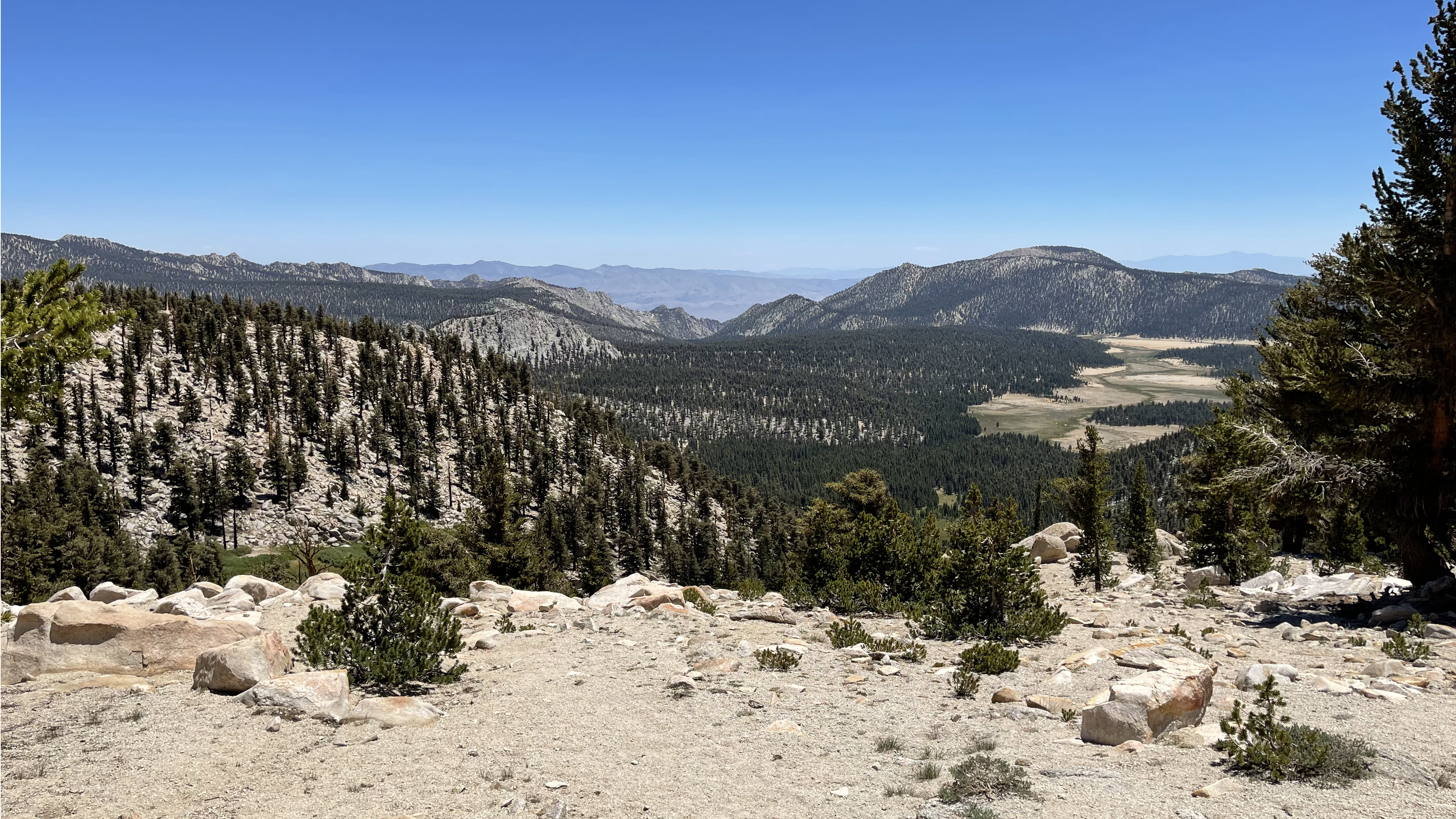
Whitney MeadowSiberian OutpostMt. LangleyThe great sand fieldSierra Crest and New Army PassSierra Crest and New Army Pass
I detour to Soldier Lake. It sits about 3/8 of a mile beyond the bear locker, buggy, but still surrounded by green. Back at the bear locker a group camped down by the outlet stream are preparing dinner. They are doing a Cottonwood Pass in and then out over New Army Pass weekend loop. Oh, that I lived close enough to the Sierra to day hike and do weekend trips.
Soldier LakeSoldier Lake
I cruise past their campsite, stop at the outlet to fill my water bottles and continue to my destination, Upper Rock Creek Lake. Upper Rock Creek Lake is surrounded by grassy swampy meadow, and its outlet is a slow flowing meandering creek. The water there promptly clogs my Sawyer filter and renders it a piece of crap that despite backflushing 2-3 times each day makes each ½ liter water break a 10 minute activity.
Upper Rock Creek Lake
Just past the lake and above the trail are several nice campsites. 6pm I am set up and preparing dinner.
About 7pm a young couple drag themselves in and set up camp nearby, Javier and Kali. This is their first ever backpacking trip, an ambitious Cottonwood Lakes – New Army Pass – to Whitney and back. They found the route on AllTrails and have been training on the high peaks around the Los Angeles area (San Jacinto, Mt San Gorgonio). They are carrying big loads, their packs don’t really fit, they are hurting, but their excitement is contagious and summiting Mt. Whitney is all they can talk about. I let myself catch their enthusiasm bug and congratulate them for making it in over New Army Pass and how they “doing it.”
Upper Rock Creek Lake and the Sierra CrestUpper Rock Creek Lake and the Sierra Crest
Day 2
7am. I say goodbye to Javier and Kali. I hope they realize their goal.
The trail initially drops steeply and then more gradually to the Rock Creek crossing. There is a brief rain shower and what do you know? The umbrella is perfect.
After the crossing I have a 1500’ climb to Guyot Pass. It begins steeply, but moderates about halfway up. I top out around 10am and am greeted shortly after by a packtrain heading south. And then Jake who is also hiking the JMT northbound.
Jake is a poet, pen name Icarus. His joy infectious, he is back on the trail after a couple year hiatus. He asks of my life’s lesson. I reply, “If you want something bad enough you’ve gotta go for it, just do it.” Now I don’t know if this is the most important thing I’ve learned in 63+ years, but it ranks up there. And backpacking is on the “bad enough” list. He asks if I’d ever considered hiking the PCT “yes, but it doesn’t quite fit with the relationship I have with my wife.” He replies that a wise man once told him “Just do it”. Got me there, but there is a difference between considering and wanting it “bad enough.” The PCT has not risen to my “bad enough” list.
We head out, me with afterburners. In retrospect I start too fast out of the gate and am more than ready to rest upon arriving at Crabtree Meadow. It’s been 11 years since my last passing here. I park at the food locker. Three observations: the food locker is “new-ish” and has been relocated, the meadow is drier/browner this July than in my prior August and September visits, and it is a small city. At least 50 people are camping here, easily visible from the food locker. On my 2006 “There and Back Again” High Sierra Trail hike there were just three of us.
Lower Crabtree Meadow, Mt. Whitney taking a peek over Mt. Hitchcock’s left shoulderUpper Crabtree Meadow
I have two tasks at Crabtree. One, rehydrate. I drink 3 liters in my slightly longer than one hour stay. And two, cache my food. I pack a dinner, a breakfast, and a day’s lunch graze in the bear can and leave the next 6+ days food here. Ah, for the next 3.5 miles I’ll carry just north of 20lbs.
As I ready to head out I am greeted by Ranger Chris. She asks my route, but not for my permit. Since I am hiking the JMT and not wag-bagging it she describes 3 locations suitable for doing my business. I end up using 2 of them.
I leave Crabtree at a leisurely pace and a couple hours later arrive at my destination, the first tarns above Guitar Lake. Camping is limited but my footprint is small and soon enough I find a spot that can accommodate my pad and sleeping bag.
Timberline Lake and Mt. WhitneyGuitar Lake
It is windy here. Weighing things down with a couple rocks, I go to soak my feet and rinse off some trail grime. I get a slight chill. My right ankle has swollen, excess fluid; likely need to start wearing compression socks.
The wind also makes a challenge of lighting an Esbit cube. Eventually I settle down with dinner and enjoy the view. The low angle sun bathes the tundra in a soft glow. I greet Paige (a PCT’er I’d met yesterday) on her descent from Mt. Whitney. We chat briefly. She heads out and I return to my thoughts and am treated to a nice sunset. It is 8pm, and I’ve two successful relatively easy acclimatization days. Tomorrow starts the real show.
Tarn 11640 above Guitar Lake
Day 3
It is Mt. Whitney summit day. 6:30am, I am packed and ready to go. I carry food, 5 liters water, and a jacket in my Osprey Stuff Pack, leaving my main pack behind. So far, the plan to “drop ballast” (food at Crabtree and main pack/gear at the tarn) and carry ever lighter loads up Mt. Whitney is working well.
Daybreak at Tarn 11640, my pack left behind well back from the trail
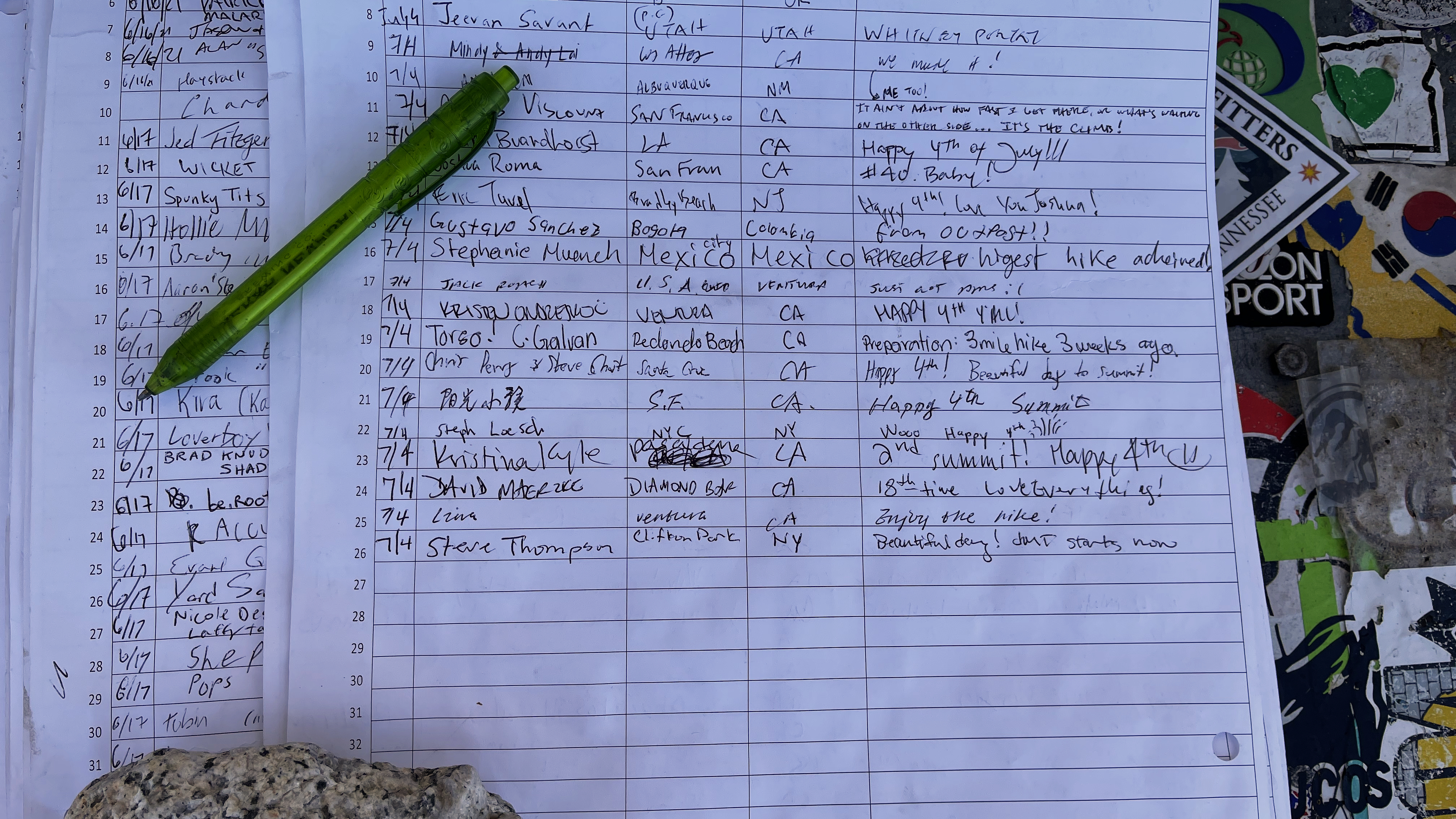
I set out deliberately slow keeping my breathing and heartrate in check. It takes me 3 hours to summit, but I am breathing easy, my pulse just a notch over 100bpm. I attempt to sign the register, but my hands aren’t working well enough to hold the pen. I’ll get to that later, meantime I find a seat, talk with a few of the several people here, give my hands a workout filtering water, and eat a snack. The nearest person is Flyer, a PCT’er, presumably named for his propeller hat but possibly named for his near continual altered state. He describes in detail how many miles he is averaging, how many miles he needs to be averaging, and how he will close the gap.
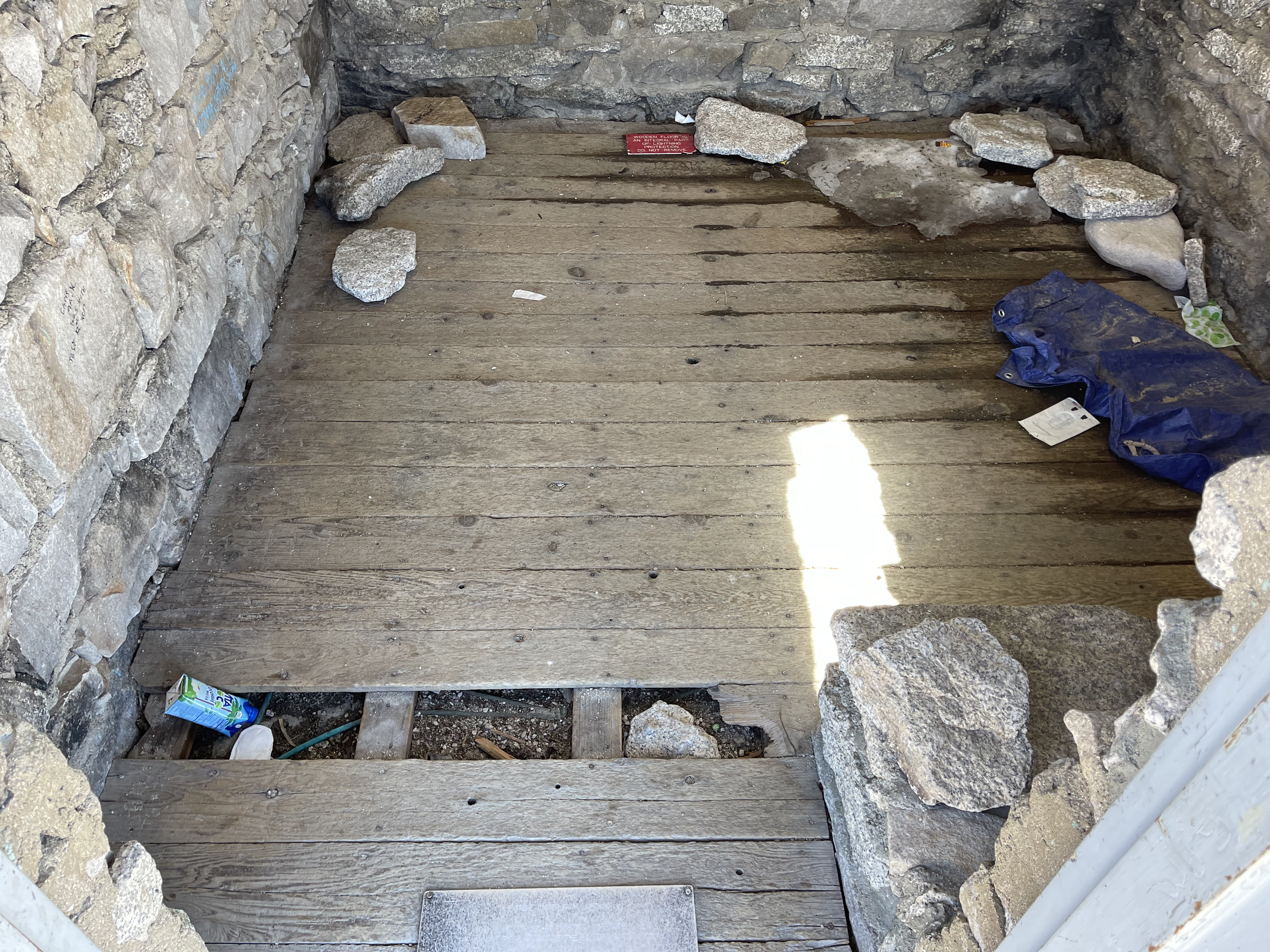
After a half hour I get up to sign the register. There is a short line so while waiting I photo document the now trashed Smithsonian Hut. The door is gone, floorboards are missing, trash is lying about, and toilet paper sandwiches line the eastmost wall. Disgusting and sad. I get my turn at the register, take a 360 series of photos (and then some), and talk with a few others.
Smithsonian Hut disgraceSummit Register
Have times changed? There is talk of personal bests and of summiting Mt. Whitney for “x” consecutive years. Nice personal triumphs but seemingly little sense of wonder. Will anyone cry with me? We are on the inside of God’s gift. Look around! We have 100-mile views, a paucity of snow, the scar of the Lone Pine Creek Fire…it is all so beautiful and so, so fragile. Where is the humility and graciousness deserving of such love? Joy and sadness and gratitude and disgust sweep through me then blend into single multi-dimensional emotion. It seems wrong to be critical. We each have our motivations and reasons for being here, but I feel alone in feeling awe, alone in the gratefulness of standing on hallowed ground. But am I really? Perhaps I have changed and cannot see.
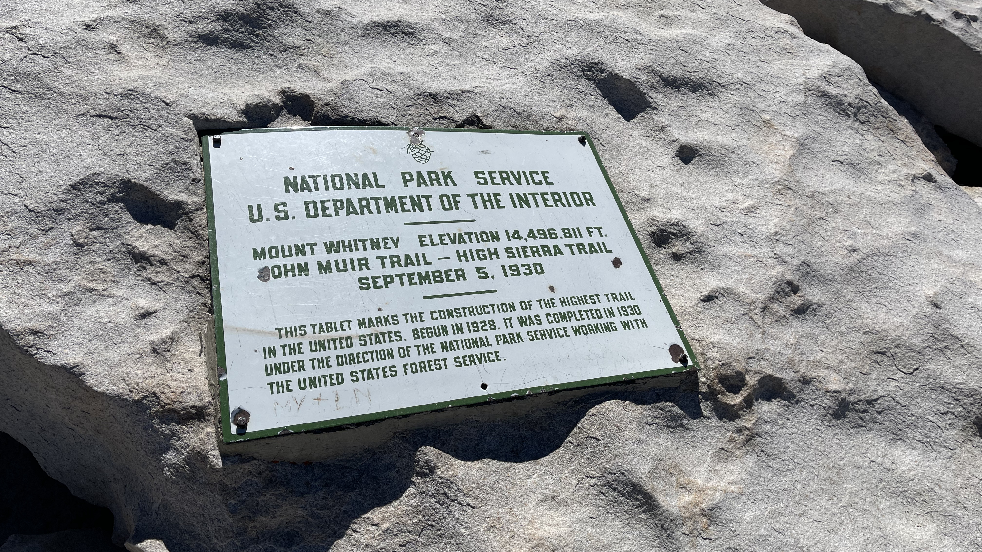
Mt. Whitney Summit Consultation LakeOwens Valley and Lone PineMt. Whitney Summit Benchmark
I sit alone with my thoughts, for the moment, and then watch as person after person has their picture taken with the wooden sign…a sign that didn’t exist a decade ago. Their joy, their triumph unmistakable. Maybe times have changed. Wither or not, I have. And wither or not I stand, ask a willing soul, and join the others in having my picture taken.
My summit picture, Flyer is behind me over my right shoulder
2 hours have passed, and it is time to move on. For next 100 feet or so my thoughts and emotions spin, then I pull out of my head and note the juxtaposition of scale, 14,000’ mountains one the one hand and the fine-grained texture of the granite on the other. Somewhere in this lay the solution to the quantum mechanics – general relativity dichotomy. I note and take care for the placement of my feet. I feel the breeze and hear the clacking of trekking poles against the rock. I accept the fullness of His gift. I tear and I smile. Yes, there is overuse and abuse, but the magnificence of God’s creation rises higher. Joy and gratitude win out.
Back at the tarn I reunite with my pack and at Crabtree Meadow, my food. In between I meet Apocalypse (John Lu / kindanomadic) who is video documenting his PCT hike, and Javier and Kali. Javier and Kali have abandoned their “out and back” quest, instead they’ll summit Mt. Whitney, exit at the Portal and trust that someone will shuttle them to their car at Horseshoe Meadow. I’m a fan. They came here to summit Mt. Whitney and despite making a bunch of first-time backpacker mistakes they are determined to summit, and will.
The Crabtree crowd has thinned, maybe by half, and my food which yesterday barely fit in the locker sits alongside a single bear can. I take an hour-long break to feed and water. It’s another 7-ish miles to the Bighorn Plateau and I want the gas to make it. Fortunately, it is 7 easy miles. I set out about 3pm.
Sandy Meadow and Red Spur
The lush Sandy Meadow is a stark contrast to Crabtree. And where the area around the Wallace Creek food locker is worked over, a short distance further, camping anywhere along Wright Creek and up into the lake basin is delightful with some spots offering views of Mt. Tyndall, Mt. Williamson, and Mt. Barnard. I reach a Wright Creek tributary and my watch alarm sounds. Time to eat. I am out of snack foods and consider pushing up the last mile or so to the Bighorn Plateau, but instead stop for dinner. It’s a nice spot, it’s 6pm, and I’m hungry.
Wright Lakes Basin, Mts Tyndall, Versteeg, and Barnard
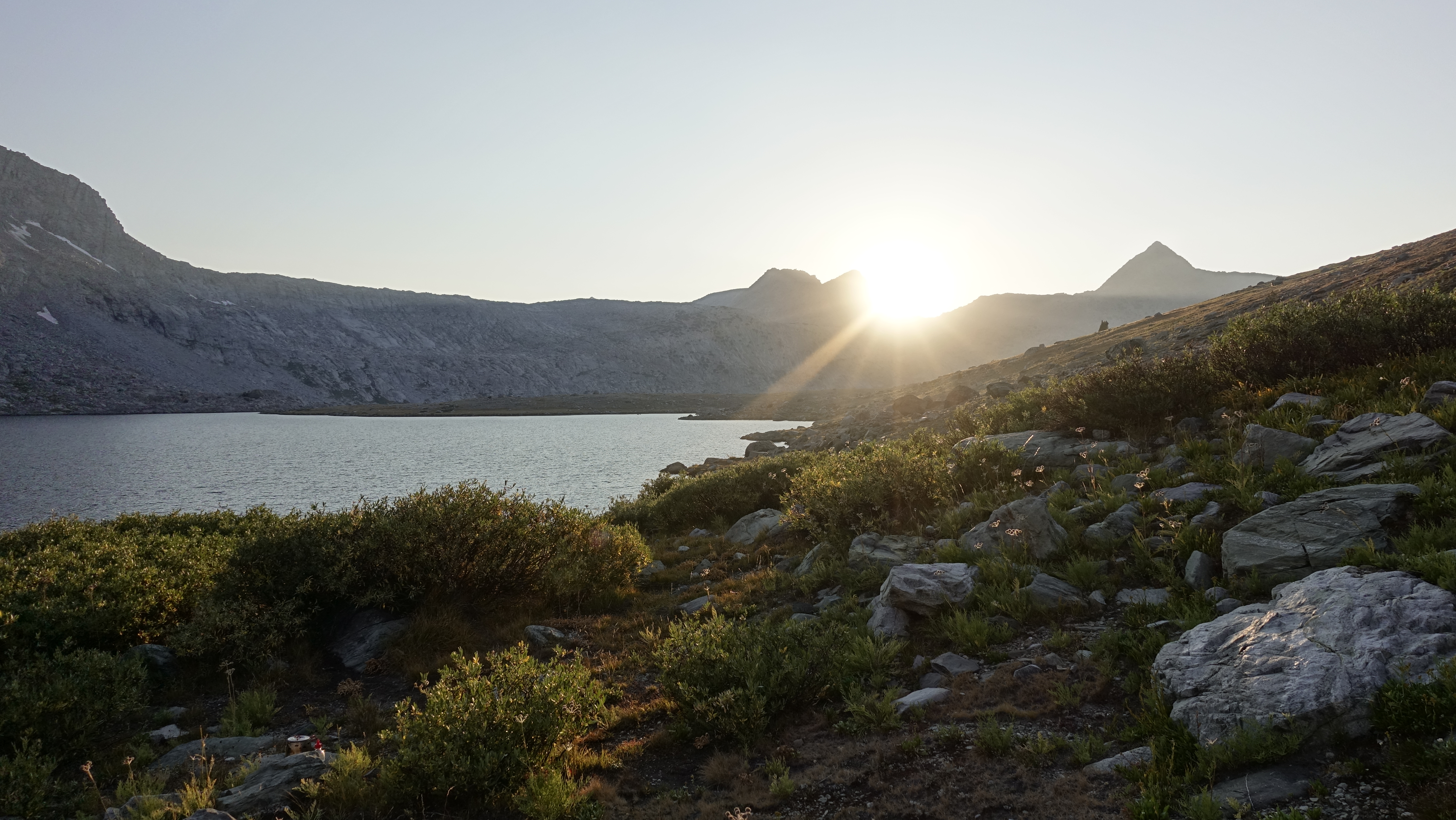
Stopping for dinner was a good call. I bound up the last mile of trail and top the Bighorn Plateau at 7:30pm. I walk about the pond and find a wide-open spot to camp. I draw water and bathe, draw water to drink, enjoy the sunset, and journal a bit. It’s been a solid day. Hiking-wise I’ve been measured and strong but now having a few quiet moments, the tired sets in and I fall asleep with the first stars.
Mt. Whitney from Bighorn PlateauSunset on Bighorn PlateauLast light on Mt. WhitneyTable Mountain Silhouette
Later, I wake to magic. Actually, I wake to pee and then notice the magic; the sky ablaze, the Milky Way and stars bright enough to cast star-shadow. Glorious, and I have it all to myself.
I am right where I need to be. Happy 4th of July.
Day 4
I am up and about shortly after 5am and feel pretty good. Planning the acclimatization days seems to have paid off. And the bonus, morning dawns as beautiful as the prior day set.
Mt. Whitney, one last look
I take my time, mostly to let things dry, and use that time to savor a hot breakfast (Pack-It Gourmet Polenta with Pork Sausage) and let my head fill with the quiet. The quiet pushes aside any trepidation with crossing Forester Pass. I can’t say why when planning this hike crossing Forester unsettled me. I’ve crossed it several times north to south, it’s less elevation than Mt. Whitney, the switchbacks are gently graded…still when planning it was my biggest worry. But in the quiet I let that go.
Kern RidgeCaltech Peak and Diamond MesaTyndall Creek and Red SpurForester Pass
The perfect morning. Cool temps, clear skies, and million-dollar views showcase the vastness of the Kern River basin. I joy, laugh, and yes, cry the 4 hours I spend in its resplendence until topping Forester Pass. Of course, there is the look back, but also the yearn forward into the more intimate Bubbs Creek.
The look back from Forester Pass into the Tyndall Creek Basin and Kern Canyon beyondThe look ahead from Forester Pass into Bubbs Creek Canyon
Forester is the final “vortex” of PCT hikers I encounter this hike. Fugitive, Diamond, and Magic all here for a moment then gone.
I set out from Forester too fast. I don’t notice it in the moment but at the end of the day it’s a whop in forehead that hits me on the climb up from Lower Vidette Meadow. I slow to a crawl. I don’t know what flips that switch. Where on the ascent I reveled in the splendor, on the descent I zoned out, only walking, and oblivious to the beauty around me. How do I get so lost?
It’s a water break that awakens me. I pause above the Center Basin food locker campsite and look about. Above me, east of the trail, I see a cairn marking the route into Center Basin. Two years ago, this marker eluded me, and I was most of the way to Golden Bear Lake before stumbling upon the old trail.
East Vidette
Beyond this I slow my pace and take time to chat briefly with the myriad people hiking southbound. They warn of a bear with cubs at Upper Vidette Meadow. Reaching Upper Vidette I pass Jake/Icarus, still joy-filled. He also saw the bear and cubs. And the Bubbs Creek trail junction sign is blazoned with an “active bear warning” post.
Message received. Since my food still doesn’t completely fit into the bear cannister I decide to camp at Charlotte Lake, the food locker closest to Glen Pass.
I am tired and grumpy as I start the modest descent to Charlotte Lake and curse at every stubbed toe and fly that buzzes my face. But seeing the lake puts me in a better mood. I find the food locker and search about for a campsite.
Charlotte Lake
I find the packer’s campsite and am transported back to 1990 and my one and only stop at Charlotte Lake. Some buddies and I used Charlotte Lake for resupply, and it is clear from the flashback we stayed the night at this campsite. Wine and cheese and sourdough, fresh oranges, and an hour-long thunderstorm were highlights marking the halfway point on our South Lake to Mt. Whitney hike.
Returning from the memories I fetch water, rinse off, and then prepare dinner. I’m in a much better mood when I store my overflow in the food locker. Chris is camped nearby. He started his JMT hike by entering at Shepherd Pass and doing an out and back to Mt. Whitney, definitely the hard way. Chris also saw the bears in Upper Vidette, mama on one side of the trail cubs on the other and he in between. He unknowingly walked into it when someone yelled “bear!” then quickly backed out of it.
We talk for a bit then I head back to camp. About 8:30 I lie down, make a few notes, and review the many pictures I’ve taken, just 3 this afternoon. Do I zone out when I go too fast, or do I zone out first and lose the perspective to control my pace? I am no closer to the answer. What is clear is when I go too fast, I see less, enjoy less, and it leaves me spent.
Day 5
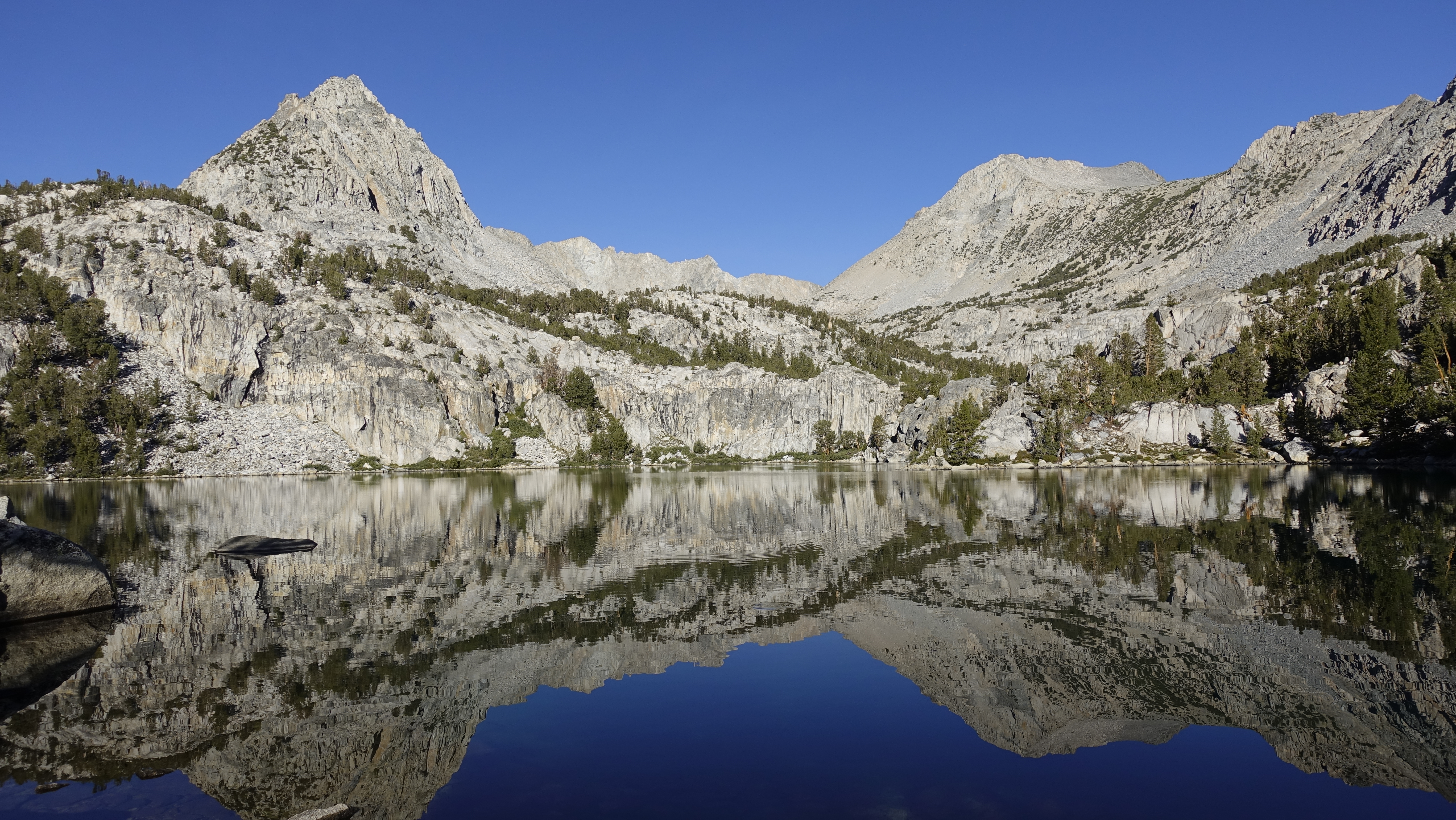
A pleasant morning. Charlotte Lake is glass and sky-blue.
Peak 11600+ above Charlotte LakePeak 11600+ above Charlotte LakeCharlotte Lake
I pass Chris at the JMT trail junction and start the climb toward Glen Pass. I am not quite rested, but when I contrast to the last two summers, I feel pretty good and the hike up Glen Pass is not that bad. My pack is getting lighter, at this time of day the trail is mostly shaded, and from the junction just a 1500 foot climb. At Glen Pass, I join Chris and two others who also camped at Charlotte Lake.
Charlotte DomeThe look back from Glen Pass to Mt. Brewer, North Guard, Mt. FarquharThe look ahead from Glen Pass into Rae Lakes Basin lying beneath Diamond Peak and Black Mountain
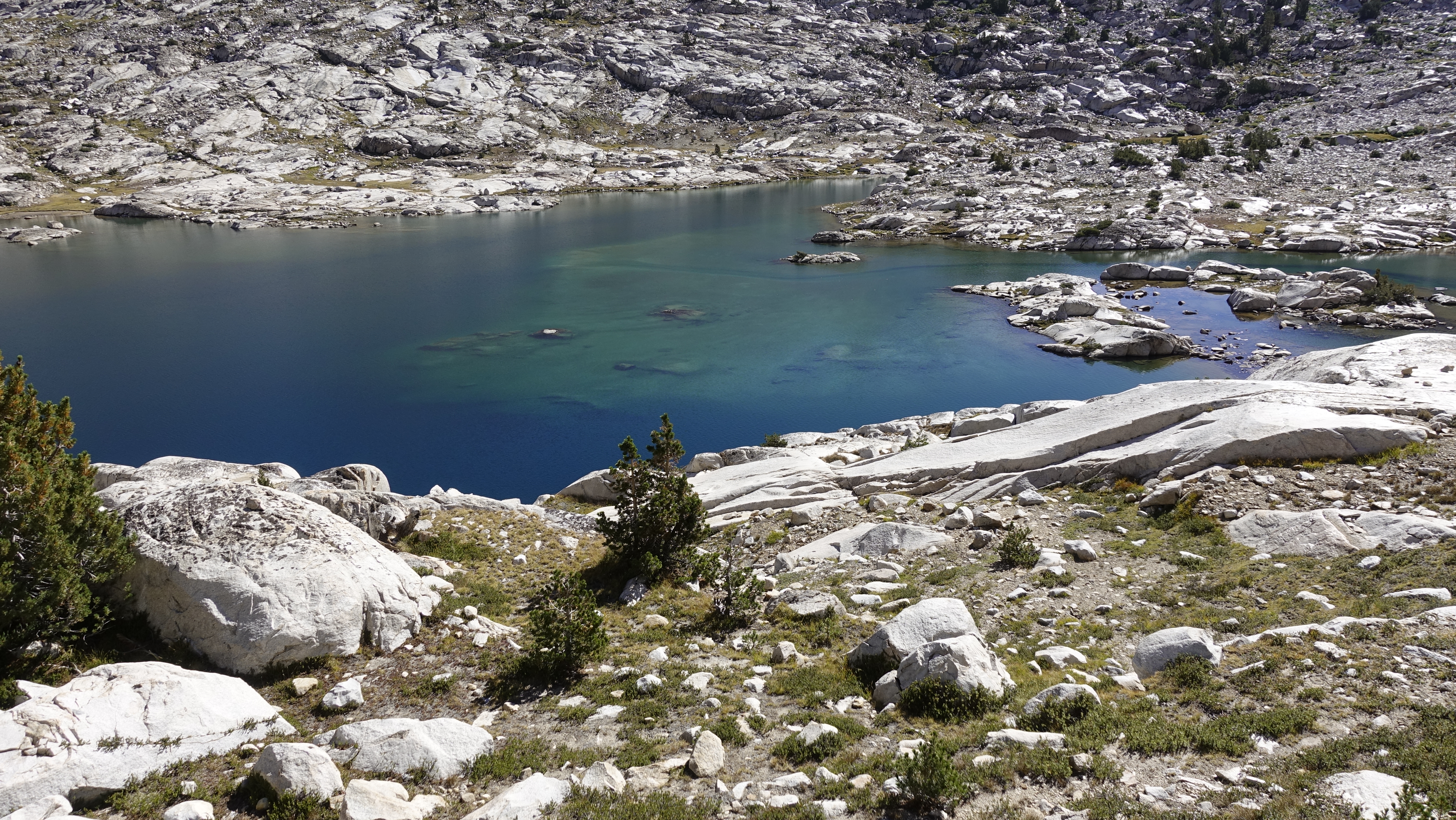
Rae Lakes is unusually uncrowded. It is late morning enough that most people should be on the trail but as far as I can see and hear, I have a slice of solitude.
This is my first time through the Rae Lakes basin northbound. And truth be told, it is not as beautiful looking away from Painted Lady as looking toward, and today the breeze washes out Fin Dome’s reflection in the middle lake.
Fin Dome over the Middle Rae LakePainted LadyFin Dome, Middle Rae Lake
But and a big but it is when I see Arrowhead Lake. This, on my 5th time through the Rae Lakes basin, I see Arrowhead Lake, I mean really see Arrowhead Lake for the very first time, and learn a great lesson: stop every few minutes, turn around and look back. It is magical.
Arrowhead Lake
My joy is broken, and I curse my filter at a water stop. I backwash for the 2nd time today and still the positive flow is little more than a trickle, and to top it off the hose gasket has started falling out. 10 minutes for a simple drink of water. I’ll say it again, piece of crap.
I finish my drink, put the bottle and filter away, and re-enter my bliss.
Window Peak, Castle Domes, Pyramid Peak
It’s nearing 3pm when I arrive at the Wood’s Creek bridge. Surprisingly there is but one group camped here. I cross then stop for a snack and to soak my legs. My right leg is swollen, and sensitive to touch. The cool water brings relief. I’ve been resisting and just dealing with it the last few years, but much worse and it could be disabling.
The Woods Creek “Golden Gate”
Midway through the break Chris catches me. He is end of day struggling, his calorie intake not quite up to his energy needs. I describe how I mostly keep things in control through respiration, hydration, and snacking. He thinks the hourly snack cadence has merit, but his food as packed is not set up for this.
His destination tonight is Twin Lakes, mine is the tarn at ~10,900’ a short distance above them. I tell him if Twin Lakes is too boggy and buggy push up the extra half mile and join me.
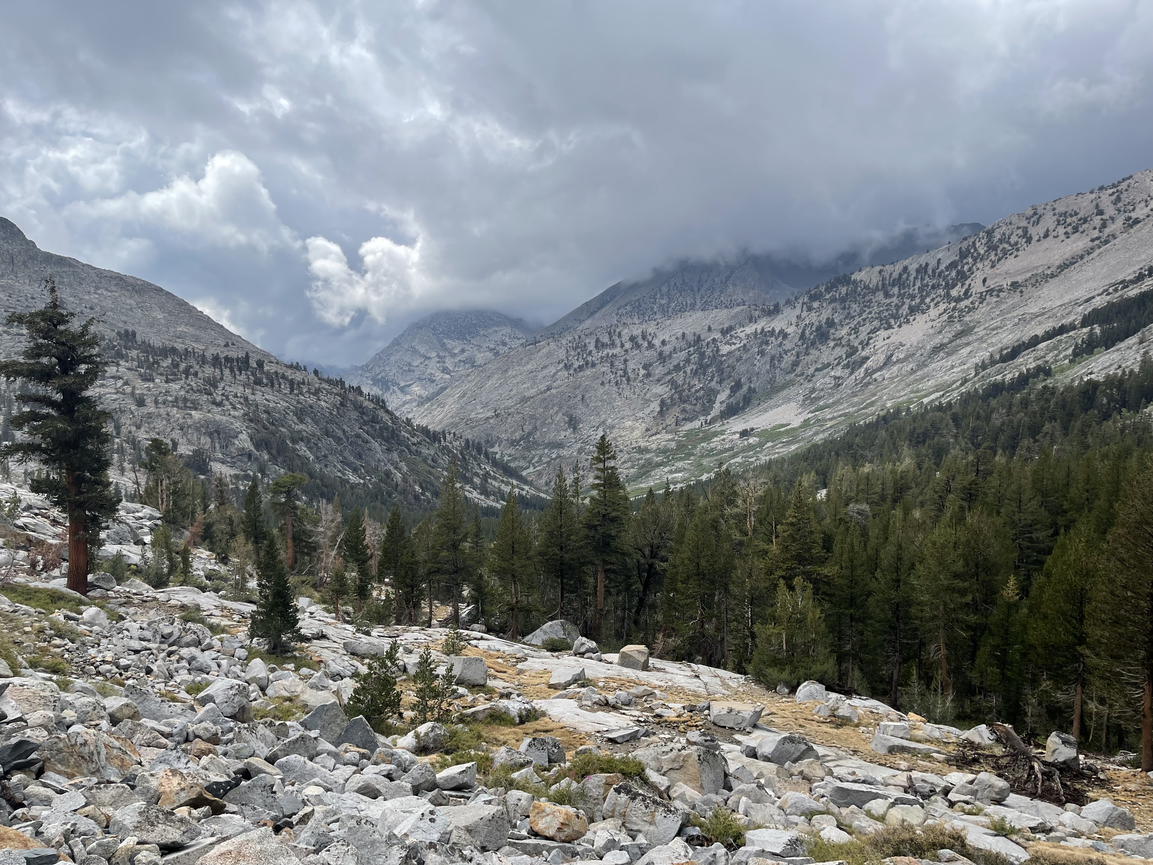
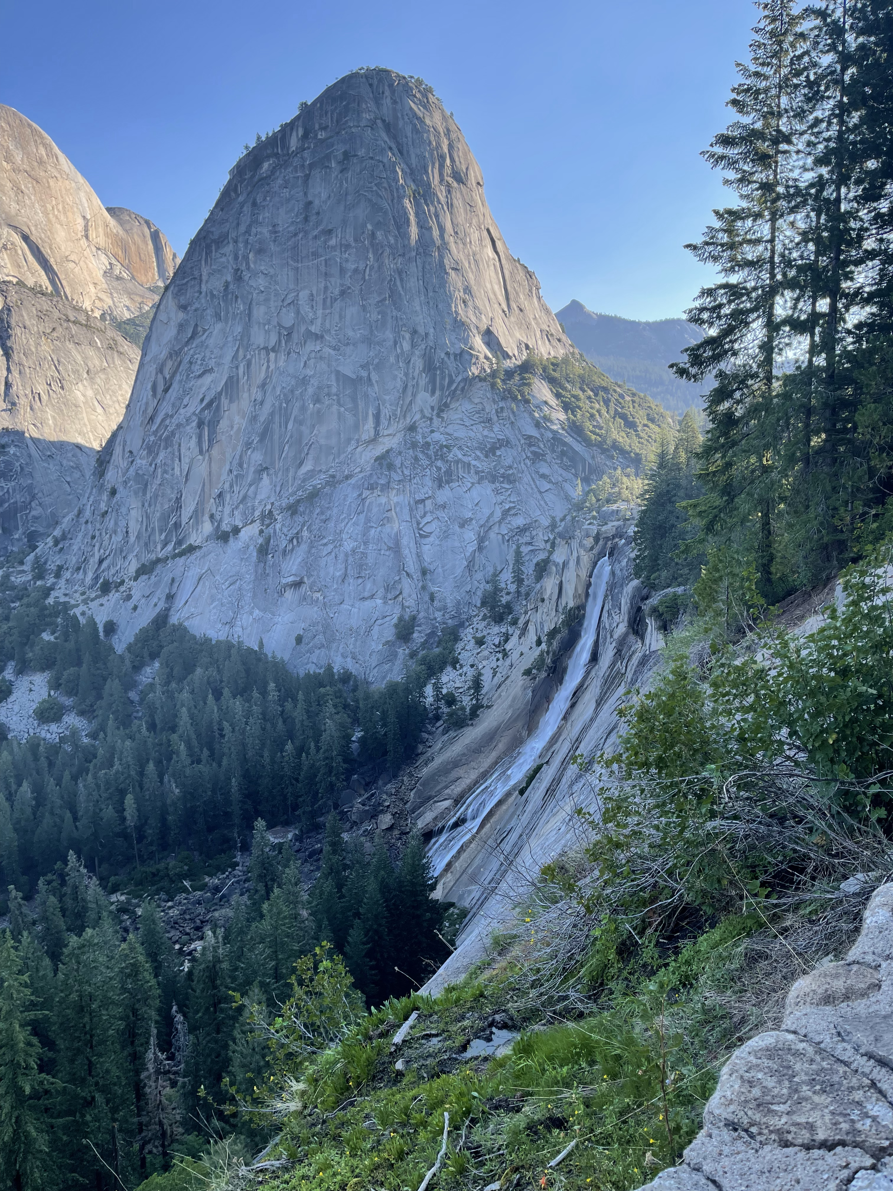
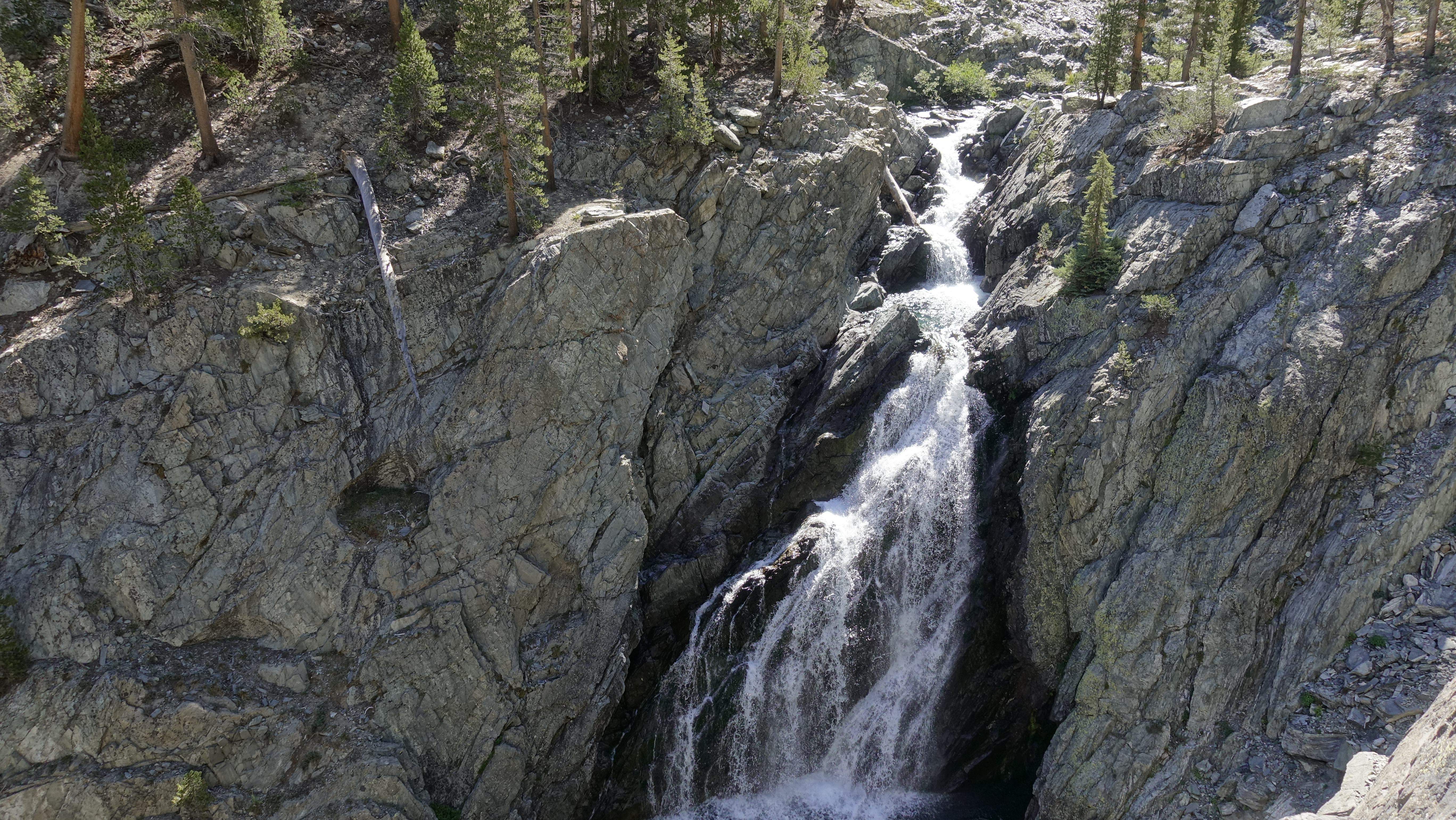
My leg no longer sore, I saddle up and start the afternoon climb. The Wood’s Creek canyon is beautiful. The creek cascades down slide after slide and if there were camping along this stretch, I would enjoy sliding and then splashing and soaking in a pool at the bottom of one. And beyond these, the waterfall. And more, the appearance of rust colored rock provides both contrast and visual interest. Yes, I’ve been here before and yet am seeing it all new.
Mt. Clarence KingWoods Creek Waterfall
What to make of my mindfulness? Is it a northbound vs. a southbound perspective? Is it the conscious effort to stay attuned and not get lost as I did on the Forester descent? Is it a greater confidence? Or some of each?
I reach the tarn as the sun drops below the ridge south of Crater Mountain. I drop the pack, strip down, and go for a swim. The tarn is shallow, maybe 4’ deep, and I suppose it would be classified as eutrophic as the bottom is quite soft and stirring it brings a waft of hydrogen sulfide. Thankfully the muck I stirred is away from the shore, I still need to draw water for tonight.
View south from Tarn 10900View south from Tarn 10900
Mosquitos are plentiful so I don my wind shirt and pants, a head net, and doctor my ankles and wrists with deet. I find a spot to camp and set about making dinner. On the first bite I forget and attempt to push a spoonful through the netting (I made this same make a couple years ago at Lake Reflection) and so do a bit of clean up before sitting down to eat.
Chris arrives, having missed the use trail to Twin Lakes, and sets camp next to me. He said he’d stopped about an hour above the bridge and cooked a meal, and that had really helped his energy level and hopefully doing a food reset will improve how he feels throughout the day. We talk until well past dark sharing some of our adventures and as we close for the night, I need the flashlight to find my way around. Thankfully the bugs have subsided, and I don’t need to zip into the bivy.
Day 6
Chris asks my plans for the day (cross both Pinchot and Mather passes) and then details his decision to nero and stop at Bench Lake where he’ll use the time to reorganize his food and recover. He leaves his gear and heads down the hill to check out Twin Lakes and possibly get some less skunky water. He returns as I set out.
It’s a gentle 2 miles before the final climb to Pinchot Pass. The trail wanders through an alpine tundra basin surrounded by colorful metamorphic peaks. The change in geology is striking. The 70-ish miles from Horseshoe Meadow to the Woods Creek bridge are dominated by the grays and whites of granitic rock. But 70 miles of gray is not monotony. Rather it is a dynamic canvas against which the reddish bark of evergreens, the deep green of their overstory, the bright green of meadows, and the colors of the individual wildflowers pop in contrast. Here, at least by my eyes, the colorful peaks pop and the vegetation tends to blend in.
Mt. WynneA look back at Tarn 10900Crater Mountain
The wind is ripping down the final climb to the pass and I remove the umbrella to prevent it thrashing about. But this is just on the downslope, at the pass all is calm. There, I am joined by Patrick, also hiking the JMT northbound. His stop is brief. In my solitude I look about and let the views become etched in memory. I want the impossible blue of Lake Marjorie on instant recall.
Looking south from Pinchot Pass to Mt. Cedric Wright and the tarny Woods Creek HeadwatersLooking north from Pinchot Pass to Lake Marjorie
Where are all the people? Certainly just a few enter this region via Taboose Pass, but 40 people a day leave Yosemite southbound and who knows how many hop on at one of the many trailheads along the way. So, it seems reasonable that I expect to encounter a few dozen people each day and while that has been the case, today I am a lone wanderer, the silence broken only by my foot fall. That is until I listen more deeply. Tuning in I hear the unseen. The breeze. The South Fork Kings River. Birds chirping. And I see. The return of granite at Lake Marjorie. Alternating stretches of forest and meadow. Bees and butterflies working streamside flowers. And clouds building in the southern sky.
Lake MarjorieThe Palisades come into viewMather PassMeadowland below Upper BasinSouth Fork Kings River
Upper Basin by contrast is “crowded.” I meet a group of 4 southbounders and am passed by a northbounder shredding the trail.
From Upper Basin, a look backFrom Upper Basin, another look back
I catch Don at Mather Pass. He is out on a long section of the PCT, Kennedy Meadows to Lake Tahoe. Headed to Lower Palisades Lake tonight, he is logging ~20-mile days. My goal tonight is Deer Meadow. My original hike plan was Lower Palisades Lake, but I feel pretty good and Deer Meadow will shave a couple miles off tomorrow’s long climb through LeConte Canyon and up to Muir Pass.
The view south from Mather PassThe Palisades and Palisades Lakes from Mather PassLower Palisades Lake and Mather PassAtop the Golden Staircase
Reaching Deer Meadow I find all the missing people. There are maybe 40 to 50 people camped down here, scattered and out of sight of each other over a 2+ mile stretch of Palisade Creek. I find my own private spot, set camp, bathe, then eat. I am packed for the night by 8:30pm, and after about 5 minutes of sit-down quiet time tired again sets in. It’s been a good day, but it’s time for bed.
Day 7
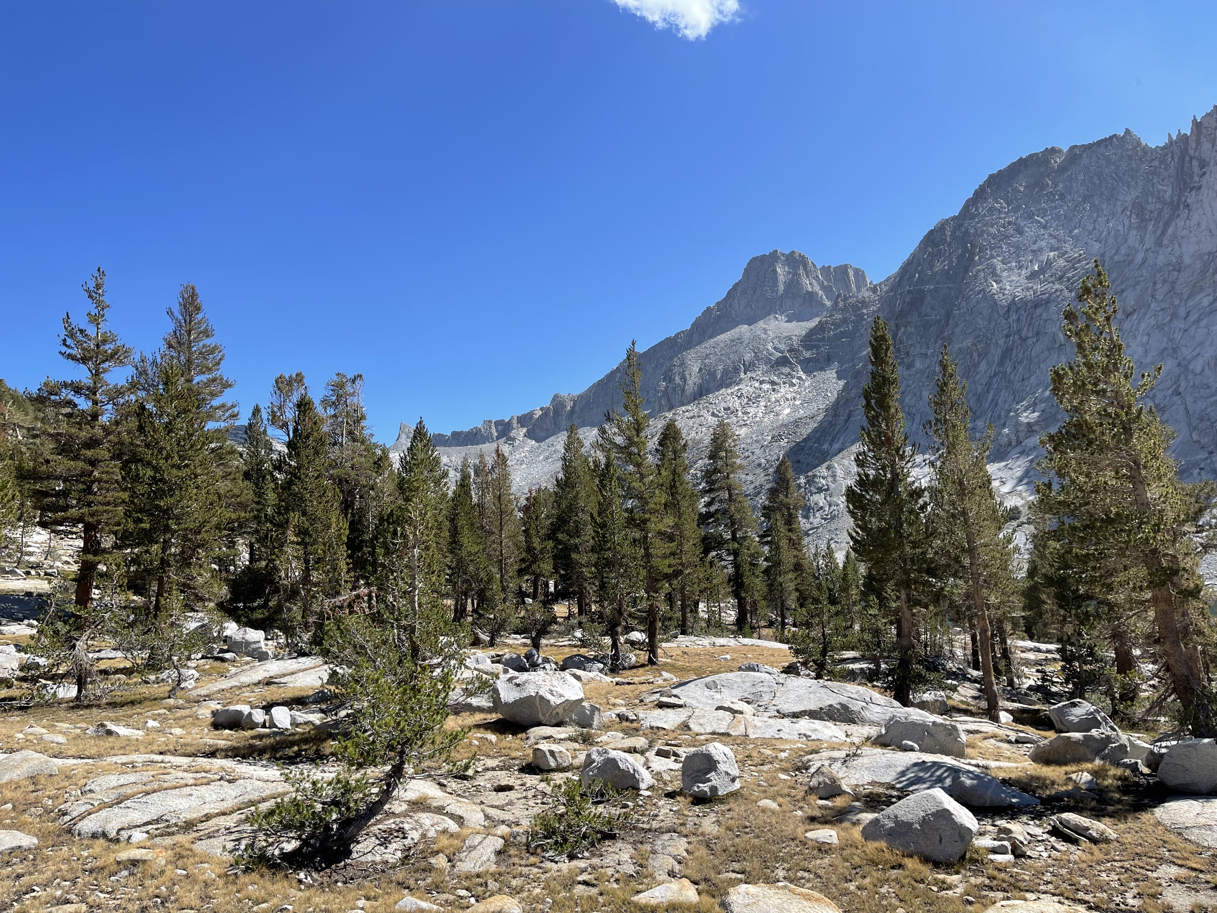
I leapfrog most of the morning with a northbound JMT family. I’m envious; when it comes to backpacking and family, it is just me. The kids were into weekend hikes, but never had interest in anything longer. And I’m also a bit self-aware that my backpacking style is maybe not for everyone. My backpacking trips aren’t as extreme as some, but they aren’t casual dalliances.
Approaching them at Grouse Meadow one says, “Look! Look!” I do, and across the creek lies a doe with two fawns prancing about, just days old guessing from their diminutive size. Mama has her eyes on us. “Just stay on your side of the creek,” reads her stare.
Grouse Meadow
I pause for a break at the Dusy Branch bridge. Less water and more algae on the rock, but there are fish once again in the pool. I soak my feet and lower legs, the right still swollen but no longer painful to touch. Soaking periodically throughout the day and in the evenings helps. I’ve noticed my lower legs and feet being quite dirty. The legs I can explain away as sunblock always attracts dirt, and the feet somewhat since the mesh trail runner uppers let in a lot of dirt, but even after a soak a significant amount of dirt remains – every skin fold and wrinkle, my hands as well, is striped in black and takes a lot of scrubbing to get clean. My guess is ash, a result of last year’s fires, has made the dirt dirtier. And maybe the water turbidity and the increased presence of algae is also a result of the fires?
Langille PeakLeConte Canyon
Next stop, the Rock Monster, teeth restored. Here I meet a group of 5 southbounders. Each started their JMT hike solo, they became a group at VVR. For them it’s lunch time, me just a pause for water and snack. I wish them well and start the climb toward Muir Pass.
The Rock Monster
I am really liking the umbrella. From here to Sapphire Lake there is little natural shade, and the section through Barrier Rock is hot. Most I encounter say something to the effect of “What a great idea.” I let them know I absconded with the idea from PCT’ers I’ve met over the years and that it is great. I feel like I am 15-20 degrees cooler not having to wear a hat. The umbrella has earned a permanent place in my kit.
LeConte Canyon from Barrier RockHelen Lake
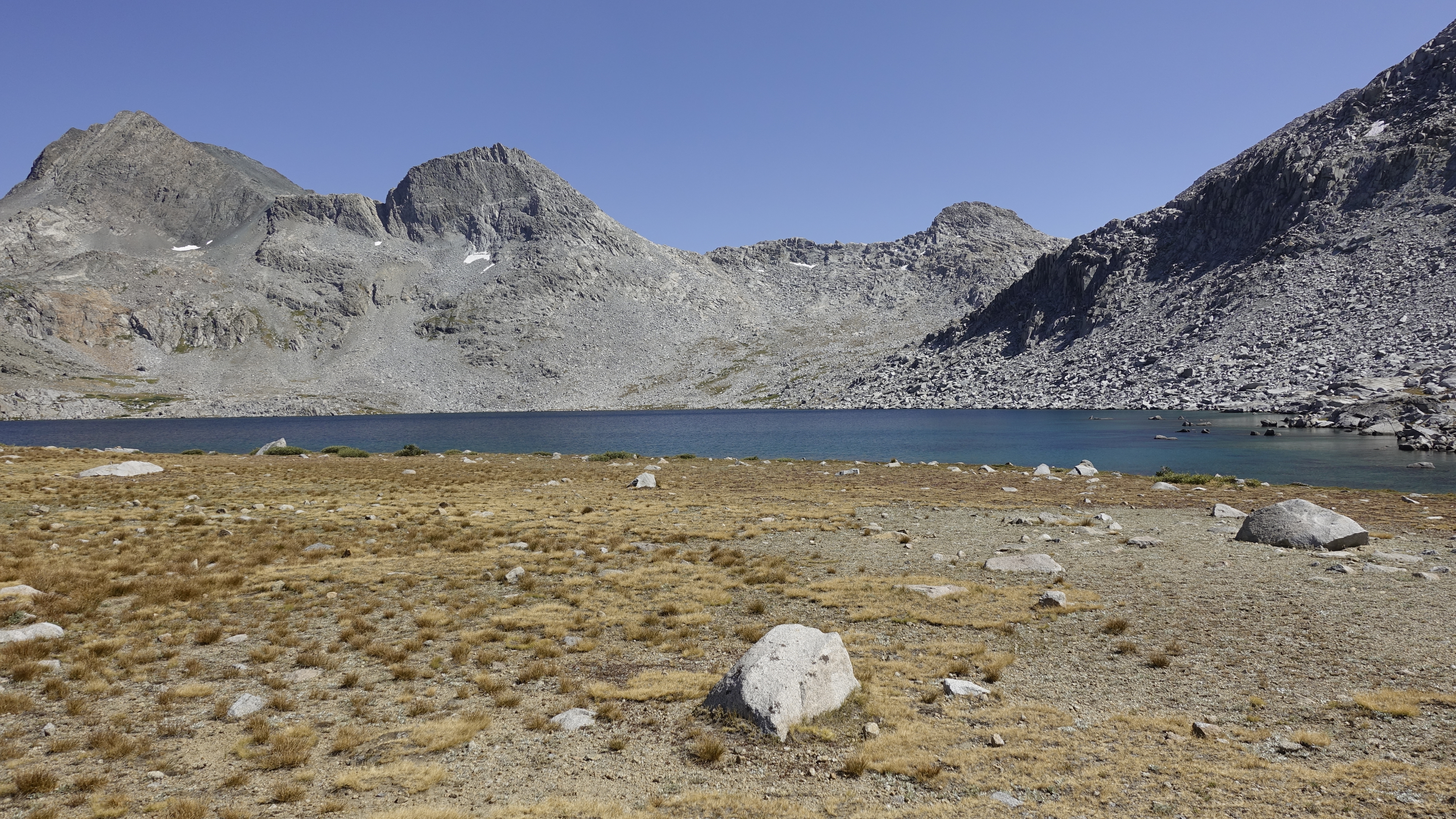
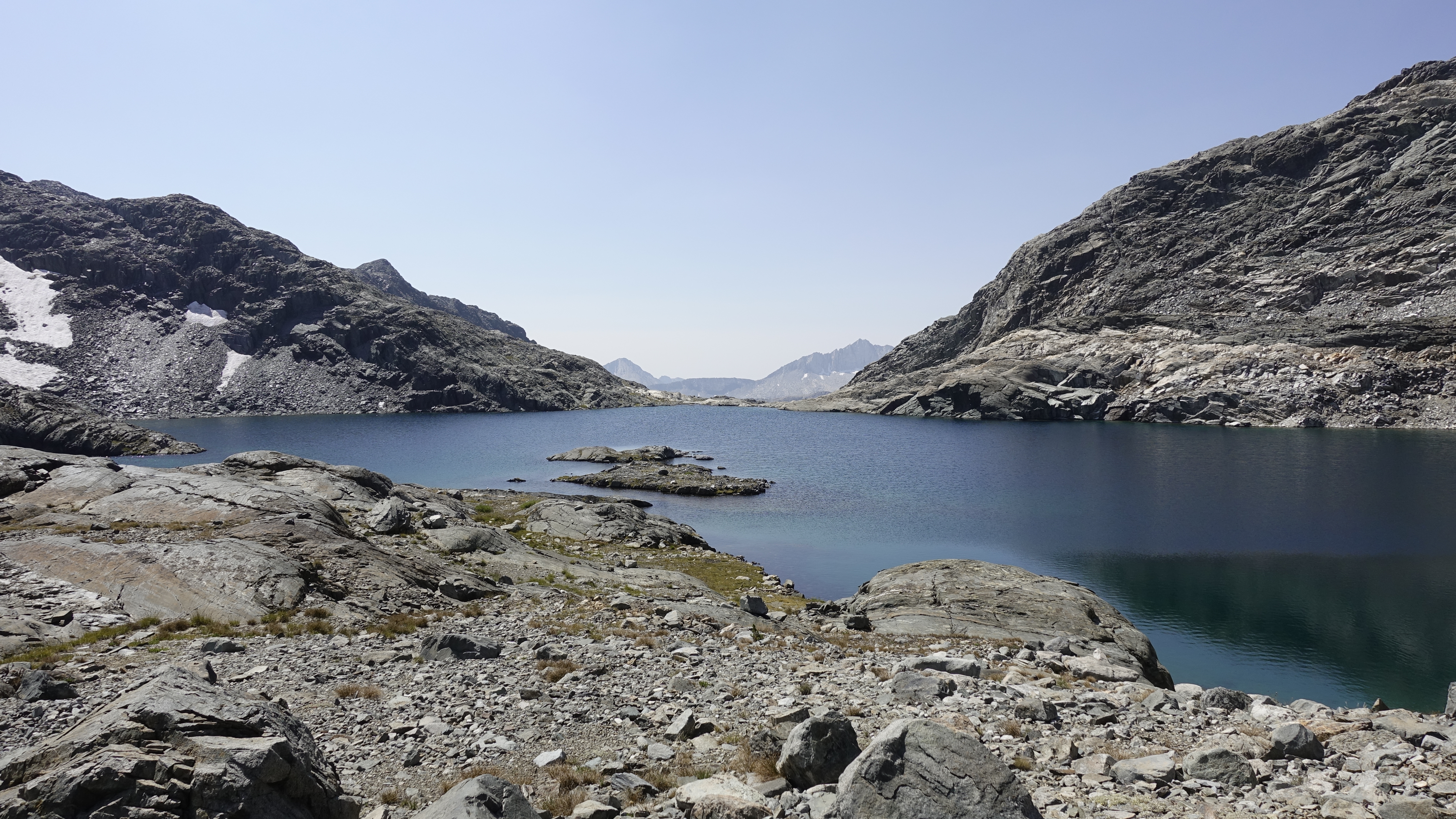
Don catches me and we leap frog to Muir Pass. I suggest camping at Sapphire Lake and we agree to meet up and camp there. It’s been my experience Sapphire Lake has the fewest campers although it is quite crowded tonight.
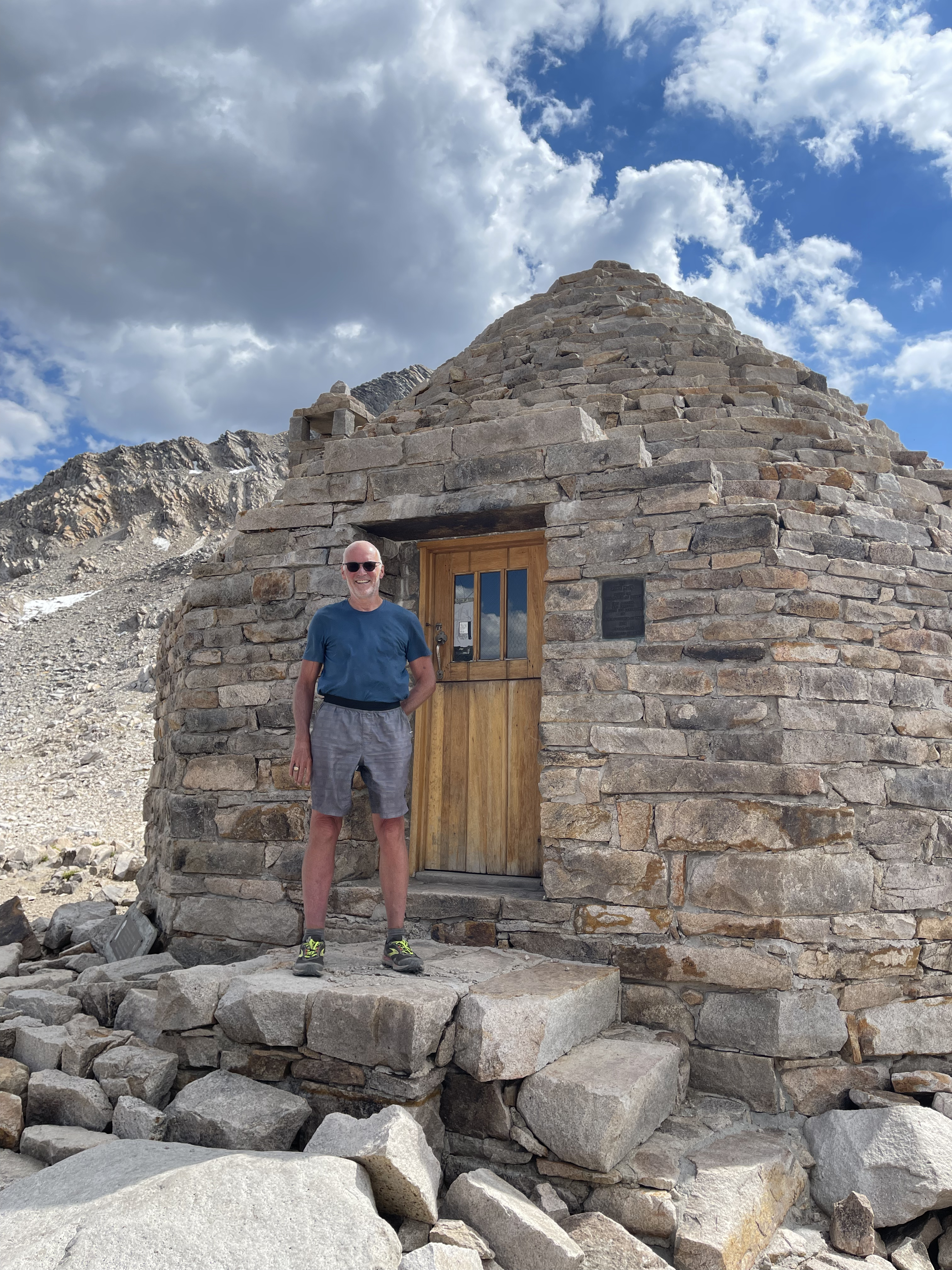
Muir HutThe old fireplace, my first time here in 1972 it was still open Then my Boy Scout troop carried wood and canned food to stock the shelter for emergency useInside of the dome roofSnuck another one of me in hereWanda Lake from the “safety” of Muir PassWanda Lake, approaching the mosquito plagueGoddard Divide, Mt. Solomons on the left and Mt. Goddard on the rightThe Evolution Group from unnamed lake at 11300Goddard Divide from unnamed lake at 11300
We meet up and share our experience with the clouds of mosquitos at Wanda Lake. Don, a few minutes ahead of me had been warned. Me, I just stumbled upon them and inhaled a mouthful before realizing what was happening. In 52 years backpacking I’ve never seen anything like it. Right out of Exodus.
Hundreds of dead mossy’s coat Don’s picardin prepped legs. Our message to all headed that way, “beware.”
We set camp in a sand filled gap between the slabs. Were it to rain we’d flood but the forecast is clear. Sapphire Lake is beautiful in the late afternoon, early evening light. I take a photo of Mts. Fiske and Huxley, draw some water, then steal away to bathe in the pools down by the outlet and bring relief to my leg. I look forward to this daily ritual of rinsing away the salt, the grime, and the miles.
Mt. Fiske and Mt. Huxley over Sapphire Lake
Back at camp I prep my dinner. Don and I hit it off and the conversation flows. He tells about a guided trip he did with Skurka, that it expanded his comfort zone and taught him a lot. We quiet when a neighbor complains (8:30, really?) then Don retires while I watch the unfolding show. The sun has set and the mountains glow in a silvery purplish hue. The few of us still up and about just smile at the gift.
Sunset on the Goddard DivideLast light on the Evolution GroupMt. Fiske and Mt. Huxley glow
Day 8
I head out just as the sun reaches the north shore of Sapphire Lake. Today is my “rest” day, an easy-ish pretty much all downhill walk, the first 10 miles through perhaps the most beautiful stretch of the JMT, Evolution Basin and Evolution Valley. And also, to note, my pack has dipped below 20 lbs.
Sunrise at Sapphire Lake
Evolution Lake awes in predawn shadow. I tear up at the beauty and feeling of joy, and give thanks that God has granted me this moment.
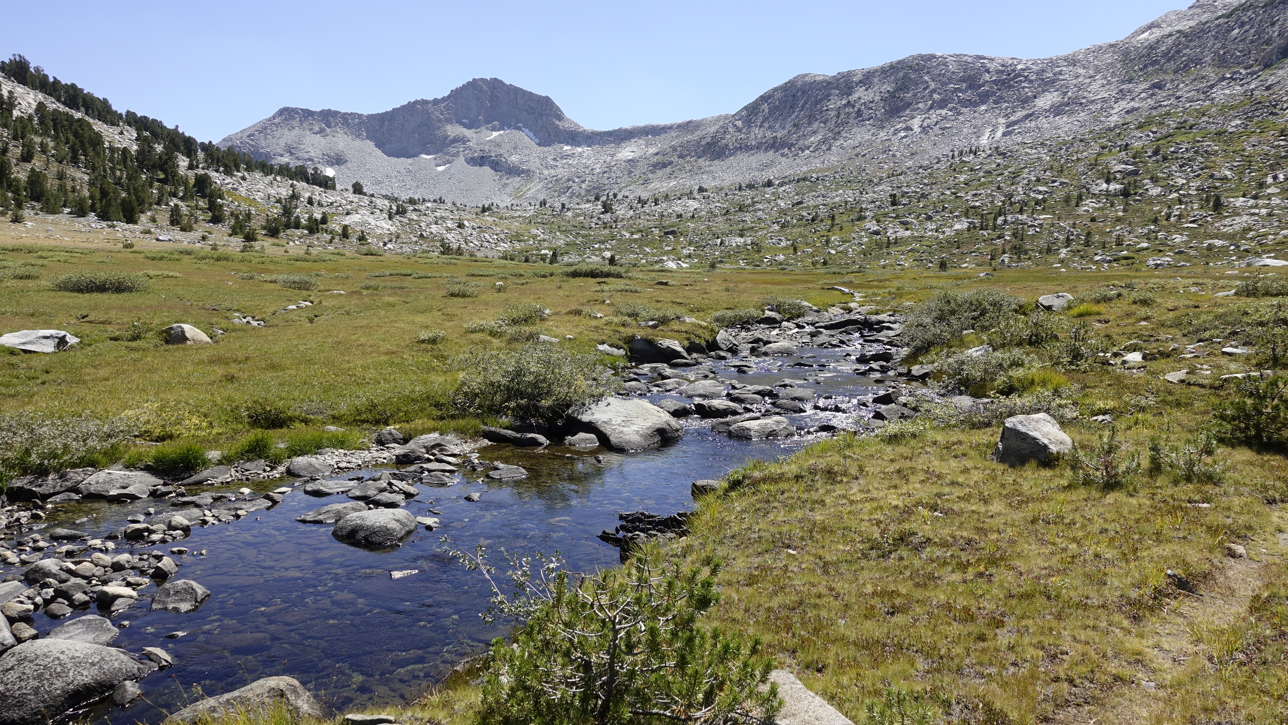
And just beyond I hear a creek, and I laugh. I first “discovered” this spot in 2004 and it remains a personal favorite. The sound of water, the smell of onion, and a stunning overlook of Evolution Valley. I eat a few onions, drink unfiltered water, gaze into the deep, and remember. I had met a couple guys from Wales then, and one said, “You just need to let it become engraved in your mind, so you don’t forget.” I often stop for “engraving.”
The “no filter” creek wild onions at 10,800′Sierra Lupine
Down the switchbacks and through the Evolution Valley. The meadows are still rich and lush. Where is the wildlife? Or do I just not perceive? I do know to look back though. The iconic view from McClure Meadow, of Mts. Mendel & Darwin, and the Hermit, while “engraved” is always a must see in the now.
McClure Meadow, Mt. Mendel, Mt. Darwin, and The Hermit
The Evolution Creek crossing is a busy spot. A group sits at creekside, just upstream, and a young couple are wading ashore. This is their first time in the Sierra, hiking North Lake to South Lake, and loving it. I share a bit on the grandeur to come.
I cross and am drawing water when Apocalypse arrives. I call out and greet him. He doesn’t remember me. “I met you when you were hiking up Mt. Whitney,” I say and ask about his filming. He films his Evolution Creek crossing from multiple angles and explains that filming adds maybe a mile and an hour or so to each day. I wish him well.
And then down a final set of switchbacks. The temperature rises uncomfortably as I reach the San Joaquin River in Goddard Canyon. I first notice it at the Franklin Meadow bridge crossing, but at the bridge crossing where Goddard Canyon narrows the heat is oppressive. And what is with the biting flies? I stop at this bridge to soak my legs. Across the trail from here is a large campsite where my scout troop camped in 1972. Some good memories: tossing frisbees, playing Risk, and baking Bisquick “bread” which was always burned on the outside and gooey on the inside. I put the flies, for the moment, out of mind.
Alpine GoldSouth Fork San Joaquin River bridge crossing, upstreamSouth Fork San Joaquin River bridge crossing, downstream
It is just after noon and the Piute Creek bridge is maybe an hour away. Too early and too hot I think and rather than camp there I decide to camp an hour further down trail just beyond the MTR cut off. It will still be an early stop to the day, and it will set up an early morning hike up to Seldon Pass. When I get there…It’s a nice enough riverside campsite, but so much for plans, and for rest days. I dislike the heat, I dislike more the flies, and I dislike even more the smell of horse shit that pervades this area. I decide to just go pick up my resupply at MTR, and unless they have a short stay cabin available, high tail it to the expected more hospitable Sallie Keyes Lakes.
Muir Trail Ranch, or MTR, now directs backpackers to a dusty ghetto-land down by the river. About 20 backpackers are in the process of sorting their resupplies. I ring the bell, collect my Homer bucket, ask about and strike out on the short stay cabin, and for a brief moment consider buying the Katadyn Hiker Pro they have on display to replace my Sawyer Micro.
I Included 2 treats in my resupply. A sleeve of Tate’s chocolate chip cookies and a one pound package of Twizzlers. The cookies hold no appeal to me. Usually, I am a chocolate chip cookie fanatic but out here one taste and I’m not feeling it. They do however prove quite popular with the crowd. I leave 5 band-aids and 6 deet wipes to the hiker barrel, dispose of my trash, stack my Homer bucket, and ready my pack. It takes me all of 45 minutes. Oh, and the Twizzlers hit the spot. I ration them, adding a few to my daily graze.
Soon I am cussing at the Sallie Keyes Cutoff Trail. It’s one mile and 700 feet of sun exposed use trail and I am sweating profusely when I reach the JMT. And beyond, even the JMT is a hot climb through the “manzanita zone,” just not as steep. And to top it off, it is humid.
In the “Manzanita Zone” climb from Muir Trail Ranch, Blaney Meadows far belowIn the “Manzanita Zone” climb from Muir Trail Ranch, storm brewing to the east
Clouds roil and thunderclaps, and people are hastily making camp at ~10,000 feet right as the trail levels off. I toil on. Rain or no rain I’ll get to the first Sallie Keyes Lake and camp there. I’ll wait out any storm and swim away the miles.
Camped right off the trail are Corn Cob and her sister. They are not your quintessential PCT hikers. Where most display a certain stoicism, these young ladies endure the same with infectious joy. 5 minutes with them and my disposition vastly improves.
I reach the lake and set up behind two guys, T-Rex and Nick. I take a good look at T’s tent as I’ve seen nothing quite like it before. It is a custom rig, the floor serving a dual function as a poncho. I set up my tarp, first time ever outside of my backyard. It “scares” off the storm, the clouds break without a drop or rain, and the last light of day warms the surrounding peaks.
The lower Sallie Keyes Lake
I get my swim and then fix dinner. It is 8:30pm. I visit with Nick and T, they are headed to VVR tomorrow. Given that it is walk-in, walk-out I’m not sold. But I’ll sleep on it.
Day 9
I wake at 5am, rested, and lay about a few minutes thinking over my options for the day. A shower, clean clothes, and real food win out and I decide on VVR. I should also catch Don there and we can discuss further doing an off-trail route next summer. Grinding out of MTR, though I disliked it in the moment, in retrospect was a good call. Though I gave up my nero, the Sallie Keyes Lake is much nicer camping than the San Joaquin near MTR, the swim restorative, and it’s nice to have most of the climb to Seldon Pass behind me. Plus, those extra miles give me the flexibility to include VVR in my hike.
It’s a cool, damp morning. The Sallie Keyes Lakes are glass and the surrounding cirque walls delay sunrise for the hour needed to summit Seldon Pass. Just one more big pass, Donahue, awaits.
The upper Sallie Keyes LakeHeart Lake
Six of us collect here, 5 headed to VVR. I am the last to leave, lingering, ensuring Marie Lake’s permanence in my mind. Some lakes are most beautiful from their shoreline, Marie is most beautiful from here.
The view south from Seldon Pass, Heart LakeMarie Lake from Seldon PassMarie Lake from Seldon Pass
The section from Marie Lake to Bear Ridge is new to me. I have hiked it twice, once each direction, but have little recall of the trail. I remember instead the people. Blake, a walking rain gear and breakfast food test laboratory, and our discussion of Through Silicon Via processing. Ryan and Kevin, my trail mates on our southbound climb of Bear Ridge. The Israeli couple I greeted with my entire Hebrew vocabulary. And Art on our Big SHR Loop. Today, though I have different company. Today I make it a point to feel the meadows, make note of the flowers, smell the forest, and listen to the creek. My first JMT hike was a social experience. This one? It’s different. I have and am enjoying the social, yet as, and maybe more importantly, I am feeling and seeing and living. I have joy and peace and aliveness.
Muir knew:
“The sun shines not on us but in us. The rivers flow not past, but through us. Thrilling, tingling, vibrating every fiber and cell of the substance of our bodies, making them glide and sing.”
Rosemarie MeadowsBear CreekLeopard Lily
But alas, the waltz ends. Bear Creek peels away to join the South Fork San Joaquin and the JMT makes an abrupt, hot climb up Bear Ridge. The folk from VVR have posted directions at the Bear Ridge Trail junction. They say it is 8 miles and that we are to hop the gate and walk across the dam. My recon says 6.7 miles, but nonetheless it is a long steamy descent to the Vermillion Valley Dam. T, an Ultra Runner floats ahead, I plod more slowly. Rain showers off and on and explain the humidity. I pass a group in raingear and praise my umbrella.
Lake Edison comes into view and we get a sense for the scale of the drought.
Lake Edison
Then civilization. Roads, cars, gates, cell towers, cabins, and more. It’s a windy walk across the dam then one final mile to VVR. VVR is both familiar and unfamiliar. It looks the same, the amenities are the same, and the “rules” are the same, but…
The rules are given us by Megrit with Jim standing by. Jim is selling VVR to Megrit’s son. After the rules she explains their plan. This summer they work VVR and learn its ins and outs with Jim always by to advise, and if needed, assist. And in the transition the desire is to continue and if possible, even improve upon VVR’s long-standing hiker-friendly and family friendly heritage. I ask if a room is available, no, VVR is fully booked. A room would have been nice, but it is most encouraging to learn they are, have been, and look to be fully booked this season despite a harrowing 2020 and this year no ferry service. I grab my beer, a Stone Arrogant Bastard, and my pack, and walk over to the group campsite.
I greet Don who arrived and set up about an hour ago. Last night, had I the energy to look about Sallie Keyes Lakes I would have found him there. I set my tarp, get organized, queue up for a shower and laundry, and while waiting get a couple flavored waters to drink. I had let my hydration schedule slide on the hike into VVR and want to catch up.
In the store I find Jim and thank him for making VVR what it is, the good times and the memories, and that he’ll be missed. It seems he’s leaving it in good hands.
Don and I eat dinner, and again breakfast together. We talk about previous adventures, he more detail on his Skurka trek in the southwest, me about Grand Canyon and off-trail hikes in the Sierra. Don has interest in doing or doing something like Skurka’s King’s Canyon High Basin Route or Yosemite High Route. And we also talk about the changes, the adaptations we need to make as we age. He shares that he is ending his hike here, that at the planned pace his body is just not recovering and what’s the point when you can’t enjoy. And though I’m not working through the same degree of recalibration, having reworked my last two summer hikes because I couldn’t physically sustain the planned itineraries I have some sense of the disappointment and questions of the “what now?”
The best I can figure for me is making a “10%” adjustment. In 2009 I averaged about 2mph. This year I’ve been averaging about 1.5mph. In 2009 I spent 9-10 hours per day on the trail. This year, and the last couple years I’ve been hiking 11-12 hours per day. So, I need to cut my ambitions about 10% and, as I have on this hike, added another 400 calories per day, or food to sustain the additional 2 hours hiking. So I am recalibrating, but between going slower and hiking longer, it is not a big adjustment.
Day 10
After breakfast I settle my tab and say goodbye to Don for a second time. We have loose plans to keep in touch and explore the possibility of a joint off-trail hike next summer.
As I leave VVR, the extent of last summer’s Creek Fire is all around. Kaiser Pass Road was the fire break that likely saved VVR, and the next 3 miles around the northwest shore of Lake Edison are fire devastated, except a narrow strip along Cold Creek. It’s sad, but at the same time hauntingly beautiful, teeming already with new life though full recovery is generations away.
At the Mono Creek TrailheadCold Creek BridgeThe worst I saw
The fire line ends abruptly as the trail rejoins Cold Creek and enters Graveyard Meadow. This, and the upper meadow, are lush, a rich sea of tiny white flowers sprinkled with a few isolated lavender blooms. And as is wont with wet meadows, they are buggy. The mosquitos annoy when I stop, the flies however swarm and travel with, abating only on the final climb to Goodale Pass.
Upper Graveyard Meadow
About halfway up this climb I meet a couple, and the to be maid of honor, on their way to Lake of the Lone Indian, a late afternoon wedding planned.
Goodale Pass has a unique geology. It is broad and sandy, but unlike Cottonwood Pass the alluvial sand has not buried everything and I am treated to a variety of rock and boulder formations reminiscent of the In-Ko-Pah Mountains along Interstate 8. This visually interesting terrain extends all the way to Squaw Lake.
Goodale Pass, the view northGoodale Pass, the view south
I leave the In-Ko-Pah’s where they fall away into the Lake of the Lone Indian, enter a sea of blue flowers, and finally return to a more familiar Sierra as I rejoin the JMT. All the while, the view north is alive. Mt. Ritter and Banner Peak are twin watchtowers of a storm brewing over Volcanic Ridge and the Middle Fork San Joaquin River. The skies to the north swirl and clouds dance all afternoon, then at suppertime recede.
Storms brew over the Middle Fork San Joaquin RiverLake of the Lone IndianA carpet of blue, I believe a type of Spreading PhloxSquaw Lake
The sound of Fish Creek’s cascades is welcome and signal the end of the downhill. I cross the bridge and start the approach to Tully Hole. Dark clouds lie to the east, but they are more the result of juxtaposition opposite the sun than a looming storm. And at last, a surprisingly easy “sprint” up the switchbacks to Lake Virginia. Lake Virginia is differently beautiful than Marie Lake. Marie Lake is best from high above, Lake Virginia best from shoreline. From the northeast shore or from the upper pond, the view south to the Silver Divide should be on everyone’s bucket list.
Approaching Tully Hole, storms over the crestLake VirginiaRed Mountain PaintbrushLake VirginiaLake Virginia, sunset on the Silver DivideLake Virginia, sunset on the Silver Divide
Day 11
It’s a beautiful morning over Lake Virginia and likewise Purple Lake. With little to no breeze both are mirrors. I expect to make good time today as it is mostly downhill to Reds Meadow, and that proves mostly true except for my detour to Duck Lake; yes, a navigation error.
Lake Virginia, morning glassSunrise on Peak 11160, reflection in Lake VirginiaSilver DividePurple Lake
I enjoy this stretch of the JMT. Many gripe about the pumice, and though it can be annoying, I tend to focus on the views out over Cascade Valley. The trail turns inward at Deer Creek and my focus turns to the flower and butterfly display of Crater Meadow. I usually hike later in the season and miss all this, so I slow to wallow amidst the lavender, white, and yellow flowers, and the brilliant orange gold, and the lavender colored butterflies.
Cascade ValleyCrater MeadowMammoth Mountain
Passing the Red Cones, the view opens up again, revealing the Minarets, Mt. Ritter, and Banner Peak. And the just before reaching Reds Meadow the JMT passes through the recovering scar of the Rainbow Fire. It’s been 29 years and it is maybe halfway back, the new growth now as tall as the crumbling ghosts, about 10 feet tall. Is it possible that I hike the JMT at 90 years? If so, I’ll get to see this place again in its fullness, and will get to see the recovery around VVR at its halfway point.
Sentinels of the Middle Fork San Joaquin River Iron Mountain, Volcanic Ridge, the Minarets, Mt. Ritter, Banner PeakRainbow Fire burn after 29 years of recovery
Reds Meadow is bustling with at least 100 people. I expected people, but not this. I collect my resupply, ask about a room or cabin (none available), and get a Diet Coke to drink. I find a seat at a picnic table and sort the resupply. I leave a dinner and breakfast in the hiker barrel, then head to the shower house for 15 minutes of showering; ah, the luxury of just standing in the warm flow. I do my laundry and then return to the picnic tables and the crowd.
A bus pulls in and most of the people disappear. I visit with a family from Vermont, JMT southbounders. I relate as they describe the difference, so far, between the Sierra and the mountains out east. They’ve hiked the Long Trail so they’ve got this, but yes, the Sierra are different, and IMHO better. As mountains go, I’ve hiked in the northeast, I’ve hiked in the Rockies, I’ve hiked in the Cascades, and I’ve hiked the mountains of Southern California. None compare to the Sierra. I enjoy them all, but none compare.
Disappointingly, the Mule House is take-out only. Not that the food is any different, but the atmosphere is. I order a burger and while waiting purchase an IPA 395 at the market. The burger is lackluster, the beer is excellent.
Belly full, I make the short walk to the campground. I choose the relative solitude of a “private” site over the busy-ness of the backpackers site. I settle across from the campground host. She comes by to collect and says a fire near Bass Lake will be impacting air quality. I set up camp, laying my pad and sleeping bag out on top of the picnic table.
Mr. Lee stops by. Mr. Lee, from South Korea, is 87 years old. He asks about my hike and the Sierra, and then shares that when he was 24 years old he summited Mt. Whitney…in 1957, the year I was born. He’s come back, but “no more” to do any significant hiking. He asks when I’ll be leaving in the morning. I reply “about 7,” he nods and walks off. A few minutes later he returns and gives me 2 ramen cups and explains how to prepare them. I graciously accept.
Day 12
$30 for breakfast? Yikes! And though it is 2 rather large pancakes, 4 real eggs cooked over easy, a mound of bacon, and real coffee, $30 is a king’s ransom. Just the same, I swipe my card and eat. The justification? Breakfast is more the twice as good as the $20 burger I had last night.
It’s about 8am when I set out. Instead of cutting over to the JMT I head north toward Devils Postpile. I’ve been to Devils Postpile and hiked the loop several times, still I cannot resist doing it again, and as always, I discover something I haven’t noticed before. Today it’s the view north, the Minarets, Mt. Ritter, and Banner Peak “edge on,” and a final stand of posts at the bridge crossing of the Middle Fork a short distance north of the interpretive signs.
Devils PostpileDevils Postpile, polished tilesEdge on view of the Minarets and Ritter Range, smoke courtesy of the River FireDevils Postpile, the classic viewPosts at the Minaret Lake Trailhead bridge
A short distance further the trail intersects the JMT, and the JMT and PCT split. My route today is the PCT high trail. I choose this route not because it is new to me, but to have a slightly easier hike.
What a treat! First, are 2 beautifully forested miles along the Middle Fork San Joaquin and the mile long crossing of Agnew Meadows, and then 5+ miles of beautiful high-country meadowland with spectacular views of the Minarets, Mt. Ritter, Banner Peak, and Shadow Lake. Today the views are marred by smoke from the River Fire, but on a clear day? Breathtaking! And if that weren’t enough, on the “cut-over,” I watch ducks at play in the Badger Lakes, followed by the million-dollar view of Banner Peak and North Glacier Pass anchoring the end on view of Thousand Island Lake.
Middle Fork San Joaquin RiverAgnew MeadowsMt. Ritter and Banner Peak from the PCT High TrailLush meadow lines much of the PCT High TrailShadow Lake, what if a clear day?Badger LakeBanner PeakThousand Island Lake, Banner Peak, North Glacier Pass
Combinations of the PCT High Trail, the JMT, and the River Trail provide day hike loop options out of Agnew Meadows and I meet maybe 20 people doing such. I again have proximity envy.
It’s a short climb up to Island Pass. I walk around the north end of the west tarn and with a bit of scouting find a hard site with an excellent view of Banner Peak. I set camp and make my way to the tarn to collect water and swim. Swimming is more restorative than bathing. Clean and refreshed, I prepare dinner. Mr. Lee’s ramen is hot, and spicy. Delicious!
Island Pass, west tarn The granite penninsula my platform for a dive inBanner Peak from my campsite on Island Pass
Day 13
The sunrise on Banner Peak grabs my attention, my tiny campsite perfectly situated to just sit and watch morning come. So, I sit and watch, and finally crawl out of my sleeping bag to start the day. 5:30am. Island Pass was a good choice for camp, the perfect mix of scenery and seclusion, the exact opposite of Reds Meadow.
Sunrise on Banner Peak
As I pack, I consider my planned destination, the Tuolumne Meadow backpacker site, and if I really want the crowds. There is not a whole lot I can do, from here to Yosemite Valley the JMT is at its busiest, but I can press on to the Cathedral Lakes. There, I am still likely to have company, but can find a site out of neighboring eye shot with the feel of solitude.
The meadowlands below Donohue Peak and Mount Andrea Lawrence are stunning, a pocket-sized oasis of green, laced with creeklets and dotted with tiny ponds, and quite the contrast to the southern Sierra.
Donohue PeakTarn in the Rush Creek drainage
The JMT “serves” the Sierra to you just about any way you like them. Rugged, steep climbs on hardrock granite. Gentle, green meadowlands. Crowds where it nears the front country. Seclusion any time you want it. You really get to taste it all.
I’ve spent most of my hiking life wandering the southern Sierra and had you asked even up to a week ago, I’d have said I prefer the granite. There, there is an intensity that is my attraction. But today’s wandering, and yesterday along the high trail, and last night’s campsite…there’s an appealing calmness here north. South, I find peace relaxing after a challenging day. Here, at least this morning, there is peace, period.
Before long I reach Donohue Pass. I stop for a rest, and to make water. I lost the gasket to my filter and am relegated to making water with chlorine dioxide tabs. There was a time before filters, and then a time before that time. Before filters there were tabs. Chlorine dioxide, and before that iodine, and before that iodine crystals. But before that was the time of Sierra Cups and drinking the water fresh. And though I miss the no treatment days, I used to not find the treated water that objectionable. But today, I hate it. It tastes like over chlorinated swimming pool water. The difference? Perhaps then, I always had lemon drops or Jolly Ranchers candy, and perhaps they cut the foul taste. But today, yuck. I’ll deal with it for now and buy drinking water at Tuolumne.
Donohue Pass, entering Yosemite
Ahead I can see the length of Lyell Canyon, behind me Mt. Lyell and its glacier, a source of the Tuolumne River. It’s a lovely hike. The trail parallels, generally a few hundred feet back from the river, and I pass, never close enough to stop and talk, several parties lounging at riverside or swimming. Me, I make a couple water stops, and on one of those, a leg soak.
Lyell CanyonLyell CanyonMt. Lyell and Mt. MaclureLyell Canyon and its expansive meadowland
My first stop in Tuolumne is the ranger station. I ask about Half Dome permits and to my disappointment they are now only issued in the Valley. My option now is to sneak a climb.
Cathedral Peak, backdrop to a dry Tuolumne Meadows
Another mile and I am in the heart of civilization. I get a burger at the grill and on first bite think it is time to give up on burgers. On my first JMT hike I had breakfast here and at Reds; it was Whitney Portal before my first burger. Who knows if memory serves me well, but I enjoyed my Whitney Portal burger, these not so much.
Decision time, 3:30pm. Do I stay the night at the backpackers site or continue to the Cathedral Lakes? It isn’t a hard call. Memories of my first JMT hike and Upper Cathedral Lake are too strong. I’ll push on. But first I buy a gallon of drinking water and use ½ to backwash my filter. After this I’ll use it in reverse. Odd thing about the Sawyers. A bottle married to the outlet threads with a “tornado” coupling is water tight, while the inlet threads, even with the gasket, without careful tightening, leak. A clever design flaw. Nonetheless, whether right thinking or wrong thinking, I figure the filtration running the filter in reverse will be sufficient.
I set out with a PCT hiker. We head east to the Lembert Dome parking lot, then pick up the old dirt road that leads to the Parson’s Lodge and the Soda Spring. He stops along the way, having cell signal, to call his wife. I continue. I had thought about drinking from the soda spring, but arriving there, there are 3 kids walking about inside the enclosure exclaiming being “grossed out” by the orange color. Not that the water would have been any less stomped had they not been there, but the stomping would have been out of sight out of mind, and I probably would have tasted. But not today.
Lembert Dome, the Tuolumne Meadows store is a slight detour off the John Muir TrailUnicorn Peak and Cathedral PeakSoda Spring, had kids not been stomping about in the water I would have taken a drink The orange color is due to iron, not algae
On to Parsons Lodge. It is closed. I had hoped to tour it, but that must wait until a post-COVID time so without pause, across the meadow I go.
Parsons Memorial Lodge
A father and son are fishing off the bridge. Well dad is. The young boy is running about excited and making joyful squeals. My 30 some odd year-old son doesn’t squeal anymore, but fishing is one thing we share.
Across the meadow, cross the road, and onward. It’s a little after 5pm when I reach the junction to the Cathedral Lake trailhead.
Tuolumne Meadows looking eastTuolumne Meadows looking west
To be honest I don’t remember this much uphill. Of course, as a southbound hiker I was headed downhill this stretch, and also first thing in the morning. I take it slow and grind it out. Near the North Buttress I stop to chat with 2 women, mom and daughter on their out and back to lower Cathedral Lake. I assure them that most of the climb is behind them.
North Buttress
Upper Cathedral Lake is “crowded”. I make the 7th person here. Finding a secluded, see no one hear no one site is not hard. I set camp, then make my way to the peninsula. At 7pm there is no direct sunlight, but the air temp and the water are warm. I wade in calf deep then surface dive and swim about. The water is wonderful and 200+ miles of weariness wash away. Two others join, then leave, while I continue to swim, maybe halfway to the north shore and back. Then for a while I tread water. Finally, it’s been over twenty minutes, I finish and lay on the rock peninsula, restored.
Upper Cathedral LakeSunset at Upper Cathdral Lake, I have an almost identical shot from my 2009 JMT hikeSunset on Cathedral Peak, the image, “engraved in my mind” convinced me to stay here and not at the Tuolumne Meadows backpacker campsite
Day 14
I ease into the day. It is almost 8am and I’m not yet on the trail, and when I do head out, I am a lone traveler, no one else astir. “Easing” is suitable this morning, the hike through Long Meadow a gentle, near perfect blend of blue sky, green fields, iconic Cathedral and Unicorn Peaks to the north, and the Clark Range, which appears to be beyond the “ends of the earth,” to the south. All this, and only me, solitude on this stretch of the JMT a gift.
Cathedral Peak over Upper Cathedral LakeUpper Cathedral Lake, sky blueLong MeadowCathdral Peak over Long MeadowUnicorn Peak over Long MeadowClark Range at the ends of the earth
My detour to Clouds Rest starts at Sunrise Camp. The trail loops by the Sunrise Lakes, surprisingly few campers, then begins a steady climb. At precisely 12 noon a trail crew “drops” their tools and breaks for lunch, and then, just beyond the Forsyth Trail junction, comes a steady stream of descending day hikers.
Upper Sunrise LakeLower Sunrise LakeHalf Dome sneaks a peek
I’ve seen pictures of and from Clouds Rest, none do it justice, and I can’t find a way to distill my description to a few words. I stay atop more than an hour letting is all soak in.
Yosemite Valley from Clouds RestMe on Clouds Rest
The descent first follows the Stairs of Cirith Ungol. These keep me on edge until the trail moderates into more conventional switchbacks. At the JMT junction I make another navigation error and turn right toward Half Dome; left would have taken me to the intended camping along Sunrise Creek.
My plan had been to camp at Sunrise Creek, then rise early to beat the ranger and summit Half Dome. Instead, I am at the Half Dome junction, it’s not quite 4pm, and I meet a permit-less group “denied” their trip up the cables. I toy briefly with the idea of hanging out until the ranger leaves, but just briefly, and decide instead to continue to Little Yosemite Valley for the night. What a zoo! I don’t census but would be surprised if there were fewer than 200 people here. I find a spot between fallen trees which intended or not make up most of the campsite boundaries here.
I drop my pack and walk down to the Merced River for a swim. There are people at play up and down stream. The water is warm, slow moving, and the pools deep. I dive in, swim out to mid-stream, and tread water. Several minutes of this and I can feel my right leg “release” if that is the right word. It remains swollen, but is no longer painful.
For all the people it is quite peaceful. There is background chatter, to which I contribute by talking with my neighbors, but no one being obnoxious. Still, should I do this again, I will skip Little Yosemite Valley and just finish the hike.
Once in my sleeping bag I tune out the world and enjoy one last night on the trail.
Day 15
Not much to it. It’s an easy walk to Nevada Falls, which is more picturesque from the JMT than the Mist Trail, and then garbagy walking amidst the pavement shards to Happy Isles.
Liberty CapNevada Falls
I reach the Vernal Falls bridge at 8:30am but the sun is shining directly in my face, the falls hidden in the glare. I ask someone to take my picture at the trail head sign and in that I suppose I’ve formally completed my 2nd JMT thru-hike, but I’ve got another 3 miles of wandering the valley floor, until I settle at the YARTS stop outside the visitor’s center and call home.
FinishedThe trickle that this year is Yosemite Falls
The YARTS pulls up around 2:30pm and I, and the handful gathered hop aboard. It makes several stops. A few depart at the May Lake trailhead, and a few hop on at Tuolumne. At this point we are about 20, all headed to Mammoth Lakes.
I get off at the Shilo Inn stop and make the short walk to the Sierra Lodge. I retrieve my duffel, check in, and am in the room by 6pm. I text my wife, enjoy a long shower, and pack the duffel. 7:30pm and time to eat. I cross the street to John’s Pizza Works, order a too-large pizza, the first of 3 beers, and arrange a morning taxi to the Mammoth airport.
In bed by 10, alarm set for 7am.
Day 00
I wake before the alarm, fix a pot of coffee, and take another shower. I think finally I’ve got the ash scrubbed out of my hand and foot creases, and the dirt out of my nails. I feel clean now.
The MAWS taxi arrives at 9am, and by 10:30 I am in the rental car turning left onto Hwy395. I’ve a very simple plan: drive to Las Vegas and catch the redeye home. A call from my son breaks the monotony, we talk all the way to Lone Pine and for the 45 minutes I wait for a table at the Alabama Hills Café. Breakfast makes a good lunch.
I fill the tank for $5 a gallon which gets me to Las Vegas. It’s mid afternoon and I’ve time to burn. I stop for a chiropractic adjustment, then go and browse an REI. It is much better stocked than last summer. I eat dinner at Jalisco’s, their excellent Chili Verde, return the car, and wait 3 hours to board my flight. The flight is on time and get’s me home.
Epilogue
How different can two hikes be? That’s not a profound question, each hike is different, even when returning to familiar track. Still, it’s been 12 years since my first JMT thru-hike, and it begs reflection.
Most notable is how different things look when hiking the opposite direction, and in that, how many familiar places I saw for the first time. Arrowhead Lake, Woods Creek Canyon, Rush Creek, and Tuolumne Meadow to name a few. Perhaps it is that newness, but northbound to me, is the more stunning.
Northbound, I thought might be more difficult than southbound. I set out from Cottonwood with 8½ days of food and a 45lb pack, whereas in 2009 I set out from Yosemite Valley with one day of food and a 20lb pack. I probably didn’t get down to 20lbs until the morning I left Sapphire Lake, but didn’t experience any particular difficulty with the bigger load, my itinerary was appropriately dialed. Entering via Cottonwood Pass minimized elevation change (both ups and downs), my first 2 days were short-ish, and I used the Crabtree food locker as a cache carrying the bare minimum up Mt. Whitney. The dialed in itinerary is me acknowledging age and backing off, and despite the extra 12 years I rate this northbound hike the easier.
Like it or not, I am not quite as able as 2009. It was good for me to meet Don, spend the evening at VVR discussing our reduced abilities, and our reluctances to give in. Note my describing it as reduced and not declining as I don’t want to imagine it being a trend. But truth is, to cover big miles at my slower pace I need to extend the number of hours I hike. Learning this from my last two summers I added an extra 400 daily calories to fuel the longer hiking days.
Gear-wise, not much change. For shelter I added a tarp, hiking in the northeast has taught me to separate shelter and raingear, and an umbrella. I’ve been off and on with the umbrella, but after this hike it has a permanent spot on my gear list. Not only do I feel 20 degrees cooler without a hat, the portable shade effectively offsets the huge quantity of sunlight above tree line in early July. I may eventually trade the tarp and bivy for a DCF tent. The weight is about the same and it’ll give me an item for that future Christmas list.
And a few other observations… Disappointingly there is a larger “leave maximum trace” hiking population, Exhibit A being the Smithsonian Hut. Youth groups. I encountered 4, none Boy Scouts. Boy Scouts used to be just about the only youth group. Crabtree Meadow. More crowded than Guitar Lake. More people in general. I figure this is timing, early July vs. late August. Early July sees the last of the PCT hikers and all schools are out. By late August the PCT’ers have passed and for some school is back in session.
All told though, put the differences aside. My 2nd JMT thru-hike was awesome, and my exact need. Give me a few years, I’ll certainly do it again.
Hike Stats
In all, I hiked 254 miles, 57k feet elevation gain, and 63k feet elevation loss.
I like easy so opt for prepackaged meals, just add boiling water. Lately I prefer Pack-It Gourmet dinners and hot breakfasts. For lunch I carry stuff I can snack on throughout the day, about 200 calories per hour. Key, perhaps, is the total calories, carbs, protein, and fat each day which powers me for about 12 hours.
Saturday I pulled out the gear list and piece by piece lay my gear out on the floor. As expected I made a few last minute tweaks. Then time to organize my food.
Outside the bear can 3 days, 2 nights of food. Night one I’ll camp near a bear box and stash the overflow. Day 2 I’ll stash the bear can near Crabtree Meadow and haul the “loose” food to a camp somewhere above Guitar Lake (and above “bear line”). Day 3 I’ll carry the loose food, water, plus a jacket and such for a dayhike summit of Mt Whitney and on return collect my gear and bear can. With the loose food I can fall 1/2 day behind plan and remain gluttonous, but if all works out I’ll collect the bear can early afternoon and head north a few miles to the Bighorn Plateau. But whatever, after dinner night #3 everything should fit into the bear can and I’ll not have to worry about it.
Food organized I load my pack, except the hip belt pockets, place it into the travel duffel. Added a sack with my hike clothes, a sack with my when I get off the trail clothes, a sack with my hip belt pocket contents, and some travel toiletries and done.
The last bit of prep…I activated and sent a test message over the inReach.
I do have a short list of things that I’ll take with me or in my carry-on (anything with batteries), the 5 things that go in my backpacking “wallet”, and the three items I’ll buy in Mammoth Lakes but I feel ready.
Now to be patient, though I know the anticipation will build.
Mailed the resupply buckets today, not last Friday, and it was near mini-disaster.
I had the incorrect zip code for the Red’s Meadow address and the post office pulled up Lone Pine for the destination, not Mammoth Lakes. The clerk mentioned that perhaps Lone Pine and Mammoth share the same zip code. I should have looked it up there and then, but didn’t think to until I got home, saw the error and made a 2nd trip to the post office to correct the error.
Whew!
That would have made for an interesting Red’s Meadow stop and a scramble to find foods at their store for the last few days of my hike.
It is still possible the resupplies don’t arrive at their destinations, but with expected delivery next Monday and a receipt notification I will have confirmation before I leave and a chance to figure something out.
In any event, this is the last of the planning elements other than packing. And as I get to that I’ll probably have one or two tweaks to the gear list.
Saturday morning I saw that five July 2nd Cottonwood Pass permits were now available. I grabbed one of these and cancelled my Cottonwood Lakes permit. This change makes for an easier Day 1. Mileage for Day 1 drops to 10.6 miles.
I also noticed that my Gaia GPS tracks for Day 3 and for Day 12 were incorrect and revised these. With these and the above change my trip total drops by 1/2 mile.
Finally, yesterday, I reserved/paid/printed labels for the MTR resupply and mailed the Red’s Meadow resupply reservation form.
All of these changes are reflected in the original post’s itinerary table.
Last weekend I placed orders with Pack-It Gourmet, Amazon, and REI, and beginning Thursday boxes started arriving. Saturday I received the final confirmation, everything I ordered should be delivered.
Today was “Christmas.” I have all the food items except tortillas (which I’ll purchase at the last minute) and any treats to include in the resupplies. And I have all items on the gear list, though need to check and refresh my first aid and toilet kits. Once I get to that level of detail it is quite likely I’ll need to make a run to the market or Walgreen’s.
This is all quite unusual for me; that is have all my stuff nearly four weeks before I head out. Last year I had everything down just over a day and half before I left. Resupply has a way of forcing early prep.
And training is going okay. I do a pretty good job of staying fit year-round, but the COVID gym closures set my lifting back. I don’t have a barbell and plates in my home setup.
I’ve built back to 100% of my pre-Covid strength with exception of squats and deadlifts which are 90-95%. Aerobically, I can sustain a heart rate at 150 bpm for 30 minutes, and recover in under 10, and added “distance” running once morning temps reached the upper-20’s. 10k is a comfortable distance, 8.5 miles is my longest so far. I’ve been ramping slowly. I started too fast a couple years ago and banged up my knees; I didn’t run at all for close to 2 years. My endurance on the trail is better when I run, even better when I can rip half-marathon distances. I’ll keep with the 10k for now; don’t want to over-do it and start the hike hurt, and I’ll continue increasing my distance after the hike.
I am hiking the John Muir Trail this summer; in fact, starting July 2nd. That is the easy part. “Getting there” or figuring out how to get there has been a bit of challenge and one I think worthy of documenting if only to have the instruction handy should I decide to go it again. This note is not a comprehensive guide to permitting, travel logistics, and resupply planning, but is a detailed account how I have planned to do it.
My priorities for travel are schedule predictability and spend as little time possible in transit. I have limited time off from work, constraints on when I can get away, and want to maximize my time on the trail. And in effort to optimize the away from work time I generally want to travel Thursday, start hiking Friday and for most trips return home on the week out Sunday, or if a holiday weekend, Monday. For hikes in the Sierra, I like August and September especially the last week August through Labor Day (for the extra day).
But I am getting ahead of myself. Permits. What about permits?
This year I have a family trip at the end of September so set my sights on a hike starting any Friday or Saturday in July or August. And for permits I started playing the Happy Isles and Mt Whitney Trail lotteries as soon as the windows opened; played them several times. The mistake with this was ignoring the possibility of failure and not reserving permits out of Horseshoe Meadow as they became available. And of course, I failed.
My backup plan: checking rec.gov several times every day. To my delight, in early May some thoughtful permit holders, when their plans changed, cancelled and I was able to score a Cottonwood Lakes permit for July 2nd and a Cottonwood Pass permit for August 6th. My boss prefers July 2nd and my plans build on that. Meanwhile, I cancelled my August 6th permit for someone else to enjoy.
I’ve edited the permit twice. Once to adjust the nightly stops, and a second time to extend my stay just in case I need an extra day.
About getting there…I’ve outlined my travel priorities, and there are a few other considerations: 1) I am travelling from near Albany, NY. 2) Most of my hikes are from east side trailheads so my best “fly in” options are Mammoth, Las Vegas, Reno, LA. 3) For weeklong trips a rental car that sits at the trailhead is generally cheaper than one-way rentals and hired shuttles. 4) While hiking I need a place to keep my travel duffel and clean change of clothes. This most often is a rented car but can be a hotel with the promise of a night’s stay. 5) And with all my constraints I’ll tend toward the cheaper end of the available options.
Integrate everything above, my go to for weeklong hike, for the last 7 years is fly to Vegas, arrive ~11am, rent a car, do my last-minute shopping, drive to Lone Pine, pick up the paper permit, get a room at elevation for the night, and then off to the trailhead first thing the next morning. But this isn’t quite optimal for a 2-week JMT hike.
A rental car, parked for 2 weeks, is wastefully expensive and I am going to need a shuttle anyway. This year there are no one way rentals into Mammoth or Bishop until August and United stopped its daily flights in and out of Mammoth with the onset of COVID. Using public transportation from LA or the Yarts from Fresno both take a long time and have tight connections that put priority one at risk. The only thing that is easy is I’ll have my permit in hand and don’t have to be at a ranger station by 4:30pm that afternoon before I start hiking.
Have you started playing the violins yet? Should I continue?
Long story short, the solution this year is Thursday the 1st: A Southwest flight into Reno, the Eastern Sierra Bus into Mammoth, and stay the night at a Mammoth Hotel where I can store my travel duffel in a ski locker. Friday the 2nd: a crack of dawn East Side Sierra shuttle to Horseshoe Meadow.
I suppose I could have just written this last paragraph.
The getting home is simple by compare. If successful I finish Friday morning July 16th in Happy Isles. From there it is the afternoon Yarts to Mammoth and another hotel night. Saturday the 17th I take a cab to the Mammoth Airport, rent a car from Enterprise, and drive to Las Vegas. From there it is a red eye and arrive back in Albany by noon the 18th.
Of course, I also need a Plan B and Plan C way of getting home. Plan B, what I do if I hike too slow: exit at Tuolumne and hop onto Plan A with the after Yarts or exit at Mammoth and hop onto Plan A. Plan C, what to do if I must bail? Wing it and rely on a few kind souls to get me to Mammoth where I can get back onto Plan A. There is always the Plan D wing it option where I am evac’d out of the backcountry, but I am not going there.
Things were a lot easier when I lived in Arizona. I just drove.
———-
With travel down it is onto menu and resupply.
My backpacking menu is rather pedestrian. I want convenience, so no home dehydrating and no original recipes for me. I like Pack-It Gourmet and start there for both breakfasts and dinners. Lunch is seldom a stop and sit meal, instead I graze a couple hundred calories per hour from bars, almond M&M, nut butters, dried fruit, and sausages. The grazing habit is a trial and error learned practice of how I need to eat and sustain myself while hiking 12+/- hours a day.
The choices are not the most calorically dense but not too bad, and there is enough variety to keep me interested and eating. Menu details, quantities, and nutritional values are listed in the table below.
Food
Quantity
Calories
Carbs
Protein
Fat
breakfast – 14
Pack It Gourmet Breakfast
3/4 cup
370
48
14
14
Nido
6 tbsp
210
18
12
12
Strawberry Protein Shake
1 scoop
110
1
25
0
Waka Coffee
28
0
0
0
0
snack – 15
Probar
3
1170
150
24
57
Almond M&Ms
1/4 cup
220
25
4
12
Water flavoring – True Lemon
3
lunches -15
Almond Butter – 5
2 pkg
440
10
12
38
Fruit Bits
1/4 cup
120
30
1
0
Sausages – 10
6sausage
330
3
21
27
Cheese
1triangle
180
40
12
14
dinner -14
Pack It Gourmet Bolognese – 2
1 serving
790
44
31
10
Pack It Gourmet Gumbo – 2
1 serving
390
55
36
4
Sausages
6sausage
330
3
21
27
Pack It Gourmet Texas State Fair Chili – 2
1 serving
680
72
40
27
Pack It Gourmet Austintacious Tortilla Soup – 2
1 serving
380
44
30
11
Tortillas
2 – 8″
300
46
10
9
Big Un Burrito – 2
1 serving
380
52
25
10
Tortillas
2 – 8″
300
46
10
9
Pack It Gourmet Tuscan Beef Stew – 2
1 serving
570
70
41
14
Tortillas
1 – 8″
150
23
5
4.5
Shepherds Cottage Pie – 2
1 serving
660
68
36
28
660
68
36
28
average daily total
3319
358
143
156
I am resupplying at Muir Trail Ranch and Reds Meadow. These I’ll mail by June 18th. This gives them about 3 weeks to arrive and I’ll likely have confirmation they’ve been received before I start hiking. Quantities carried and what goes in each bucket are listed in the next table.
Pack
MTR resupply
Reds resupply
9 oz Jay Robb egg white protein
3.5 oz Jay Robb egg white protein
3.5 oz Jay Robb egg white protein
2 boxes Waka Coffee
1 box Waka Coffee
1 box Waka Coffee
27 probars
9 probars
9 probars
27 pkgs True Lemon
9 pkgs True Lemon
9 pkgs True Lemon
1 15.9oz bag Almond M&Ms
1 15.9oz bag Almond M&Ms
8 pkg Justin’s Almond Butter
2 pkg Justin’s Almond Butter
2 bag Fruit bits
16oz bag Dukes Shorty Sausages
16oz bag Dukes Shorty Sausages
1 bolognese
1 bolognese
1 gumbo
1 gumbo
1 chili
1 chili
1 tortilla soup
1 tortilla soup
1 big un burrito
1 big un burrito
1 tuscan stew
1 tuscan stew
2 cottage pie
5 triangles cheese
5 triangles cheese
2 polenta with pork sausage
1 polenta with pork sausage
1 polenta with pork sausage
2 west memphis grits souffle
1 west memphis grits souffle
1 west memphis grits souffle
2 santa fe corn pudding
1 santa fe corn pudding
1 santa fe corn pudding
2 sunshine bowl
1 pkg Tortillas
1 pkg Tortillas
12 Esbit Cubes
5 band-aids w/antibiotic ointment
1 sheet shop towel, quartered
SS Wire Toothpick
6 Deet Wipes Insect Repellent
1oz Sunblock (1oz in resupply)
Toilet paper, 45 sheets
1oz Hand gel
Plug and charging cord
Next is gear. I probably have not changed more than 5 items since 2006. Absent food, fuel, and water I am about 15 lbs. This year call it 16 since I am going to carry both a tarp and a poncho unless the 2-week forecast as of July 1 is two weeks no rain. This includes the bear can.
gear
McHale Sarc-chasm Backpack
2 Mons Peak Tiger Paw carbon trekking poles
Chrome Dome Umbrella
Western Mountaineering Ultralight Sleeping bag
1 Osprey Ultralight Stuff Pack / doubles as sleeping bag stuff sack
Inflatable pillow
Thermarest Neo-Air Large
1 stuff sack
Mountain Laurel Designs Cuben Tarp
Mountain Laurel Designs Cuben Pro Poncho/tarp
Mountain Laurel Designs bivy
8 aluminum y-stakes with attached guylines in rolled into tarp
Anker charger (plug and charging cord in resupply)
iPhone cable
Locker key
Small notepad, pencil
Sea to Summit mosquito head net
clothes to wear
Prana shorts
Underwear
Patagonia Merino 1 t-shirt
2 pair Injinji toe socks
Trail Runners
Orthotics
Hat
Scrap of paper with phone #
A bit of cash
Debit card
Medical insurance card
Driver’s license
Eyeglasses
Suunto Core Compass/Altimeter watch
Bandanna
Tin of lip balm
Lastly, here is the above and my hike itinerary laid out in table format.
JMT Itinerary
Date
Day
Description
Miles
9-May
Sunday
Score! Booked a Cottonwood Lakes Permit for early July. Thank you, person who cancelled their reservation.
22-May
Saturday
Update gear list, plan menu
23-May
Sunday
Book flight for 7/1, Albany to Reno, Southwest #0140 / #1443, Leave 6:20am / Arrive 10:55am. Spendy! Book room for 7/1 Submit reservation request for Eastern Sierra Transit, Reno Airport to Mammoth Lakes Submit reservation request for East Side Sierra Shuttle, 6:30am pickup
24-May
Monday
Confirm (pay half) reservation with East Side Sierra Shuttle; balance due at pickup
25-May
Tuesday
Confirm (pay) for Eastern Sierra Transit bus ticket; Confirmation #079028A
29-May
Saturday
Book room for 7/16 Book flight for 7/17, Las Vegas to Albany Book Enterprise one-way rental for 7/17, MMH to Las Vegas
30-May
Sunday
Order food from Pack-it Gourmet Order food and misc. from Amazon Order any last-minute gear from REI
6-Jun
Sunday
Get resupply “Homer” buckets at Home Depot
12-Jun
Saturday
Grab a July 2nd Cottonwood Pass permit (5 show available), cancel my Cottonwood Lakes permit
15-Jun
Tuesday
MTR “opening day”, pay for resupply and print labels Mail (USPS) the resupply notice to Red’s Meadow
21-Jun
Monday
Mail resupply to MTR and Reds
28-Jun
Sunday
Pack
1-Jul
Thursday
Fly Albany to Reno, Southwest #0140 / #1443, Leave 6:20am / Arrive 10:55am Eastern Sierra Transit, Reno Airport (Ground Transportation outside of Door D) to Mammoth Lakes Vons Purchase tortillas and 2L Smart Water Walk to and Check-in Hotel, Mammoth Lakes
2-Jul
Friday
Check-out, leave travel duffel in hotel locker Shuttle to Cottonwood Pass Trailhead, 6:30am pickup Begin hiking ~10am, hike to Upper Rock Creek Lake
10.6
3-Jul
Saturday
Hike to tarns above Guitar Lake
14.0
4-Jul
Sunday
Dayhike Mt. Whitney then hike to the Bighorn Plateau
18.4
5-Jul
Monday
Hike to Bullfrog Lake outlet
15.7
6-Jul
Tuesday
Hike to Pinchot “pond” just above Twin Lakes – Glen Pass and beyond Woods Hole
16.0
7-Jul
Wednesday
Hike to Lower Palisades Lake outlet – Pinchot and Mather Passes
16.1
8-Jul
Thursday
Hike to tarn above Helen Lake
17.2
9-Jul
Friday
Hike to Piute Creek Bridge – Muir Pass
17.3
10-Jul
Saturday
Hike to Bear Creek – resupply at MTR, Seldon Pass
18.6
11-Jul
Sunday
Hike to Lake Virginia – Silver Pass
17.6
12-Jul
Monday
Hike to Reds Meadow – try to get a cabin
16.0
13-Jul
Tuesday
Hike to Island Pass
17.1
14-Jul
Wednesday
Hike to Tuolumne Meadow – Donohue Pass
18.5
15-Jul
Thursday
Hike to Clouds Rest Junction – maybe snag Clouds Rest?
16.7
19.6
16-Jul
Friday
Hike to Happy Isles via Half Dome YARTS to Mammoth Lakes Check-in Mammoth Lakes Hotel, retrieve bag from locker
10.6
240.4miles 243.3miles
17-Jul
Saturday
Check-out Taxi to Mammoth Airport Enterprise Rental Drive to Las Vegas Fly Las Vegas to Albany, Delta DL950 / DL4853, Leave 11:59pm
18-Jul
Sunday
Arrive 11:43am
Hopefully some of you find it useful, whether preparing your own JMT hike or in grabbing bits that you can use on another adventure. I welcome questions and comments, and in recompense for any harm endured while reading this I’ll report back on how it actually plays out.
A bit over a year ago I wrote that I thought the worst impacts of COVID-19 would pass in 2-3 months. Well the first wave did, but we had a 2nd, then a 3rd, and had threats of a 4th that the vaccines appears to cutting short.
Basing my thinking, not so much on science but on my observed experience with virus caused diseases during my lifetime I was wrong by a mile. A better compare might have been the Spanish flu pandemic, but I’ll sit tight on my prognostications and let the data get crunched and settle out over the next few years. Then we’ll know (or someone will know) and I hope by then there is a single story and not a Democrat story and a Republican story.
Looking out the window from my home office, it is a beautiful August afternoon; sunny with a light breeze and a few clouds adding contrast to the bright blue sky. Rather than daydream I step outside and let the sun shine on my face. I take a few deep breaths then return to resume work.
The work from home thing is okay, but I miss the social contact. Video meetings are not the same. Sure, my wife (Nancy) is home and my son visits once, sometimes twice a week but I feel adrift in a world of video conferences. Not exactly solitary confinement, but still isolated; even an introvert like me needs occasional eye contact.
Here, in New York, it’s been five months of COVID lock down and I am more than a bit stir-crazy. I want out. I need out.
Most summers I escape to the Sierra. Each fall I start reading through old trip reports on Topix and other sites, study maps and Secor, plotting routes to obscure and not so obscure places and by spring have always a couple of 1-to-2-week treks that blend familiar favorite places with some new “exploration.” But this year I skipped all that and planned another JMT thru-hike. And so, I plotted logistics instead of routes.
Then COVID hit. I “lost” the trailhead lotteries. Logistics got more complicated. Air travel seemed sketchy. By April California was locked down and the northeast US was a mess. I abandoned the idea of a summer hike in the Sierra and settled into the very compact work from home and immediate family new routine.
Very compact. Too compact. So here I am, a week into August, and going out of my f-ing mind.
I need out.
———-
Saturday night with a beer in hand I peruse the Topix trip reports; and wonder… I check my work schedule and could rearrange/manage being “out” the first week of September. I wonder some more… North Lake…Piute Pass…big quota, lots of options. How do you even get a walk up permit these days?
Over to recreation.gov… Monday’s, first come first serve. That means getting one on the 17th if I intend to start hiking the last weekend August. To figure out what I’ll need to do I find an available permit and open the application to see what info is needed.
What else will I need? A flight to Las Vegas. Delta has one that arrives before noon; perfect. Rental car…no issue there either. I’ll be able to pull this off…unless the fires smoke me out.
Sunday afternoon I text my boss and confirm the time off if I want it.
Monday morning, I open the recreation.gov website. About 11am the Piute Pass permits are posted and 15 minutes later all are taken. Should I decide to do this I’ll get one shot at the permit.
I debate with myself all week.
Friday over dinner I ask Nancy “Would you mind if I went backpacking, providing I can get a permit?” “Where?” “The Sierra.” “There is no place closer?” “Yes, but I don’t really like that much the hiking around here, there is just no place like the Sierra.” “Two weeks?” “One, well with travel and all, a week and a half.” Nancy doesn’t really embrace the idea, but if I can put it all together, I’ll be headed west.
Saturday, I write Art. Hike out of North Lake first week of September… last minute plan…book permit for two? He replies… “unfortunately no.”
Monday morning, I am back on recreation.gov. Refresh, refresh, refresh. Paying ill attention to my work meetings I keep watch for the permits to post. 10:35, no. 10:37, no. 10:41 got it! Only a few minutes to fill in the application, pay and done. I have a permit, 8 days 7 nights, Aug 28th – Sep 4th! Around 11am I finally “show up” for work.
Monday evening it is time to piece together the remainder of my hike. Flights…booked. Rental car…booked. Pack-it Gourmet, Probar, Amazon…food ordered. I leave in 10 days.
———-
Now to finalize my route. Generally speaking, my plan was to enter over Piute Pass head south and make my way up to Amphitheater Lake over Cataract Creek and Dumbbell Passes into Lake Basin (a portion of a hike Art and I needed to cut a few years ago) then over Cartridge Pass to Bench Lake (on my long-time destination list) and then haul it back and exit over Lamarck Col.
I considered 3 different routes to LeConte Canyon. The JMT, a slight detour up Goddard Canyon then x-country to Davis Lakes and Helen Lake, or a longer detour to Martha Lake and across Ionian Basin. I opt for the latter. (I always seem drawn to the long way) Then on the return from Bench Lake I add the SHR segment over Cirque, Potluck, and Knapsack Passes.
My 8 day overly ambitious itinerary:
North Lake to Piute Creek Bridge
Piute Creek Bridge to Ionian Basin
Ionian Basin to Amphitheater Lake
Amphitheater Lake to Bench Lake
Bench Lake to over Cirque Pass to Lake 11,760
Lake 11,760 to Starr’s Camp
Starr’s Camp to the tarn below Lamarck Col
Exit
My actual 8-day itinerary. (Cataract Pass, Dumbell Lakes, and Bench Lake must wait)
North Lake to Piute Creek Bridge
Piute Creek Bridge Martha Lake
Martha Lake to Ionian Basin
Ionian Basin to Dusy Basin
Dusy Basin to Palisade Creek (below the Golden Staircase)
Palisade Creek to the unnamed Tarn just west of the Helen Lake inlet
Unnamed Tarn to Lower Lamarck Lake
Exit
ReConn form complete, I just need food and a paper permit. Thank goodness for expedited parcel delivery and Ranger Jennifer. By Tuesday the 25th I have everything I need and it all fits into the travel duffel. I have a full day to chill.
———-
Thursday morning 4am I pop right out of bed, Nancy drops me at the Albany airport around 5, and shortly after 6 I am on the way to Las Vegas (via Detroit). The Delta flights are “full” – middle seats are empty – and wearing masks continuously for almost 9 hours is just a minor inconvenience. We bounce land in Las Vegas, I collect my duffel, grope my way through the contactless car rental, and by 11am am sitting in the car and mapping my route to Lone Pine. Whole Foods on Las Vegas Blvd for cheese and tortillas, Home Depot on Rainbow Blvd for denatured alcohol, then lunch at In-N-Out, a stop at the chiropractor, and by 12:30 I am headed west on Blue Diamond Rd toward Pahrump, Death Valley and ultimately Hwy 395. Had the Lone Pine interagency visitors center been open I’d have had time to pick up a next day permit.
Getting from Albany to Lone Pine has a lot of pieces and with this, my 3rd run, I feel I have it down.
My goal for the night is to convince the folk at Parchers Resort to rent me a hiker’s cabin for the one available night (quarantine rules says they must book for 2 nights), Plan B is finding a room in Mammoth Lakes (hotels can book for one night). I prefer to stay at elevation the night before starting a hike and a bed plus morning shower are preferred to a Plan C trailhead campsite.
On route I call Parchers. Plan A is no go. I switch to Plan B and stay at the Alpenhof Lodge in Mammoth.
———-
8/28. North Lake to Piute Creek Bridge.
The alarm sounds at 5. I shower, take care of the usual morning stuff, do another check of my gear, and head down the mountain. I take a leisurely breakfast in Bishop, drive the final leg, make one last check on my gear, and set out on the Piute Pass Trail right at 8am.
North Lake / Piute Pass Trailhead
It is a clear, slightly chill morning. I pass a group of 5 on their way to Desolation basin where they will base camp and for all intents go off in different directions. I didn’t catch everything they have planned, but two will backpack a loop ultimately crossing the Glacier Divide at Alpine Col.
After another short climb I exit the forest cover, arrive at Loch Leven, and pause for a water stop; the water level quite low.
Loch LevenLoch Leven showing low water level
I am not hiking particularly fast, keeping my respiration in check, and arrive at Piute Pass around 11am. Pilot Knob does it’s best to stand out from a western horizon hazed in smoke.
Humphreys Basin from Piute Pass
My pace quickens on the easy grade to Hutchison Meadow and I keep at it as the trail paralleling Piute Creek descends more steeply and a lot more roughly to the bridge crossing. I cross into SEKI, leave the trail, walk a short distance, and find a flat, sheltered area to camp.
7pm, 16.6 miles for my first day. I am tired in a good way.
———-
8/29. Piute Creek Bridge to Martha Lake.
I wake at 6:30 and don’t rush things. My legs are leaden, but no aches and pains. I suppose it comes down to conditioning; work from home and no gym has cut into my normal regimen. I start hiking at 7:30, and again follow a moderate pace and keep my respiration in check. What works for me is to walk only as fast as I can keep up by breathing in through my nose. It is warmer than yesterday morning, but in all nice temps. This time last summer I’d wager it was a good 10 degrees warmer my entire hike.
I pause at the bridge crossing Goddard Canyon. Just west of this bridge crossing is a nice campsite. Art and I stayed here in 2011, and way back in 1972 it was a packers’ campsite and I camped there with my Scout Troop. Watered and snacked I resume my plodding. The JMT reenters forest cover and in short order the Goddard Canyon Trail. I leave the JMT for the lightly used track and memory returns of the gentle climb. Despite the gentleness I move slowly. I reach a waterfall at mid-morning, and later a lovely meadowed area just before the final climb to Martha Lake.
Waterfall in Goddard CanyonMeadow below Martha Lake, approx 10,400′
I move at a snail’s pace, but that’s okay; more time to let this place soak in. I arrive at Martha Lake shortly after 3pm.
Martha Lake
Time to reset. I had expected to get here about noon. Do I keep poking along and set out for Ionian Basin, or do I stop for the night and recover/regroup? It is clear my itinerary is too ambitious and will need rework, and it is clear at a pace of 1 mph I am gassed and should I proceed, I won’t get far. Not a tough decision, stop for the day, enjoy a rejuvenating swim and the solitude.
I set camp, cowboy camping so not much to do, and use the inReach to let my wife know my location, that I need to rework my itinerary, and will let her know the new play after I see how tomorrow goes.
3:15pm, 11.5 miles for my second day. I feel good about my decision to stop. And even better as the landscape pops with the setting sun. I start to decompress.
Goddard ColSunset at Martha Lake
———-
8/30. Martha Lake to Ionian Basin.
I am hiking by 7:30 climbing toward Goddard Col. Martha Lake recedes. There is clear demarcation where the black metamorphic rock of Mt. Goddard and the Goddard Divide appear.
Mt Reinstein over Martha LakeMartha Lake from Goddard Col
I’ll follow this belt across and through the Ionian Basin to the base of the Black Divide. The route is reminiscent of sections of the Superstition Mountains, fractured basalts and schists with coarse surfaces; hard on the shoes and harder on the shins should one fall. Topping Goddard Col I see a complex landscape and myriad small lakes.
Ionian Basin from Goddard Col
I pick my way across choosing the worst possible line; my progress is slow, today not from weariness but from descending and hoping for a route along the shoreline of Lake 11951 only to have to climb and skirt a cliff band. To any who take this route: just stay high. I err in this three times. Not to worry though, I’ve let go of needing big miles and am simply enjoying finding my way by trial and error. I have a GPS track, but orienting the map and calling a line is much more fun. The morning gone I reach Lake 11818, one of several in the Ionian Basin headwaters of Goddard Creek. It has three “nodes” and at the middle to southern joint it is a “hop-across to the eastern shore.
Lake 11818, lower/south node
On the far side of the middle node, I see the first people since the Piute Creek Bridge. I make my way over and say hello to a field crew working there taking soil samples and testing for biologic activity. They proceed to explain a lot of science I won’t pretend to understand. They sample the soil along the same routes every few years and map the biologic activity to the changing climate to determine what if anything good or bad is happening. This team is exiting Ionian Basin the way I entered and I advise they remain high above Lake 11961.
It is well after noon when I say farewell. The track now is straightforward: ascend a wet grassy gully to Lake 11837 follow its outlet Lake 11592, and then follow its bouldery outlet down to Chasm Lake. Upon reaching Lake 11592 I note the pristine clarity, orient myself, locate Wanda Pass and pivot 180 to see Charybdis standing watch over the Enchanted Gorge. I briefly relive my first visit to Ionian Basin.
Lake 11592, pristine clarityCharybdis
A rough half-hour later I reach Chasm Lake.
Chasm Lake
Chasm Lake has two inlets. One from Lake 11592 and one from the east end Ionian Basin. The second inlet tumbles as a waterfall from the east basin. I take a longish break and enjoy an invigorating shower. And then another. The feeling of being compacted and closed in washes away.
There is a bit of scrambling to ascend alongside the waterfall and reach the tarn dotted marshlands of the eastern basin. The eastern basin is gloriously intimate; at most a couple hundred acres. And today it is all mine.
This year marshland is a misnomer. The smaller ponds are cracked, caked, and dry. Too bad. At the right time one can camp spot in the center of this basin and have to the north, Mt. Solomons bright, granitic, uplifting, and to the south Charybdis jagged and foreboding. I suppose I could go fetch water and camp here, instead I choose to camp near the unnamed lake at 11500 where I can have water and better yet, swim.
Now a full day behind my original itinerary AND in general moving more slowly than my original plan I consider my “Plan B” options deciding to follow the SHR south to Lower Palisades Lake then the JMT north to Evolution Lake then exit at Lamarck Col. Using the inReach is clumsy, but after about 20min I’ve texted the route change to my wife. The inReach is a useful gadget, but sending anything other than the preset messages is arduous.
6:30pm, 5.9 miles for my third day. This was a good time.
———-
8/31. Ionian Basin to Dusy Basin.
I slept well, and get an early 7:15 start. Exiting Ionian Basin is at times a “4 wheel” scramble. The slope is crumbly and there is bit of wasted effort. I reach Lake 11828 just before 8am.
Lake 11828
There is some nominal route finding to reach Black Giant Pass, then an easy amble down a boulder strewn meadow to the JMT. I look up trail to Muir Pass then drop my pack for a mid-morning break at Helen Lake. The water is as clear today as my first visit some 48 years ago.
Muir Pass, the Muir Hut a tiny specHelen LakeDespite the JMT traffic Helen Lake remains remarkably clear
About 10:30 I set off down the Muir Trail, my destination tonight one of the lakes in Dusy Basin below Knapsack Pass. My rewired route is Dusy Basin tonight and follow the SHR tomorrow probably to the lower Palisades Lake or maybe down the Golden Staircase to Deer Meadow. From there it is JMT through Evolution Basin and exit over Lamarck Col.
I am not in any particular hurry. I stop to watch the frogs in Eugene Lake, do a “health” check of the Rock Monster at Big Pete Meadow – poor thing must have gum disease for it lost all its teeth – and then cruise past the Dusy Basin Trail junction to take a break and soak my feet in the Dusy Branch underneath the footbridge. I’ve stopped here several times and each there are fish in the pool just above where the bridge crosses. Today there are none. Maybe this is intentional and part of the Yellow-Bellied Frog recovery or maybe not, but the change, the “loss” makes me sad.
Rested, refueled, and watered I return to the trail junction and start the climb up to Dusy Basin. Afternoon climbs on this slope are hot so I temper my pace and in short order I cross the bridge, the last couple of switchbacks, and enter Dusy Basin. I leave the trail, find a familiar creekside erratic and stop for my last break of the day. It is right at 4 o’clock. For hiking the Muir Trail and up to Dusy Basin I’ve seen surprisingly few people, and no one since Little Pete Meadow; guessing…COVID? Hard to say. The permits are getting sucked up, but definitely fewer people out here; presumably no-shows.
I rest a half hour then lazily make my way up the lower chain of lakes toward Knapsack Pass; lazily because I’ve run out of gas. Running out of gas is a constant this trip. I pushed through it on my first day, but at that point was headed downhill. Since then, I’ve packed it in late afternoon with little appetite to resume after dinner. Still after the break and fuel stop, I feel I should have more. I don’t get winded, but am lacking endurance. My ruminations end when I see a lone male sunning nude along the creek north of Lake 10742.
I call out before I am right on top of him. He is not in the least disturbed by my presence. “Catching the last bit of sunlight,” he says. We chat briefly. About halfway up the chain I cross a talus field and set on a large sandy patch near a rockbound pond. I go for a short swim, but with the sun below the horizon no nude sunbathing for me.
5:30pm, 13.0 miles for my fourth day. One purpose of this trip was to get out of my compact and somewhat isolated COVID existence. And though alone I enjoy the solitude and expand; out of compactness and into grandness.
Knapsack Pass from Dusy Basin
———-
Dusy Basin tarn at 11,855′
9/01. Dusy Basin to Deer Meadow.
I start hiking around 7:30am and top Knapsack Pass some 90 minutes later. What a contrast north to south. Where I started the day with clear air to the south and west views are somewhat obscured in the smoky haze. From Knapsack I find the old trail leading slightly uphill to the east before descending to Lake 11468, the lower of the two Barrett Lakes. In this small bowl the haze dominates, pushing ever eastward toward the crest throughout the day.
Lake 11468, the lower Barrett Lake
The upper Barrett Lake, for the moment, spared.
Lake 11523, the upper Barrett Lake
And then the climb up Potluck Pass. Rather than attack it directly I follow a track that contours on slabs around Point 12005 rather than crossing the saddle between it and Polemonium Peak. This route is easy, but I figure takes twice as long. That said, if you absolutely hate talus (I don’t) it makes a fine alternate. The final ascent of Potluck Pass is joyful walk up moderately sloped ramp. I top out at quarter past 1. Lovely Lake 11676 reposes below with line-of-sight view to Cirque Pass above its west end.
Lake 11676
And over my left shoulder, North Palisade and Polemonium Peak.
North Palisade and Polemonium Peak
An hour later I reach Lake 11676 one of my favorite spots in the Sierra. Some good memories here including an August thundersnow in 1973.
Lake 11676
Cirque Pass is an easy 45-minute ascent on ramps, but today for the life of me, I cannot find a clean descent and it takes more than an hour to reach the tarns at 11,400’. From here the zig zags look quick and easy.
Cirque Pass
From the tarns there are easy grassy slopes to the right and soon enough I am within sight of the JMT just below Lower Palisades Lake.
Lower Palisade Lake
Here, at 5:30, though getting late in the afternoon, I still have gas in the tank and head down the Golden Staircase to find a camp along Palisade Creek in Deer Meadow.
7:15pm, 9.6 miles for my fifth day. Feeling strong.
———-
9/02. Deer Meadow to the Tarn (11,750) just above Helen Lake
A bit of a late start, 8am. Today I have a nice easy 9 miles, and then the climb up toward Muir Pass. I encounter a non-talkative group breaking their camp at the junction with the middle fork. Most people will at least respond to a hello, these just look at me and turn away. I take the hint and start my walk up through Le Conte Canyon.
Stopping for water in Grouse Meadow I meet a brother and sister doing the southern half of the JMT. They comment on my sending a message on my inReach. They don’t send messages on theirs, rather they let the tracking feature update and advise that they are stopped or on the move. I have not used the tracking feature and was unaware that doing so would at regular intervals make my whereabouts known. They head on. We leap frog most of the day.
I make it a longish break, snack a bit and knock back about a liter of water while enjoying the view up canyon. Today is the clearest air of the hike and Grouse Meadow, today at least, strikes as perfection.
Grouse Meadow
An hour later near the Dusy Branch I see a doe with 2 fawns. Deer usually see me and bolt off, but these could care less. They are grazing, and having sized me up go back to their late morning snack.
Some very nonchalant Deer
I stop for lunch with the toothless rock monster and start thinking about where to camp for the night. Maybe Wanda Lake? No need to go too far. I have this afternoon plus 2 days to get over Lamarck Col and out. I’ll just push on and see.
I take the climb toward Muir Pass. Only 2 southbounders. I am certain COVID has reduced the number of people out here. A shame really. The Sierra, at this moment, is probably one of the safest places on the planet. Eventually the white granite transitions to the dark metamorphic rock of the Goddard Divide and the walls of the canyon close in. Here the JMT is one with the outlet of Helen Lake. Early season it is a wade, today there is just a trickle to my left. I meet the lake for a 2nd time, still beautiful. I’ve been told there is camping if you walk a short distance along its southwest shore, but I won’t look for it today.
Helen Lake (again), maybe there is some camping along the shore to the right or on the far side
I’ve decided, or so I think, to camp at Wanda Lake. Then over the next rise is a small unnamed lake I haven’t before taken notice of. A few sandy patches, a short distance below the trail, one clear of rocks, legal both in distance from the trail and lake. Its austere beauty captures my attention and I decide to stop and camp here. There is plenty of afternoon left for a swim. A real swim, and then sun to warm the chill away.
Tarn at 11,750′
4:30pm. 13.9 miles for my sixth day. Refreshed and in my personal paradise.
———-
9/03. Tarn (11,750) just above Helen Lake to Lower Lamarck Lake
Waking up some time between 6:30 and 7:00am and being on the trail around 7:30, with few exceptions, is my clock. I reach Muir Pass about 8am and am shocked to see the “monument” to John Muir lying on the ground aside the Muir Hut. Who, I wonder, would have done such a thing? Until I enter and see and something new and notice the date. How time flies. I was last here 9 years ago and the old monument has likely been sitting there for 3, maybe even 4 years, waiting for the park service to haul it out. Living in New York I get to the Sierra once a year at best and eons pass between visits to places. My mind roils, it is likely I’ll never see all my favorite places again.
The new monument (or plaque) inside the Muir Hut
I must choose wisely between the desire to see something new and the desire to see an old love one more time.
One blessing of fewer people is the quiet and ability to get lost in thought. I start building the list. Maryana’s and Alix’s arrival bring me back to the now. They are southbound JMT’ers who set out with an older experienced backpacker who bailed due to injury. They decided to carry on. Their story makes me smile. We talk about things that have worked/gone well and things to do differently. Number one for them is “bring more dessert, especially chocolate.” I ask if almond M&M’s qualify as chocolate. “Yes!” I open my bear can and remove a beat-up bag with maybe a quarter pound of Almond M&M’s. They are gone in seconds. They take a selfie of us to remember the moment, shoot a picture of me, and we are on our ways. (they successfully finish).
Me at the Muir Hut (thanks Maryana!), notice the old monument “kicked” to the curb
There is no hurry today besides I am passing through the “Holy of Holies” and move at a pace commensurate with the deep reverence I have for Evolution Basin. Each step warrants a look ahead and an occasional look behind as the glory unfolds.
McDermand and Wanda LakesWanda LakeWanda LakeGoddard DivideSapphire LakeSapphire LakeA look back toward Sapphire LakeEvolution LakeEvolution LakeEvolution Lake
Below Wanda I meet a man out hiking “because there is nothing other that I can do”. He lives in Australia and was on business in the US when Australia banned incoming travelers due to the corona virus. Now on an extended “sabbatical” he is using the time to backpack the US. I don’t know if Australia is so restrictive to international travel that he cannot return home (even if he quarantined), but it is a good enough excuse if the “punishment” is a summer’s worth of backpacking the Sierra and Rockies.
A large group of fishers are camped at Evolution Lake. We exchange hellos, but I don’t stop to talk. I surmise by the size of their tents, the presence of storage totes, and the toilet room they were packed in and will be likewise retrieved after a few days.
I stop for lunch on the shelf, at a creek crossing about ½ mile below Evolution Lake. There is water, shade, the smell of wild onion, and a stunning view into Evolution Valley. A couple stop to water and in their break are discussing where to stop for the night. It is only noon. If they push hard, they can camp at the door step of MTR, or nicer spots a mile or so below the Piute Creek bridge. On the easy spectrum, they can stop at McClure Meadow, or they can stop just before the bridge of the nascent San Joaquin about a half mile below its confluence with Evolution Creek. Or myriad places in between. So many choices. I offer my favorites and why, but special places are personal and I am certain they found their own. Tonight, my intended place is the melt pond below the Lamarck Col snow field.
Resuming my hike I grunt the climb and pause at the tarn on Darwin Bench, resplendent. The outlet, opposite shore this view, has a superb overlook of Evolution Valley. I’ve got to plan a camp there into a future trip.
Darwin Bench
I take the “right hand” canyon up the Darwin Lake chain. At the 3rd lake I meet a 5 people, 4 on their “cancelled” Sierra Club outing. Though cancelled due to COVID these 4 friends decided they could and would do it on their own. One of the women shows off her euroSHIRM telescope trekking umbrella. It weighs more than my Chrome Dome, but the handsfree attachment system rocks.
I join their conversation with the McClure Meadow ranger. He must be hauling close to 100lbs of trash collected today in Darwin Canyon. His haul includes a fly fishers float tube! What the hell is wrong with us when in a single season we turn paradise into a landfill? Our party ends and I start the ascent of Lamarck Col. This is my first passage west to east.
Far above I see 2 people scrambling through the talus. I catch them and we summit together. One look back and we begin our descent. The snowfield is more ice than snow. I carried microspikes for this purpose and use them to cross a 10-foot ice sheet. I toss them back and the 2nd crosses and ultimately the 3rd. And to my disappointment, the tarn is dry. I really wanted to camp here. In wetter years the blend of mini glacier and melt pool are just perfect.
Darwin CanyonLamarck Col, the ice field and dry melt pond
The guys I met stop just below the sand field where the creek appears. I continue on to Lower Lamarck Lake arriving late afternoon as the fish start to hit. A swim cleanses my earlier disappointment and though a mere 2.5 miles from my car, tonight I own this bit of God’s creation.
6pm. 13.4 miles for my seventh day. With my lake front camp, all is well in my world.
———–
9/04. Lower Lamarck Lake to my car at North Lake.
What can I say? I leave this
Lower Lamarck Lake
and 90 minutes later load my pack into the car.
9:30am. 2.4 miles for my eighth day. 86.3 total.
———-
For my route home, tonight I stay in Lone Pine, tomorrow night in Las Vegas, and then fly home on the 6th. Hmmm, all day to get to Lone Pine.
I start down the hill. First stop, Cardinal Village. A few people are scattered about. I ask the young lady working in the store how they have been doing. Booked full since the reopening, but most of the summer was quite slow. I purchase a soda and a stuffed bear toy for my grandson.
Then over to the South Lake trailhead. The parking lot is half full; backpackers, day hikers, and fishermen. There are boats on the lake. Also, there is this guy sitting in an open camper playing guitar and belting out tunes. He is a singer/songwriter who plays clubs; sometimes solo, sometimes with a band, in So Cal. But the clubs are all closed. So, he’s been out camping. A day here, a day there, camping and playing. He is on his way to meet and resupply his son-in-law at Sonora Pass who is hiking a PCT section; stopping and gifting us at every trailhead along the way. I give him an audience and thoroughly enjoy our sing-a-long, harmony included.
Down the hill to Bishop. I stop and ramble through Wilsons. It is not quite the same. My first memories are 50 years old and then (and for many years after) it was one of, if not the best backpacker store on the planet. Not so today. Not REI scale disappointment, but disappointment nonetheless.
I grab a burger at the Country Kitchen in Big Pine then up to Onion Valley. Here, the trailhead is packed. I guess mostly day hikers since so few people are in the backcountry. I ask the few people sitting at the trailhead and no one needs a ride so I start down the hill. A bit below the parking area where the overflow lines the road a guy jumps out waiving a blank sheet of cardboard. I stop and roll down the window. “Need a lift?” “Yes! We saw you drive in and when you came out in less than 10 minutes, we knew you were the one. I am Mark and this is Bear Spit.”
Bear Spit’s story is he rescued some food from a bear and though the rescue was successful (no injury to human or bear) he in the process got covered in bear drool. Bear Spit needs a ride to his resupply at the Mt. Williamson Motel, Mark to the post office. After retrieving his resupply John has no plan other than to find a room for the night. With my offer to drive him back to Onion Valley in the morning he decides find a room in Lone Pine. We drop off Bear Spit, get Mark’s resupply, and head to Lone Pine. He gets a room at the Dow, where I am staying. Our agreement is to meet up at the Alabama Hills Café for breakfast and I’ll shuttle him back to Onion Valley. My plan is shower, peruse Elevation and High Sierra, and then settle in for beer and pizza at Pizza Factory.
———–
9/05. Viva Las Vegas.
I meet up with Mark and after we breakfast, I shuttle him back to Onion Valley where he meets up with, and I meet, ‘Smitten’. Smitten, because he fell in love with the Sierra on this, his first visit. We break COVID protocol, I give Mark a hug, and wish him a successful finish to his JMT hike.
Then it is down the hill and off to Las Vegas. I fly home tomorrow.
———-
Epilogue.
I give it a week and send Mark a text congratulating him on his successful JMT thru-hike. He was on Whitney for the sunrise, along with Maryana and Alix. I am glad for my small part in their adventures.
———-
Notes on Gear.
Caldera Cone Sidewinder Tri-Ti with Kojin burner and 600ml Evernew pot. Perfect size for solo treks, less than 1oz per boil.
Katadyn BeFree. High flow. Easy to fill and slug a ½ liter. No clogging, but my water sources were pristine.
Progressive, Transitions Eye Glasses. Great when needing sunglasses, but I need a bit of practice looking down through the reading lens to plan my foot placement. I still think the glasses better than contacts, but time will tell.
Brooks Cascadia 15. All-round perfect backpacking shoes. The off-trail sections beat the hell out of these, but the sole/lugs are sticky on all terrain (wet or dry), the rock plate keeps the feet from getting beat up, and the low stack + flexibility provides excellent tactile feel.
———-
Notes on Food.
Pack-It Gourmet breakfasts. Polenta with Pork Sausage, Santa Fe Corn Pudding, and West Memphis Grits Souffle are all excellent. Quick to rehydrate and f-ing delicious. I’ve been eating muesli, granola, and oatmeal breakfasts for the last 50 years and the Pack-It Gourmet breakfasts are game changers. I also tried their Good Day Sunshine Bowl. This is better than your average oatmeal, but nothing extraordinary.
Waka Instant Coffee. 10x better than Starbucks Via.
Average 3200 calories per day. Not quite enough.
———-
Note on me.
If I am to execute a JMT hike before I retire (a 2-week itinerary), I need to up my fitness. I seem to have plenty of respiration capacity, but need more endurance. At my strongest I was running half marathons, but stopped due to knee pain. Though it’s been a couple years I’ve started running again. Punched in and am doing well at 6 miles. Should that get easy will start to add miles.
Gear List
gear
McHale Sarc-chasm Backpack
2 Mons Peak Tiger Paw carbon trekking poles
Western Mountaineering Ultralight Sleeping bag
1 sleeping bag stuff sack
Inflatable pillow
Thermarest Neo-Air Large
2 DCF stuff sacks
Mountain Laurel Designs Cuben Pro Poncho/tarp
Polycro Ground Cloth (this instead of bivy if no bugs expected)
8 aluminum y-stakes with attached guylines in rolled into tarp